
")
Current Snapshot
For all the latest updates visit: DisasterAWARE
1800x1080a
gab
goes19_ir_07L_202509241415_lat35.8-lon-50.2
241448_earliest_reasonable_toa_34
07L_tracks_latest
a2
17
goes19_ir_93L_202509241415_lat19.1-lon-53.7

93L_tracks_latest
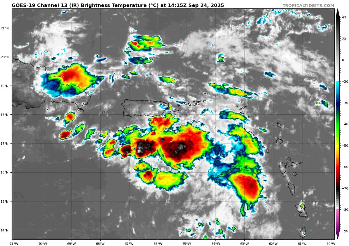
goes19_ir_94L_202509241415_lat17.6-lon-65.0

94L_tracks_latest
By PDC’s Senior Weather
Specialist Glenn James

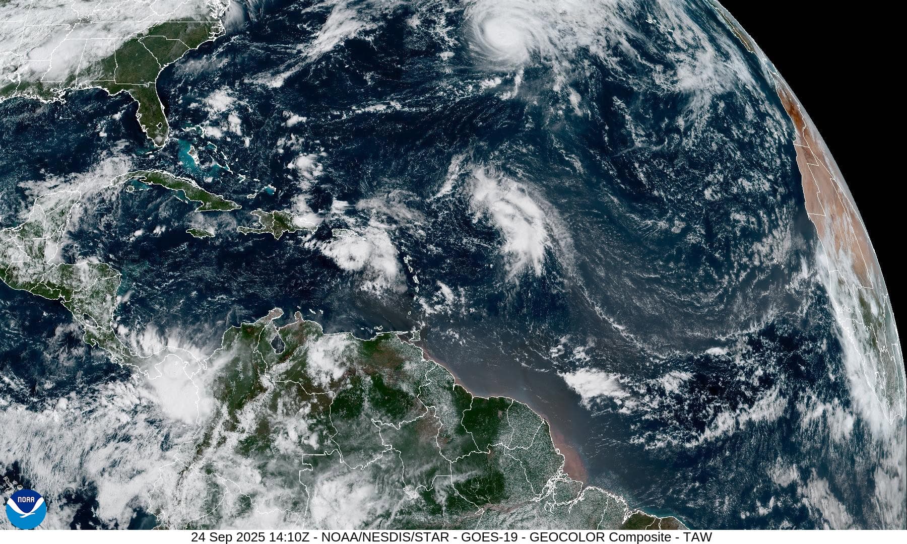
The Pacific Disaster Center’s (PDC Global) Wednesday, September 24, 2025, Tropical Cyclone Activity Report…for the Atlantic Ocean, the Caribbean Sea, and the Gulf of America
Current Tropical Cyclones:
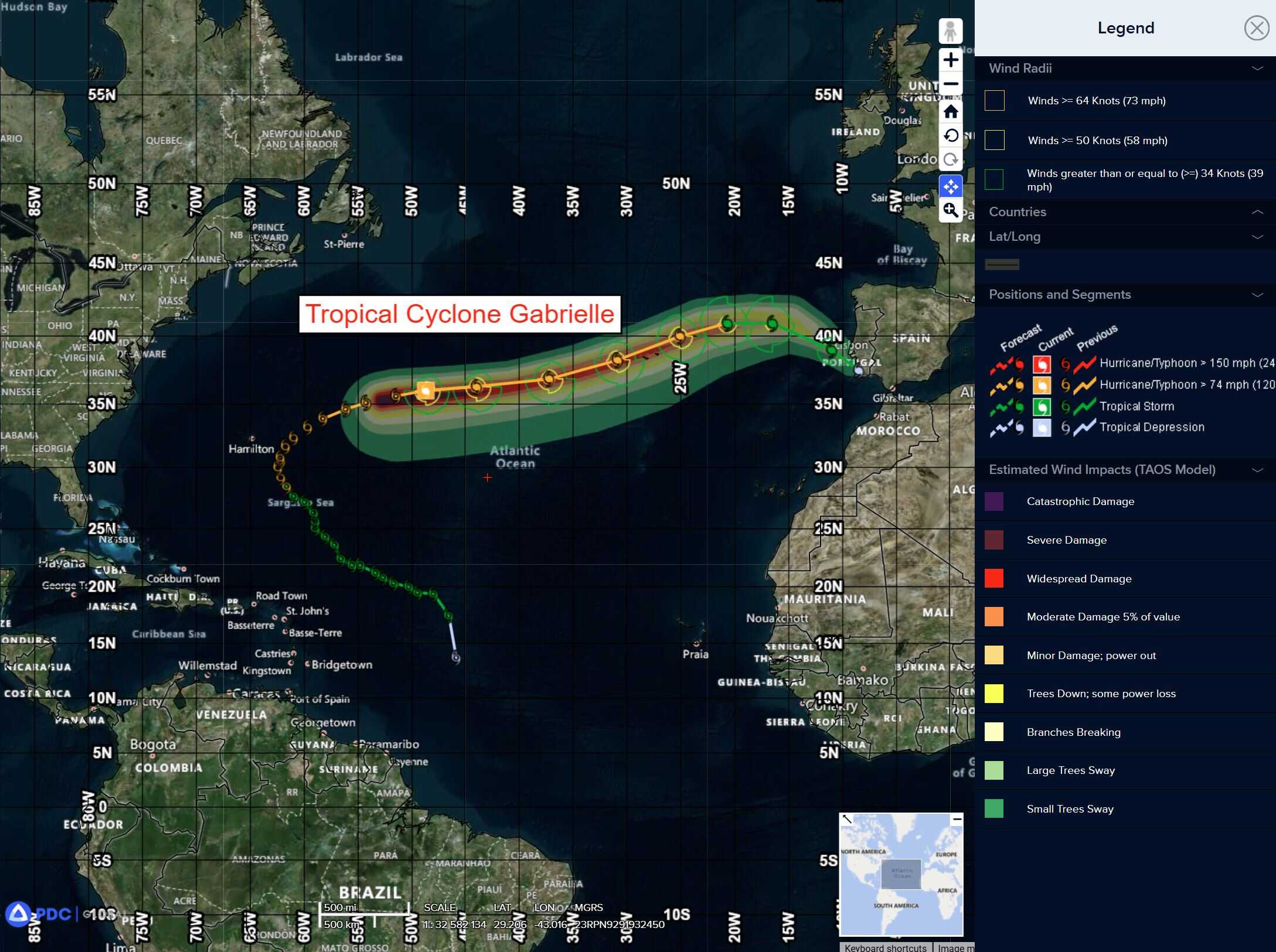
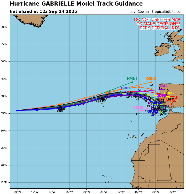
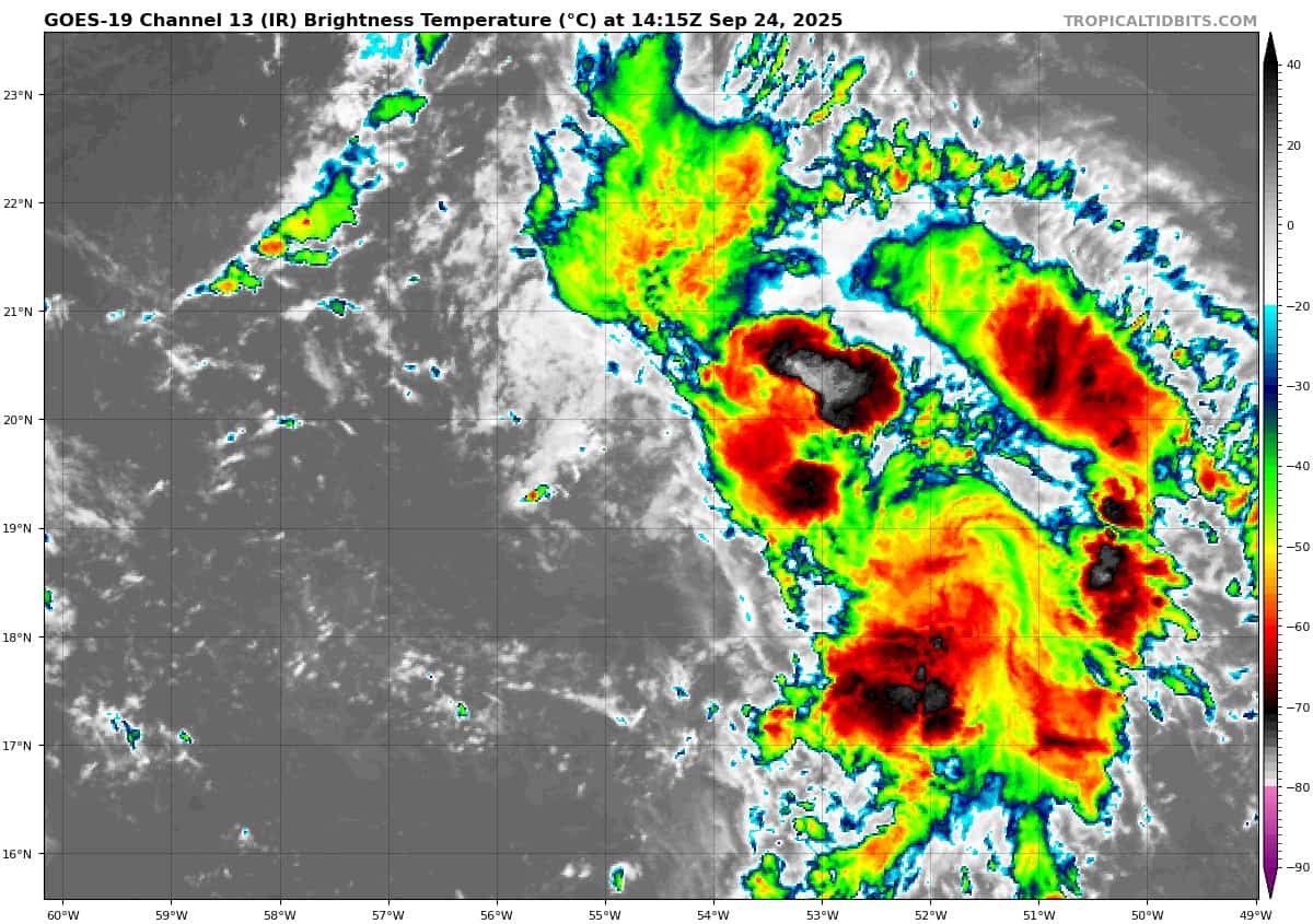
Tropical Cyclone 07L (Gabrielle)…is located about 1200 miles west of the Azores
Atlantic Ocean:
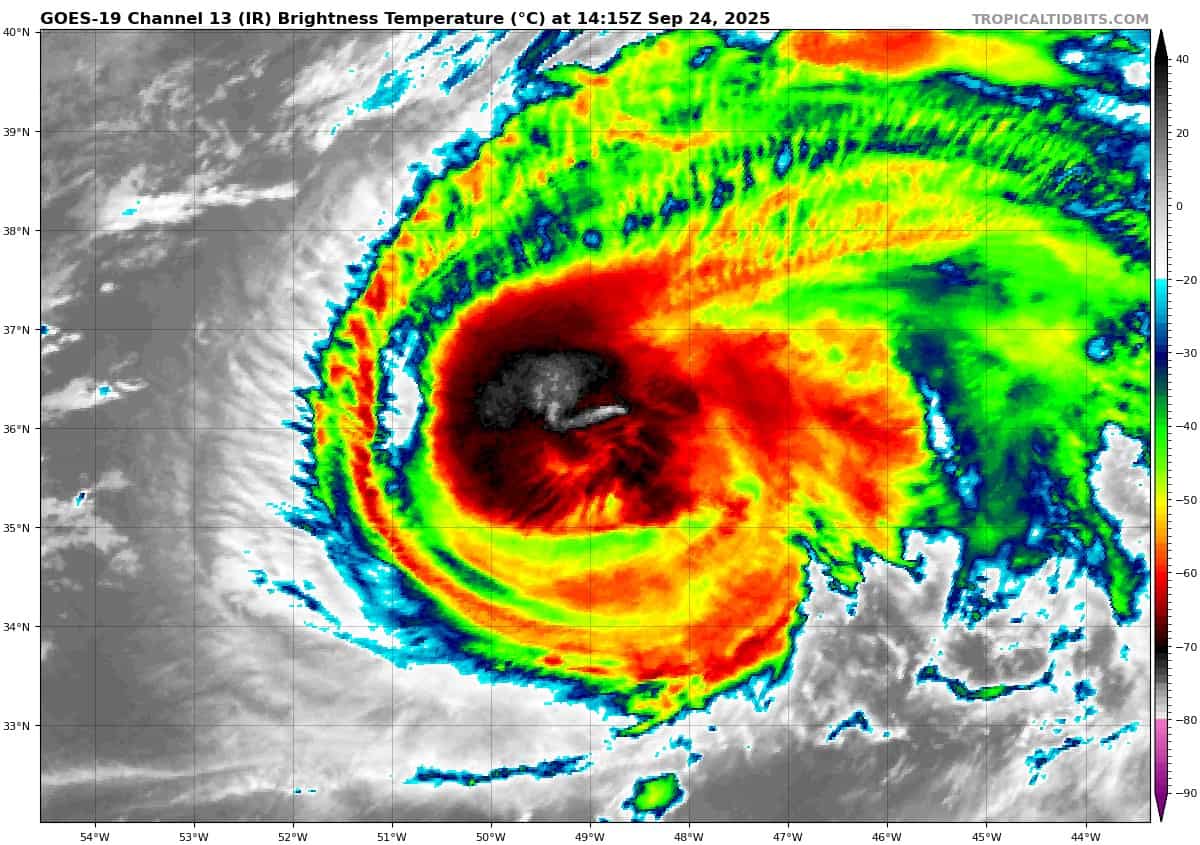
Tropical Cyclone 07L (Gabrielle)
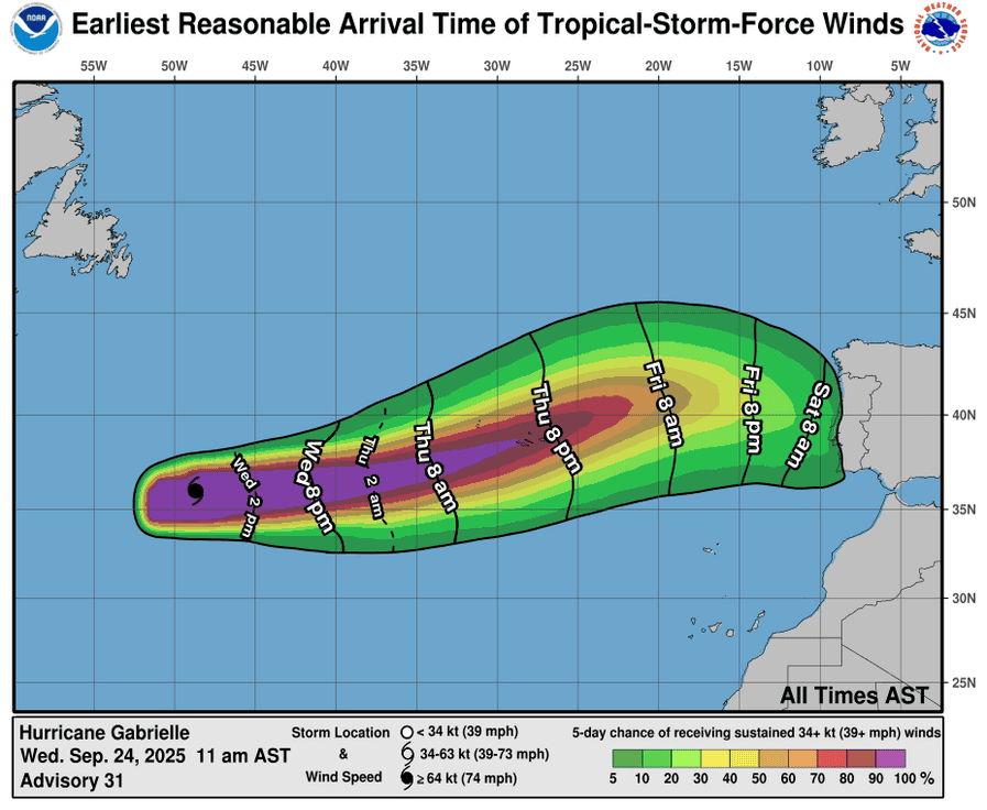
GABRIELLE MOVING QUICKLY EAST-NORTHEASTWARD ACROSS THE SUBTROPICAL ATLANTIC…HURRICANE WARNING IN EFFECT FOR THE AZORES
According to the NHC advisory number 31
Gabrielle is moving toward the east-northeast near 25 mph (41 km/h). This general motion with some increase in forward speed is expected to continue for the next couple of days, followed by a slower eastward to east-southeastward motion this weekend. On the forecast track, the center of Gabrielle will approach the Azores during the day on Thursday, and move across the island chain Thursday night into Friday. Maximum sustained winds are near 110 mph (175 km/h) with higher gusts. Some weakening is expected during the next couple of days, but Gabrielle is still forecast to be a hurricane when it passes through the Azores. Hurricane-force winds extend outward up to 45 miles (75 km) from the center and tropical-storm-force winds extend outward up to 150 miles (240 km). The estimated minimum central pressure is 962 mb (28.41 inches).
HAZARDS AFFECTING LAND SURF:
WIND: Hurricane conditions are expected in the Azores Thursday night and Friday, with tropical storm conditions likely by Thursday evening.
STORM SURGE: A dangerous storm surge is expected to produce significant coastal flooding in areas of onshore winds in the Azores. The surge will be accompanied by large and destructive waves.
RAINFALL: From Thursday into Friday morning, Gabrielle may bring 3 to 5 inches, or 75 to 125 mm, of rainfall across the central and western Azores. During the same time outer bands from Gabrielle may also result in 1 to 2 inches, or 25 to 50 mm, of rain across the eastern Azores.
SURF: Swells generated by Gabrielle will continue to affect Bermuda over the next couple of days, and the U.S. East Coast from North Carolina northward and Atlantic Canada over the next day or so. These swells are expected to produce life-threatening surf and rip current conditions.
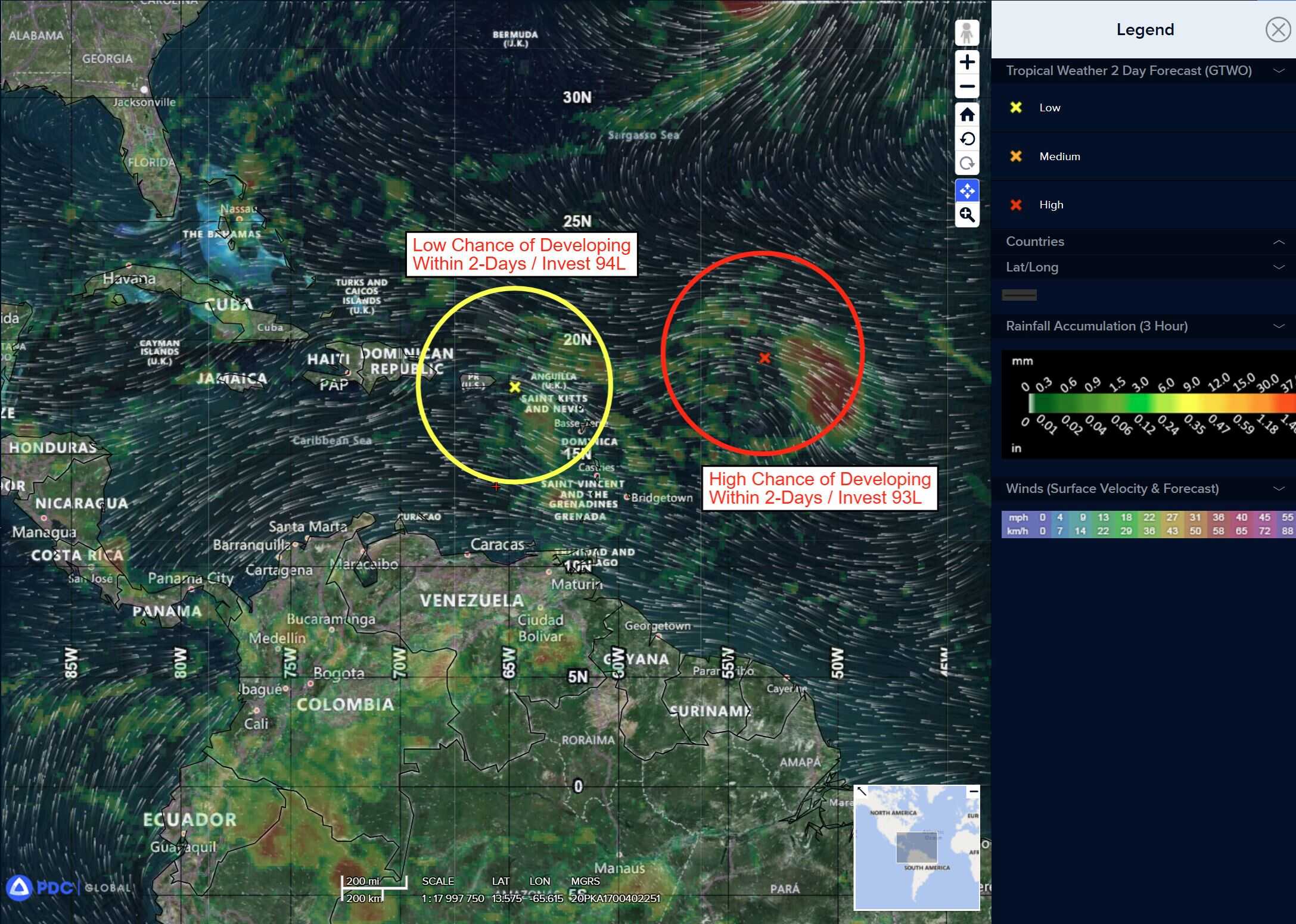
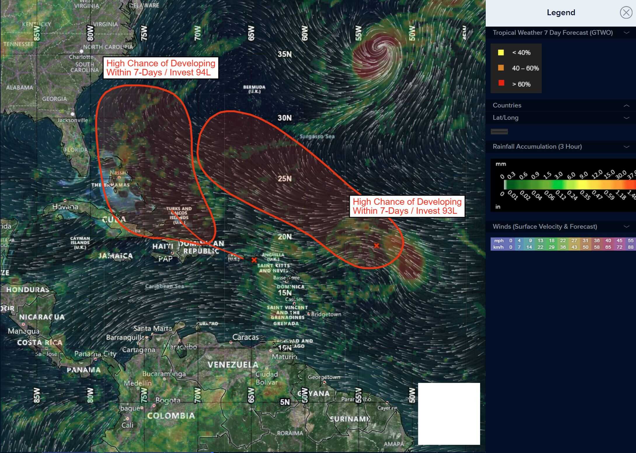
Central and Western Tropical Atlantic:
Invest 93L
>>> Shower and thunderstorm activity associated with an elongated area of low pressure located several hundred miles east of the Leeward Islands continues to show signs of organization. Environmental conditions are forecast to be favorable for further development, and a tropical depression is likely to form later today or Thursday while the system moves west-northwestward to northwestward into the western tropical Atlantic, well north of the Leeward Islands. Additional information on this system, including gale warnings, can be found in High Seas Forecasts issued by the National Weather Service.
* Formation chance through 48 hours…high…90 percent
* Formation chance through 7 days…high…90 percent
Caribbean Sea: There are no active tropical cyclones
Eastern Caribbean Sea:
Invest 94L
>>> A tropical wave over the northeastern Caribbean Sea is producing disorganized showers and thunderstorms. This wave is expected to move west-northwestward at 15 to 20 mph, spreading heavy rainfall and gusty winds into Puerto Rico and the Virgin Islands today, and across the Dominican Republic beginning tonight. The system is then expected to slow down and turn northwestward when it reaches the southwestern Atlantic late this week. Environmental conditions are forecast to be more conducive for development in a few days, and a tropical depression is likely to form when the disturbance is in the vicinity of the Bahamas. Interests in the Virgin Islands, Puerto Rico, the Dominican Republic, the Turks and Caicos Islands, and the Bahamas should monitor the progress of this system. An Air Force Hurricane Hunter Aircraft is scheduled to perform a system survey this afternoon to gather data from the surrounding environment, if necessary.
Gulf of America: There are no active tropical cyclones
Tropical cyclone formation is not expected during the next 7-days.