
")
Current Snapshot
For all the latest updates visit: DisasterAWARE
1800x1080a
gab
goes19_ir_07L_202509231445_lat33.5-lon-59.2
231445_earliest_reasonable_toa_34
07L_geps_latest
12
7a
goes19_ir_93L_202509231435_lat15.0-lon-48.0
93L_gefs_latest
goes19_ir_94L_202509231435_lat17.3-lon-62.0
94L_geps_latest
By PDC’s Senior Weather
Specialist Glenn James

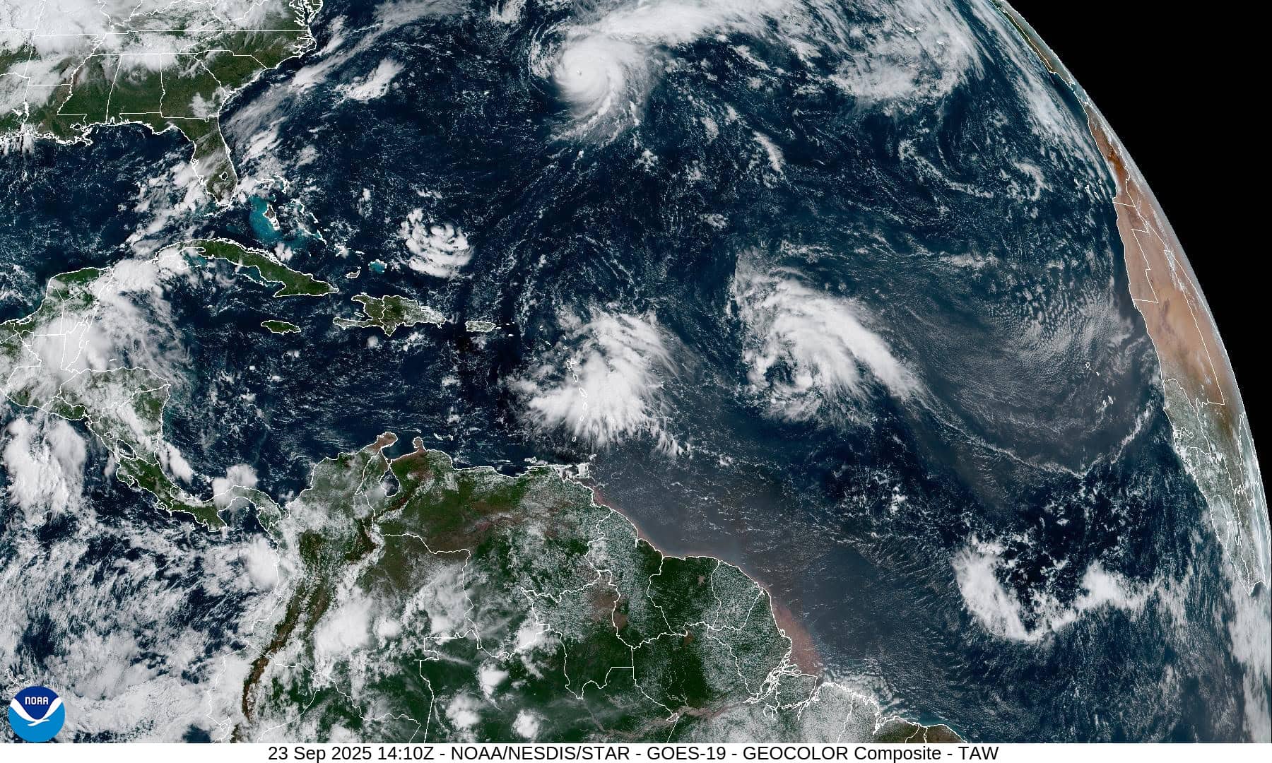
The Pacific Disaster Center’s (PDC Global) Tuesday, September 23, 2025, Tropical Cyclone Activity Report…for the Atlantic Ocean, the Caribbean Sea, and the Gulf of America
Current Tropical Cyclones:
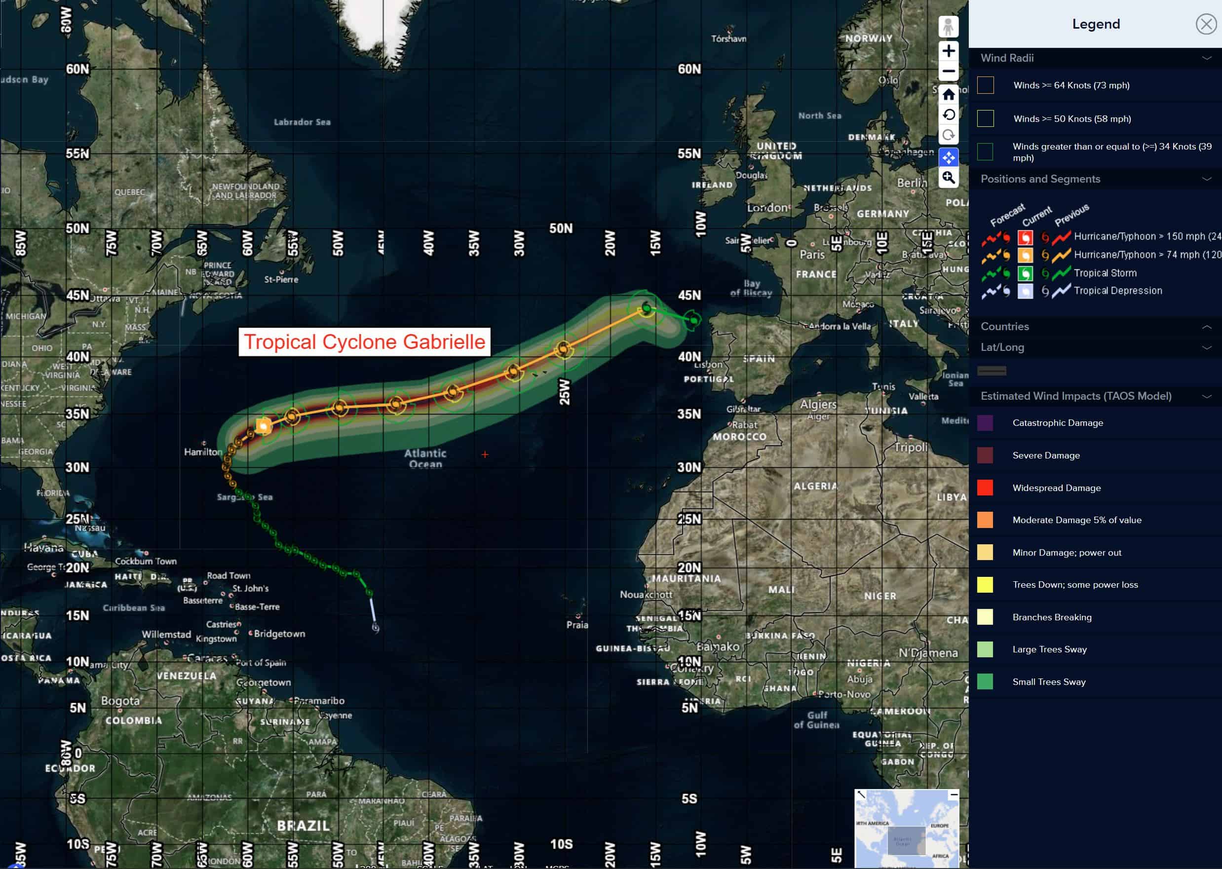
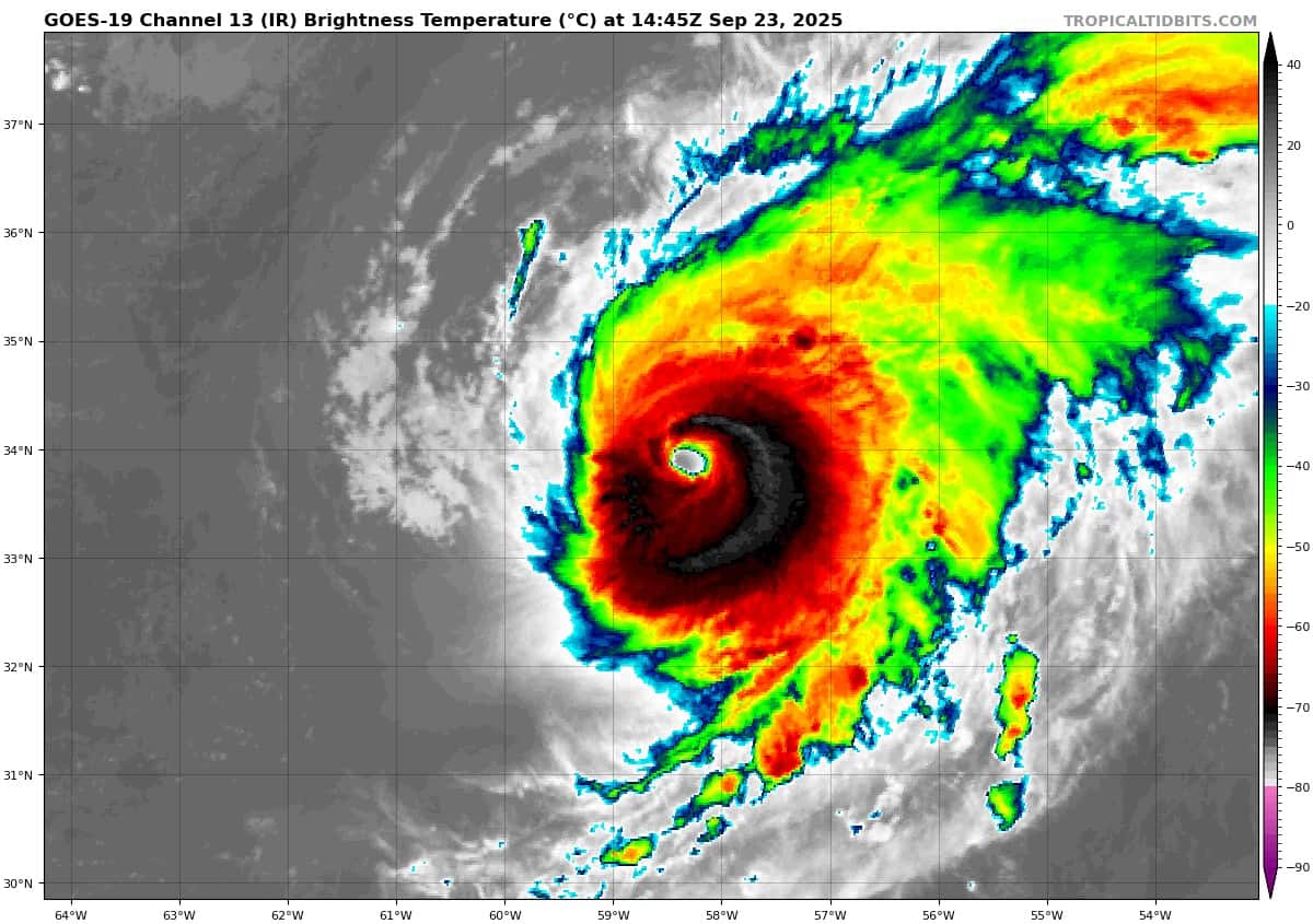
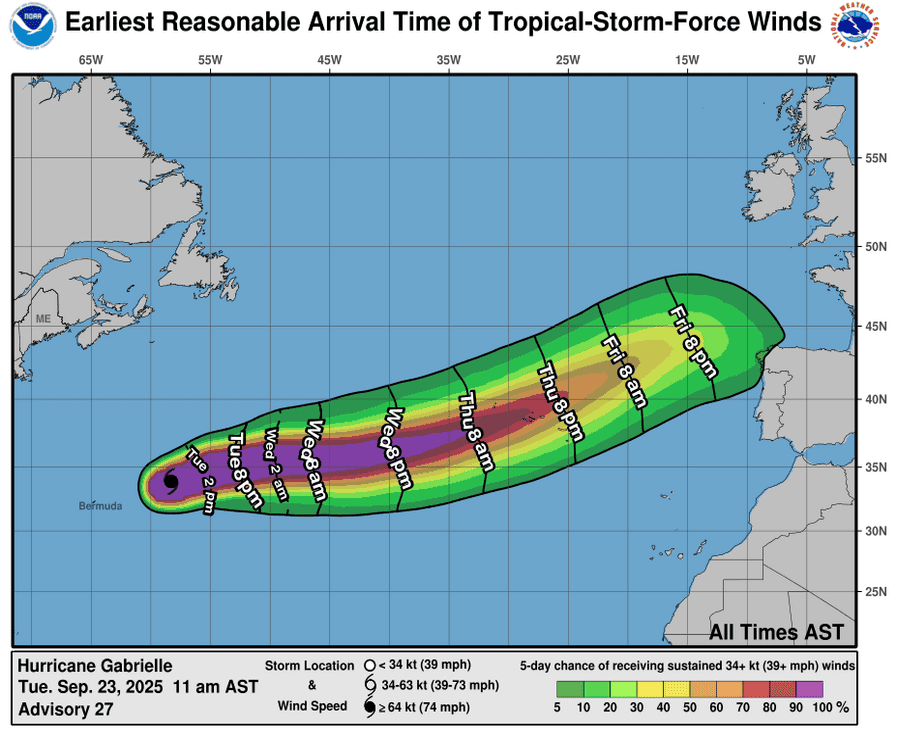
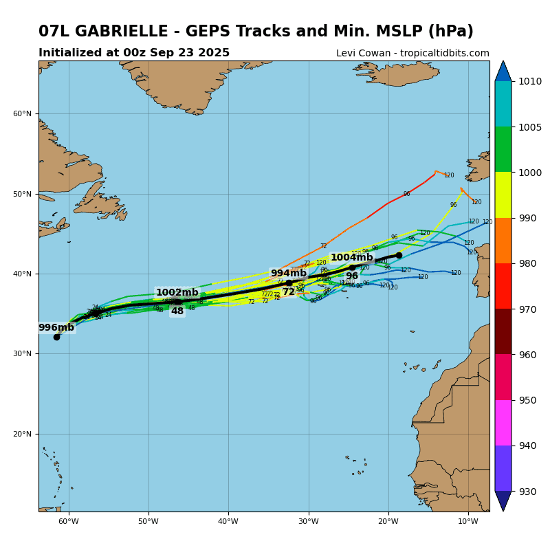
Tropical Cyclone 07L (Gabrielle)…is located about 520 miles east-northeast of Bermuda
Atlantic Ocean:
Tropical Cyclone 07L (Gabrielle)
GABRIELLE EXPECTED TO MOVE NEAR THE AZORES AS A HURRICANE IN A COUPLE OF DAYS
According to the NHC advisory number 28
Gabrielle is moving toward the east-northeast near 21 mph (33 km/h) and this motion with some additional acceleration is expected to continue for the next several days. On the forecast track, the center of Gabrielle will approach the Azores during the day on Thursday, and move across the island chain Thursday night into Friday. Maximum sustained winds are near 130 mph (215 km/h) with higher gusts. Gabrielle is a category 4 hurricane on the Saffir-Simpson Hurricane Wind Scale. Steady weakening is expected during the next couple of days, but Gabrielle is still expected to be a hurricane when it passes moves through the Azores. Hurricane-force winds extend outward up to 45 miles (75 km) from the center and tropical-storm-force winds extend outward up to 140 miles (220 km). The estimated minimum central pressure is 952 mb (28.12 inches).
HAZARDS AFFECTING LAND SURF:
WIND: Hurricane conditions are possible within the watch area by Thursday night.
STORM SURGE: A dangerous storm surge is expected to produce significant coastal flooding near the areas of onshore winds where the center makes landfall. Near the coast, the surge will be accompanied by large and destructive waves.
RAINFALL: From Thursday into Friday morning, Gabrielle may bring 3 to 5 inches or 75 to 125 mm of rainfall across the central and western Azores. During the same time outer bands from Gabrielle may also result in 1 to 2 inches or 25 to 50 mm of rain across the eastern Azores.
SURF: Swells generated by Gabrielle will continue to affect Bermuda, the U.S. East Coast from North Carolina northward, and Atlantic Canada over the next few days. These swells are expected to produce life-threatening surf and rip current conditions.
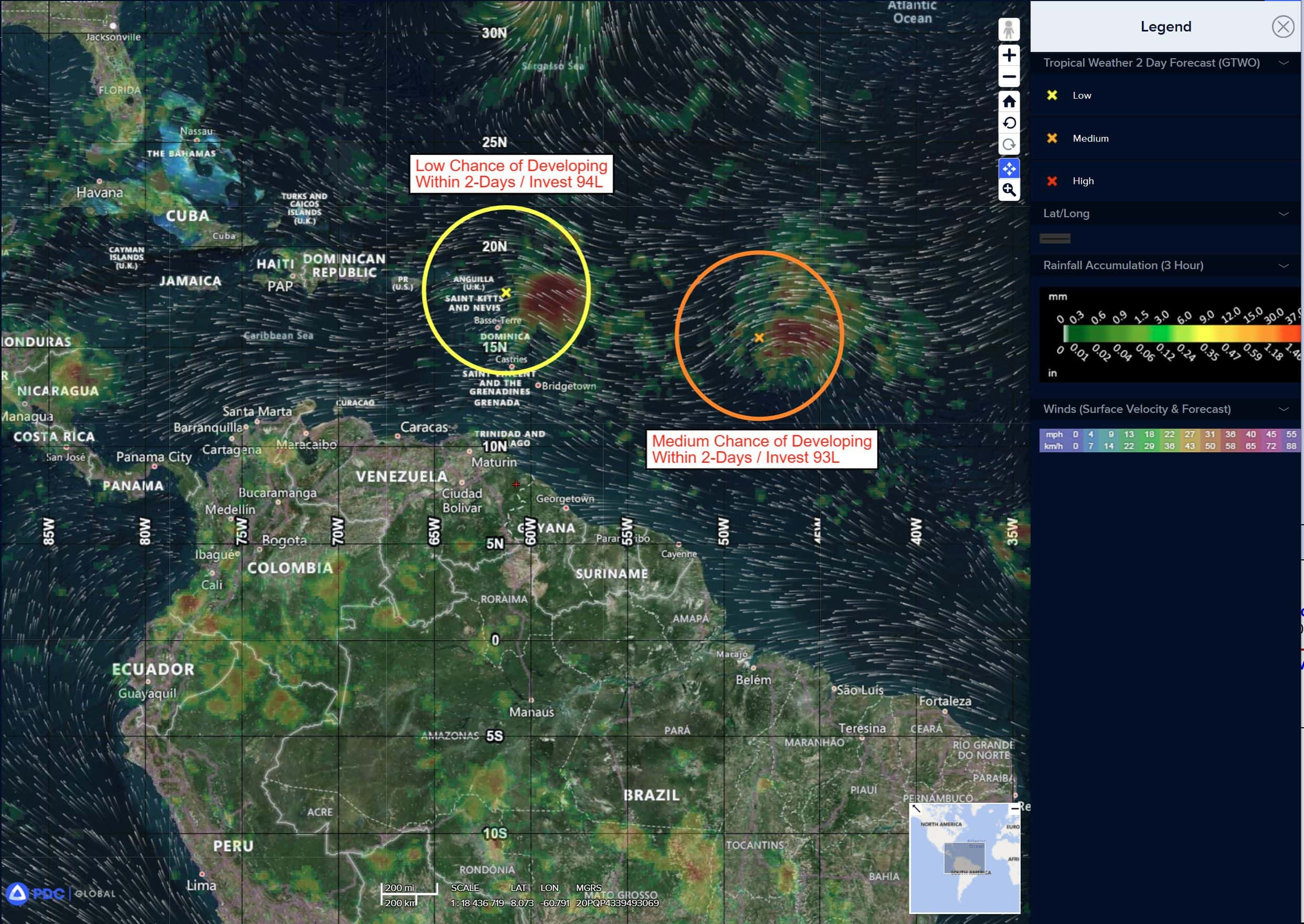
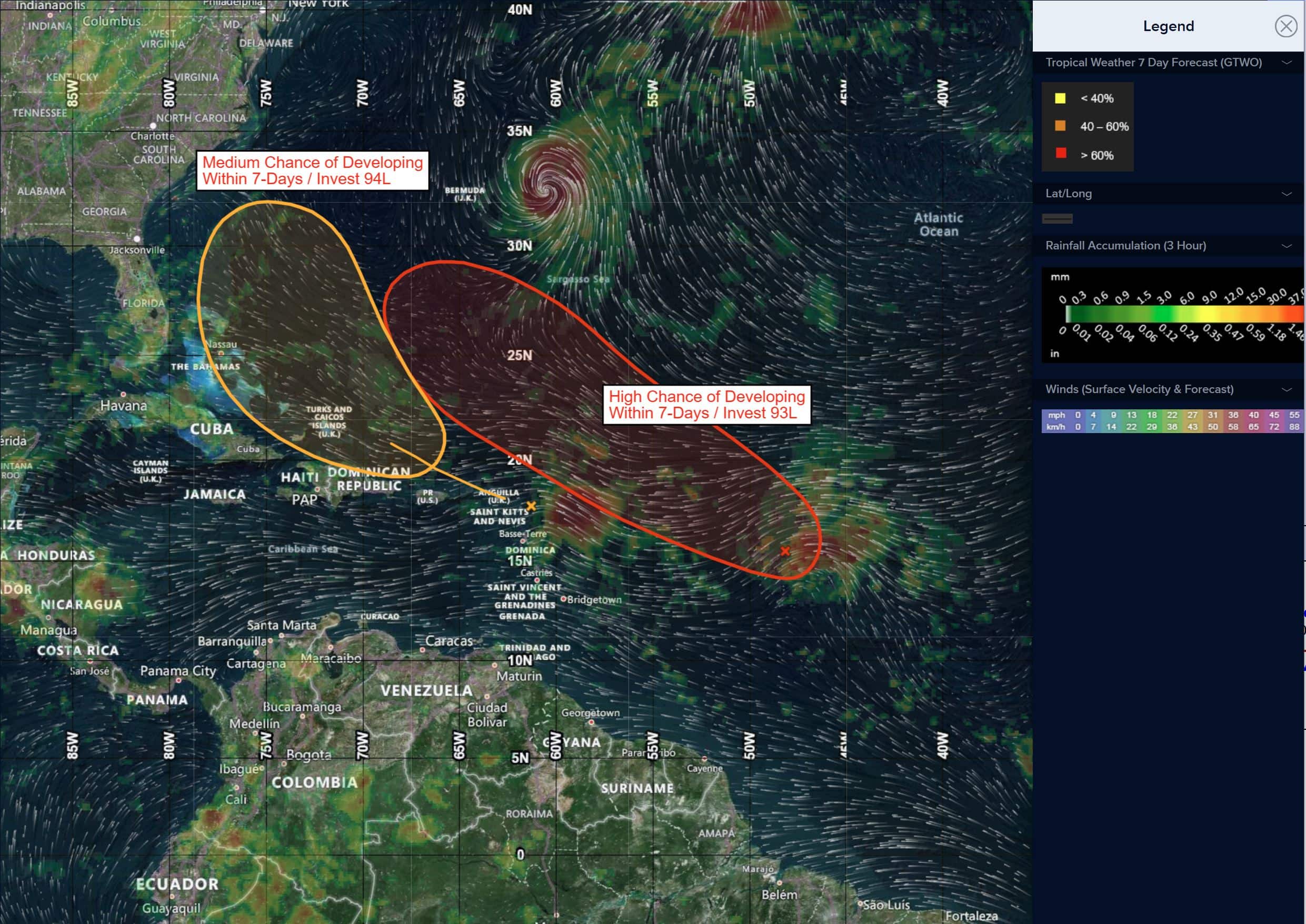
Central and Western Tropical Atlantic:
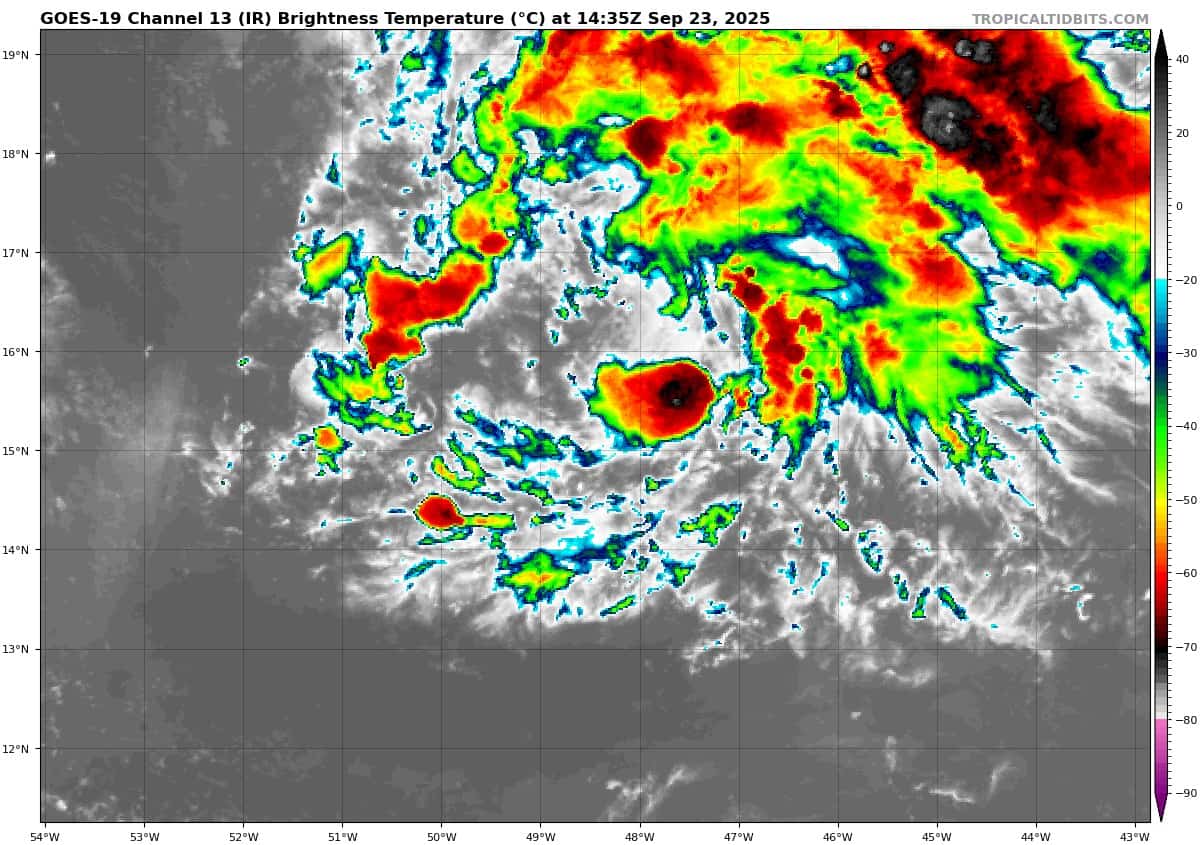
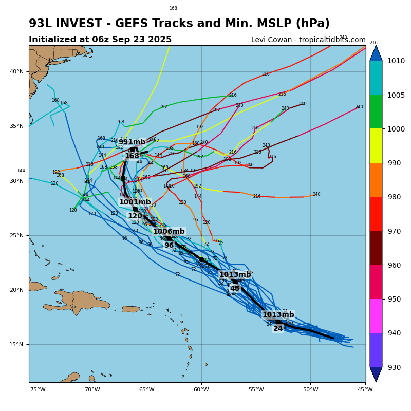
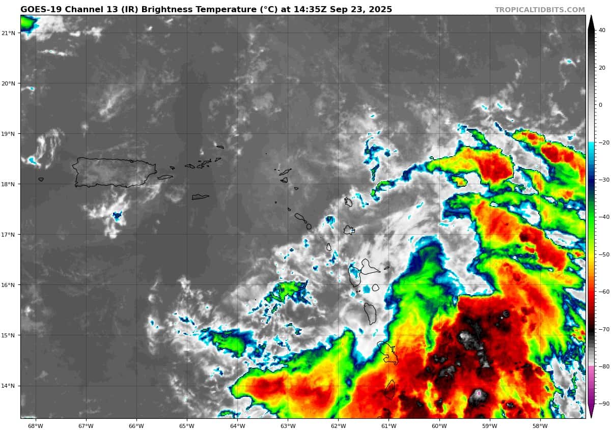
Invest 93L
>>> Shower and thunderstorm activity associated with a tropical wave located about 900 miles east of the Lesser Antilles continues to show signs of organization. Environmental conditions are forecast to be generally favorable for development, and a tropical depression is likely to form during the next couple of days while the system moves west-northwestward to northwestward into the western tropical Atlantic.
* Formation chance through 48 hours…medium…60 percent
* Formation chance through 7 days…high…90 percent
Eastern of the Leeward Islands:
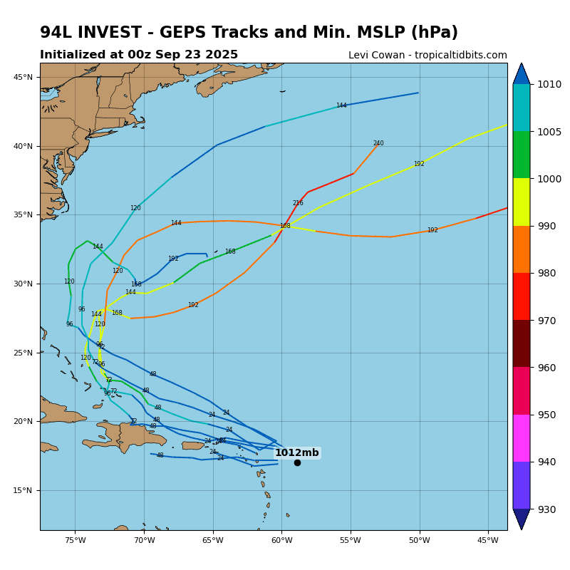
Invest 94L
>>> A tropical wave is producing a large area of disorganized showers, thunderstorms and gusty winds across much of the Windward and Leeward Islands. This wave is expected to move west-northwestward at 15 to 20 mph, spreading heavy rainfall and gusty winds into Puerto Rico and the Virgin Islands tonight and Wednesday. The system is then expected to slow down and turn northwestward when it reaches the southwestern Atlantic near the Bahamas late this week, and a tropical depression could form when the disturbance is in that region. Interests in the Virgin Islands, Puerto Rico, the Turks and Caicos Islands, and the Bahamas should monitor the progress of this system.
* Formation chance through 48 hours…low…20 percent
* Formation chance through 7 days…medium…60 percent
Caribbean Sea: There are no active tropical cyclones
Tropical cyclone formation is not expected during the next 7-days.
Gulf of America: There are no active tropical cyclones
Tropical cyclone formation is not expected during the next 7-days.