
")
Current Snapshot
For all the latest updates visit: DisasterAWARE
1800x1080a
gab
goes19_ir_07L_202509221445_lat30.4-lon-62.4
221454_earliest_reasonable_toa_34
07L_tracks_latest
2a
7a
By PDC’s Senior Weather
Specialist Glenn James

The Pacific Disaster Center’s (PDC Global) Monday, September 22, 2025, Tropical Cyclone Activity Report…for the Atlantic Ocean, the Caribbean Sea, and the Gulf of America
Current Tropical Cyclones:
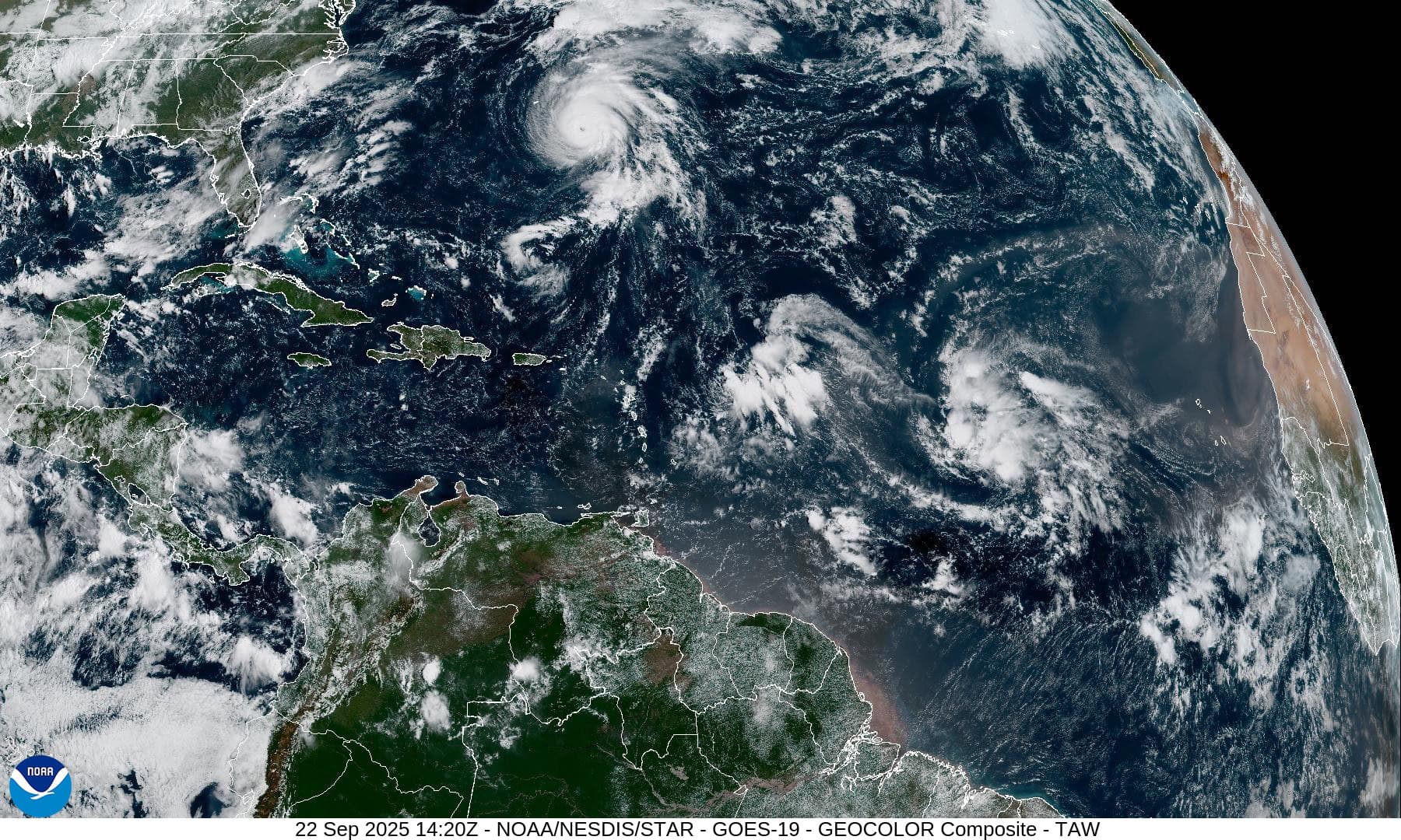
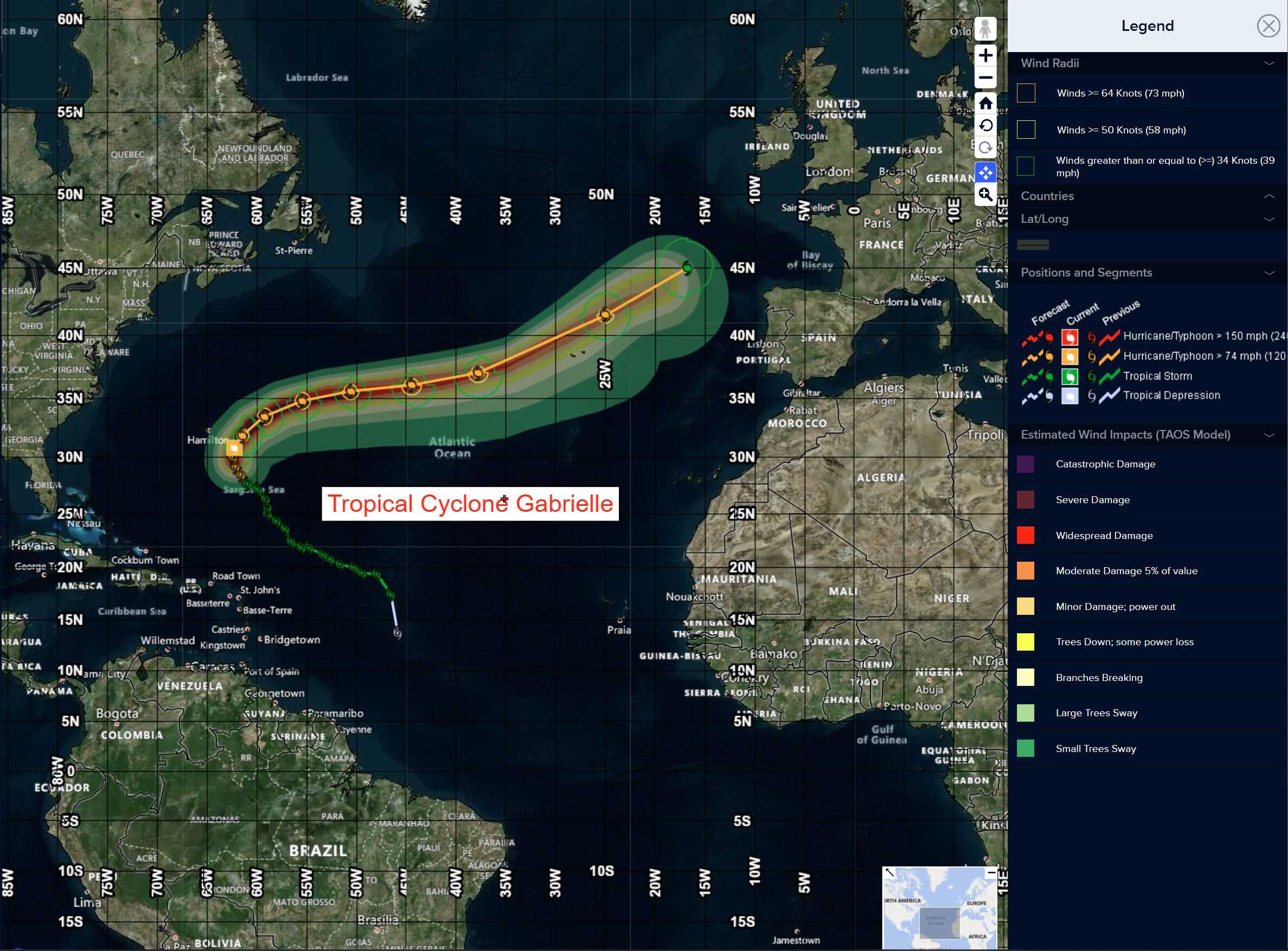
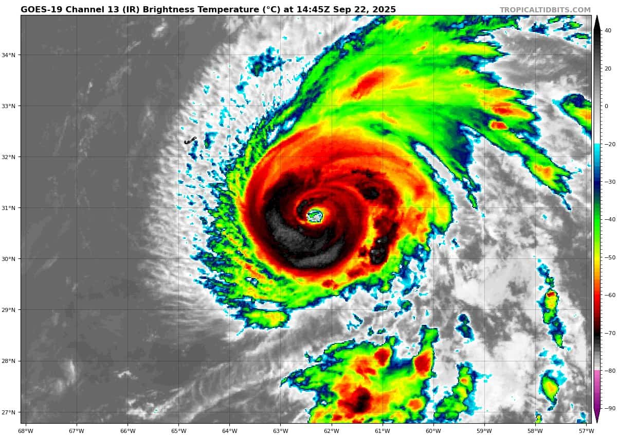
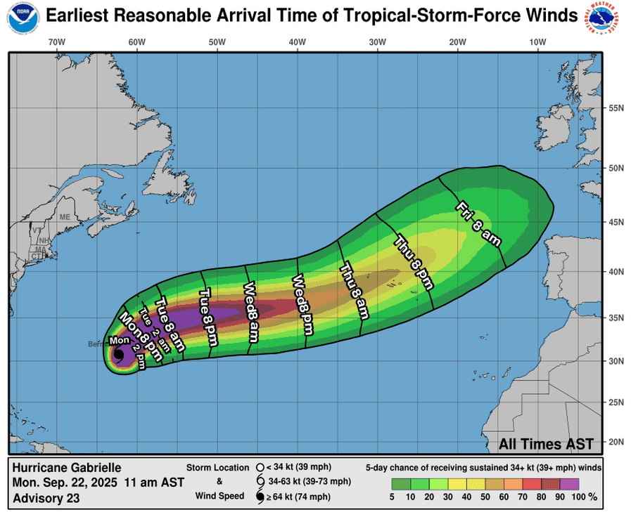
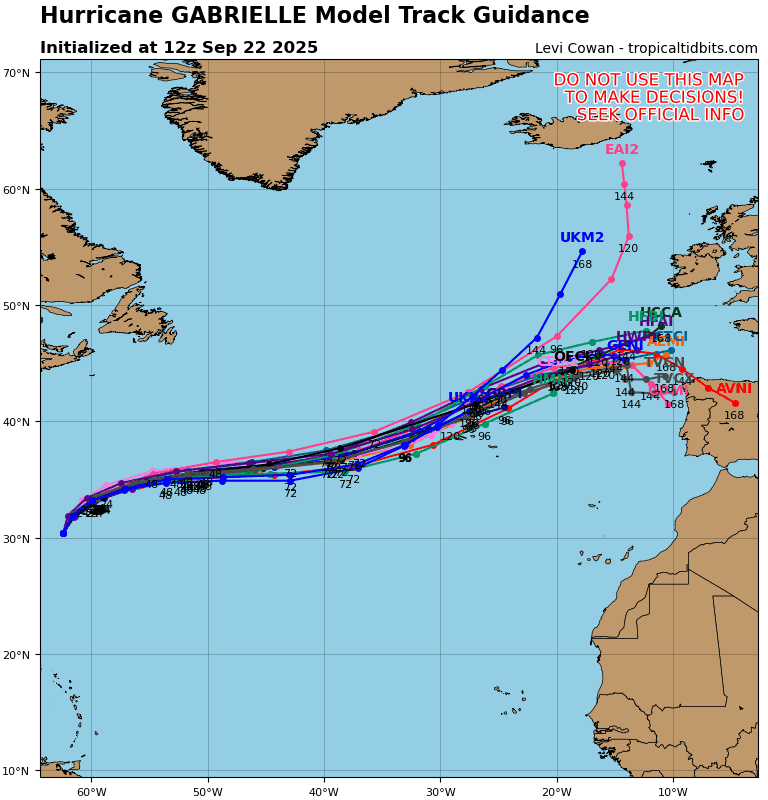
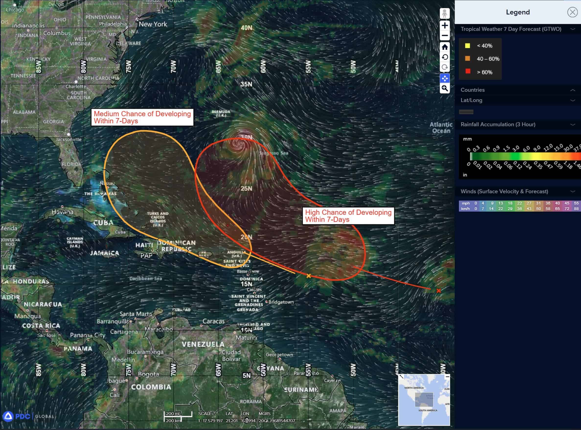
Tropical Cyclone 07L (Gabrielle)…is located about 220 miles east of Bermuda
Atlantic Ocean:
Tropical Cyclone 07L (Gabrielle)
GABRIELLE PASSING EAST OF BERMUDA…INTERESTS IN THE AZORES SHOULD MONITOR ITS PROGRESS
According to the NHC advisory number 25
Gabrielle is moving toward the northeast near 13 mph (20 km/h). A faster northeastward to east- northeastward motion is expected on Tuesday and Wednesday. On the forecast track, the center of Gabrielle will continue to move away from Bermuda tonight and Tuesday. Maximum sustained winds are near 140 mph (220 km/h) with higher gusts. Gabrielle is a category 4 hurricane on the Saffir-Simpson Hurricane Wind Scale. Little change in strength is expected through early Tuesday, followed by gradual weakening later on Tuesday and on Wednesday. Hurricane-force winds extend outward up to 40 miles (65 km) from the center and tropical-storm-force winds extend outward up to 140 miles (220 km). The estimated minimum central pressure is 948 mb (28.00 inches).
HAZARDS AFFECTING LAND SURF:
SURF: Swells generated by Gabrielle will continue to affect Bermuda and the east coast of the United States from North Carolina northward, as well as Atlantic Canada, and are expected to continue for the next few days. These swells are likely to cause life-threatening surf and rip current conditions.
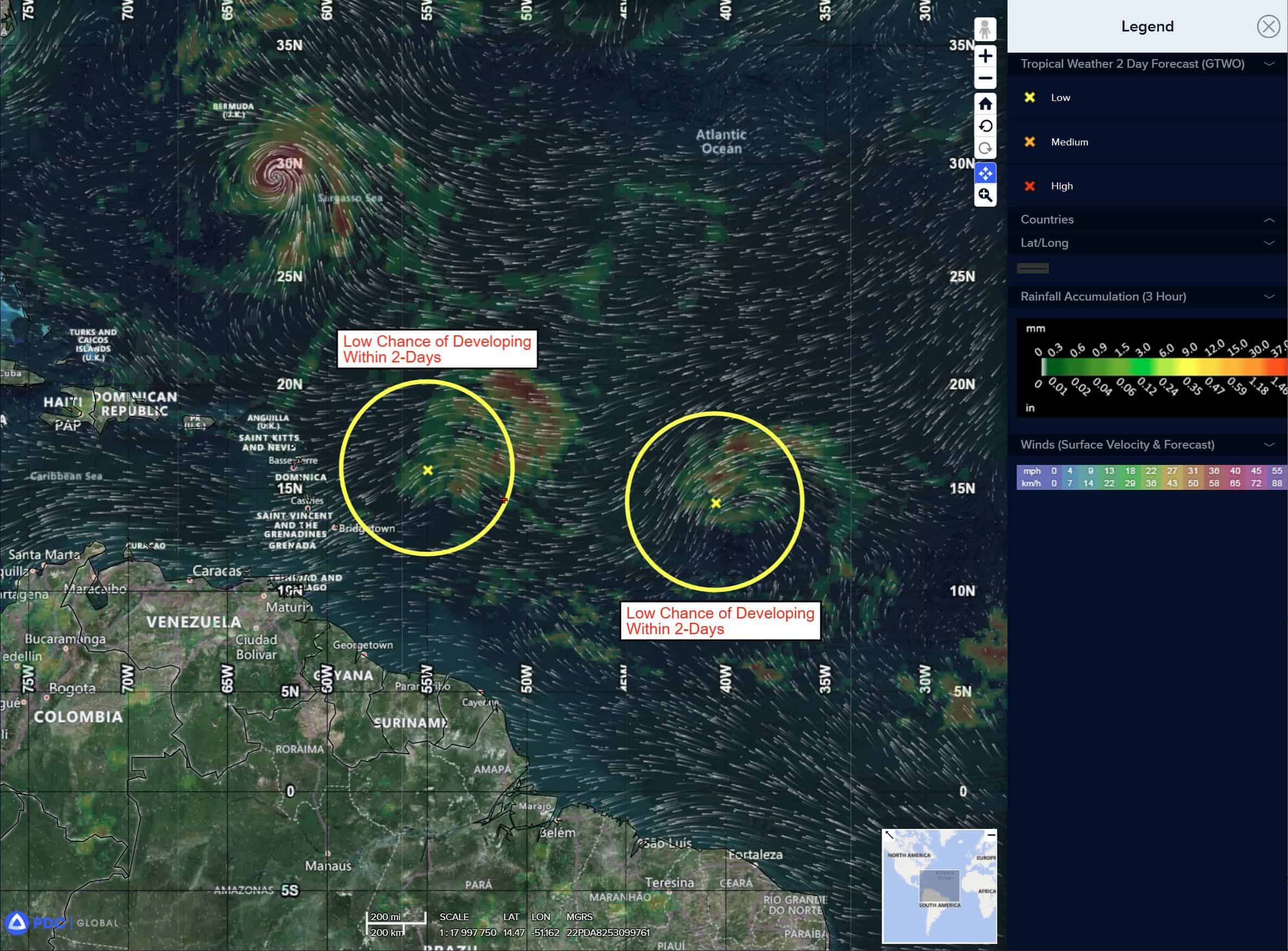
Central Tropical Atlantic:
>>> Shower and thunderstorm activity associated with a tropical wave located about midway between the Lesser Antilles and the Cabo Verde Islands continues to increase. Environmental conditions are forecast to become more favorable for development by tomorrow, and a tropical depression is likely to form on Wednesday or Thursday while the system moves west-northwestward to northwestward across the central Atlantic.
* Formation chance through 48 hours…low…30 percent
* Formation chance through 7 days…high…80 percent
Eastern of the Leeward Islands:
>>> A tropical wave located about 300 miles east of the Leeward Islands is producing disorganized showers and thunderstorms. Environmental conditions appear marginally conducive for some development over the next few days as the wave moves quickly westward to west- northwestward at 15 to 20 mph. By the latter part of this week, the system is expected to slow down and turn more northwestward, and a tropical depression could form late this week when the system is over the southwestern Atlantic Ocean or near the Bahamas. Regardless of development, gusty winds and heavy rainfall are expected to affect portions of the Leeward Islands late tonight and Tuesday and near Puerto Rico late Tuesday and Wednesday.
* Formation chance through 48 hours…low…10 percent
* Formation chance through 7 days…medium…50 percent
Caribbean Sea: There are no active tropical cyclones
Tropical cyclone formation is not expected during the next 7-days.
Gulf of America: There are no active tropical cyclones
Tropical cyclone formation is not expected during the next 7-days.