
")
Current Snapshot
For all the latest updates visit: DisasterAWARE
1800x1080a
gab
goes19_ir_07L_202509211445_lat27.3-lon-60.7
211451_earliest_reasonable_toa_34

07L_tracks_latest
low2a
7a
By PDC’s Senior Weather
Specialist Glenn James

The Pacific Disaster Center’s (PDC Global) Sunday, September 21, 2025, Tropical Cyclone Activity Report…for the Atlantic Ocean, the Caribbean Sea, and the Gulf of America
Current Tropical Cyclones:
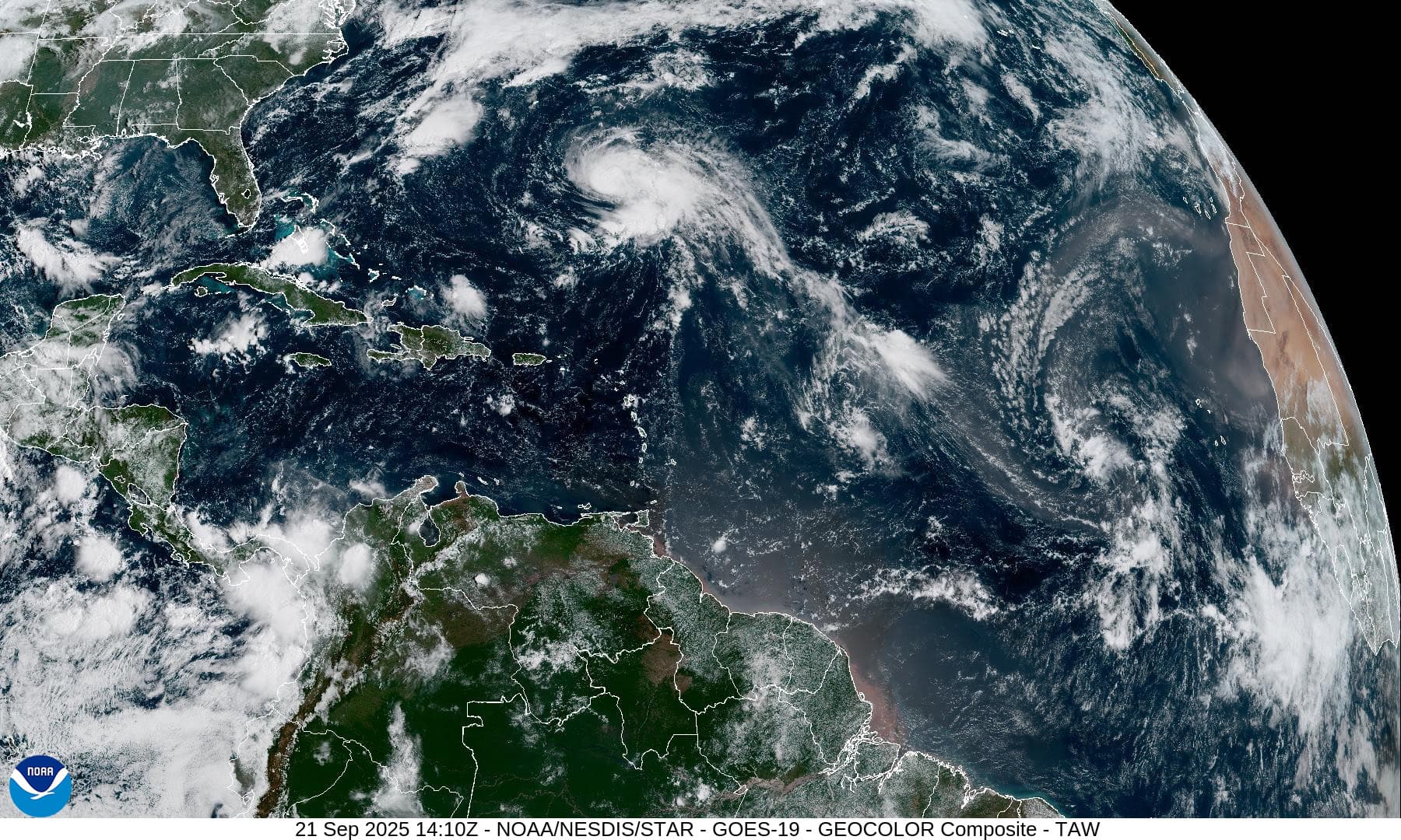
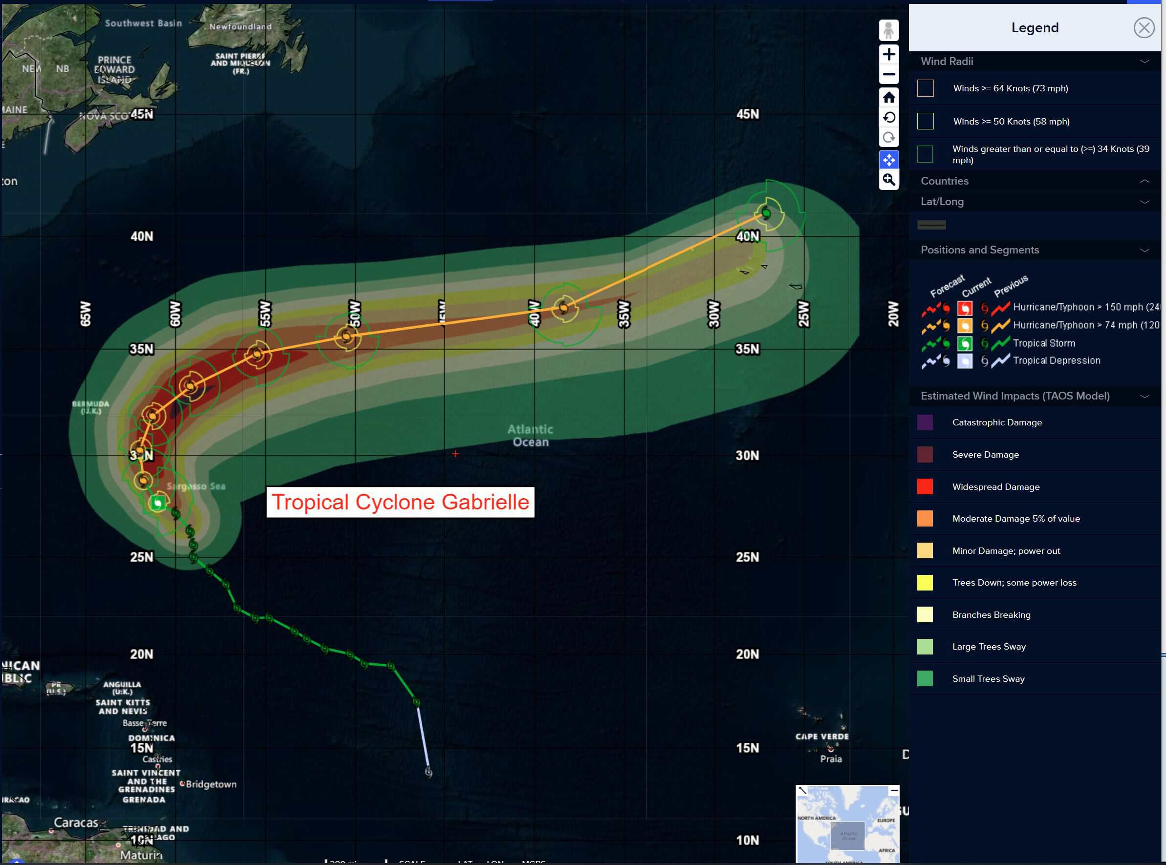
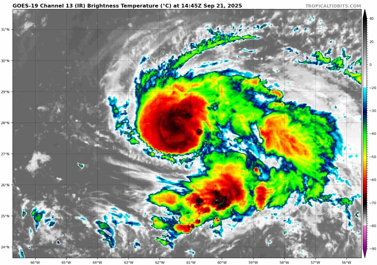
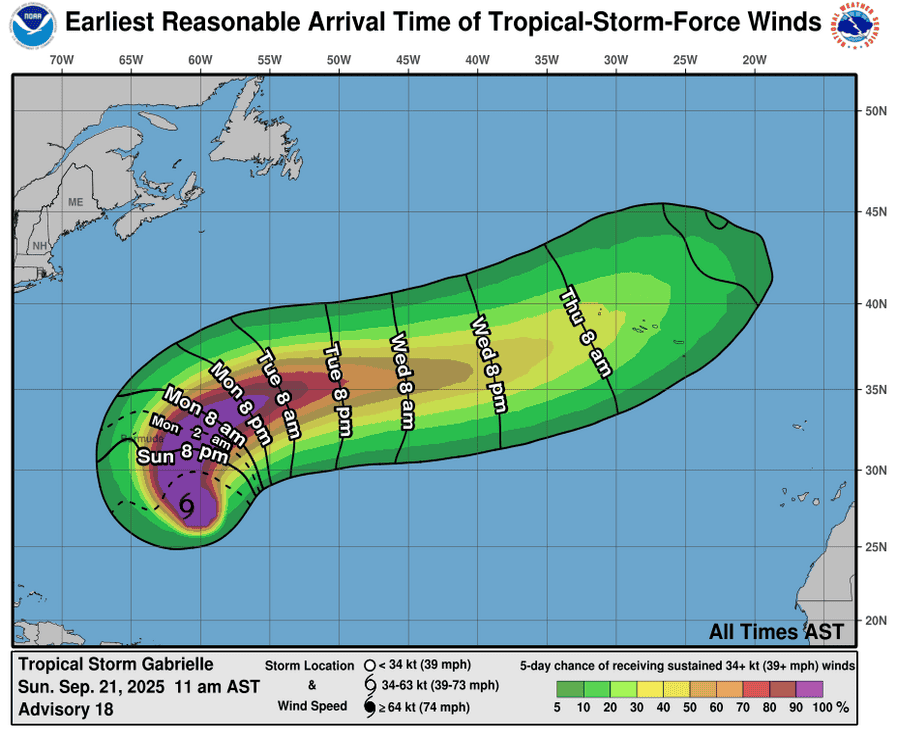
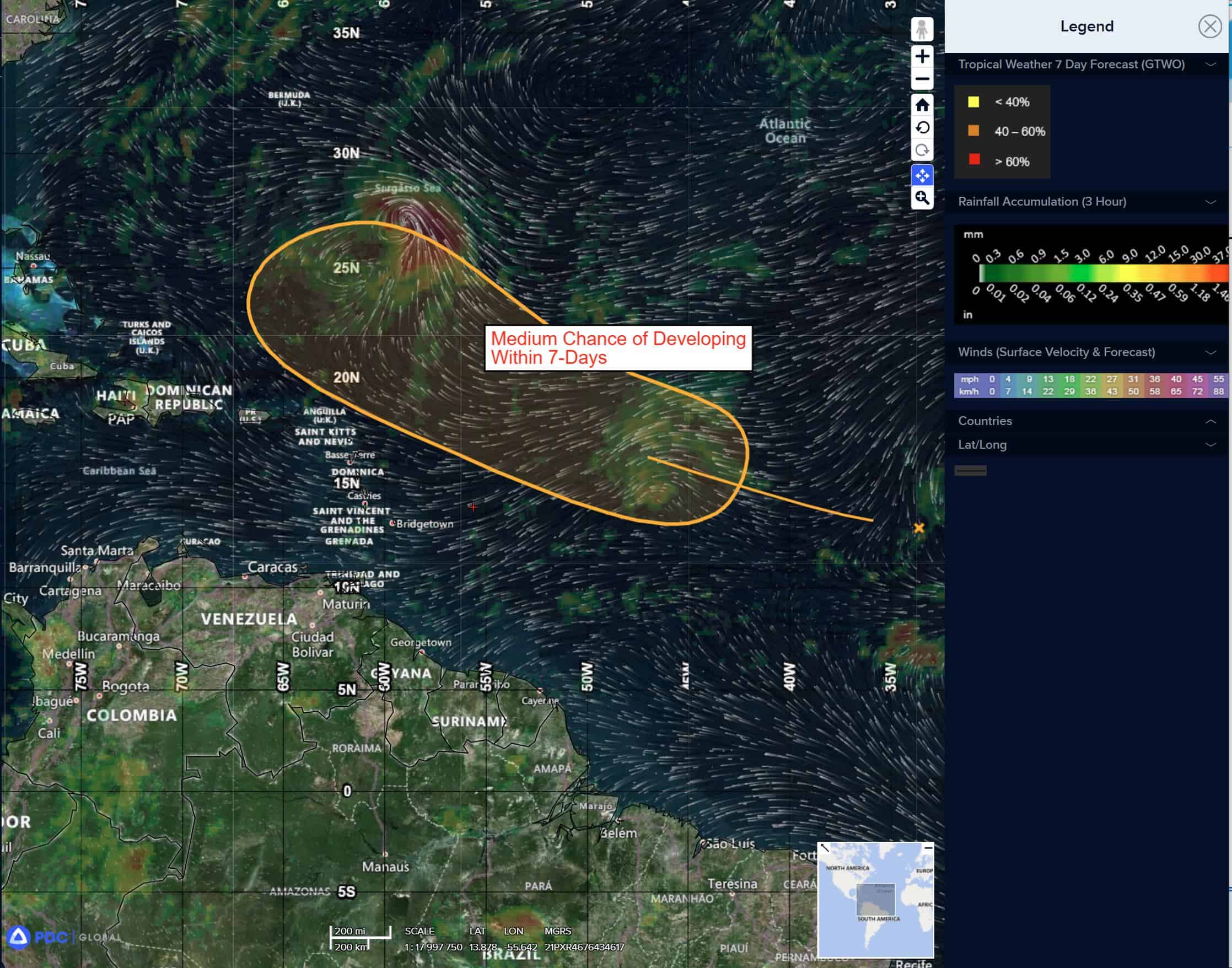
Tropical Cyclone 07L (Gabrielle)…is located about 265 miles southeast of Bermuda
Atlantic Ocean:
Tropical Cyclone 07L (Gabrielle)
GABRIELLE FORECAST TO TURN NORTHWARD SOON …FORECAST TO RAPIDLY INTENSIFY ON MONDAY
According to the NHC advisory number 20
Gabrielle is moving toward the northwest near 12 mph (19 km/h). A turn toward the north is forecast on Monday, followed by a faster northeastward or east-northeastward motion on Tuesday. On the forecast track, the center of Gabrielle is expected to pass east of Bermuda on Monday evening. Maximum sustained winds are near 75 mph (120 km/h) with higher gusts. Rapid intensification is forecast over the next day or so, and Gabrielle could become a major hurricane Monday night. Hurricane-force winds extend outward up to 25 miles (35 km) from the center and tropical-storm-force winds extend outward up to 140 miles (220 km). The estimated minimum central pressure is 992 mb (29.30 inches).
HAZARDS AFFECTING LAND SURF:
SURF: Swells generated by Gabrielle will continue to affect Bermuda during the next few days. These swells are expected to reach the east coast of the United States from North Carolina northward, as well as Atlantic Canada, starting today and continuing through early this week. These swells are likely to cause life-threatening surf and rip current conditions.
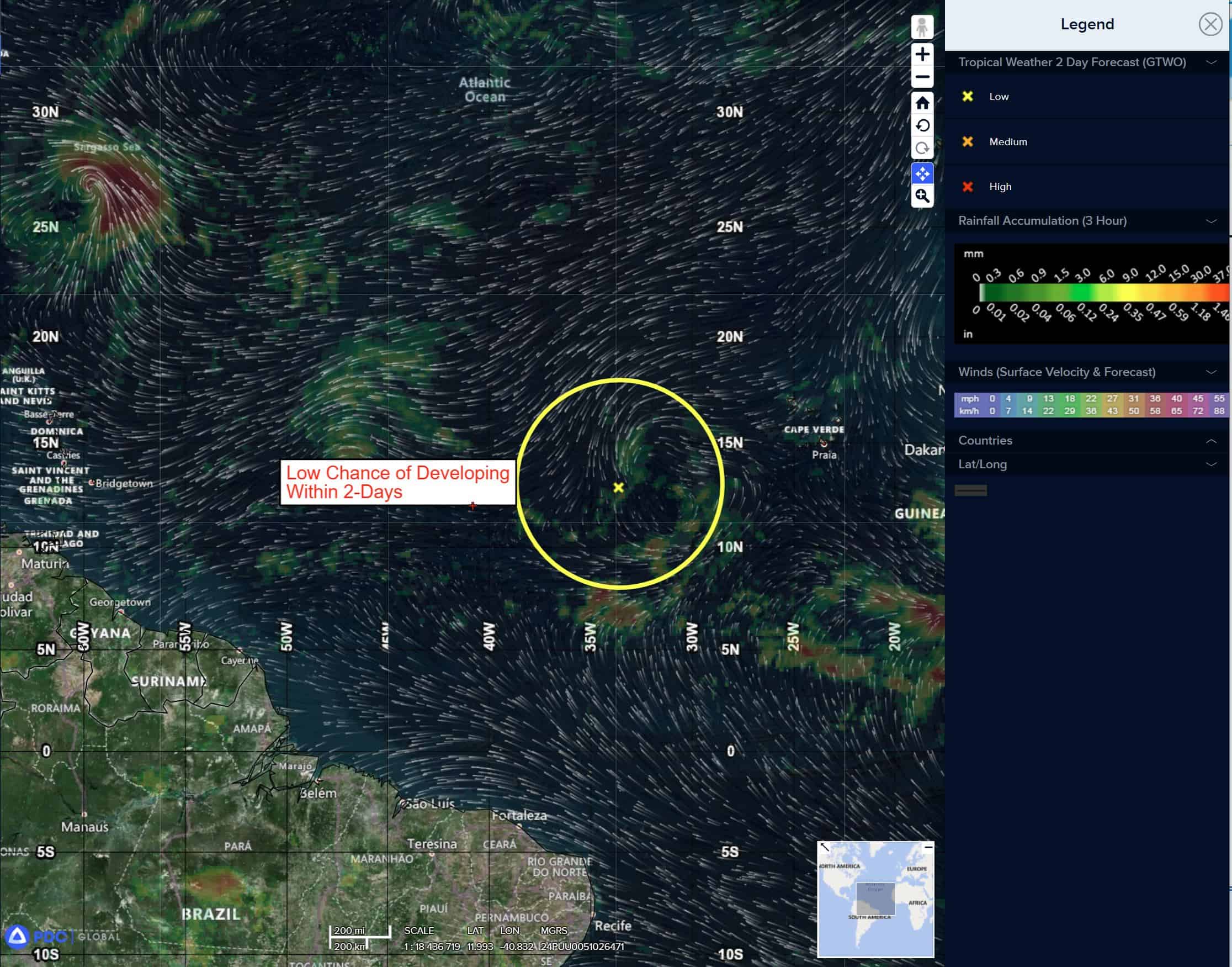
Central Tropical Atlantic:
>>> A tropical wave in the central tropical Atlantic is producing limited showers and thunderstorms well to the west-southwest of the Cabo Verde Islands. Although dry air should prevent any significant development over the next day or two, environmental conditions should gradually become more favorable for development thereafter, and a tropical depression could form by the middle to latter part of this week while while the system moves west-northwestward to northwestward across the central Atlantic.
* Formation chance through 48 hours…low…10 percent
* Formation chance through 7 days…medium…60 percent
Eastern of the Windward Islands:
>>> A tropical wave located well to the east of the Lesser Antilles is producing disorganized showers and thunderstorms. Environmental conditions appear marginally conducive for slow development over the next several days as the wave moves quickly westward to west-northwestward at 15 to 20 mph. By the latter part of this week, the system is expected to slow down and turn more northwestward, to the north of Hispaniola. Regardless of development, gusty winds and showers are expected for portions of the Leeward Islands late tonight and Tuesday.
* Formation chance through 48 hours…low…10 percent
* Formation chance through 7 days…low…30 percent
Caribbean Sea: There are no active tropical cyclones
Tropical cyclone formation is not expected during the next 7-days.
Gulf of America: There are no active tropical cyclones
Tropical cyclone formation is not expected during the next 7-days.