
")
Current Snapshot
For all the latest updates visit: DisasterAWARE

e

1800×1080
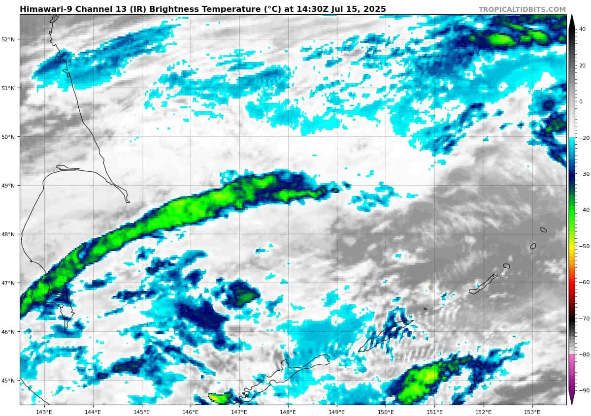
himawari9_ir_06W_202507151430_lat47.3-lon147.2
08W_151200sair
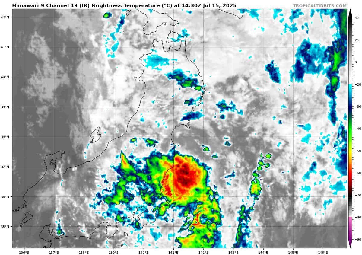
himawari9_ir_08W_202507151430_lat36.5-lon141.0

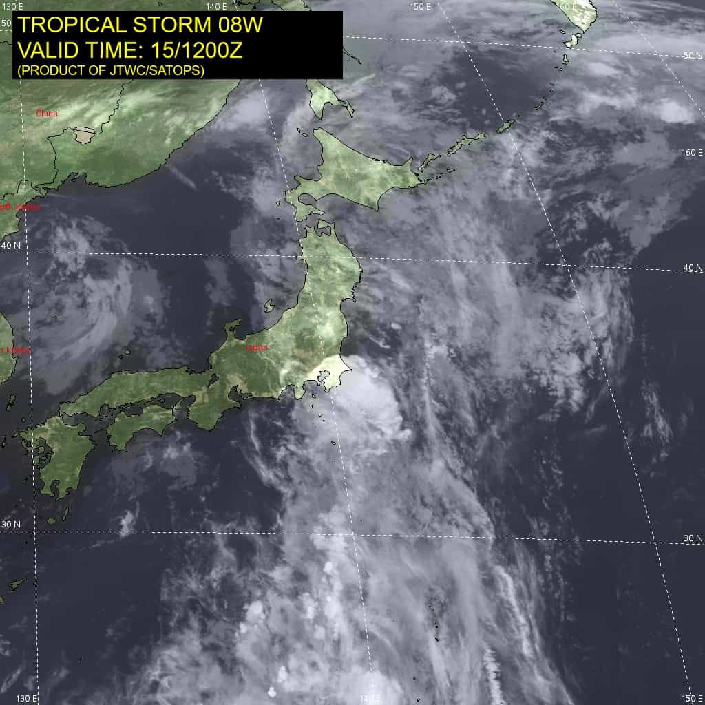
08W_tracks_latest
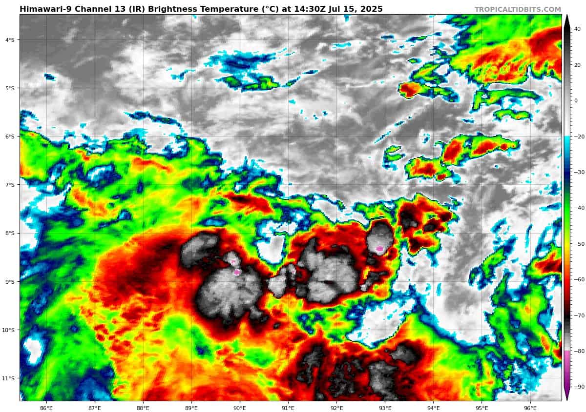
himawari9_ir_90S_202507151430_lat-7.1-lon91.2
90S_tracks_latest
By PDC’s Senior Weather
Specialist Glenn James

The Pacific Disaster Center’s (PDC Global) Tuesday, July 15, 2025, Tropical Cyclone Activity Report…for the Pacific Ocean, the Indian Ocean, and adjacent Seas
Current Tropical Cyclones:
Tropical Cyclone 08W is located approximately 56 NM south-southeast of Misawa Japan – Final Warning
Northeast Pacific Ocean: There are no Tropical Cyclones
Tropical cyclone formation is not expected during the next 7-days.
Central Pacific Ocean: There are no Tropical Cyclones
Tropical cyclone formation is not expected during the next 7-days.
Western Pacific, Indian Ocean, and adjacent Seas:
Western Pacific
Tropical Cyclone 08W – Final Warning
According to the JTWC Warning number 4, sustained winds were 25 knots with gusts to near 35 knots
Animated enhanced infrared (eir) satellite imagery depicts 08wW with a rapidly deteriorating low-level circulation center (llcc) as it quickly traverses across northern Honshu.
As the system continues to gain latitude, the environment will only worsen with increasing vertical wind shear and cold sea sea surface temperatures. As a result, 08W is forecast to continue weakening as it tracks off to the northeast over the next 24 hours and becomes washed out by the strong upper-level winds associated with the jet stream.
Deterministic and ensemble model guidance overall agrees on the track and continued weakening trend of the system.
>>> There’s an area of disturbed weather being referred to as Invest 96W, which is located approximately 436 NM east of Legazpi, Philippines
The system is currently classified as a monsoon depression, generally characterized as a large cyclonic circulation, greater than 600 NM diameter, with extensive gale-force winds over the southeastern periphery and a weak core of light winds.
Multi-spectral satellite imagery (msi) depicts a slowly consolidating low level circulation center (llcc) obscured by flaring convection that is sheared from the north. A partial ascat pass reveals a broad and elongated circulation with its strongest winds isolated to the northeast.
Environmental analysis for the area indicates marginally favorable conditions for development with moderate (15-20 knot) vertical wind shear offset by warm sea surface temperatures and moderate equatorward outflow aloft.
Global deterministic models are in fair agreement that the area of convection 96W will continue west-northwest as it gradually intensifies over the next 48 hours. Ensemble guidance agrees on a west-northwest track with ecens being more aggressive on development than the gefs.
Maximum sustained surface winds are estimated at 23 to 28 knots.
The potential for the development of a significant tropical cyclone within the next 24 hours is upgraded to medium.
South Indian Ocean
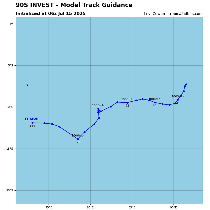
>>> There’s an area of disturbed weather being referred to as Invest 90S, which is located approximately 401 NM northwest of the Cocos Islands
Animated enhanced infrared satellite imagery (eir) depict an area of curved convective banding surrounding the southern periphery of a well-defined low level circulation center (llcc).
Environmental conditions are moderately favorable with good poleward outflow aloft and warm sea surface temperatures. The only hindrance being moderate to high (20-25 knots) vertical wind shear impacting 90S from the east.
Current global deterministic and ensemble models are in good agreement on a slow southwestward track with marginal further development over the next 24 hours.
Maximum sustained surface winds are estimated at 28 to 33 knots.
The potential for the development of a significant tropical cyclone within the next 24 hours is upgraded to high.