
")
Current Snapshot
For all the latest updates visit: DisasterAWARE
epac

1800×1080
06w
92W_120730sair
himawari9_ir_06W_202507121520_lat24.9-lon141.6

06W_tracks_latest
By PDC’s Senior Weather
Specialist Glenn James

The Pacific Disaster Center’s (PDC Global) Saturday, July 12, 2025, Tropical Cyclone Activity Report…for the Pacific Ocean, the Indian Ocean, and adjacent Seas
Current Tropical Cyclones:
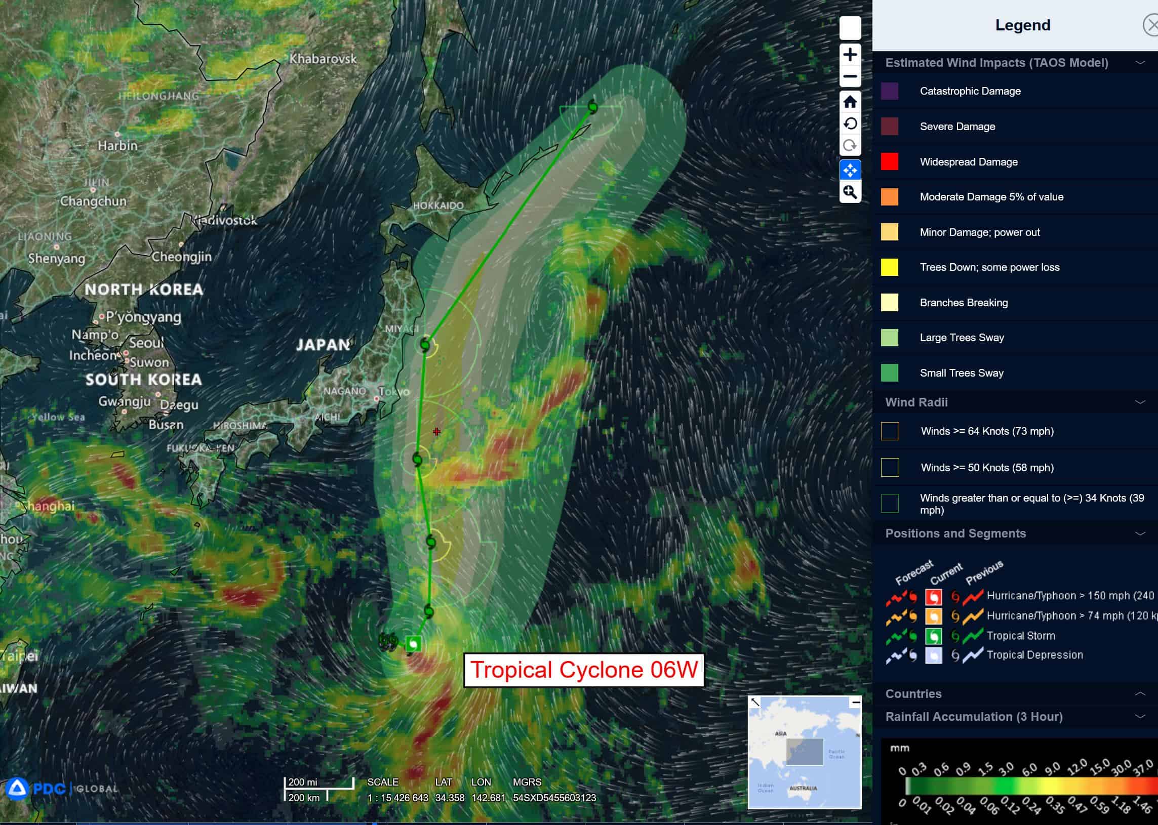
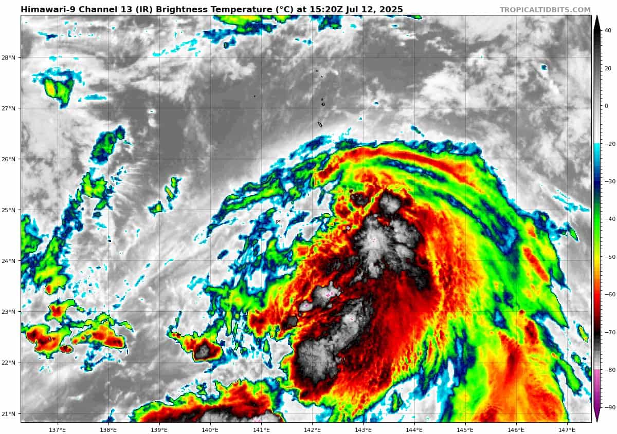
Tropical Cyclone 06W (Nari) is located approximately 547 NM south-southeast of Yokosuka, Japan
Tropical Cyclone 07W is located approximately 287 NM west-southwest of Sasebo, Japan
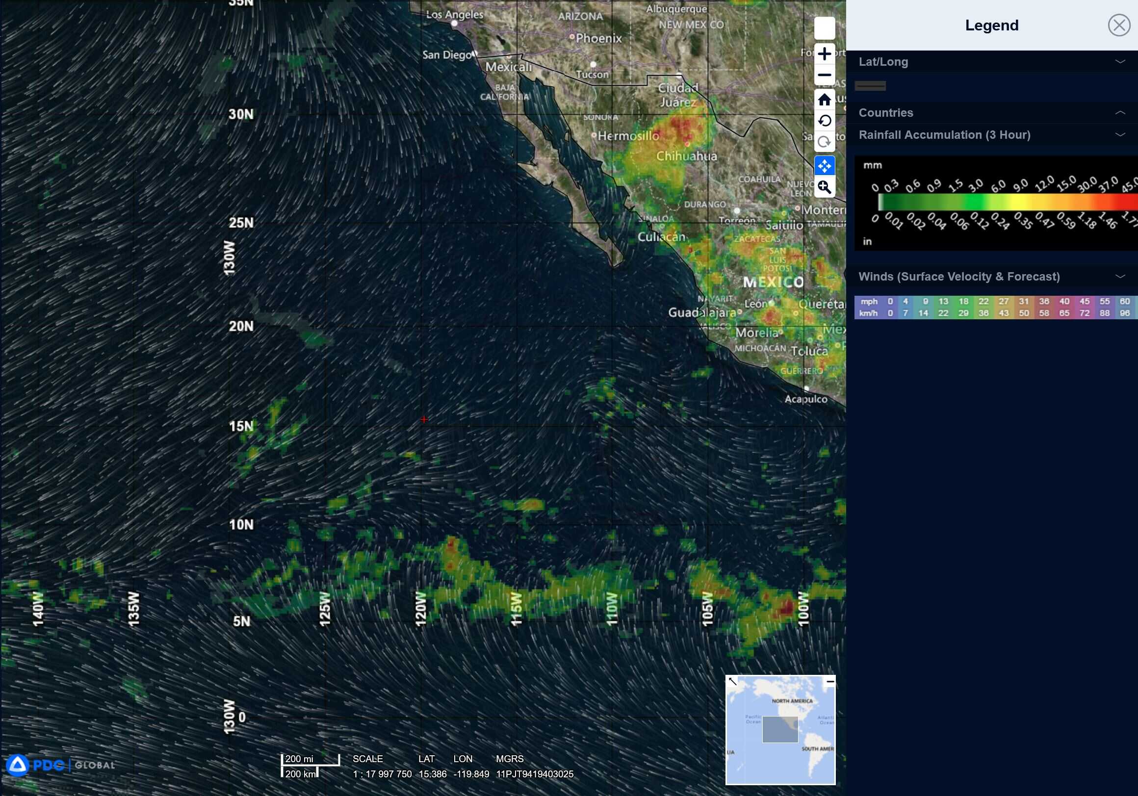
Northeast Pacific Ocean: There are no Tropical Cyclones
Tropical cyclone formation is not expected during the next 7-days.
Central Pacific Ocean: There are no Tropical Cyclones
Tropical cyclone formation is not expected during the next 7-days.
Western Pacific, Indian Ocean, and adjacent Seas:
Western Pacific
Tropical Cyclone 06W (Nari)
According to the JTWC Warning number 9, sustained winds were 35 knots with gusts to near 45 knots
After a brief period of consolidation, animated enhanced infrared satellite imagery depicts rapid weakening of the core convection over the northwestern quadrant, with increasing pressure from the northwesterly vertical wind shear. Imagery also shows persistent linear
banding along the southeastern flank of the system. Microwave imagery
has been sparse but an earlier image showed improved convective banding over the southern quadrant wrapping into a well-defined low-level circulation center.
Tropical storm 06W is struggling to consolidate and is not vertically aligned. Satellite imagery continues the show the presence of vertical hot towers within the convective mass, with cold cloud top temperatures. There is still an expectation that the system will consolidate and become increasingly axisymmetric over the next 12 hours.
As this occurs, the system is forecast to track in a more consistent poleward trajectory along the western periphery of the str through 36 hours. After 36 hours, a major shortwave trough is expected to deepen over the Korean peninsula and Japan, which could lead to a north-northwestward track closer to Yokosuka before the system recurves northeastward toward the Kuril Islands.
Extra-tropical transition (ett) will commence as the system interacts with the major shortwave trough near 48 hours, with ett completing by 72 hours as the system becomes embedded within the mid-latitude westerlies and accelerates.
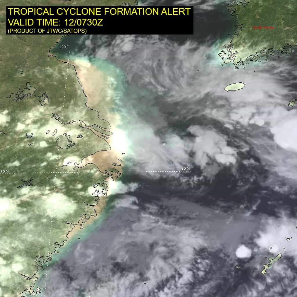
Tropical Cyclone 07W
According to the JTWC Warning number 2A, sustained winds were 30 knots with gusts to near 40 knots