
")
Tropical Cyclone 05S (Fina) – Pacific
Tuesday, November 18, 2025
Current Snapshot
For all the latest updates visit: DisasterAWARE
epac
1800x1080e
05s
05S_181200sair
himawari8_ir_05S_202511181510_lat-9.9-lon131.2
05S_tracks_latest
By PDC’s Senior Weather
Specialist Glenn James

The Pacific Disaster Center’s (PDC Global) Tuesday, November 18, 2025, Tropical Cyclone Activity Report…for the Pacific Ocean, the Indian Ocean, and adjacent Seas
Current Tropical Cyclones:
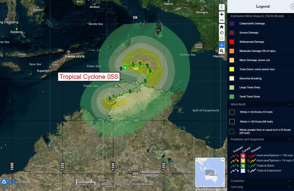
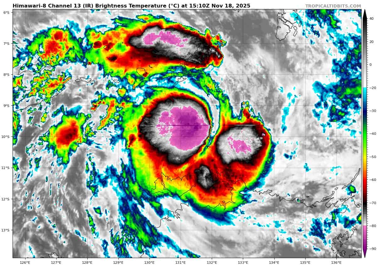
Tropical Cyclone 05S (Fina)…is located 201 NM north-northeast of Darwin, Australia
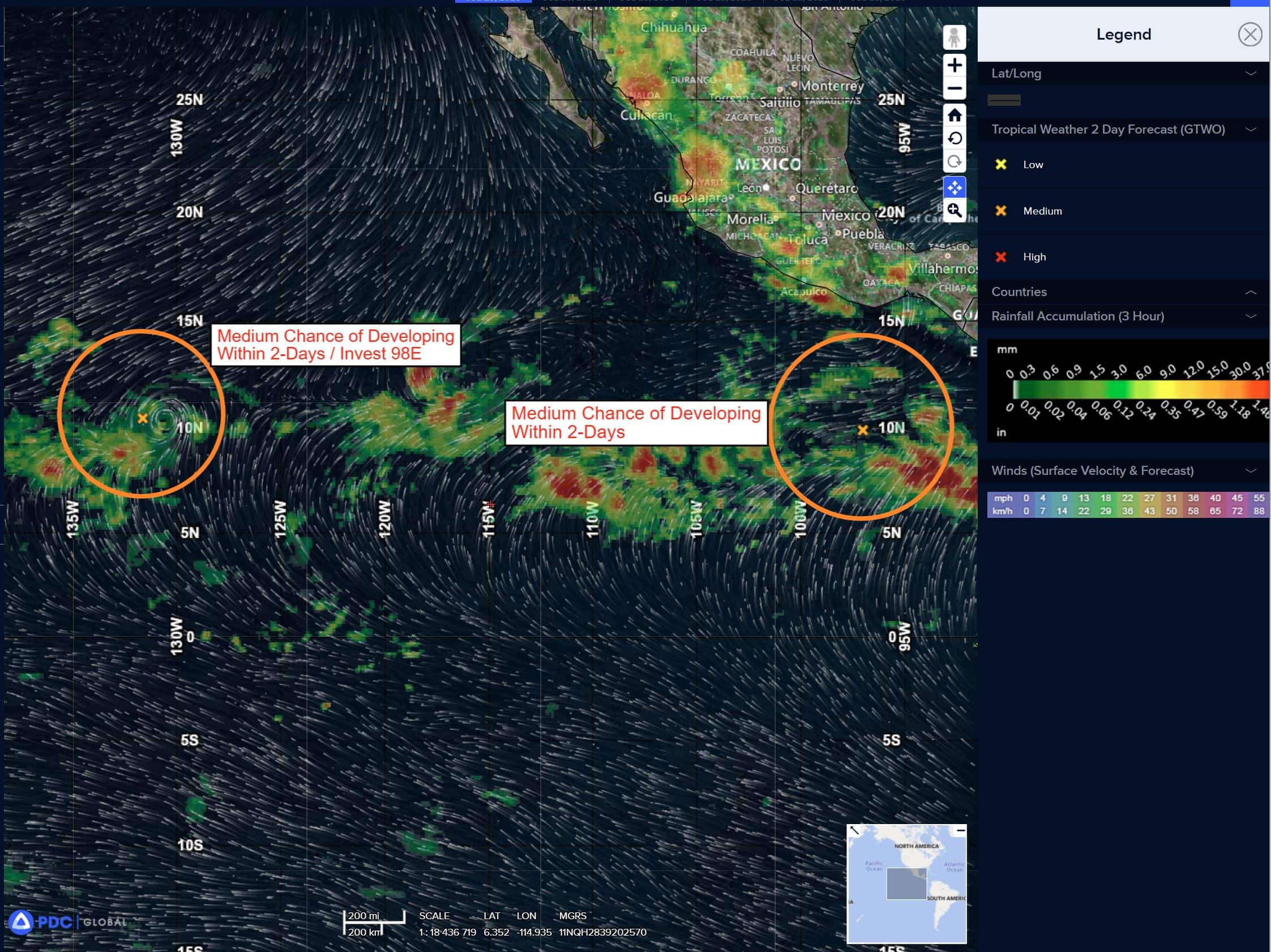
Northeast Pacific Ocean: There are no Tropical Cyclones
Tropical cyclone formation is not expected during the next 7 days.
Central Pacific Ocean: There are no Tropical Cyclones
Tropical cyclone formation is not expected during the next 7 days.
Western Pacific, Indian Ocean, and adjacent Seas:
South Indian Ocean
Tropical Cyclone 05S (Fina)
According to the JTWC warning number 4, sustained winds were 50 knots, with gusts to near 65 knots
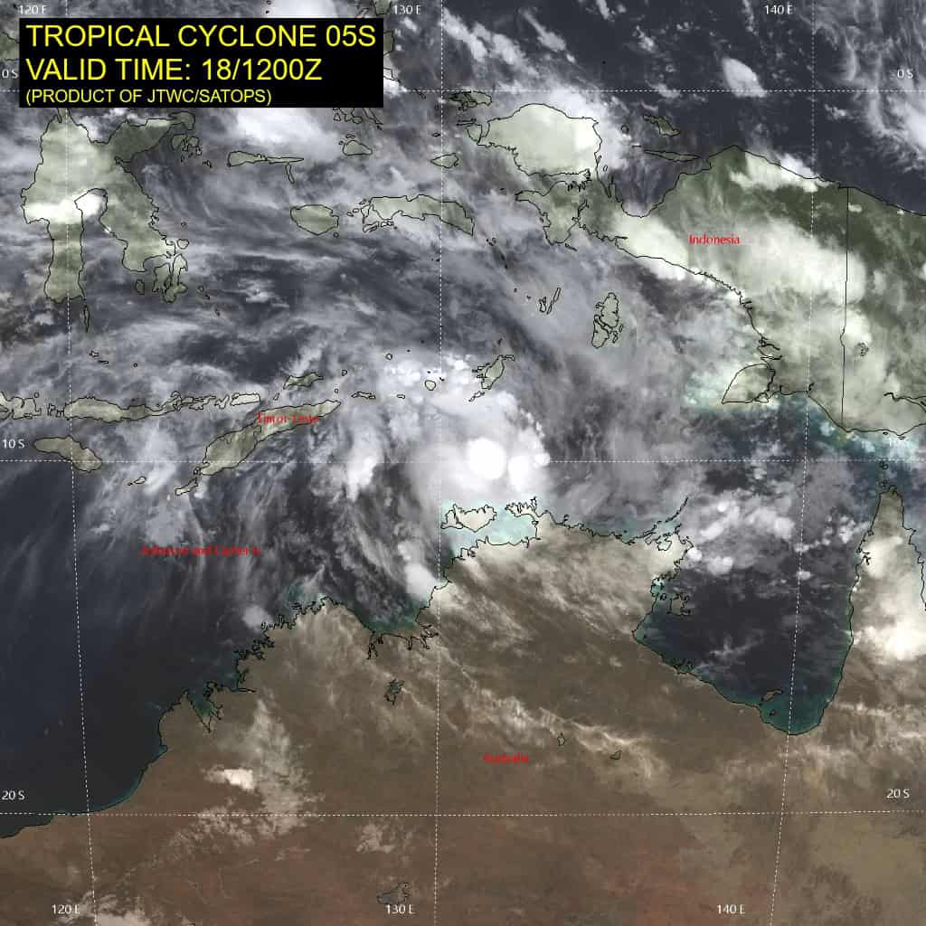
Tropical cyclone 05S has continued to consolidate under favorable environmental conditions to include radial outflow, low vertical wind shear and warm sst values.
Animated enhanced infrared (eir) satellite imagery depicts a symmetric central dense overcast feature obscuring the low-level circulation center (llcc), with persistent deep convective banding over the southern semicircle.
Animated radar imagery from the Darwin radar reveals curved banding over the southern semicircle wrapping weakly over the northern quadrant of a defined llcc, which supports the initial position with high confidence.
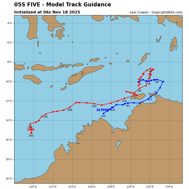
TC 05S will track slowly eastward over the next 36 hours along the southern periphery of the ner. The system is forecast to peak to about 60 knots during this time frame, with generally favorable conditions persisting through about 24 hours.
Near 24 hours, vertical wind shear (vws) is forecast to increase to high (25-30 knots) levels, which will tilt the vortex southwestward, with dry air entraining into the eastern quadrant of the core. This will initiate a gradual weakening trend through 72 hours.
After 72 hours, the subtropical ridge to the south and east is expected to broaden and strengthen becoming the dominant steering influence through the remainder of the forecast period.
This will drive the system southwestward to west-southwestward through 120 hours. After 72 hours, TC 05S will skirt the northern coast of Australia, with no change to the intensity through 96 hours. After 96 hours, the system will track back over water with a slight intensification to 50 knots by 120 hours.