
")
Current Snapshot
For all the latest updates visit: DisasterAWARE
1800e
1800x1080e

fina
05S_200600sair
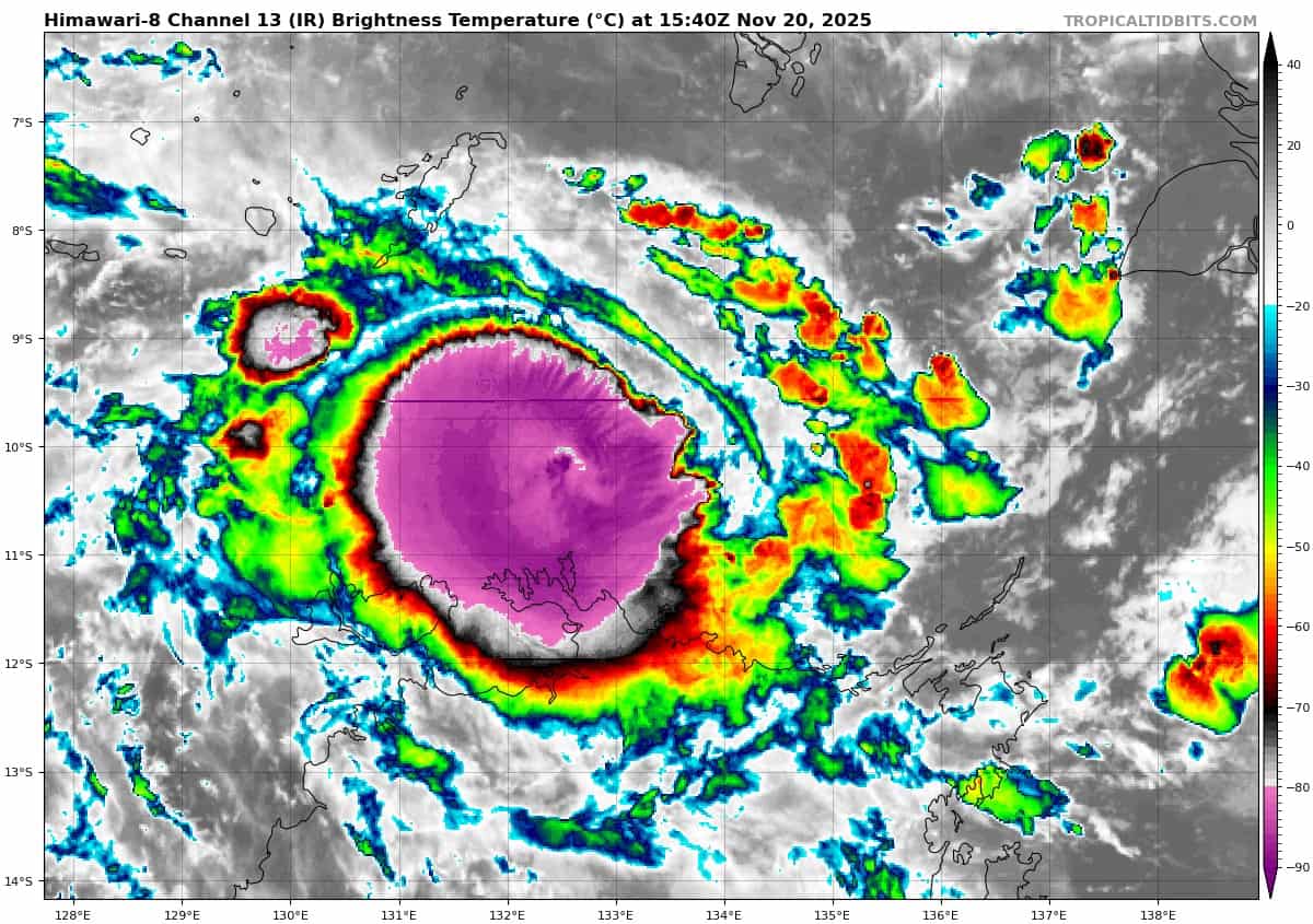
himawari8_ir_05S_202511201540_lat-10.1-lon133.3
05S_tracks_latest
By PDC’s Senior Weather
Specialist Glenn James

The Pacific Disaster Center’s (PDC Global) Thursday, November 20, 2025, Tropical Cyclone Activity Report…for the Pacific Ocean, the Indian Ocean, and adjacent Seas
Current Tropical Cyclones:
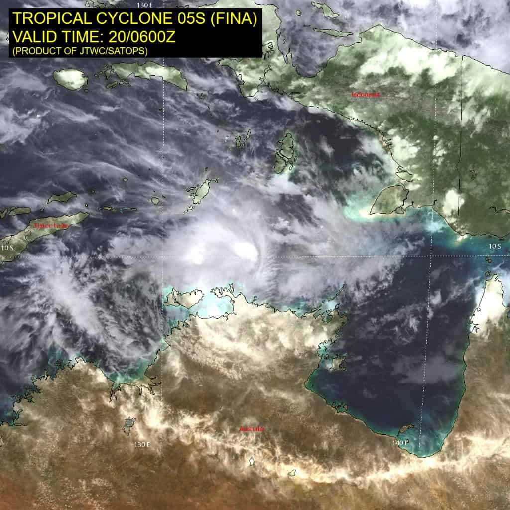
Tropical Cyclone 05S (Fina)…is located 202 NM northeast of Darwin, Australia
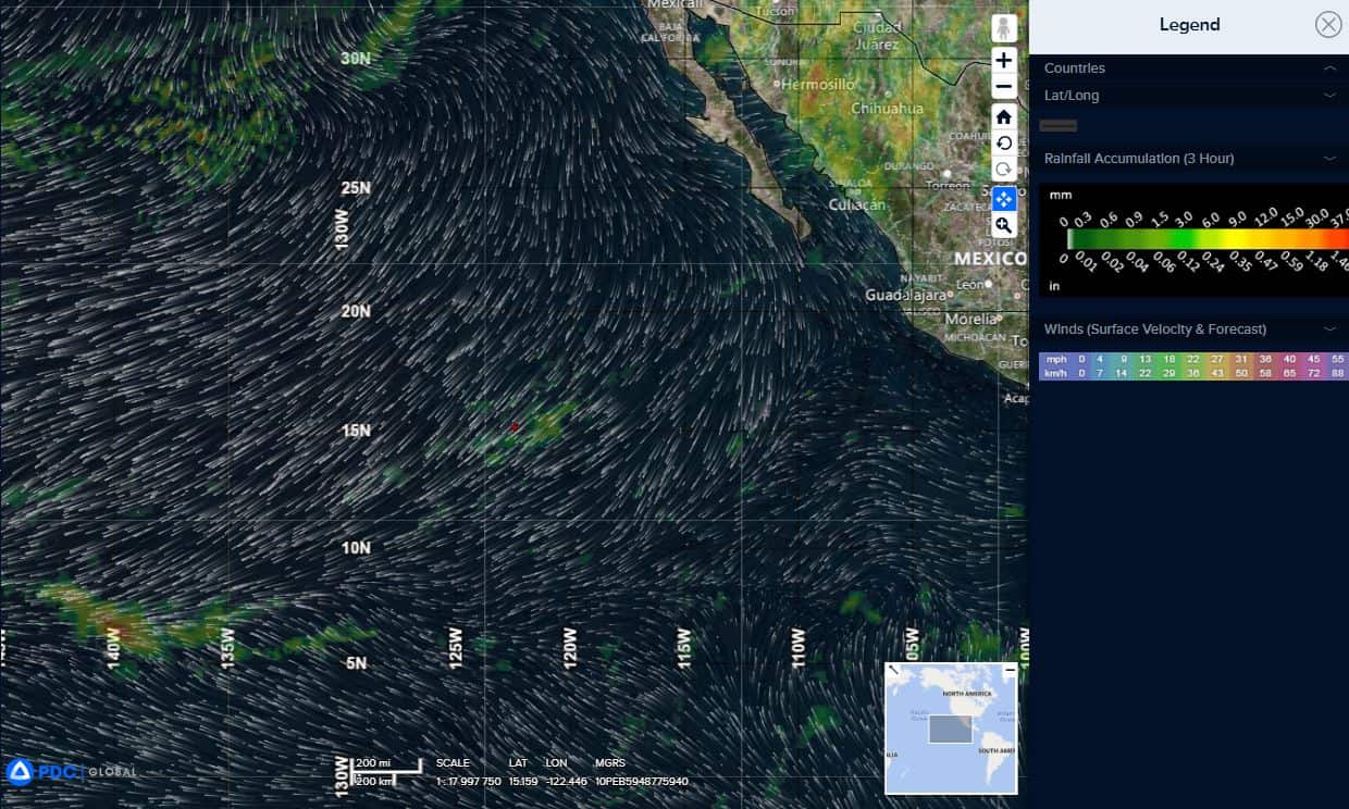
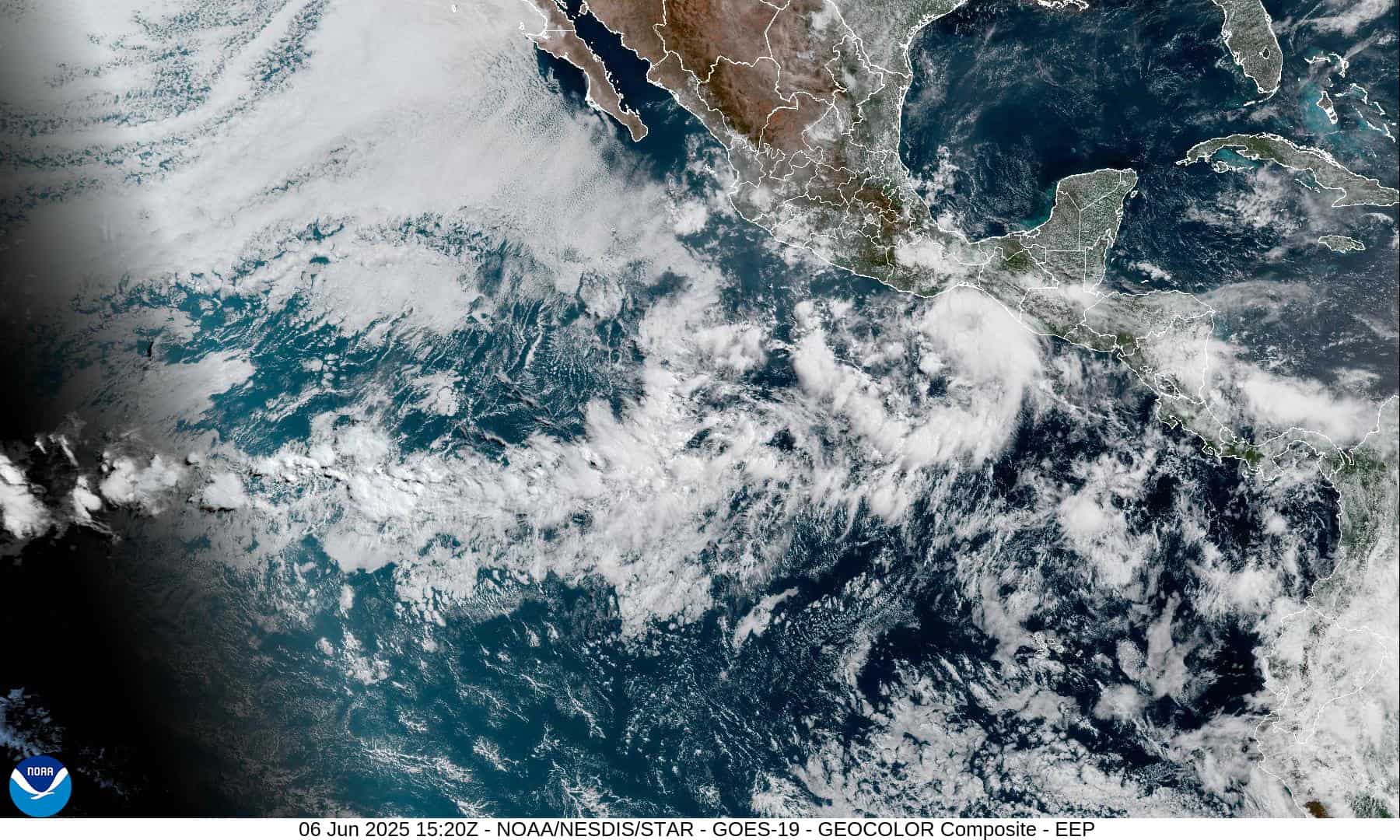
Northeast Pacific Ocean: There are no Tropical Cyclones
Tropical cyclone formation is not expected during the next 7 days.
Central Pacific Ocean: There are no Tropical Cyclones
Tropical cyclone formation is not expected during the next 7 days.
Western Pacific, Indian Ocean, and adjacent Seas:
South Indian Ocean
Tropical Cyclone 05S (Fina)
Animated enhanced infrared (eir) satellite imagery depicts tropical cyclone 05S (Fina) continuing to be impacted by northeasterly shear, causing the deep convection to be displaced to the southwest. Strong bursts of convection that are closer to the partially exposed low-level circulation center (llcc) have re-emerged around 201100z. A 200941z wsfm 37 ghz microwave image revealed a compact microwave eye feature that is ragged along the eastern semicircle. A 200929z rcm-3 sar wind speed image revealed a ring of 50-55 kts with a vmax of 57 kts in the northern semicircle.
Environmental analysis indicates that 05D is in a marginally favorable environment characterized by moderate poleward outflow, moderate (15-20 kts) northeasterly vertical wind shear, dry air entrainment, and warm (29-30 c) sea surface temperatures.
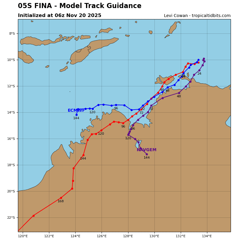
Tc 05s is forecast to begin tracking southwestward, along the northwestern periphery of a building subtropical ridge centered south of the Gulf of Carpentaria. This southwestward track is expected to persist throughout the entire forecast period.
An initial landfall is forecast to occur around 24 hours, near the Garig Gunak Barlu national park. The system will then cross the Van Diemen Gulf with a second landfall near Darwin as 05S skirts the coast. 05S is then expected to enter the northern portion of the Bonaparte Gulf near 72 hours before making a third landfall east of Kalumburu near 96 hours.
Regarding intensity, 05S is forecast to maintain intensity over the next 12 hours as the northeasterly pressure and dry air continue to impact the vortex. After 12 hours, 05S is forecast to marginally intensify through 48 hours as the shear relaxes a bit and the system becomes more vertically aligned. Mid-level dry air is expected to continue to inhibit a quicker intensification trend through the timing of landfall in Darwin. Some slight weakening as the system skirts the coast is
anticipated from 48-60 hours.
Once the system enters the Bonaparte Gulf, 05S will once again encounter increased shear (20-25 kts), this time from the northwest. This shear, along with dry air entrainment, will inhibit further intensification through the timing of the third landfall event. After the third landfall, terrain interaction will cause 05S to quickly weaken through the remainder of the forecast period. 05S is forecast to dissipate over land near 120 hours as the remnant vortex continues to track southwestward.