
")
Current Snapshot
For all the latest updates visit: DisasterAWARE
epac
1800x1080e
fina
05S_231200sair
himawari8_ir_05S_202511231430_lat-13.6-lon128.9
05S_tracks_latest
92w
95b
By PDC’s Senior Weather
Specialist Glenn James

The Pacific Disaster Center’s (PDC Global) Sunday, November 23, 2025, Tropical Cyclone Activity Report…for the Pacific Ocean, the Indian Ocean, and adjacent Seas
Current Tropical Cyclones:
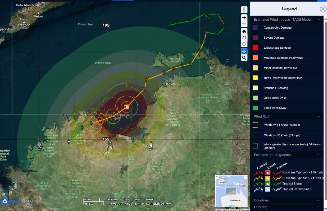
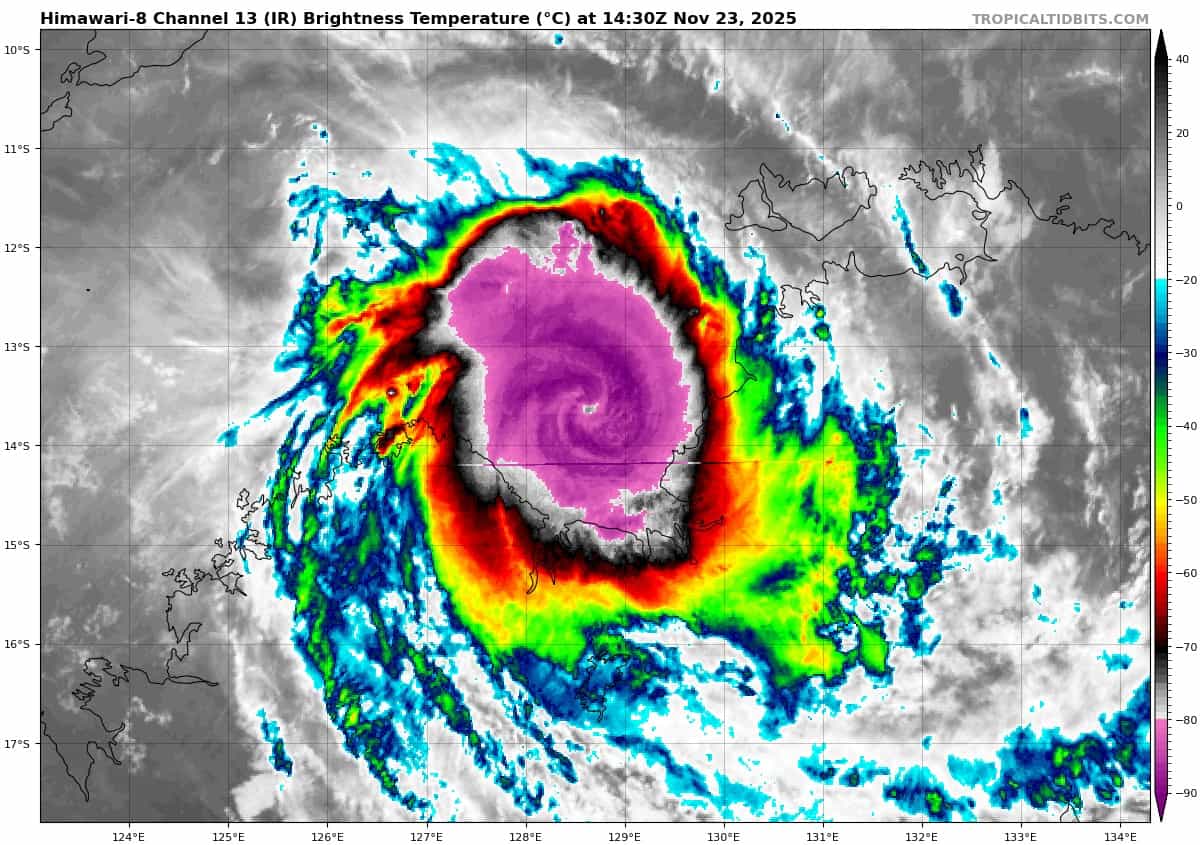
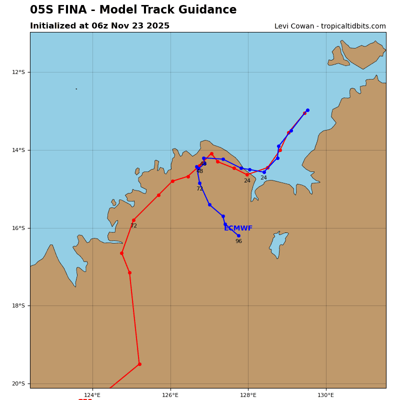
Tropical Cyclone 05S (Fina)…is located 185 NM west-southwest of Darwin, Australia
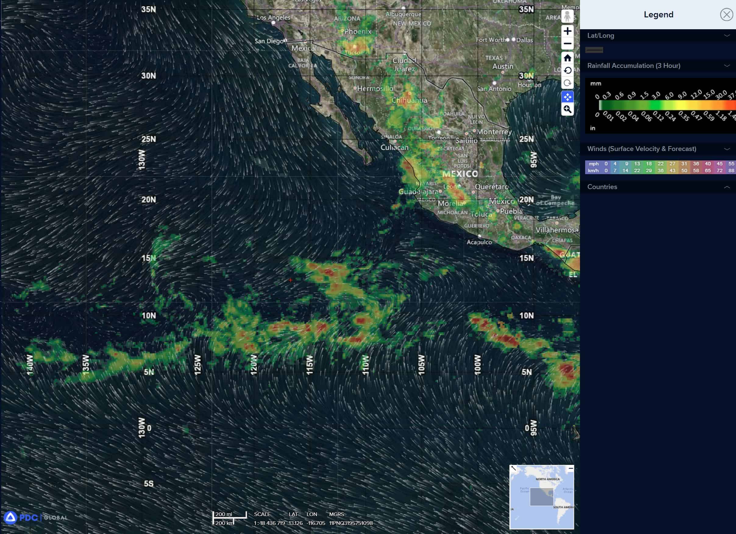
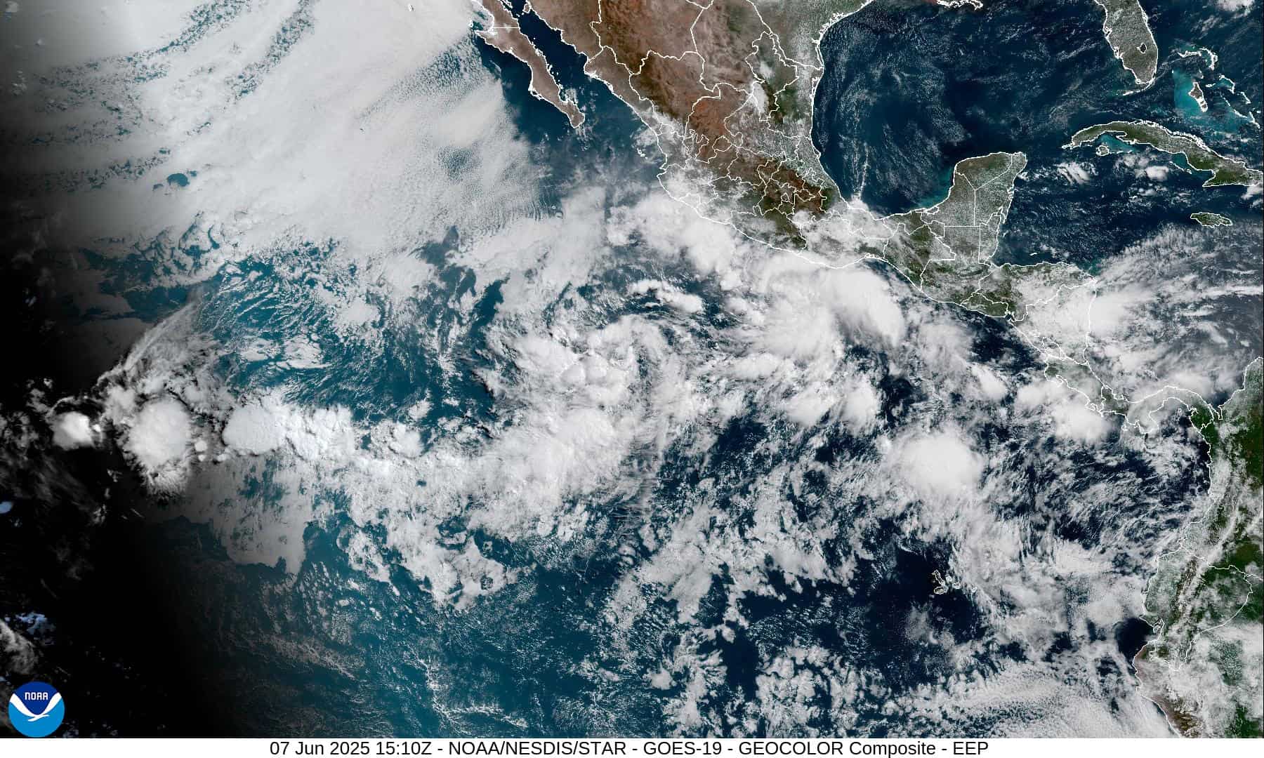
Northeast Pacific Ocean: There are no Tropical Cyclones
Tropical cyclone formation is not expected during the next 7 days.
Central Pacific Ocean: There are no Tropical Cyclones
Tropical cyclone formation is not expected during the next 7 days.
Western Pacific, Indian Ocean, and adjacent Seas:
South Indian Ocean
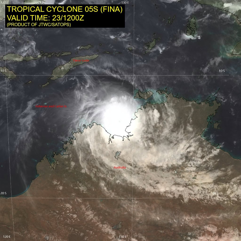
Tropical Cyclone 05S (Fina)
Tropical cyclone 05S likely re-intensified to about 100 knots at approximately 230900z but has subsequently weakened as dry air begins to entrain into the northeast quadrant of the core. Animated enhanced infrared (eir) satellite imagery depicts a more oblong central dense overcast with no eye evident. However, animated radar imagery reveals a small well-defined eye, which supports the initial position with high confidence.
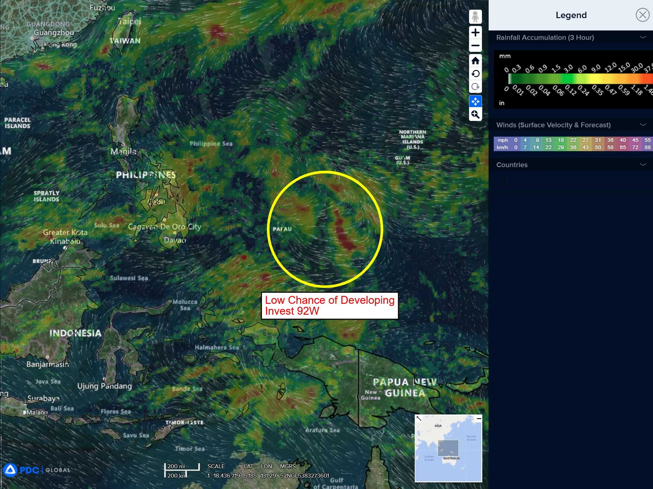
>>> There’s an area of disturbed weather being referred to as Invest 92W, which is located approximately 171 NM west-northwest of Palau.
Animated enhanced infrared imagery (eir) as well as a 230928z f17 ssmis 37ghz microwave pass depict flaring convection around a relatively broad circulation with areas of formative banding along the southern periphery of the circulation.
Environmental conditions are assessed as marginally favorable with low to moderate vertical wind shear (15-20kts), good upper level outflow and warm sea surface temperatures (27-29c).
Global models generally agree that the area of convection 92W will slowly consolidate over the next 36-48 hours as it transits over the Philippines with much more prominent development in the South China Sea.
Maximum sustained surface winds are estimated at 13 to 18 knots.
The potential for the development of a significant tropical cyclone within the next 24 hours is medium.
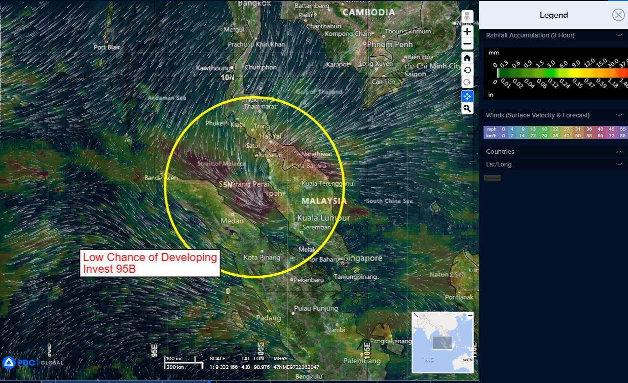
>>> There’s an area of disturbed weather being referred to as Invest 95B, which is located approximately 334 NM northwest of Singapore.
Animated enhanced infrared imagery (eir) depicts flaring convection obscuring a poorly-organized low level circulation that is getting sheared to the west in the upper levels, While a 231352 metop-b ascat image showed elevated surface winds from the north-northwest along the western periphery of the system.
Environmental analysis for this system is favorable, with low to
moderate (15-20 kts) south-southeasterly deep layer vertical wind shear, warm (28-29 c) sea surface temperatures, and moderate divergence aloft.
Global deterministic models are in a slight disagreement with gfs showing the circulation reaching up to 35 knots while ecmwf is more conservative. both models continue to show a defined circulation within the area that can be distinctly followed throughout the timeline. Ensemble models show a slight disagreement on the track but remain similar with both gefs and ecens depicting a strong signal for gradual development of the system, but gefs is showing the signal tracking into the Bay of Bengal as opposed to ecens which is showing most of the signal around the northwestern tip of Sumatra for the majority of the systems lifecycle.
Maximum sustained surface winds are estimated at 23 to 27 knots.
The potential for the development of a significant tropical cyclone within the next 24 hours remains low.