
")
Current Snapshot
For all the latest updates visit: DisasterAWARE

1800×1080
erick
goes19_ir_05E_202506181515_lat13.6-lon-95.7
181442_earliest_reasonable_toa_34
181442INTQPF_sm

05E_tracks_latest
wpac
10
By PDC’s Senior Weather
Specialist Glenn James

The Pacific Disaster Center’s (PDC Global) Wednesday, June 18, 2025, Tropical Cyclone Activity Report…for the Pacific Ocean, the Indian Ocean, and adjacent Seas
Current Tropical Cyclones:
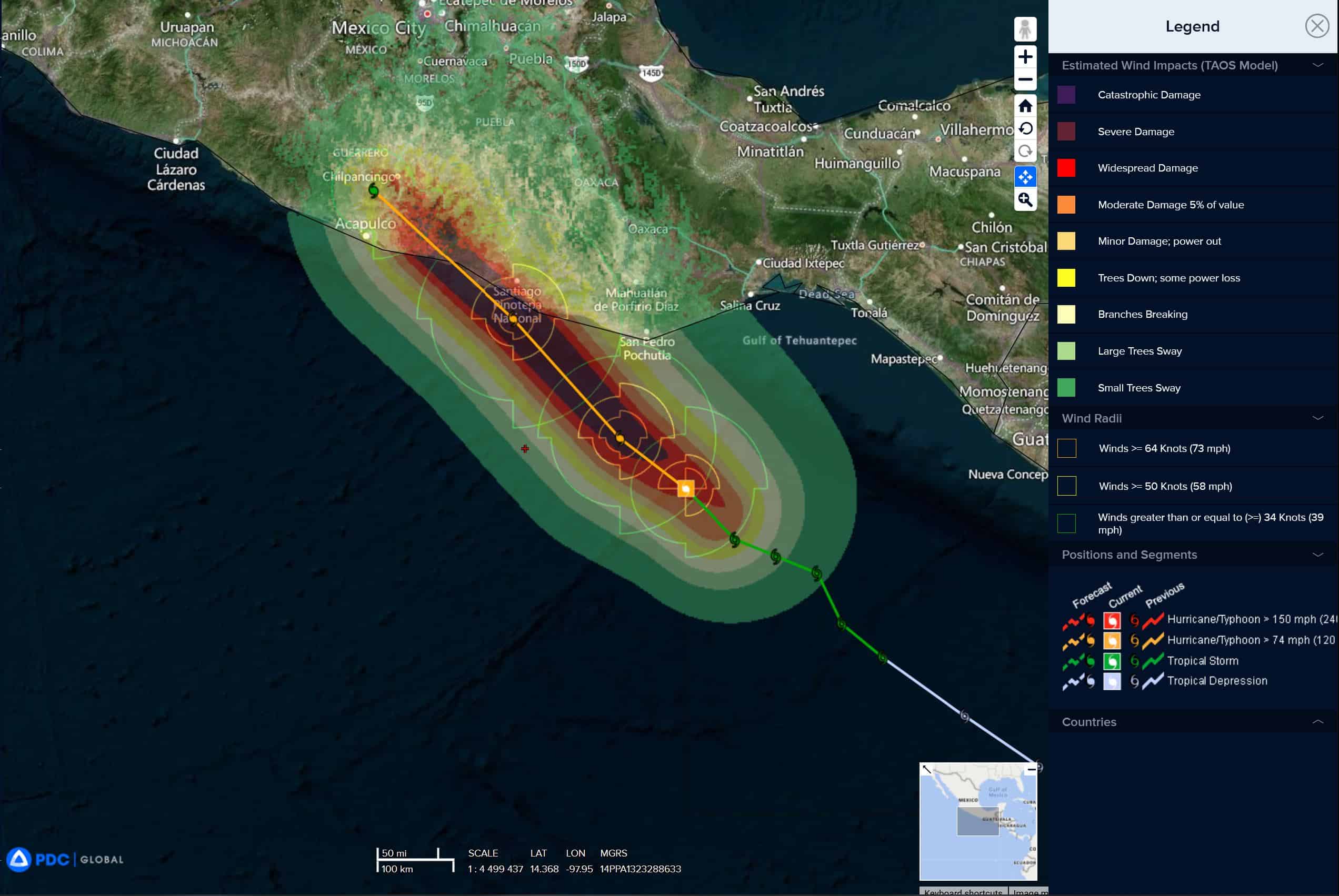
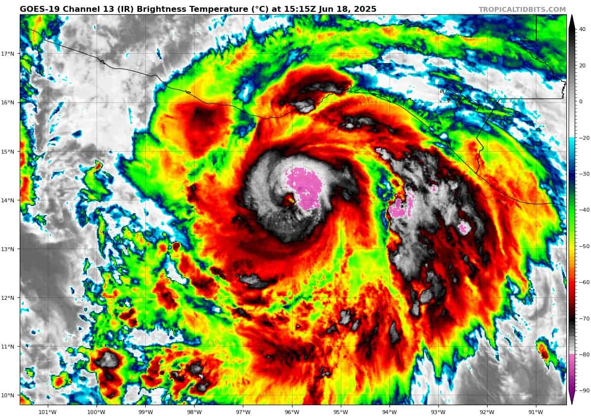
Tropical cyclone 05E (Erick)…is located about 70 miles west-southwest of Puerto Angel, Mexico
Northeast Pacific Ocean:
Tropical cyclone 05E (Erick)
ERICK NOW AN EXTREMELY DANGEROUS CATEGORY 4 HURRICANE
According to the NHC Advisory number 11
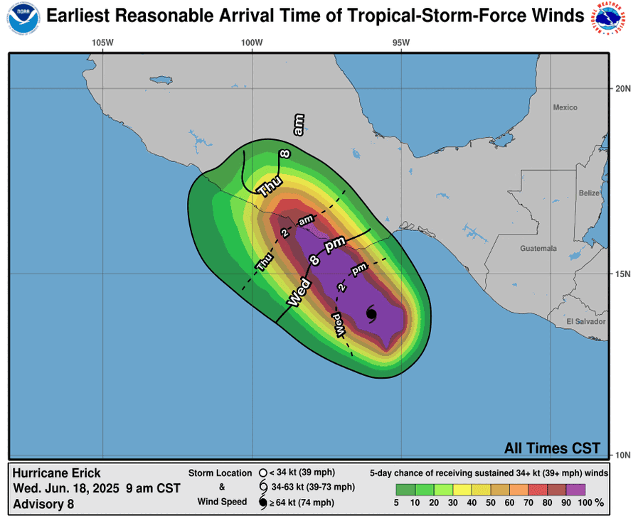
Erick is moving toward the northwest near 9 mph (15 km/h), and this general motion is expected to continue through tonight. On the forecast track, the center of Erick is expected to make landfall in the western portion of the Mexican state of Oaxaca or the eastern portion of the Mexican state of Guerrero this morning, and then continue inland over southern Mexico later today. Maximum sustained winds have increased to near 145 mph (230 km/h) with higher gusts. Erick is a category 4 hurricane on the Saffir-Simpson Hurricane Wind Scale. Some additional strengthening could occur before landfall. After landfall, Erick should rapidly weaken over the mountains of Mexico, and the system is likely to dissipate Thursday night or early Friday. Hurricane-force winds extend outward up to 25 miles (35 km) from the center and tropical-storm-force winds extend outward up to 90 miles (150 km).
HAZARDS AFFECTING LAND
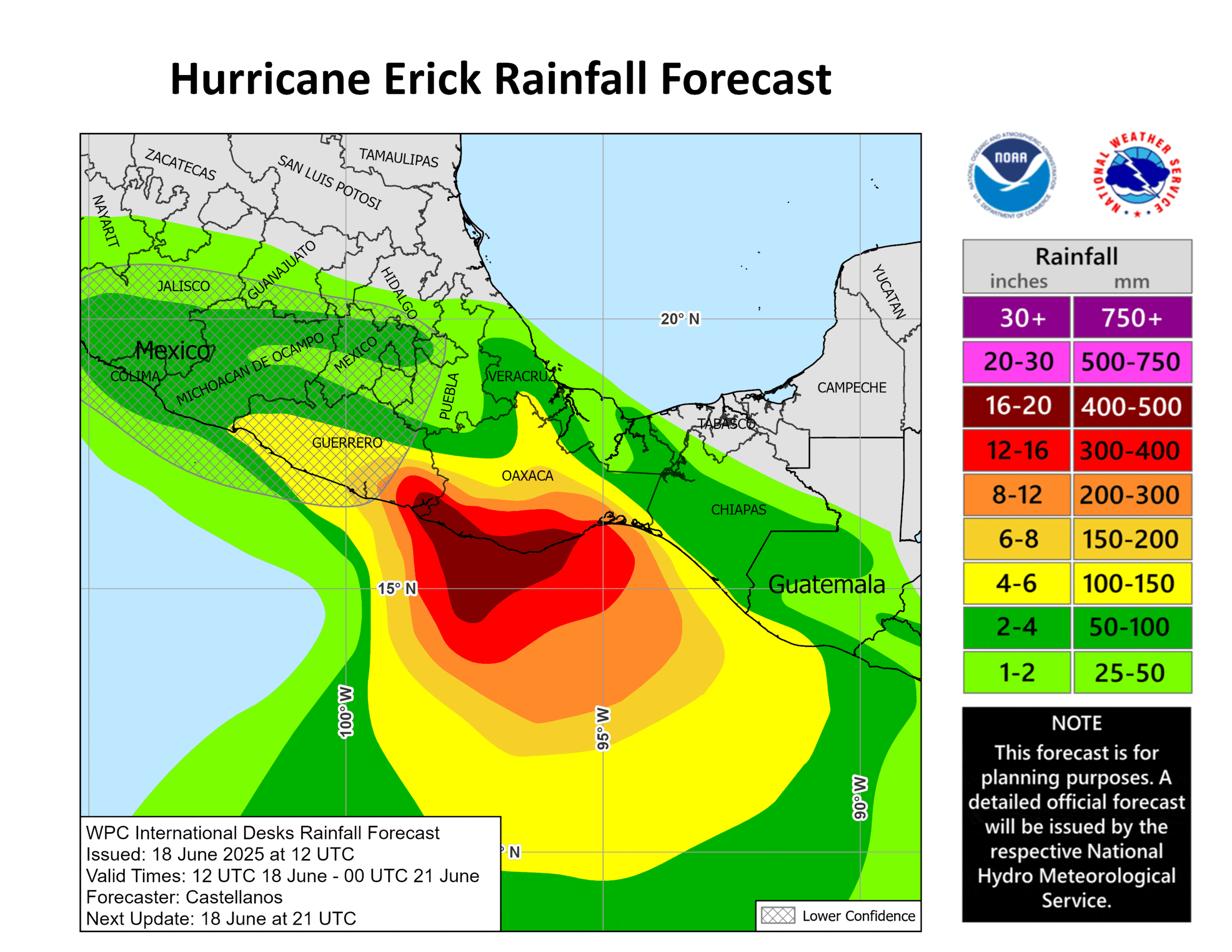
RAINFALL: Erick will produce rainfall totals of 8 to 12 inches, with maximum totals of 16 inches, across the Mexican states of Oaxaca and Guerrero. This rainfall will lead to life-threatening flooding and mudslides, especially in areas of steep terrain. Rainfall totals of 2 to 4 inches, with maximum totals of 6 inches, are expected across Guatemala and the Mexican states of Chiapas, Michoacan, Colima, Jalisco.
WIND: Hurricane conditions are expected in the hurricane warning area early Thursday and possible in the hurricane watch area on Thursday. Tropical storm conditions are expected to begin in the warning area by this evening or overnight, and preparations to protect life and property should be rushed to completion. Tropical storm conditions are expected in the tropical storm warning area beginning late today and tonight.
STORM SURGE: A dangerous storm surge is expected to produce coastal flooding near and to the east of where the center crosses the coast in areas of onshore winds. The surge will be accompanied by large and destructive waves.
SURF: Swells generated by Erick will continue affecting the coast of southern Mexico through Thursday. These swells are likely to cause life-threatening surf and rip current conditions.
Central Pacific Ocean: There are no Tropical Cyclones
Tropical cyclone formation is not expected during the next 7-days.
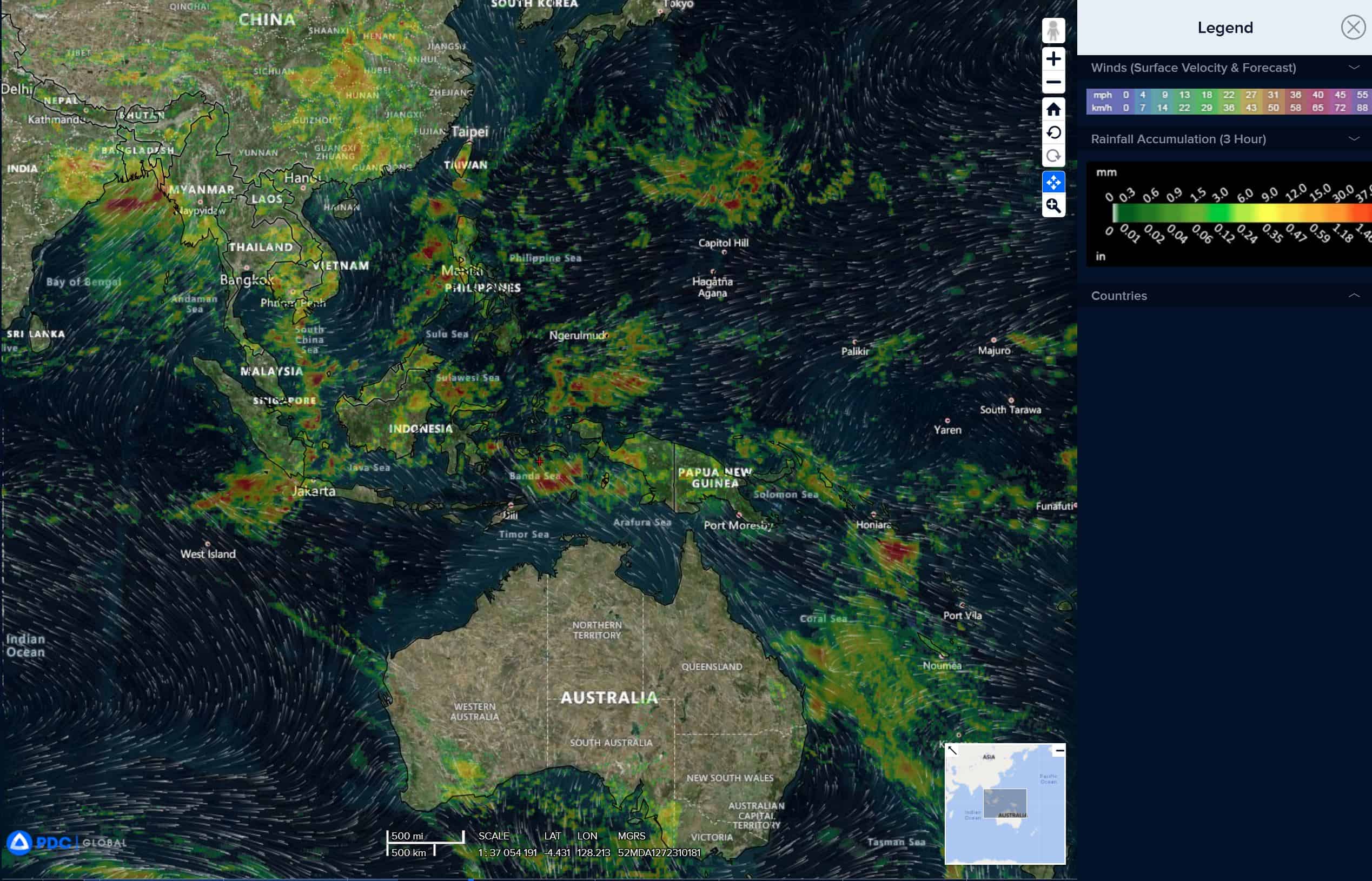
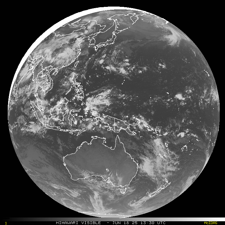
Western Pacific, Indian Ocean, and adjacent Seas: There are no Tropical Cyclones