
")
Current Snapshot
For all the latest updates visit: DisasterAWARE
1800x1080e
epac2
epac7
mun
04W_041200sair
himawari9_ir_04W_202507041420_lat30.2-lon145.3
555555
05W_041200sair

05W_tracks_latest
By PDC’s Senior Weather
Specialist Glenn James

The Pacific Disaster Center’s (PDC Global) Friday, July 4, 2025, Tropical Cyclone Activity Report…for the Pacific Ocean, the Indian Ocean, and adjacent Seas
Current Tropical Cyclones:
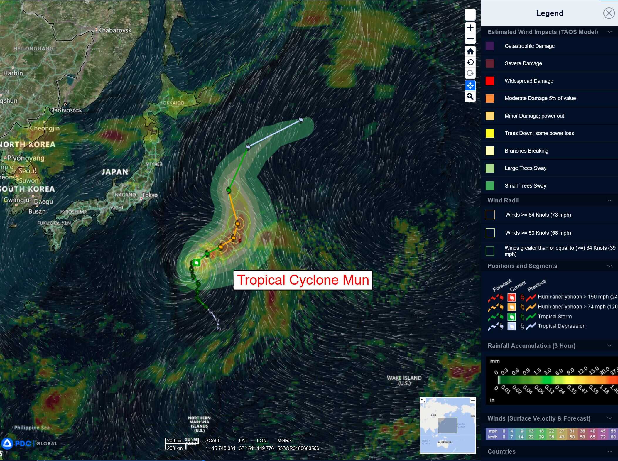
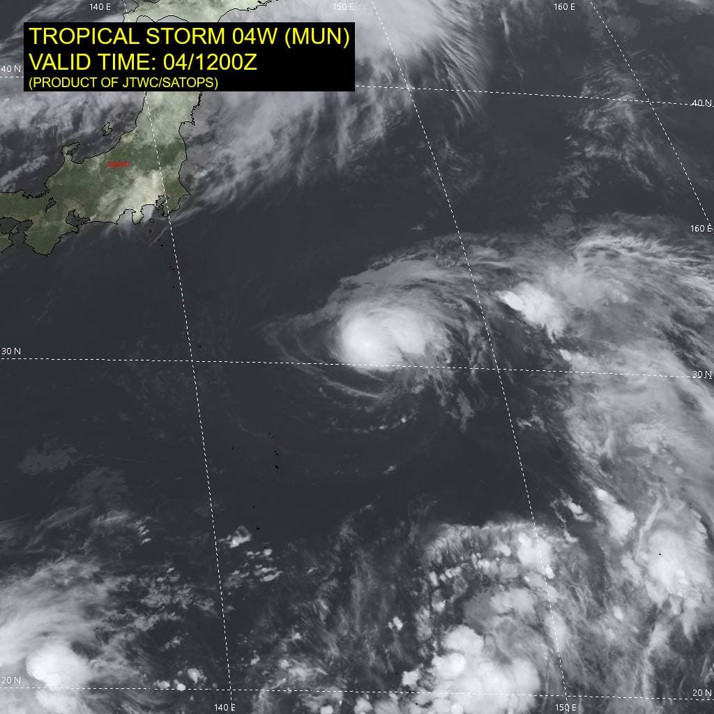
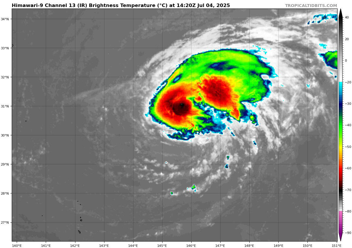
Tropical Cyclone 04W (Mun)…is located about 220 NM southeast of Yokosuka, Japan
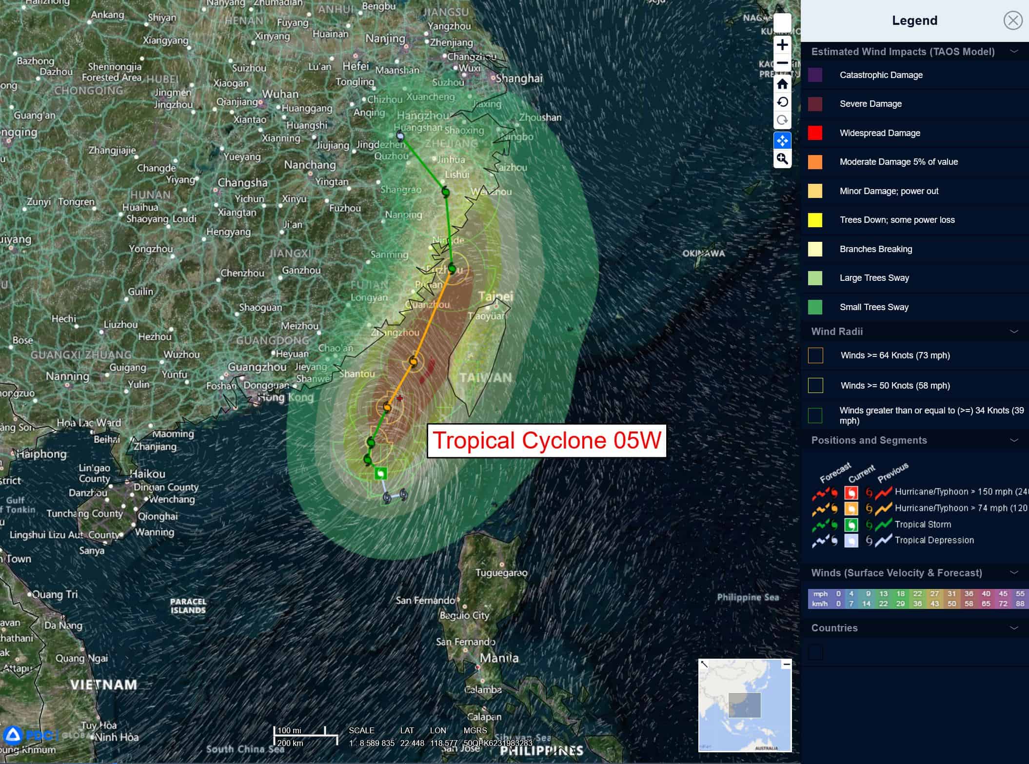
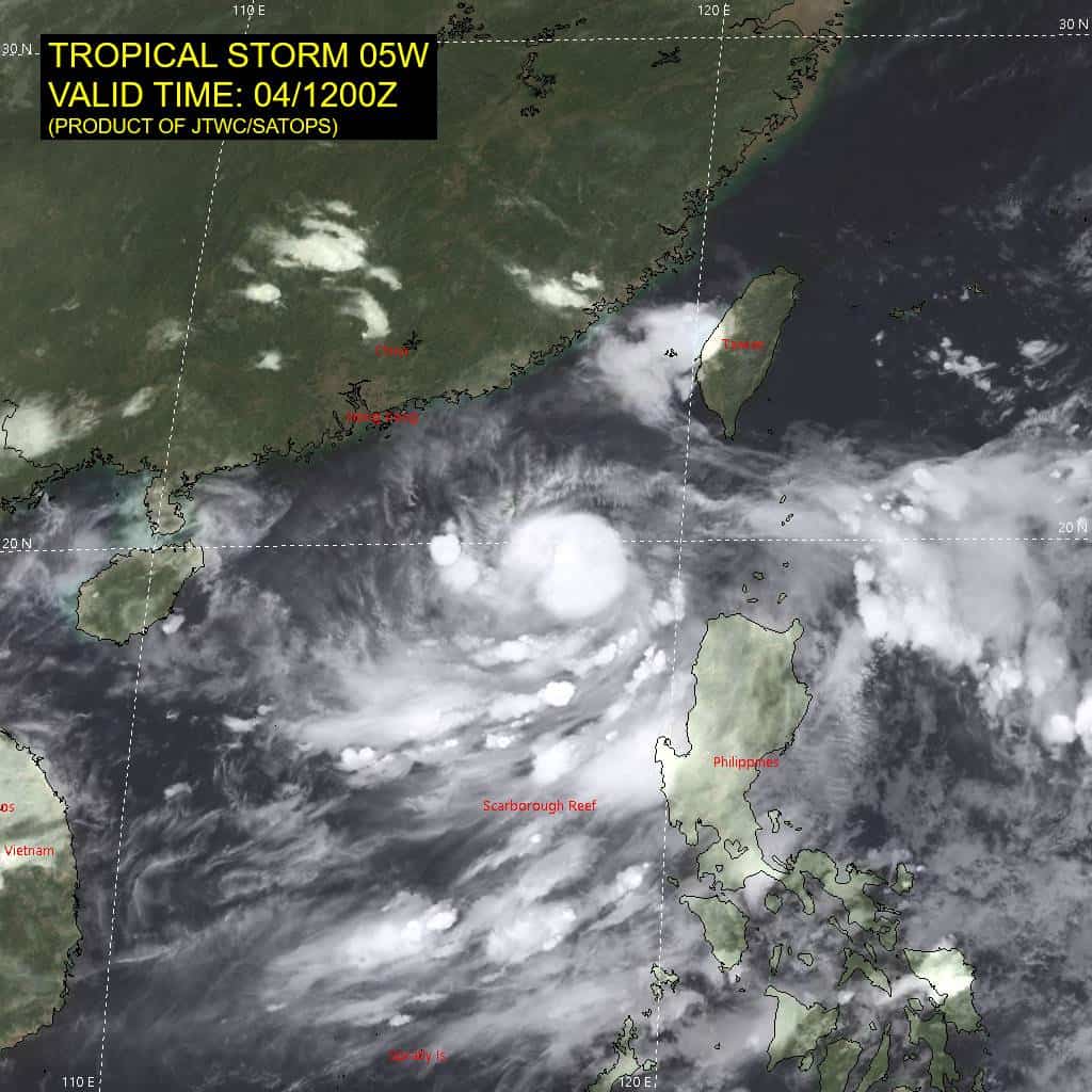
Tropical Cyclone 05W (Danas)…is located about 368 NM southwest of Taipei, Taiwan
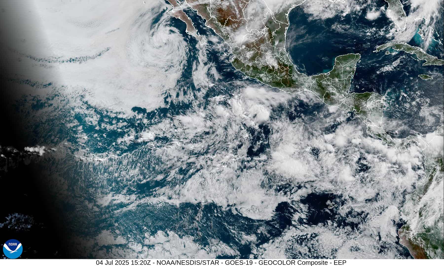
Northeast Pacific Ocean: There are no Tropical Cyclones
Central East Pacific:
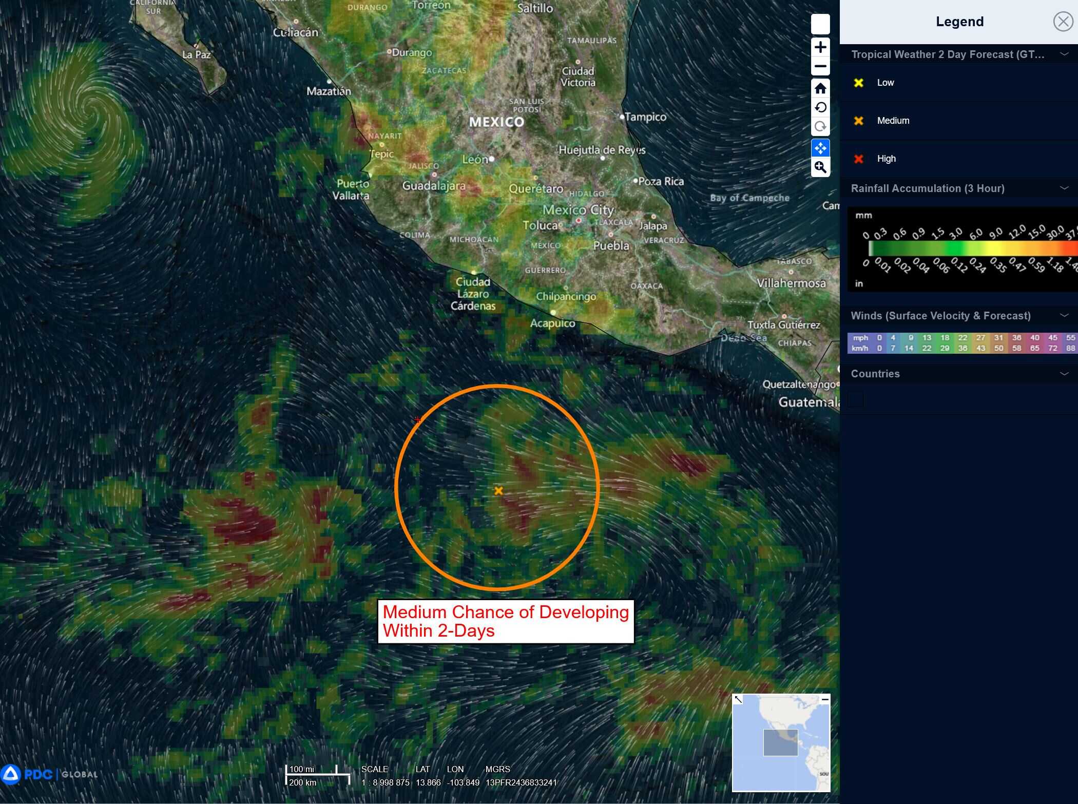
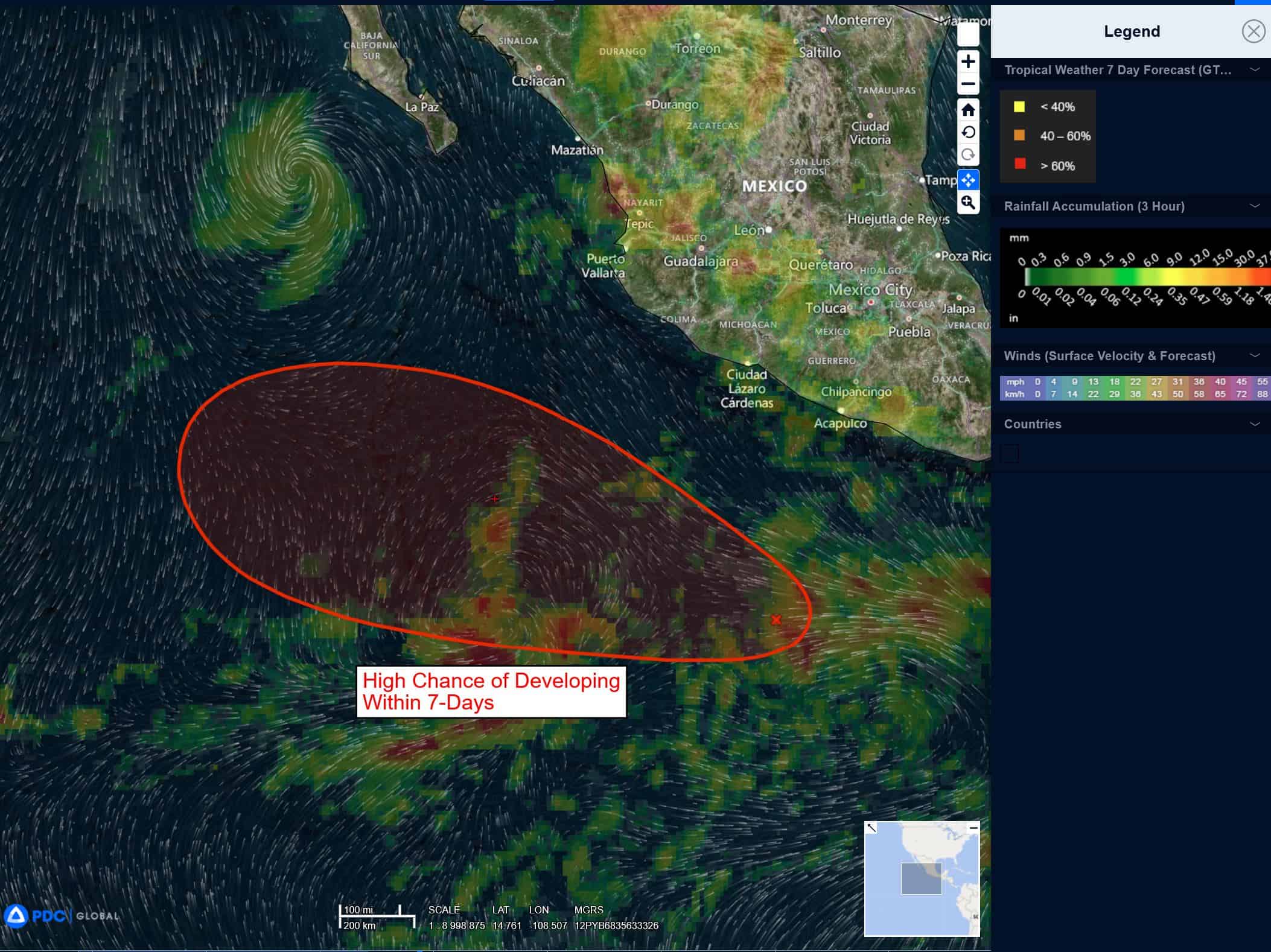
Invest 96E
>>> Satellite-derived wind data indicate that a large area of disorganized showers and thunderstorms is associated with a trough of low pressure located a few hundred miles south of southwestern Mexico. Gradual development of this system is anticipated during the next few days, and a tropical depression is expected to form late this weekend or early next week while it moves generally west-northwestward well off the coast of Mexico.
* Formation chance through 48 hours…medium…60 percent
* Formation chance through 7 days…high…90 percent
South of Southwestern Mexico:
>>> An area of low pressure could form several hundred miles offshore of southwestern Mexico late next week. Some gradual development of this system is possible thereafter while it moves generally west-northwestward.
* Formation chance through 48 hours…near 0 percent
* Formation chance through 7 days…low…20 percent
Central Pacific Ocean: There are no Tropical Cyclones
Tropical cyclone formation is not expected during the next 7-days.
Western Pacific, Indian Ocean, and adjacent Seas:
Western Pacific
Tropical Cyclone 04W (Mun)
According to the JTWC Warning number 14, sustained winds are 55 knots with gusts to 70 knots
Tropical storm 04W has maintained robust eastward outflow, enhanced by a jet and tutt cell to the east. The system has developed limited outflow over the core, with persistent deep convection obscuring the low-level circulation center (llcc). The initial position is placed with medium confidence based on animated enhanced infrared satellite imagery, which depicts a compact central dense overcast feature and partially exposed llcc over the southwestern quadrant.
TS 04W is embedded within a reverse trough formation, with the subtropical steering ridge extending from the Philippines northeastward to the eastern periphery of the system. This is general steering pattern will steer the system northeastward through 36 hours toward a break in the str associated with an upper-level shortwave trough.
Modest intensification is expected due to marginal sst values and robust outflow, with a peak intensity of 70 knots expected by 24 hours. After 36 hours, the trough will propagate eastward and the str will rebuild to the north, which will result in a more northward track through 96 hours. After 96 hours, the system will round the str axis and encounter subtropical westerlies. Rapid weakening will occur through the remainder of the period due to cold sst values and high (25-40 knots) vertical wind shear.
Tropical Cyclone 05W (Danas)
According to the JTWC Warning number 5, sustained winds are 45 knots with gusts to 55 knots
Animated enhanced infrared satellite imagery depicts a consolidating low-level circulation (llc), with improved convective banding and a developing central dense overcast driven by the improving dual channel outflow. A color composite microwave image reveals improved convective banding over the southern semicircle, wrapping into the eastern quadrant, with a defined low-level circulation center.
Tropical storm 05W is forecast to meander slowly northwestward within the competing steering environment through 12 hours. After 12 hours, the system will intensify quickly and track northward to north-northeastward along the building str entrenched to the east.
TS 05W should reach a peak intensity of 75 knots by 48 hours due to robust dual channel outflow and warm sst values. As the system tracks through the Taiwan Strait, it should weaken as warm, dry air advects off the mountains of Taiwan and entrains into the system’s core.
After 72 hours, TS 05W will turn sharply northwestward over eastern China under the steering influence of a str positioned to the north. Rapid weakening and dissipation will occur as the system tracks inland.