
")
Current Snapshot
For all the latest updates visit: DisasterAWARE
1800x1080e
2days
7days
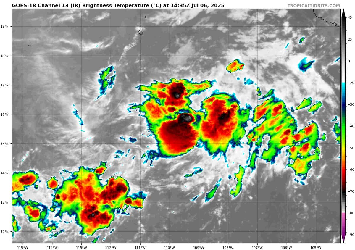
goes18_ir_96E_202507061435_lat15.5-lon-109.3
96E_tracks_latest
danas
05W_061200sair
mun
munnnnn
By PDC’s Senior Weather
Specialist Glenn James

The Pacific Disaster Center’s (PDC Global) Sunday, July 6, 2025, Tropical Cyclone Activity Report…for the Pacific Ocean, the Indian Ocean, and adjacent Seas
Current Tropical Cyclones:
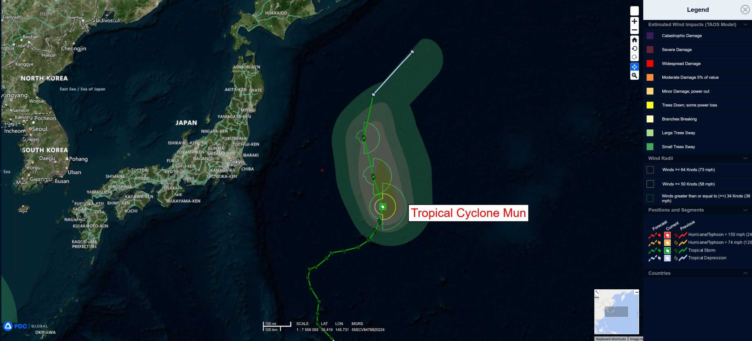
Tropical Cyclone 04W (Mun)…is located about 452 NM east of Yokosuka, Japan
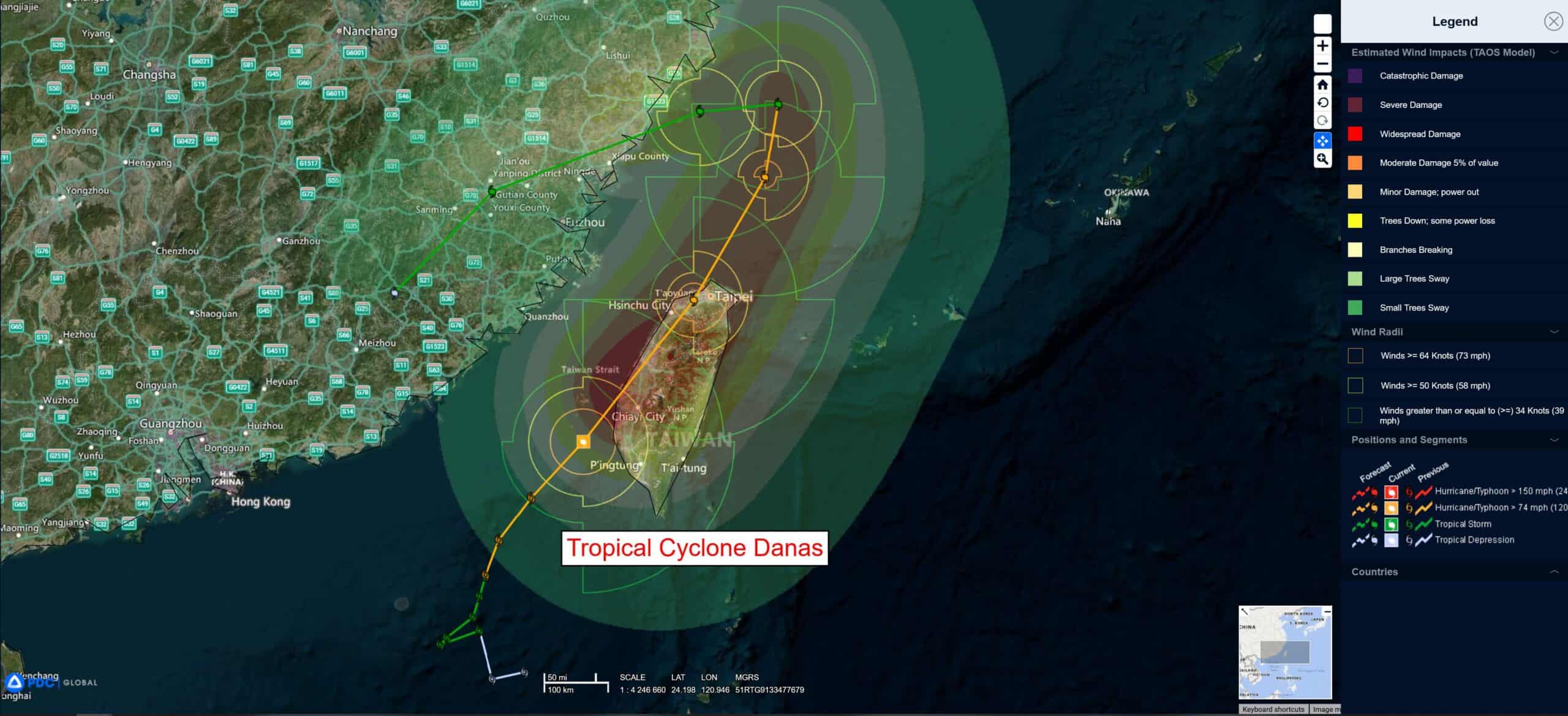
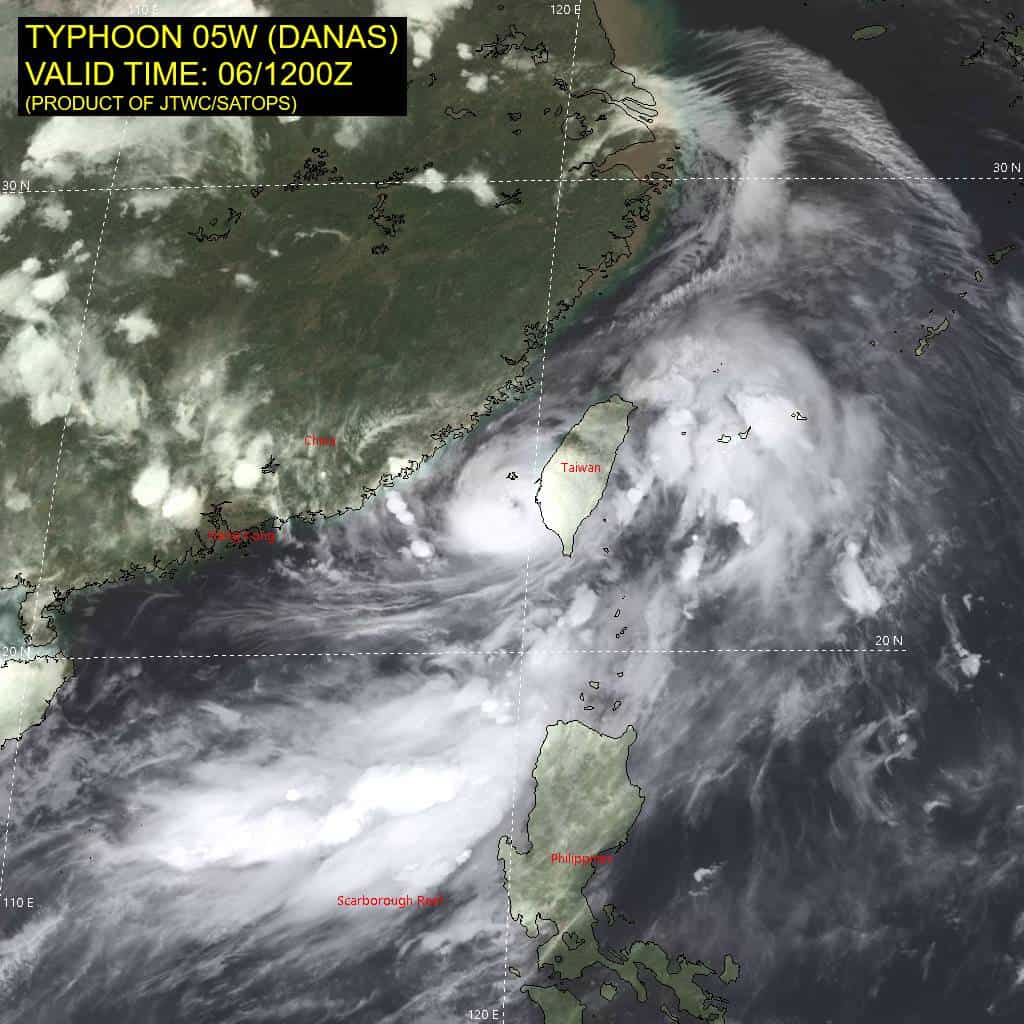
Tropical Cyclone 05W (Danas)…is located about 25 NM north-northwest of Taipei, Taiwan
Northeast Pacific Ocean: There are no Tropical Cyclones
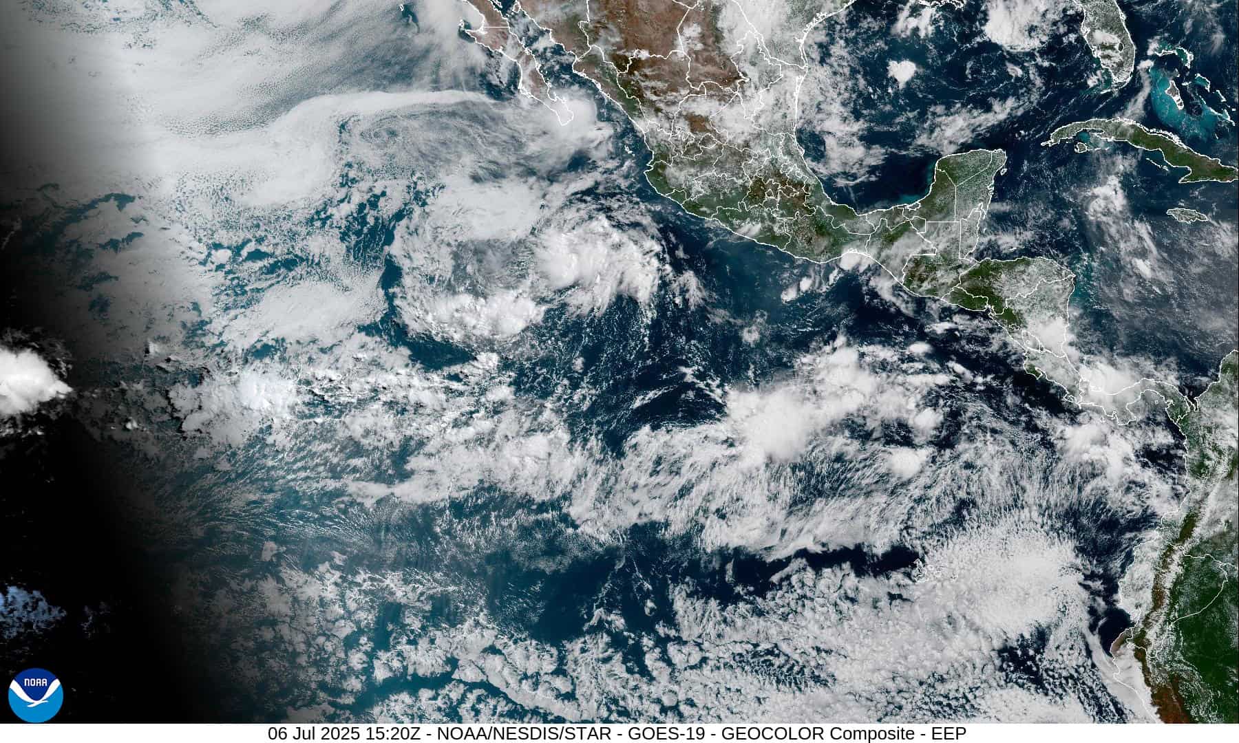
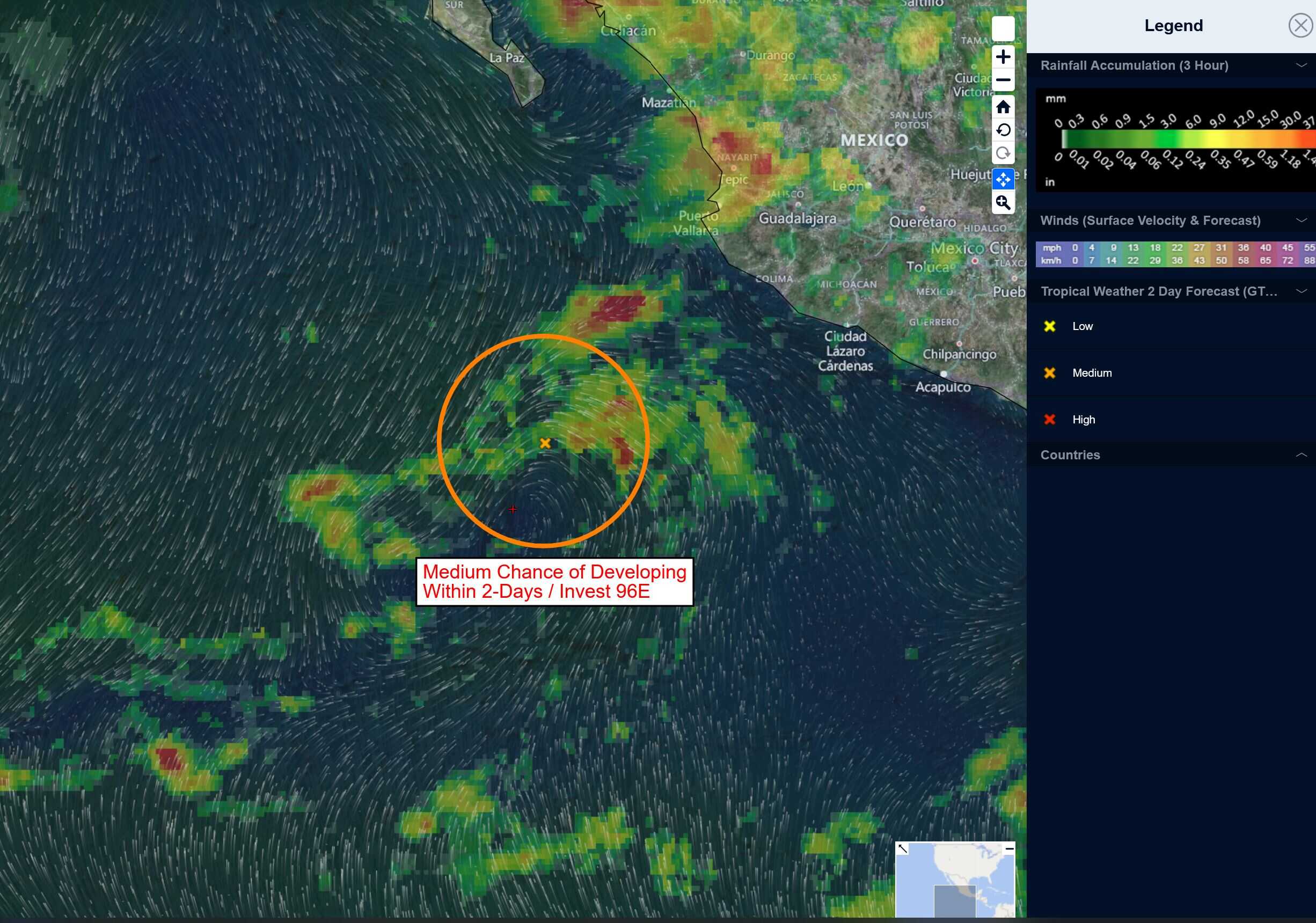
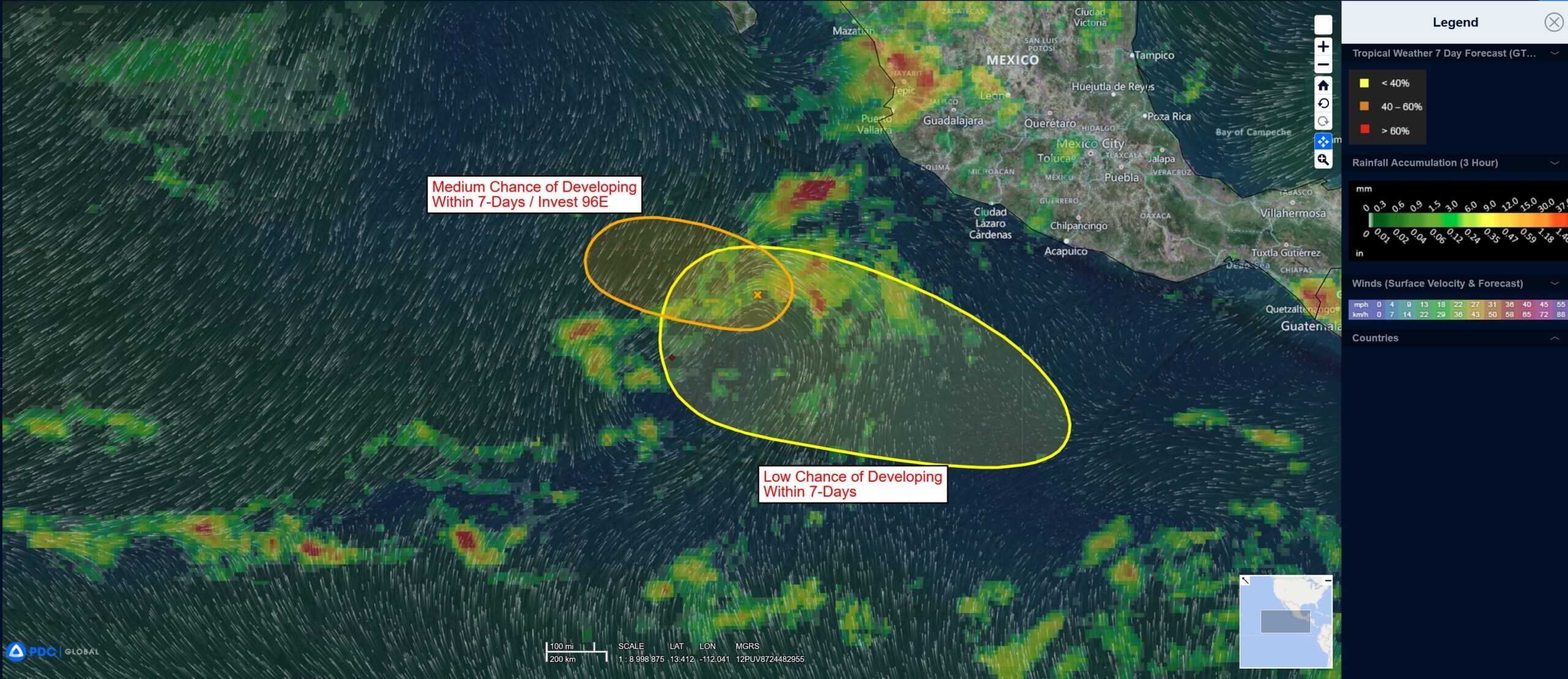
Central East Pacific:
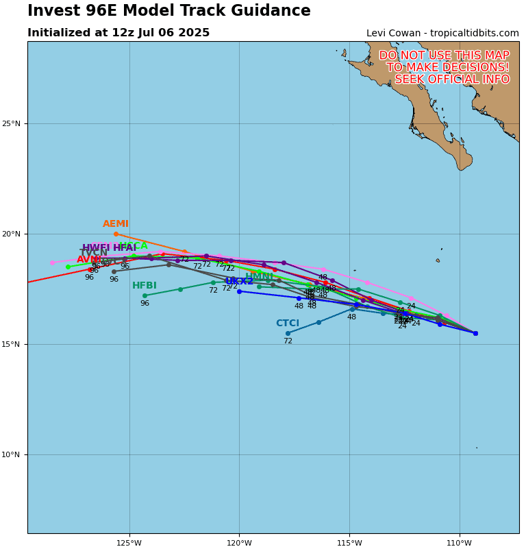
Invest 96E
>>> Disorganized showers and thunderstorms persist in association with an area of low pressure located about 500 miles south of the southern tip of the Baja California peninsula. This system could still become a short-lived tropical depression before it moves westward into unfavorable environmental conditions on Monday.
* Formation chance through 48 hours…medium…40 percent
* Formation chance through 7 days…medium…40 percent
South of Southwestern Mexico:
>>> An area of low pressure could form several hundred miles offshore of southwestern Mexico late this week. Some gradual development of this system is possible thereafter while it moves generally west-northwestward well off the coast of Mexico.
* Formation chance through 48 hours…near 0 percent
* Formation chance through 7 days…low…20 percent
Central Pacific Ocean: There are no Tropical Cyclones
Tropical cyclone formation is not expected during the next 7-days.
Western Pacific, Indian Ocean, and adjacent Seas:
Western Pacific
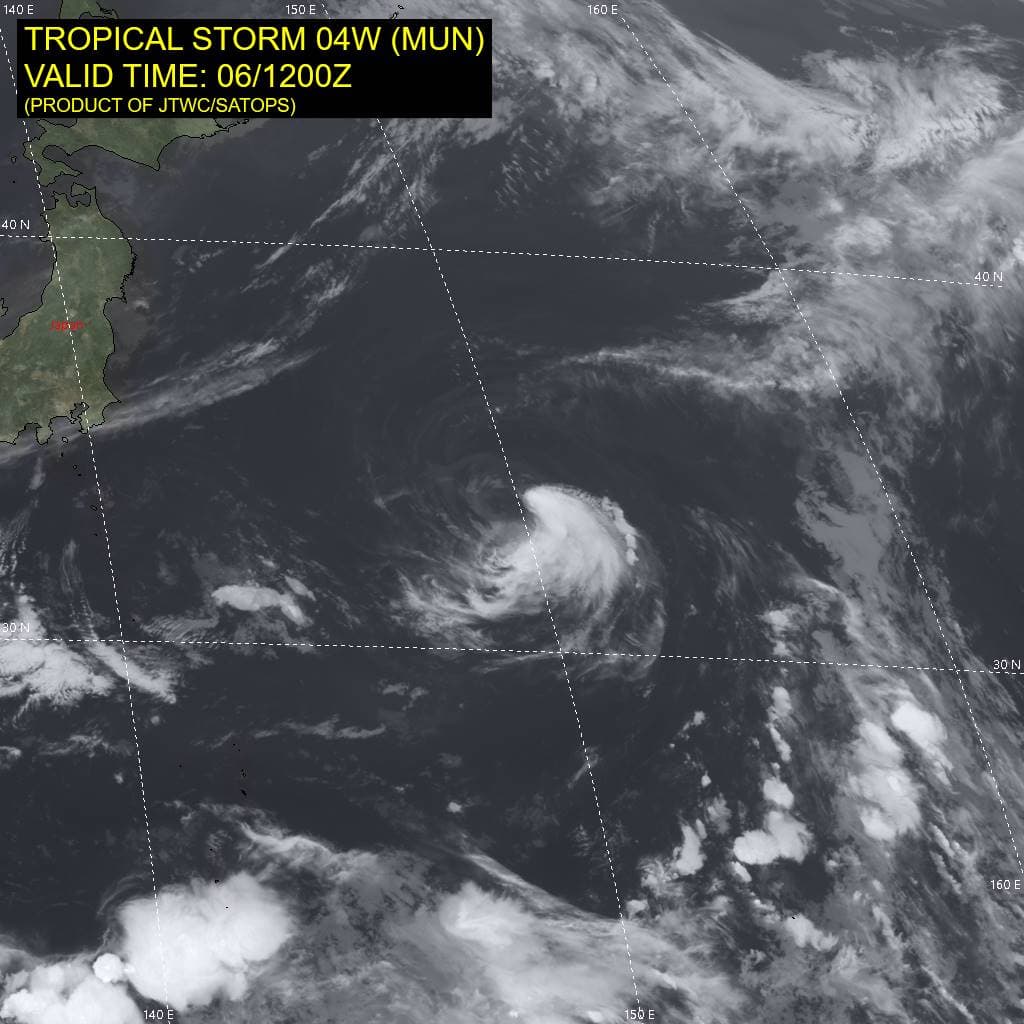
Tropical Cyclone 04W (Mun)
According to the JTWC Warning number 22, sustained winds are 45 knots with gusts to 55 knots
Animated enhanced infrared (eir) satellite imagery depicts a nearly fully exposed low-level circulation center (llcc) associated with tropical storm 04W (Mun), accompanied by well-defined, albeit shallow, convective banding features. Persistent dry air entrainment has inhibited the development and maintenance of deep convection, though the system continues to exhibit a coherent low-level vortex structure, and some stronger convective activity is present within the
southeastern quadrant.
Environmental diagnostics indicate marginally unfavorable conditions, including increasing (20-25 knot) northeasterly vertical wind shear (vws), persistent dry air
entrainment, offset by borderline warm sea surface temperatures (sst) and moderate equatorward upper-level outflow.
TS 04W is projected to track north-northwestward under the influence of a strengthening subtropical ridge to the east. Around 24 hours, the system is expected to begin turning northeastward, as it rounds the periphery of the ridge and becomes embedded within mid-latitude deep-layer westerly flow shortly afterward. Subtropical transition is anticipated to initiate near 36 hours, with completion likely by 48 hours.
In terms of thermodynamic and dynamic support, the system currently resides in a marginally unfavorable environment that is forecast to become increasingly hostile. Vertical wind shear is expected to increase beyond 30 knots within 6 to 12 hours, with dry mid to upper tropospheric air completely engulfing the system within the next 36 hours.
Concurrently, sst are forecast to decline by the end of the forecast period, collectively resulting in a steady weakening trend through the forecast period.
Tropical Cyclone 05W (Danas)
According to the JTWC Warning number 13, sustained winds are 45 knots with gusts to 55 knots
Animated enhanced infrared satellite imagery depicts a rapidly shrinking, 7-10 NM diameter, eye feature associated with typhoon 05W (Danas). TY 05W is currently tracking northeastward toward the western coastline of Taiwan. Under the influence of an extremely favorable synoptic environment, the system has undergone rapid intensification – intensifying by at least 30 knots over the past 24
hours. Deep convective banding is well established, particularly across the southern semicircle, with spiral bands extending well eastward and northward of Taiwan.
Environmental analysis confirms a highly favorable thermodynamic and dynamic setup, characterized by low (5-10 knots) vertical wind shear (vws), very warm sea surface temperatures, and strong, symmetrical radial outflow aloft. The only inhibiting factor at the moment is proximity to land and impact of terrain interaction on the wind field associated with TY Danas.
TY 05W is forecast to continue tracking northeastward through 36 hours under the steering influence of a ner to the southeast. As the synoptic ridge is reorienting along a southwest-to-northeast axis, it has induced a slight eastward adjustment to the track of TY Danas over the last 6 hours. As a result, TY 05W is expected to make landfall along the southwestern coast of Taiwan, near the vicinity of Gigu district, within the next 6 hours.
as the system nears landfall, additional short-term intensification is possible and anticipated. However, interaction with the complex topography of Taiwan, including the western foothills and the Xueshan mountain range, is expected to promote weakening of the core structure of TY 05W. Once across the island, TY 05W is forecast to weaken to around 65-70 knots, while maintaining a northeastward trajectory through 24-36 hours.
Thereafter, steering influence is expected to transfer to a building subtropical ridge (str) to the north, resulting in a turn toward the west and a secondary landfall over mainland China shortly after 48 hours. Beyond that timeframe, the system is expected to undergo gradual weakening, with full dissipation anticipated by or prior to 96 hours.
Intensity forecast confidence during the next 24 to 36 hours is assessed as medium, due to uncertainty regarding the exact track of the system and the magnitude of terrain-induced disruption on the vortex and convective structure.