
")
Current Snapshot
For all the latest updates visit: DisasterAWARE
1800x1080e

2days
epac7
goes18_ir_96E_202507051435_lat14.7-lon-105.6
96E_tracks_latest
mun
04W_051200sair
danas
05W_051200sair
By PDC’s Senior Weather
Specialist Glenn James

The Pacific Disaster Center’s (PDC Global) Saturday, July 5, 2025, Tropical Cyclone Activity Report…for the Pacific Ocean, the Indian Ocean, and adjacent Seas
Current Tropical Cyclones:
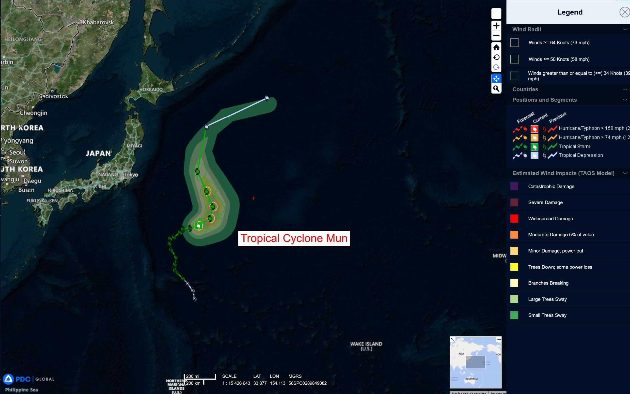
Tropical Cyclone 04W (Mun)…is located about 499 NM east-southeast of Yokosuka, Japan
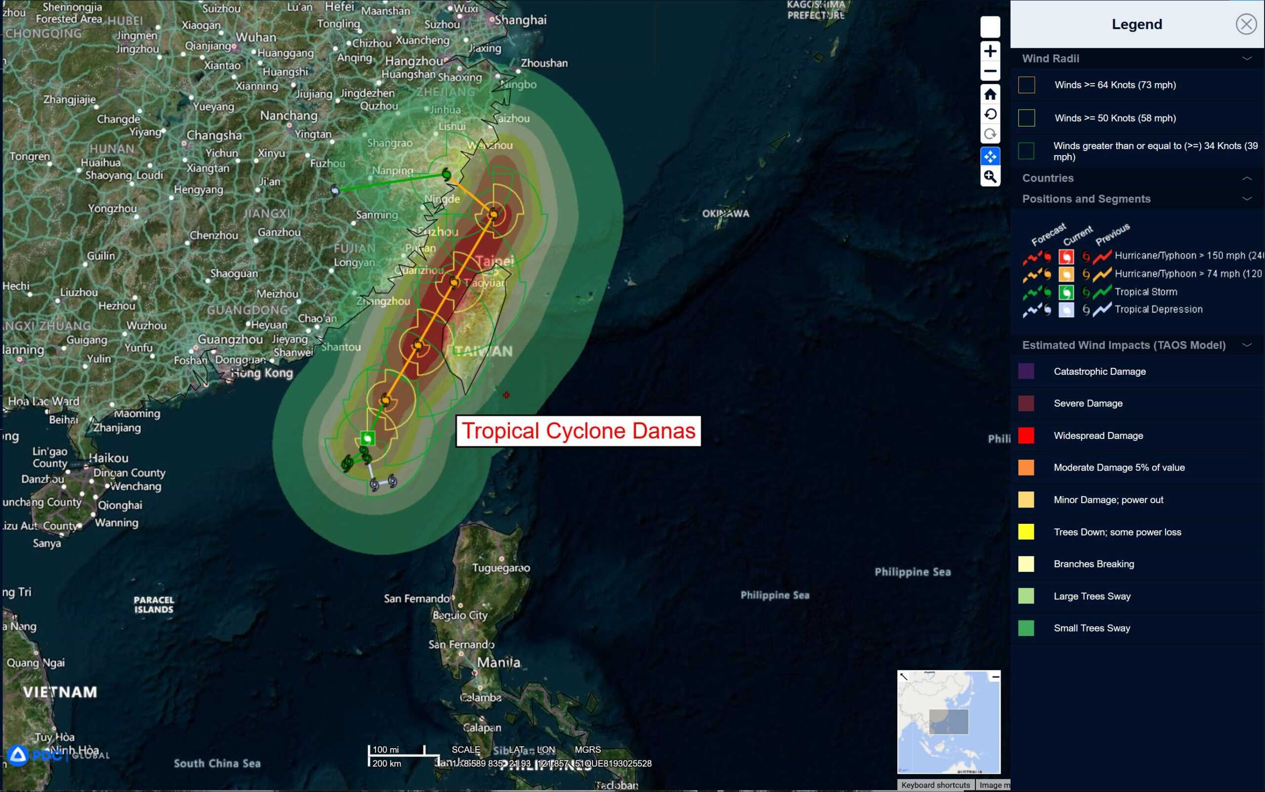
Tropical Cyclone 05W (Danas)…is located about 305 NM Southwest of Taipei, Taiwan
Northeast Pacific Ocean: There are no Tropical Cyclones
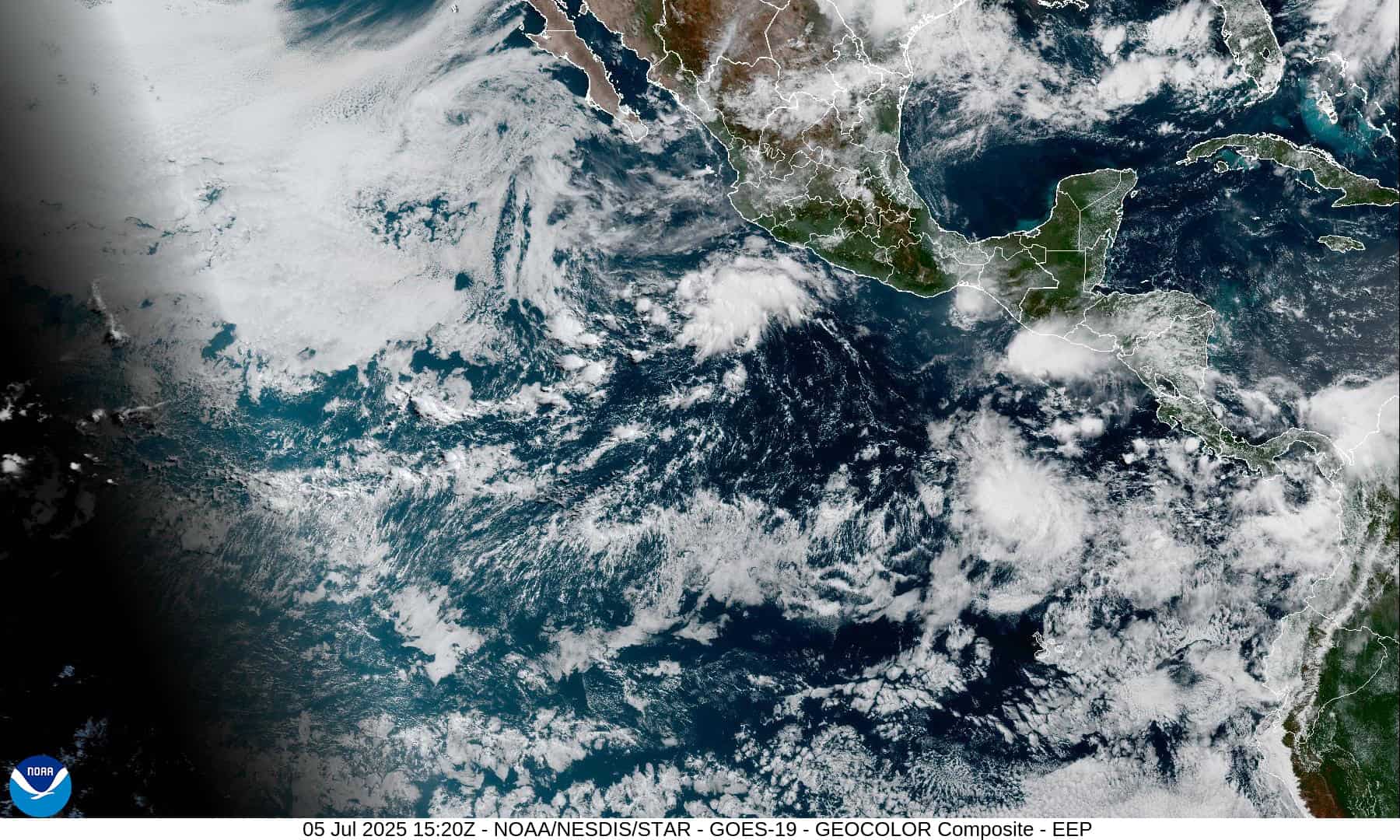
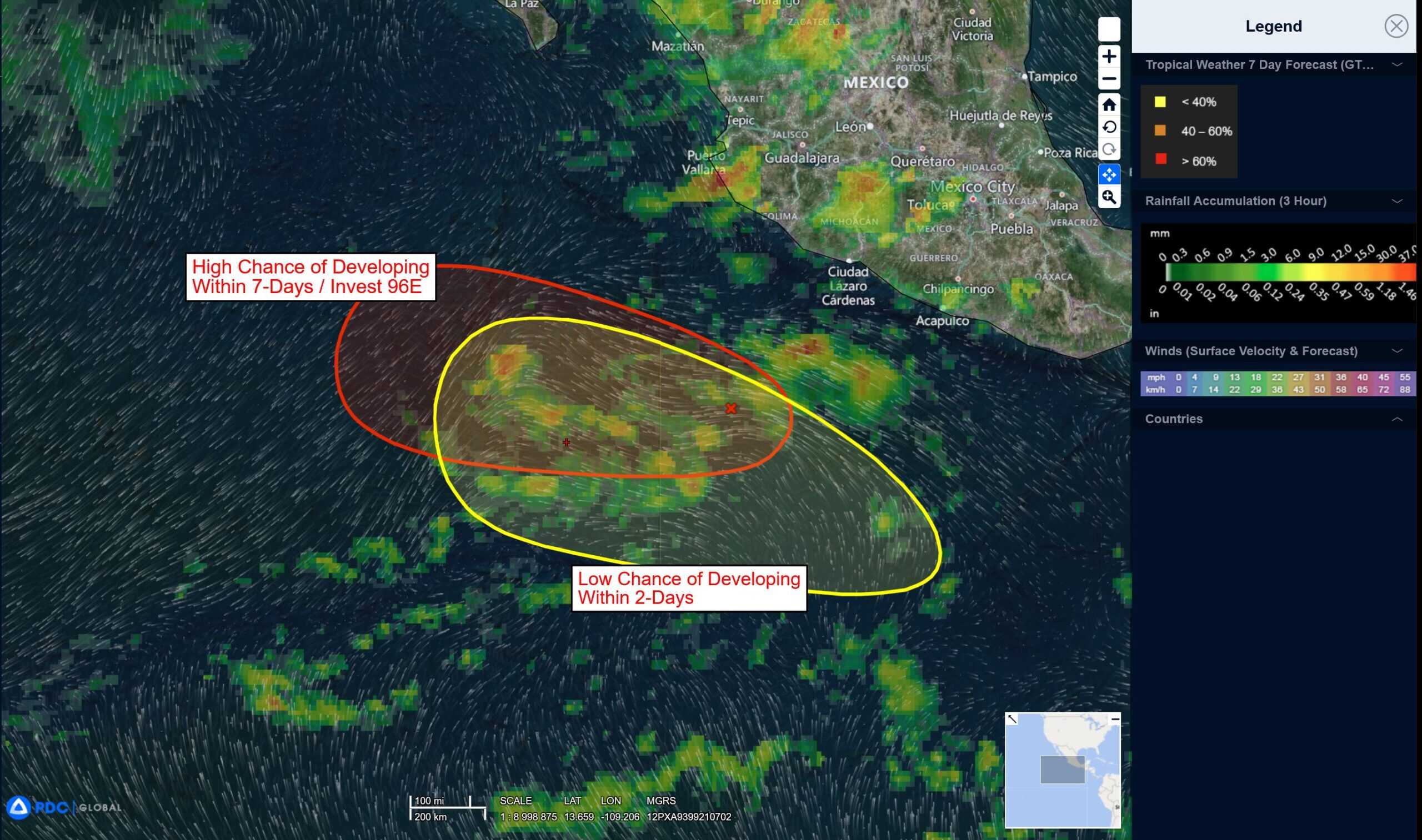
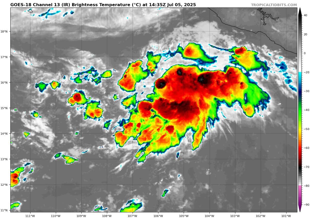
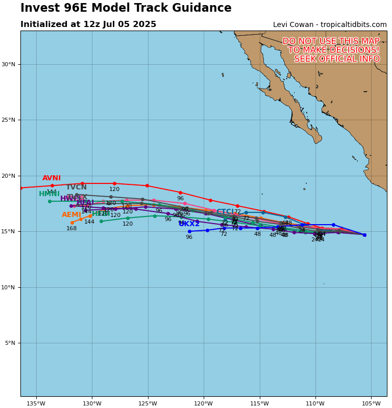
Central East Pacific:
Invest 96E
>>> Disorganized showers and thunderstorms located a few hundred miles southwest of Manzanillo, Mexico, are associated with a trough of low pressure. Gradual development of this system is anticipated during the next couple days, and a tropical depression is likely to form by early next week while it moves generally west-northwestward well off the coast of Mexico. By early Tuesday, the disturbance is expected to reach cooler water, ending its opportunity for development.
* Formation chance through 48 hours…medium…60 percent
* Formation chance through 7 days…high…70 percent
South of Southwestern Mexico:
>>> An area of low pressure could form several hundred miles offshore of southwestern Mexico late next week. Some gradual development of this system is possible thereafter while it moves generally west-northwestward.
* Formation chance through 48 hours…near 0 percent
* Formation chance through 7 days…low…20 percent
Central Pacific Ocean: There are no Tropical Cyclones
Tropical cyclone formation is not expected during the next 7-days.
Western Pacific, Indian Ocean, and adjacent Seas:
Western Pacific
Tropical Cyclone 04W (Mun)
According to the JTWC Warning number 17, sustained winds are 50 knots with gusts to 60 knots
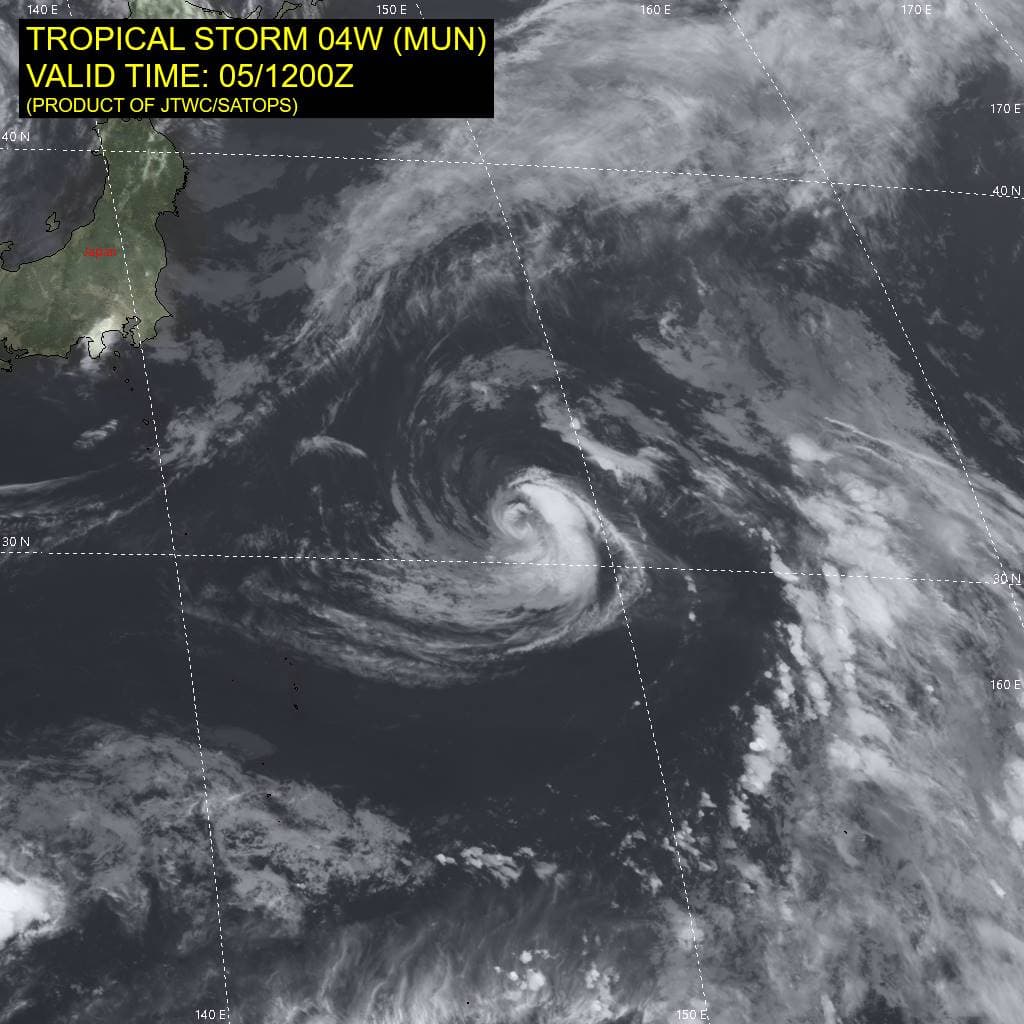
Animated enhanced infrared (eir) satellite imagery reveals tightly curved bands of convection wrapping around the low-levelcirculation center (llcc) of tropical storm 04W (Mun). The system exhibits a compact structure, with the deep convective activity primarily confined to the southern semicircle, and more shallow banding along the northern periphery.Iinfrared satellite data indicates cold cloud-top temperatures.
Environmental conditions remain conducive to further intensification, characterized by warm sea surface temperatures (sst), low (5-10 knot) vertical wind shear (vws), and moderate upper-level outflow. Dry air surrounding the system is being entrained into the core of the vortex and hinders further development of its structure at the moment.
TS 04W is expected to track generally east-northeastward over the next 24 hours, steered by a str positioned to the south. Subsequently, ridging is forecast to extend and build to the east of the storm, inducing a northward and northwestward turn. TS 04W is expected to round the ridge axis between 48 and 72 hours, after which it will begin its subtropical transition.
The system is projected to reach peak intensity of 60 knots within the next 12-24 hours, during a brief phase of less intense dry air entrainment. Beyond this period, a combination of decreasing sst and progressive dry air intrusion will initiate weakening. Additionally, by approximately 72 hours, TS 04W is anticipated to begin subtropical transition, likely completing this process by the end of the forecast period.
Tropical Cyclone 05W (Danas)
According to the JTWC Warning number 8, sustained winds are 65 knots with gusts to 80 knots
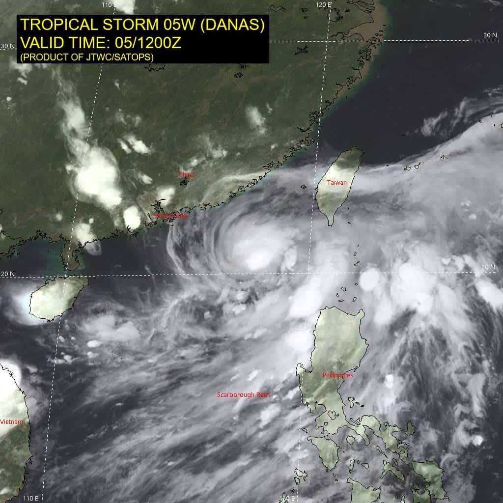
Animated enhanced infrared (eir) satellite imagery depicts pronounced deep convective banding surrounding a persistent central dense overcast, fully obscuring the low-level circulation center (llcc) of tropical storm 05W (Danas).
Environmental analysis indicates highly favorable conditions for continued intensification.
Key indicators include robust radial upper-level outflow, low (5-10 kts) vertical wind shear (vws), warm sea surface temperatures (sst), as well as continuously cold cloud tops.
TS 05W is forecast to track generally northeastward over the next 48 hours. A competing steering flow environment is inducing a slow and fluctuating translational motion, averaging approximately 3 knots, as the system approaches the Taiwan Strait. Over the next 12-24 hours, strengthening of the ner to the east is expected to become the dominant steering influence, guiding TS 05W northeastward.
By approximately 48 hours, the ner is forecast to weaken and retrogress southward, while the subtropical ridge (str) to the north amplifies and extends east-southeastward, prompting TS 05W to make a sharp westward turn toward mainland China. Rapid intensification (RI) is likely within the next 24-36 hours, supported by dynamical and statistical model guidance.
This intensification is contingent on the system remaining over warm waters of the Taiwan Strait. Between 48 and 72 hours, the system is forecast to make landfall over mainland China, likely south of Wenzhou, and begin interacting with terrain, initiating a phase of rapid weakening. Complete dissipation over land is projected by 96 hours.