
")
Current Snapshot
For all the latest updates visit: DisasterAWARE
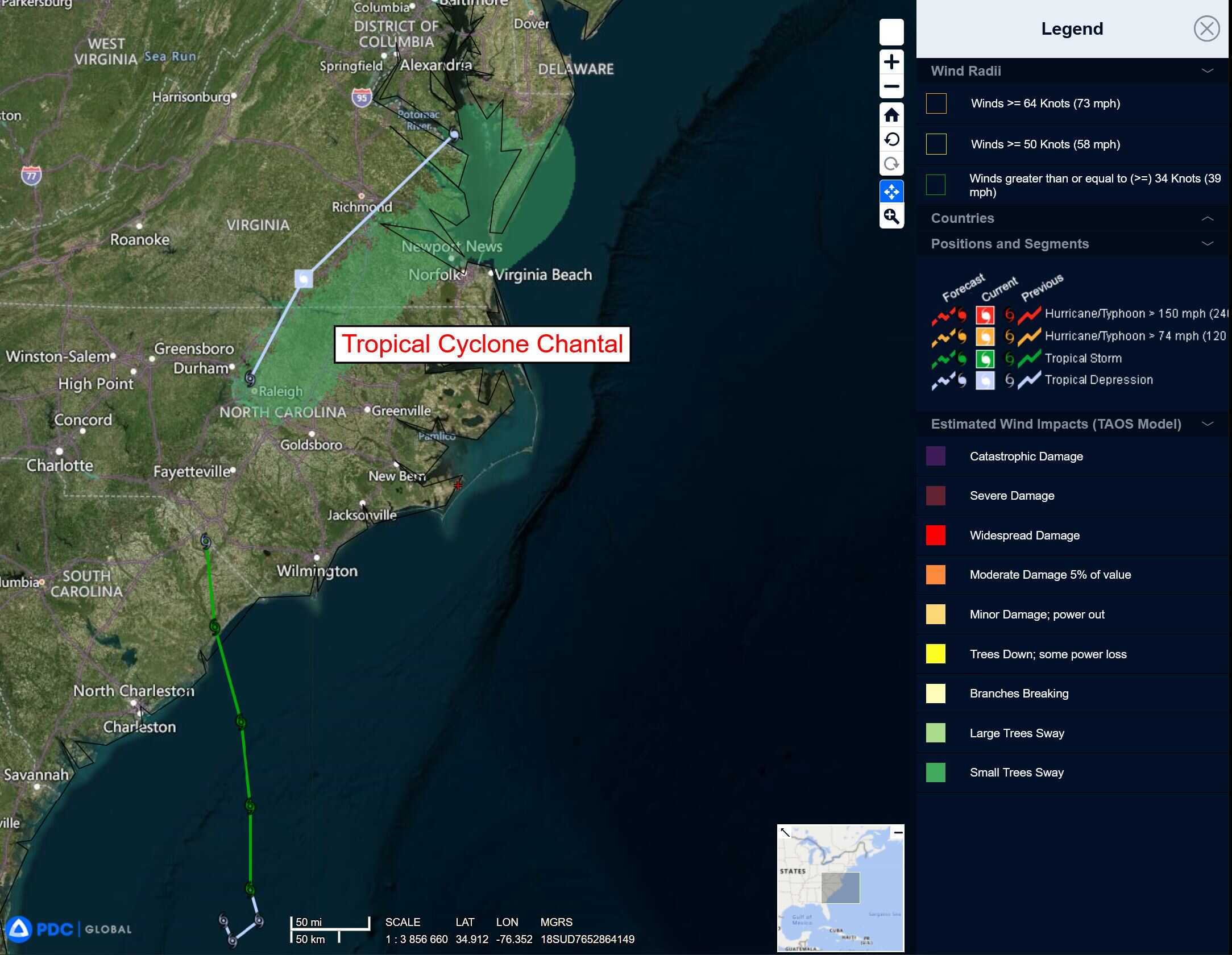
chantal

1000×1000
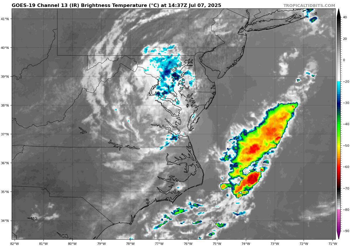
goes19_ir_03L_202507071437_lat37.0-lon-77.0
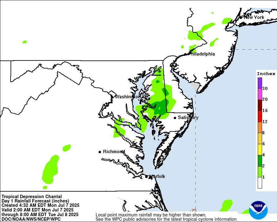
WPCQPF_sm
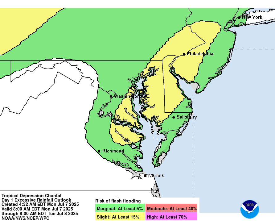
WPCERO_sm
By PDC’s Senior Weather
Specialist Glenn James

The Pacific Disaster Center’s (PDC Global) Monday, July 7, 2025, Tropical Cyclone Activity Report…for the Atlantic Ocean, the Caribbean Sea, and the Gulf of America
Current Tropical Cyclones:
Post-Tropical Cyclone 03L (Chantal)…is located 85 miles northeast of Cape May, NJ – Last Advisory
Post-Tropical Cyclone 03L (Chantal) – Last Advisory
THE FLASH FLOOD THREAT FROM POST-TROPICAL CYCLONE CHANTAL HAS WANED
According to the NHC Advisory number 14
The post-tropical cyclone is moving toward the northeast near 25 mph (41 km/h) and this motion is expected to continue with an increase in forward speed Monday night into Tuesday. Maximum sustained winds are near 25 mph (35 km/h) with higher gusts. Due to its forward motion and modest wind field, the cyclone’s wind field is becoming less defined. Post-Tropical Cyclone Chantal could open up into a trough of low pressure by Tuesday morning.
HAZARDS AFFECTING LAND
RAINFALL: Post-Tropical Cyclone Chantal could produce an additional inch of rain across portions of New Jersey and Long Island Monday tonight into Tuesday morning, with an inch or two of rain being possible across portions of Cape Cod, Martha’s Vineyard, and Nantucket early Tuesday morning. Any flash flooding would be isolated.
SURF: Life-threatening surf and rip current conditions are expected to continue at beaches along the U.S. east coast from northeastern Florida to the Mid-Atlantic states during the next day or so.