
")
Current Snapshot
For all the latest updates visit: DisasterAWARE
chantral

1000×1000
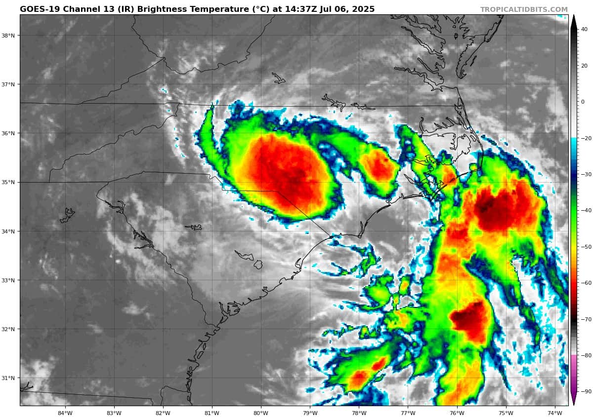
goes19_ir_03L_202507061437_lat34.0-lon-79.2
061436WPCQPF_sm
061436WPCERO_sm
By PDC’s Senior Weather
Specialist Glenn James

The Pacific Disaster Center’s (PDC Global) Sunday, July 6, 2025, Tropical Cyclone Activity Report…for the Atlantic Ocean, the Caribbean Sea, and the Gulf of America
Current Tropical Cyclones:
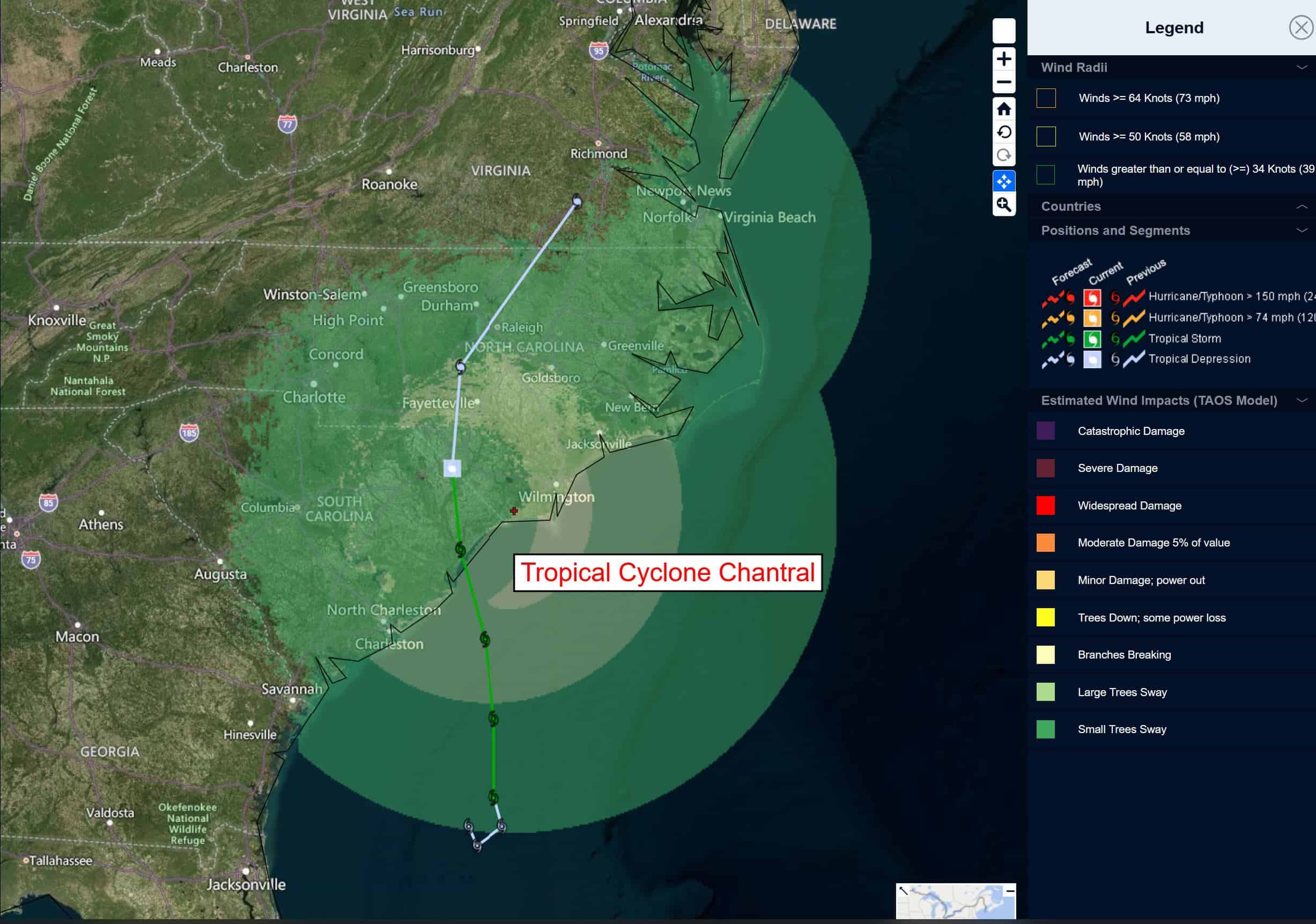
Tropical Cyclone 03L (Chantal)…is located 150 southwest of Newport News, Virginia
Tropical Cyclone 03L (Chantal)
CHANTAL MOVING INTO NORTHERN NORTH CAROLINA…FLASH FLOOD THREAT CONTINUES AS RAINBANDS MOVE ACROSS NORTHERN NORTH CAROLINA AND SOUTH-CENTRAL VIRGINIA
According to the NHC Advisory number 10
The depression is moving toward the northeast near 12 mph (19 km/h) and this motion is expected to continue with an increase in forward speed on Monday. Maximum sustained winds are near 30 mph (45 km/h) with higher gusts. Little change in strength is forecast during the next 48 hours.
HAZARDS AFFECTING LAND
WIND: Tropical storm conditions are expected in the warning area beginning this evening and continuing into Sunday morning. Tropical storm conditions are possible in the watch area beginning later today.
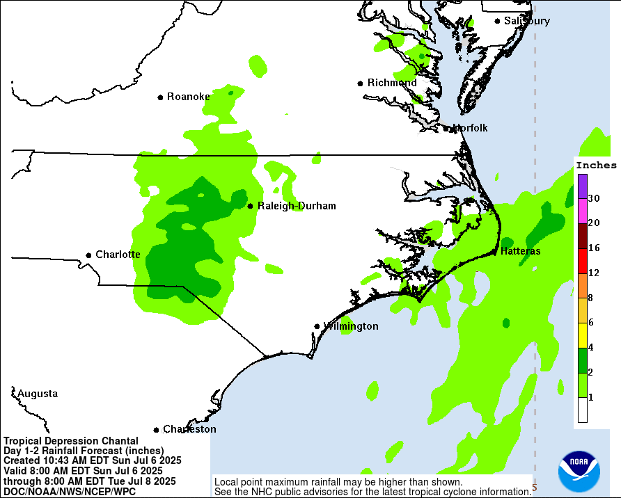
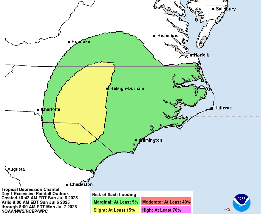
RAINFALL: Tropical Depression Chantal will continue to produce heavy rainfall across portions of northern North Carolina Sunday night and Virginia into Monday. Storm total rainfall of 3 to 6 inches, with local amounts up to 9 inches, is expected. Rainfall amounts in the 7 to 8 inch range have been measured west of Durham between Goldston, Burlington, and Caldwell. An elevated risk for flash flooding will continue into Monday.
SURF: Life-threatening surf and rip current conditions are expected to continue at beaches along the U.S. east coast from northeastern Florida to the Mid-Atlantic states during the next day or so.