
")
Current Snapshot
For all the latest updates visit: DisasterAWARE
chantral

1000×1000
goes19_ir_03L_202507051437_lat30.8-lon-79.0
051453_earliest_reasonable_toa_34
051453WPCERO_sm
051151WPCQPF_sm
03L_tracks_latest
By PDC’s Senior Weather
Specialist Glenn James

The Pacific Disaster Center’s (PDC Global) Saturday, July 5, 2025, Tropical Cyclone Activity Report…for the Atlantic Ocean, the Caribbean Sea, and the Gulf of America
Current Tropical Cyclones:
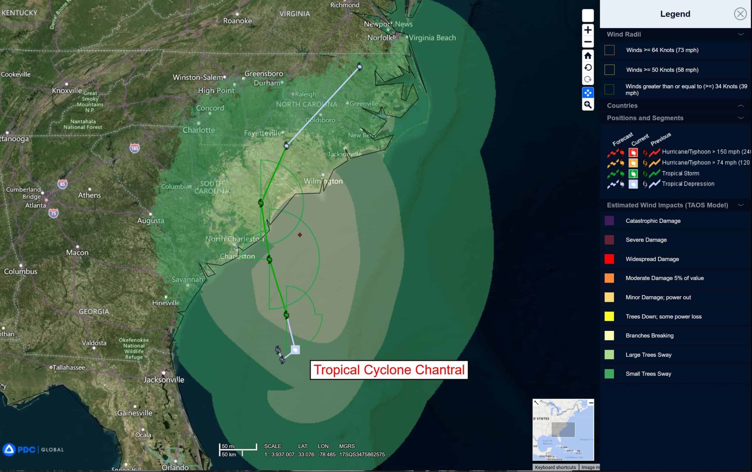
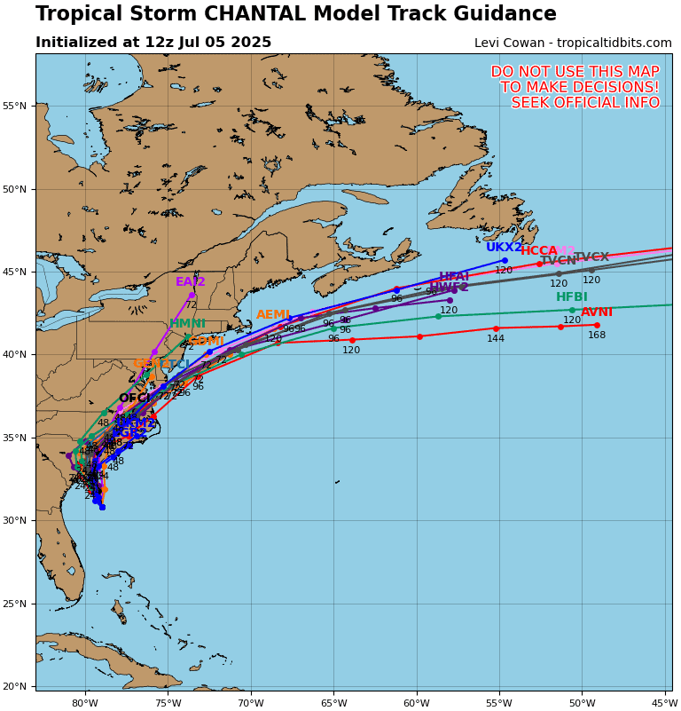
Tropical Cyclone 03L (Chantal)…is located 140 south-southwest of Wilmington, NC
Tropical Cyclone 03L (Chantal)
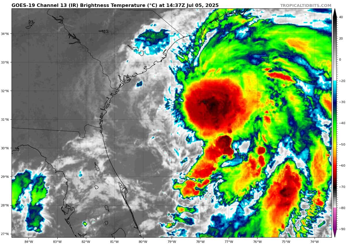
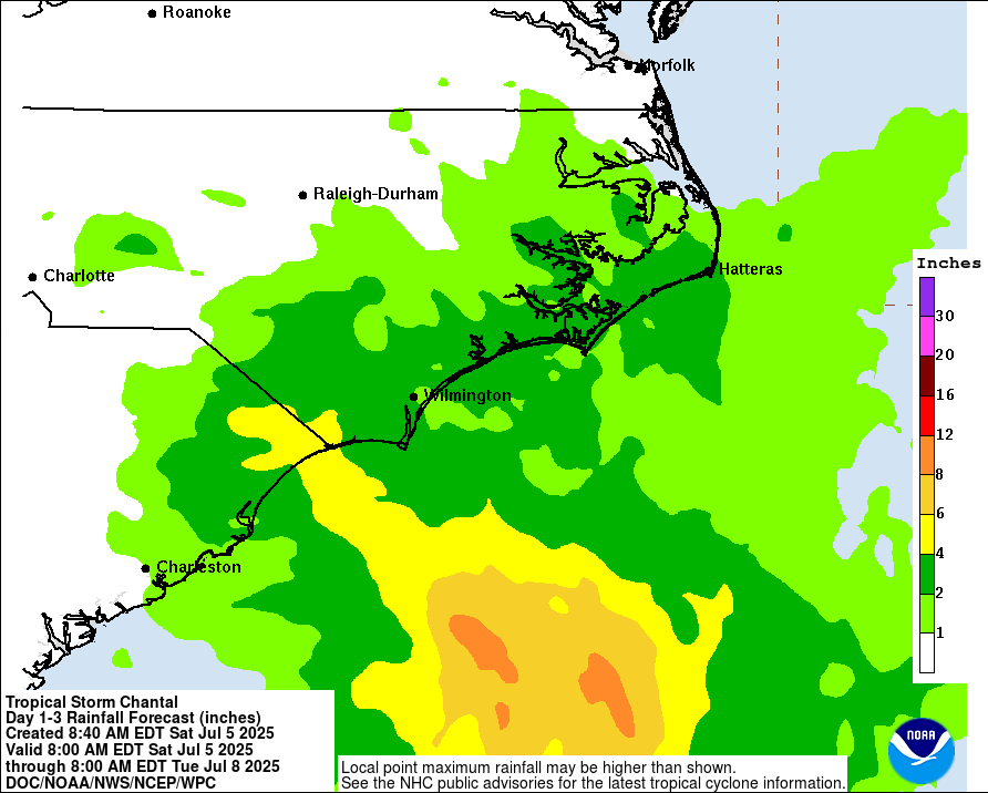
RAINBANDS FROM CHANTAL MOVING OVER THE CAROLINA COAST
According to the NHC Advisory number 5A
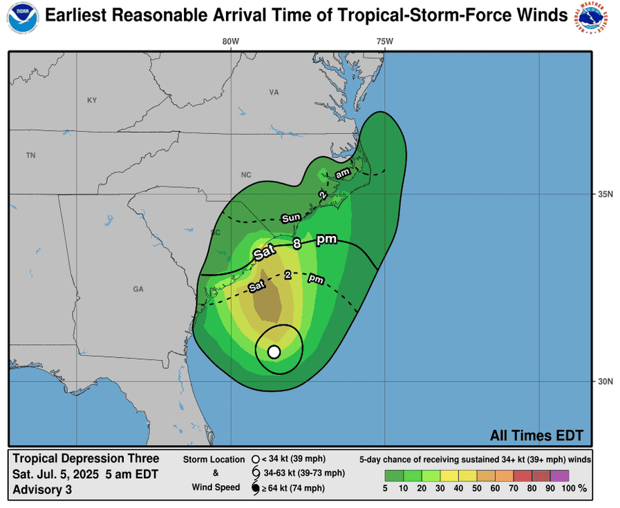
Chantal is moving toward the north near 7 mph (11 km/h). A motion toward the north-northwest is expected to begin this evening, followed by a turn to the northeast by Sunday night. On the forecast track, the center of Chantal is expected to move across the coast of South Carolina overnight or early Sunday morning. Maximum sustained winds are near 45 mph (75 km/h) with higher gusts. Some slight strengthening is forecast before Chantal reaches the coast. Rapid weakening is expected after landfall. Tropical-storm-force winds extend outward up to 140 miles (220 km) primarily to the east of the center.
SUMMARY OF WATCHES AND WARNINGS IN EFFECT:
A Tropical Storm Warning is in effect for… * South Santee River, SC to Surf City, NC
A Tropical Storm Watch is in effect for… * Edisto Beach to South Santee River, SC
HAZARDS AFFECTING LAND
WIND: Tropical storm conditions are expected in the warning area beginning this evening and continuing into Sunday morning. Tropical storm conditions are possible in the watch area beginning later today.
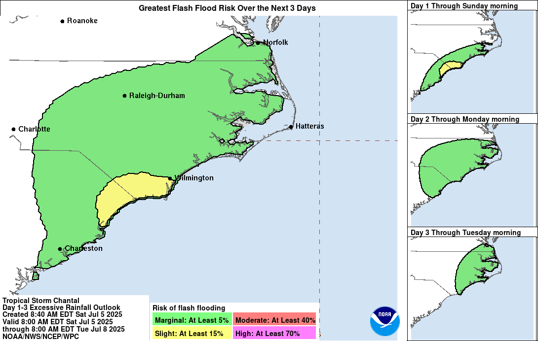
RAINFALL: Tropical Storm Chantal is expected to produce heavy rainfall across portions of the coastal plain of the Carolinas today through Monday. Storm total rainfall of 2 to 4 inches, with local amounts to 6 inches, is expected. Resulting in an elevated risk for flash flooding.
STORM SURGE: The combination of storm surge and tide will cause normally dry areas near the coast to be flooded by rising waters moving inland from the shoreline. The water could reach the following heights above ground somewhere in the indicated areas if the peak surge occurs at the time of high tide…
South Santee River, SC to Cape Fear, NC…1-3 ft
Edisto Beach, SC to South Santee River, SC…1-2 ft
SURF: The tropical storm is expected to bring life-threatening surf and rip currents along the coast from northeastern Florida to the Mid-Atlantic states during the next couple of days.