
")
Current Snapshot
For all the latest updates visit: DisasterAWARE
1800x1080e
epac2
epac7
95E_tracks_latest
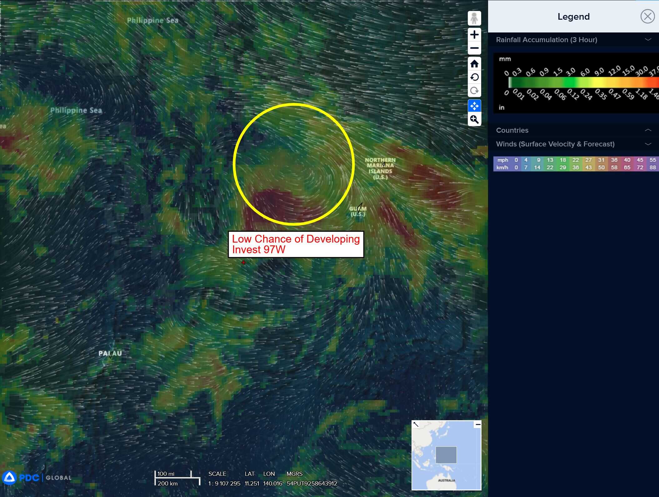
97w
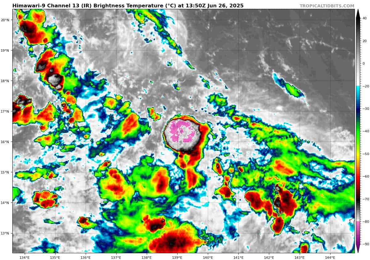
himawari9_ir_97W_202506261350_lat16.1-lon139.9

97W_tracks_latest
By PDC’s Senior Weather
Specialist Glenn James

The Pacific Disaster Center’s (PDC Global) Thursday, June 26, 2025, Tropical Cyclone Activity Report…for the Pacific Ocean, the Indian Ocean, and adjacent Seas
Current Tropical Cyclones:
There are no Tropical Cyclones at the time of this writing
Northeast Pacific Ocean: There are no Tropical Cyclones
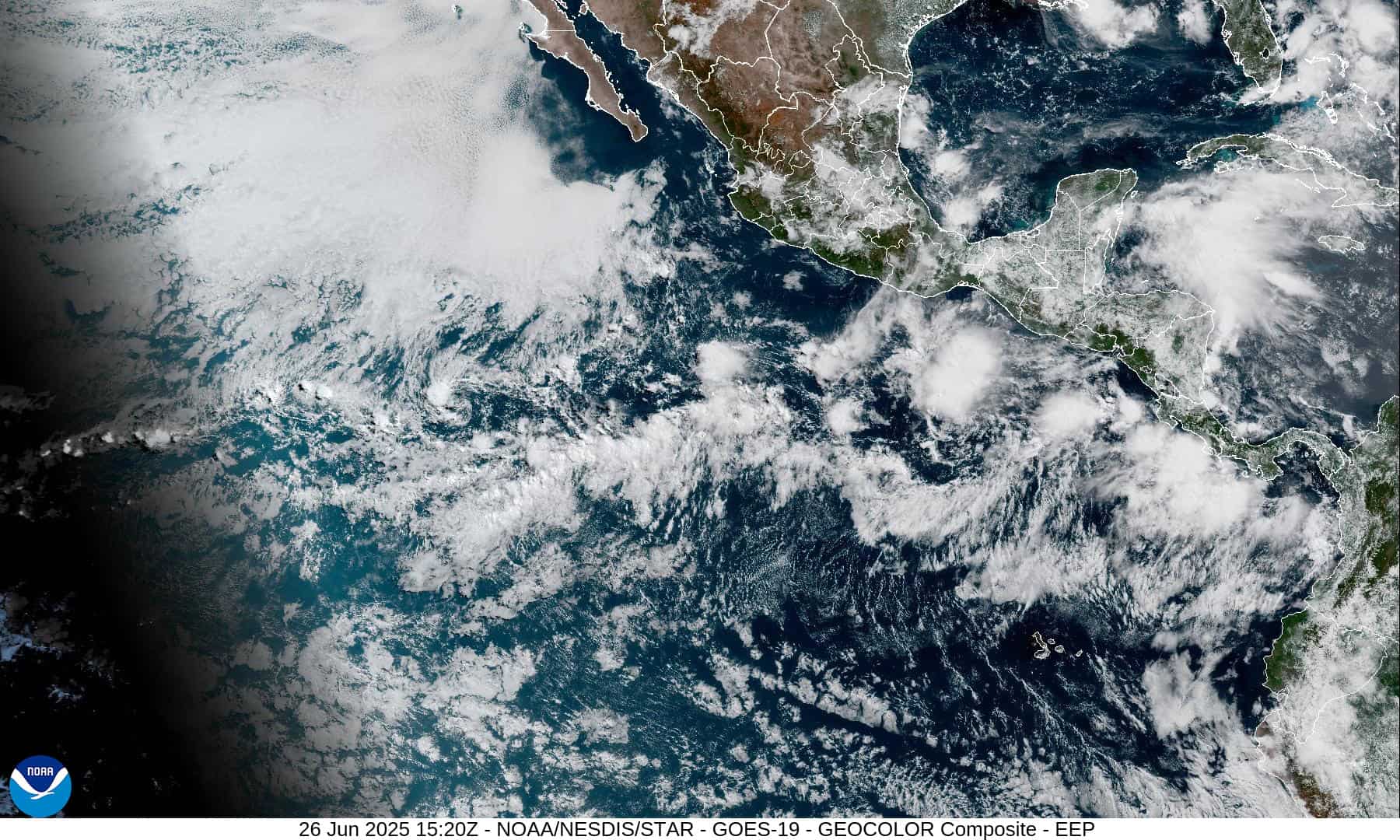
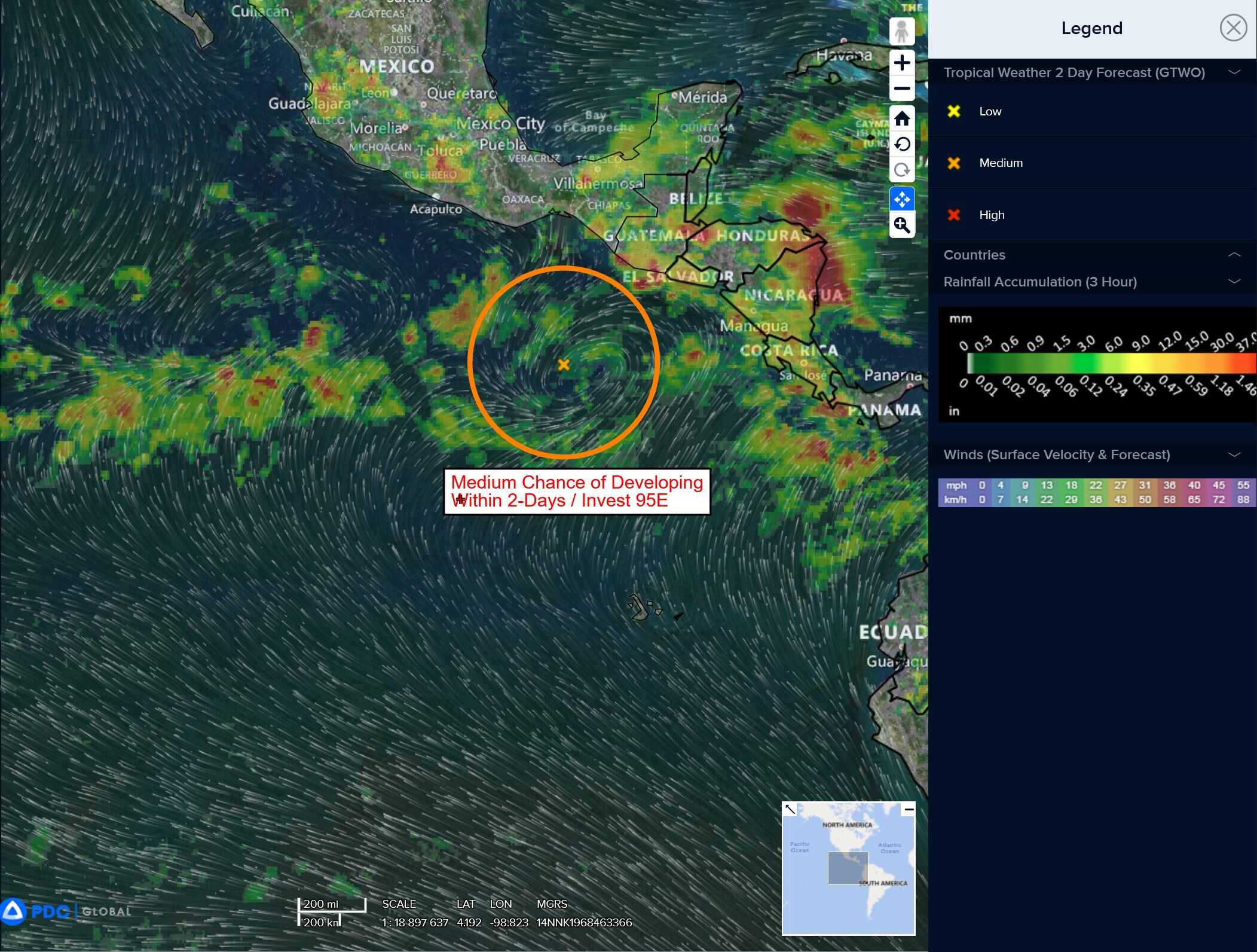
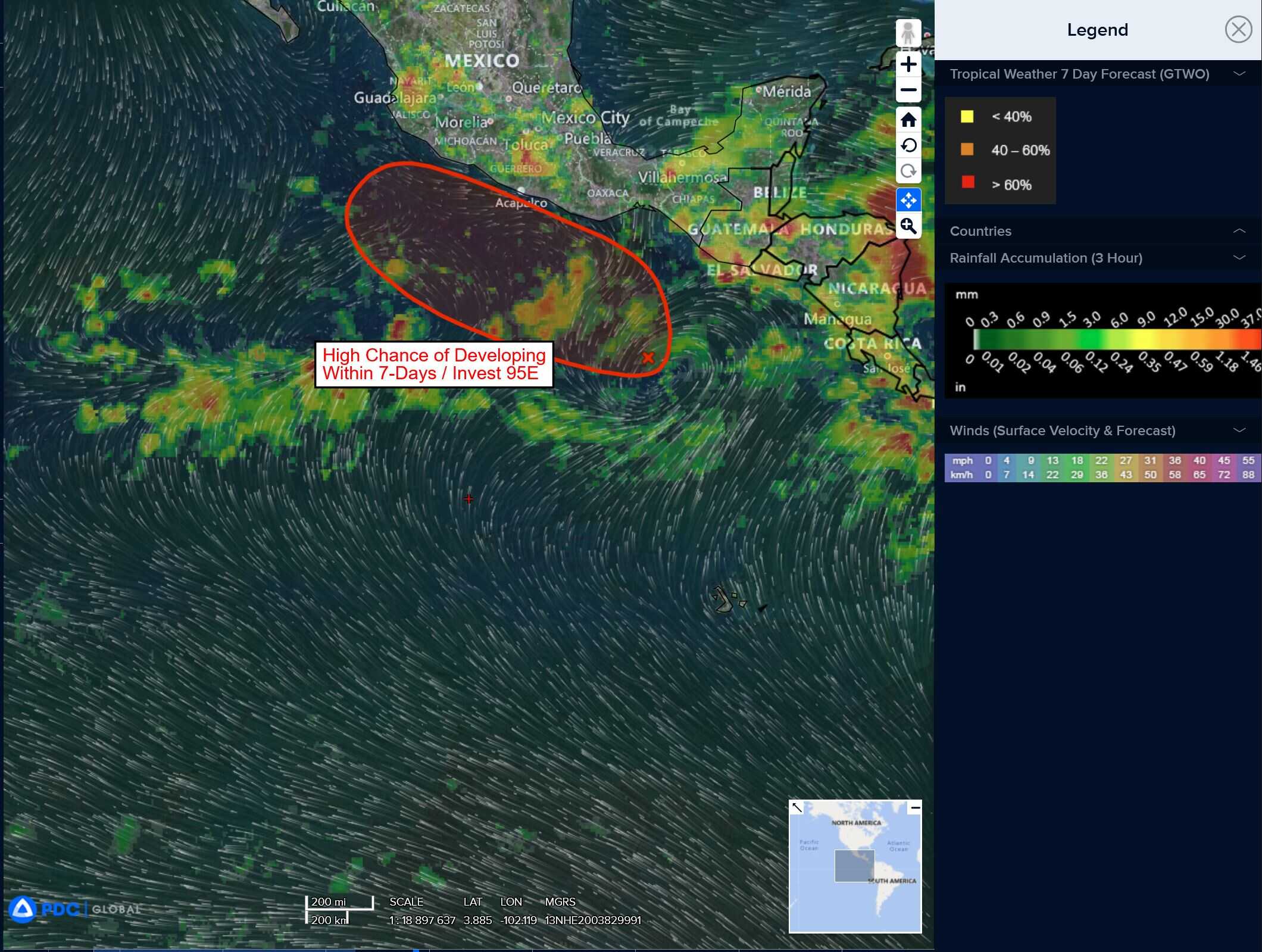
Offshore of Central America and Southern Mexico:
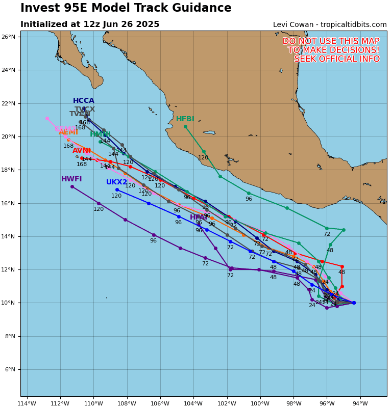
Invest 95E
>>> Showers and thunderstorms associated with a broad area of low pressure located a few hundred miles southwest of the coast of Guatemala is beginning to show some signs of organization. Environmental conditions are expected to become more conducive for development during the next few days, and a tropical depression is likely to form by late this weekend while the system moves slowly west-northwestward, off the coast of southern Mexico.
* Formation chance through 48 hours…medium…50 percent
* Formation chance through 7 days…high…80 percent
Central Pacific Ocean: There are no Tropical Cyclones
Tropical cyclone formation is not expected during the next 7-days.
Western Pacific, Indian Ocean, and adjacent Seas:
Western Pacific