
")
Current Snapshot
For all the latest updates visit: DisasterAWARE
1800x1080e
PDC
pdc7
sepat
02W_231200sair
himawari9_ir_96W_202506231520_lat14.4-lon118.7
96w
himawari9_ir_96W_202506232020_lat14.5-lon118.0
By PDC’s Senior Weather
Specialist Glenn James

The Pacific Disaster Center’s (PDC Global) Monday, June 23, 2025, Tropical Cyclone Activity Report…for the Pacific Ocean, the Indian Ocean, and adjacent Seas
Current Tropical Cyclones:
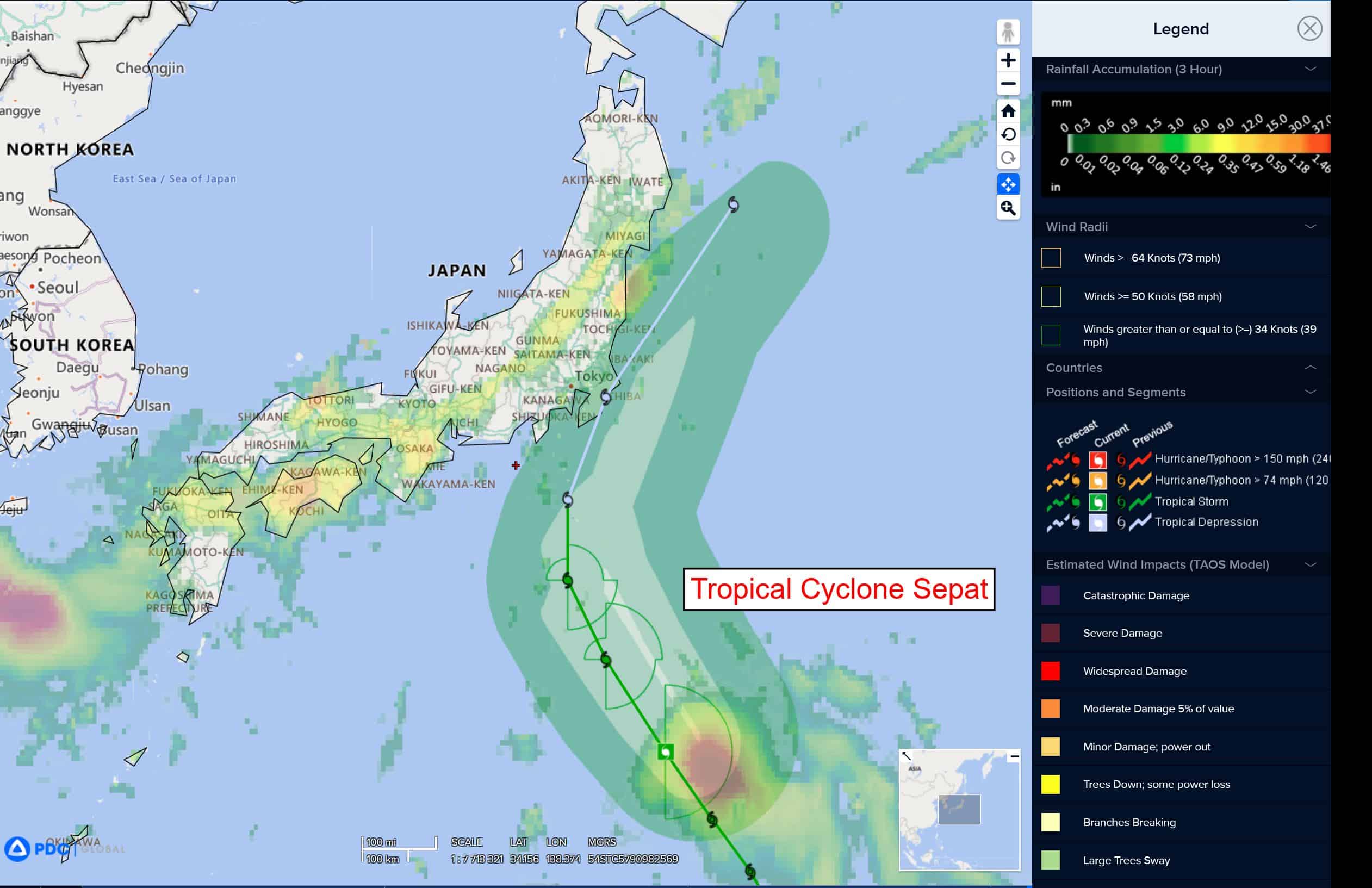
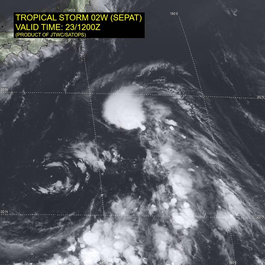
Tropical Cyclone 02W (Sepat) is located approximately 366 NM south of Yokosuka, Japan
Northeast Pacific Ocean: There are no Tropical Cyclones
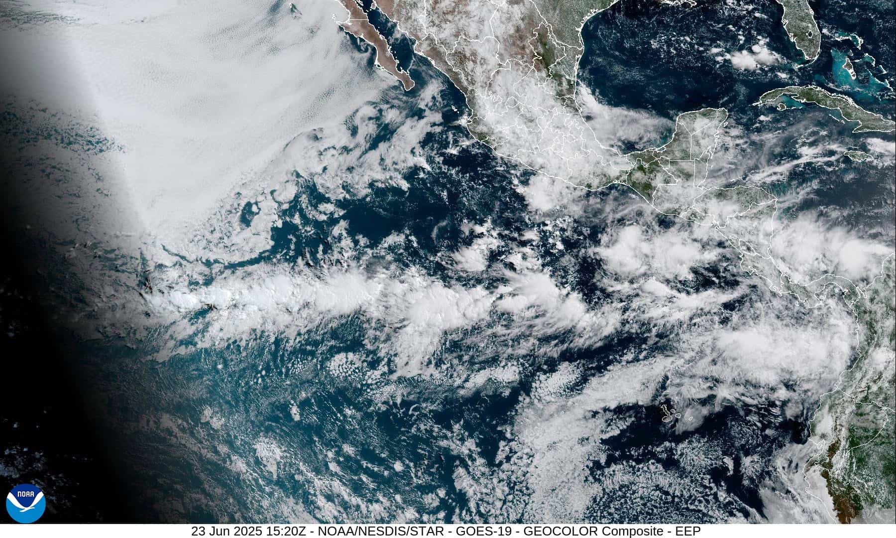
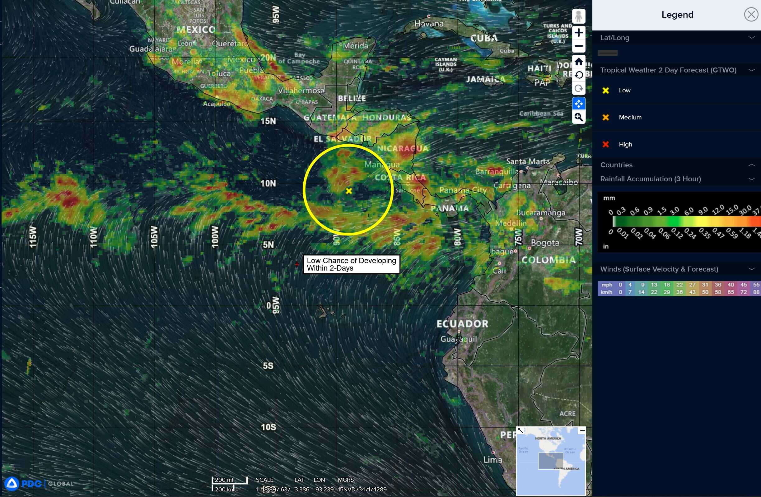
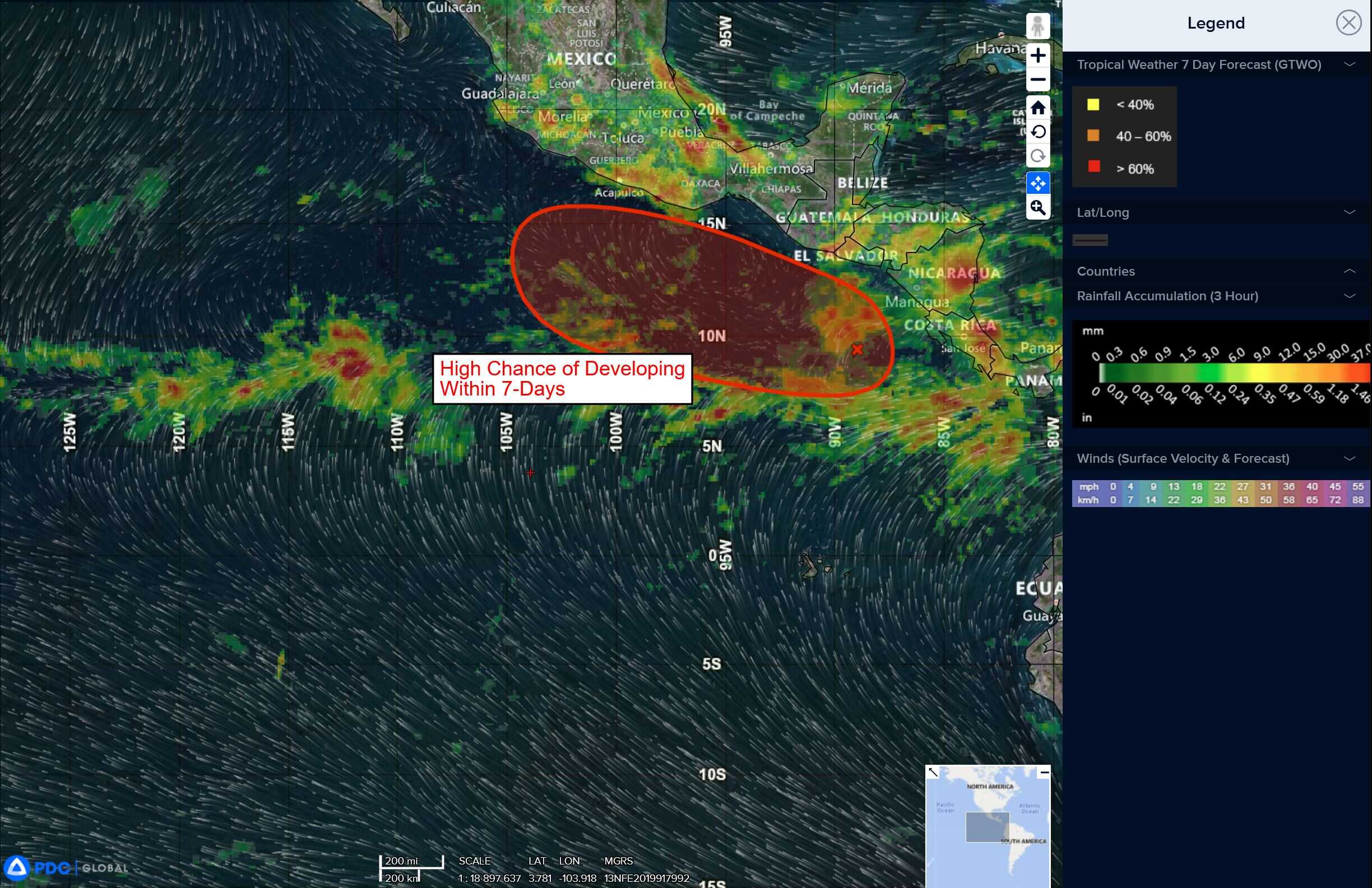
Offshore of Central America and Southern Mexico:
>>> A broad area of low pressure located a few hundred miles offshore of Central America is producing disorganized showers and thunderstorms.
Environmental conditions appear conducive for gradual development of this system, and a tropical depression is likely to form by late this week or over the weekend while the system moves slowly west-northwestward off the coast of southern Mexico.
* Formation chance through 48 hours…low…10 percent
* Formation chance through 7 days…high…70 percent
Central Pacific Ocean: There are no Tropical Cyclones
Tropical cyclone formation is not expected during the next 7-days.
Western Pacific, Indian Ocean, and adjacent Seas:
Western Pacific
Tropical Cyclone 02W (Sepat)
According to the JTWC warning number 7, sustained winds are 35 knots with gusts to near 45 knots
Animated enhanced infrared (eir) satellite imagery depicts tropical storm 02W (Sepat) tucking underneath the persistent convection, displaying an improved appearance compared to 6 hours ago. The vortex seems to be becoming more vertically aligned as the system distances itself from the effects of the tropical upper tropospheric trough (tutt) cell to the southwest. A microwave image shows the compact circulation with tightly wrapping low-level cloud lines and deep convection obscuring the center.
Environmental analysis indicates that 02W is in a marginally favorable environment characterized by moderate poleward outflow aloft, low (10-15 knot) vertical wind shear, and warm sea surface temperatures.
TS 02W is forecast to continue tracking north-northwestward along the southwestern periphery of the subtropical ridge through 48 hours as the vortex approaches the eastern coast of Honshu. Near 48 hours, 02W will begin to round the ridge axis and turn northeastward, skirting the coast. Afterward, 02W will accelerate in a northeastward direction through 72 hours as the system dissipates.
Regarding intensity, 02W is forecast to maintain its current intensity over the next 12 hours as shear stays low and sea surface temperatures remain conducive. However, the poleward outflow channel that is currently being tapped into will quickly diminish after 12 hours. Additionally, sea surface temperatures are expected to become borderline by 24 hours and then unfavorably cool by 36 hours. Sea temperatures will only become cooler along the track of 02W, which will cause the system to weaken as it approaches the coast of Honshu, south of Yokosuka.
Shear will then rapidly increase and cause the system to erode and dissipate near 72 hours as the vortex accelerates off to the northeast. If the vortex is able to stay a sufficient distance from the coast, an extra-tropical transition vice dissipation scenario could occur.
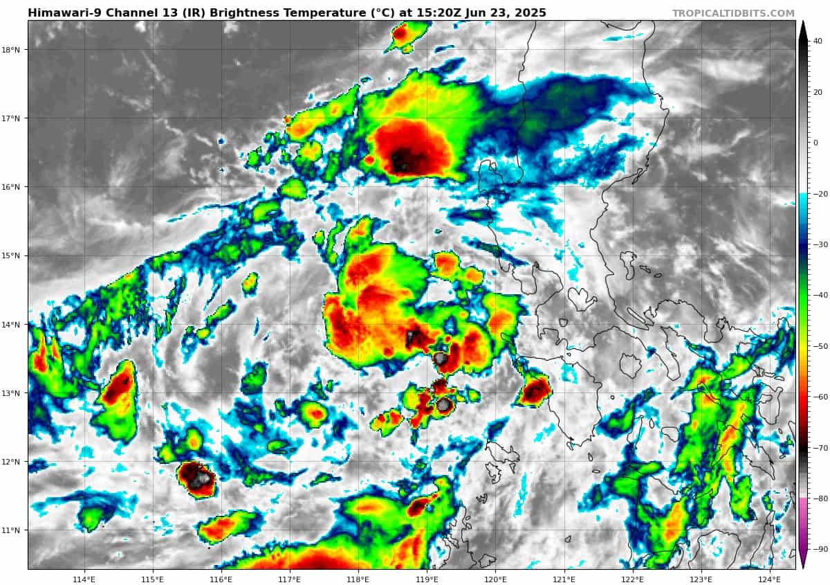
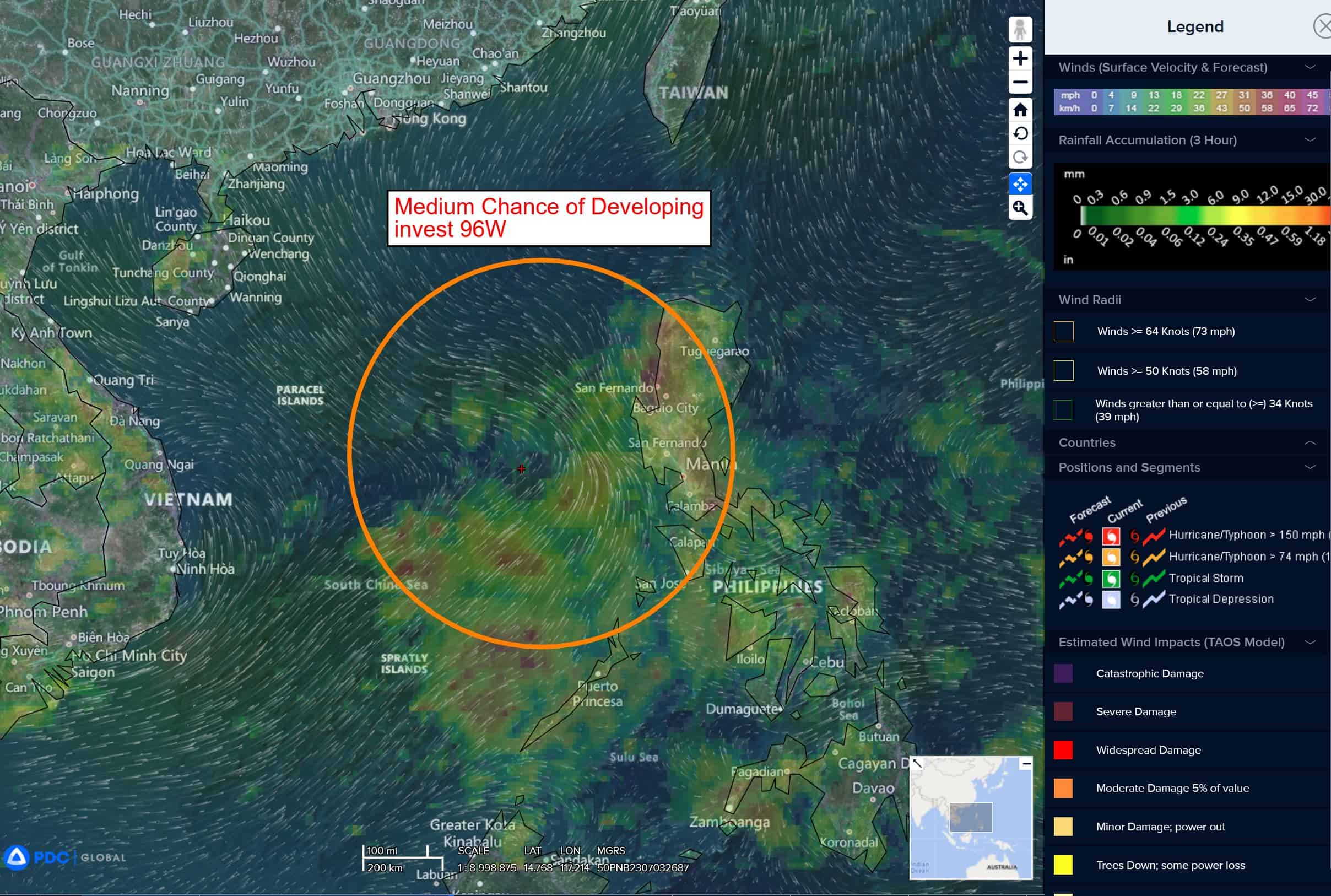
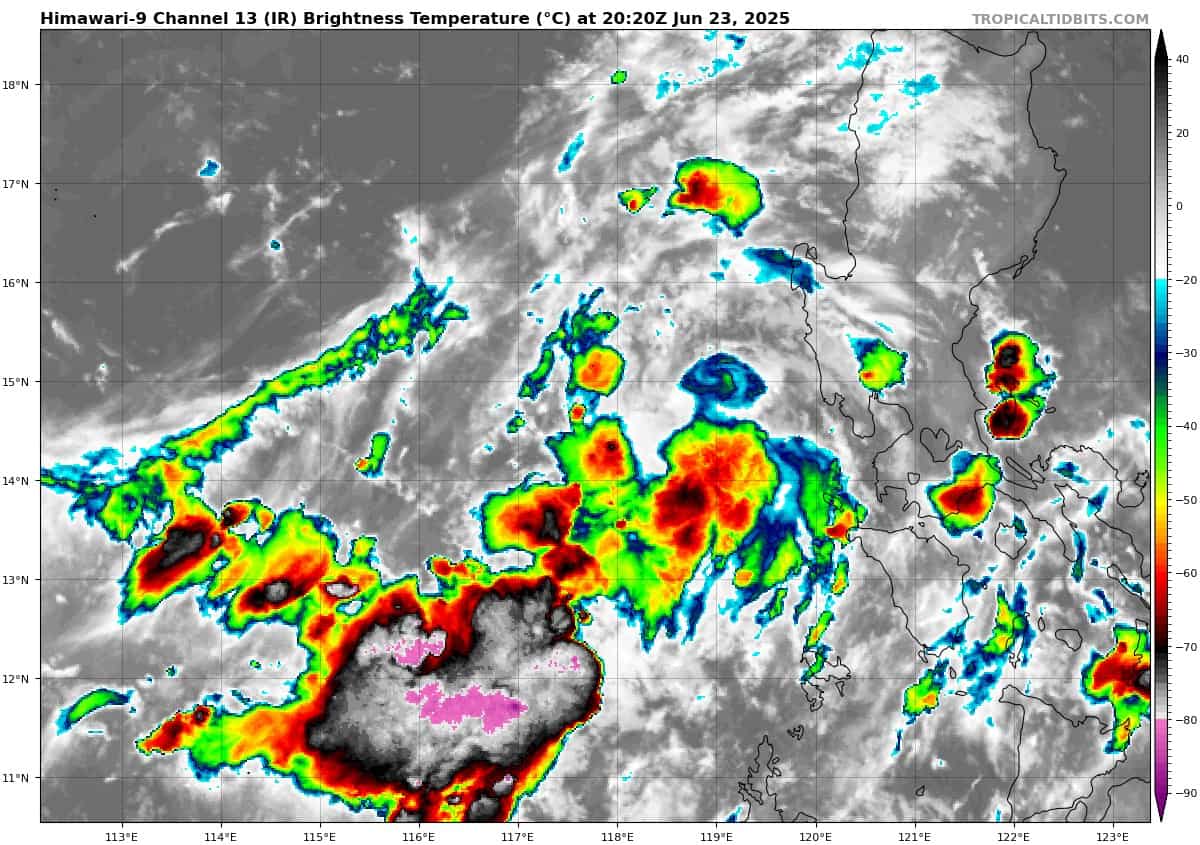
There’s an area of disturbed weather being referred to as Invest 96W, which is located approximately 415 NM south-southeast of Hong Kong
Multi-spectral satellite imagery depicts a broad, slowly consolidating low level circulation center (llcc) with weakly flaring convection. A recent microwave pass shows the broad nature of the systems structure and fragmented convective banding. A recent ship observation to the southwest of the circulation reveals 17 knot north-northwesterly winds.
Environmental analysis indicates favorable conditions for development with good vertical wind shear of 10-15 knots, good poleward upper-level outflow, and warm sea surface temperatures.
Deterministic models forecast 96W to only reach winds up to 20 knots, whereas ensemble guidance shows multiple members reaching 25 knots and higher.
Maximum sustained surface winds are estimated at 18 to 23 knots.
The potential for the development of a significant tropical cyclone within the next 24 hours remains medium.