
")
Current Snapshot
For all the latest updates visit: DisasterAWARE
1800x1080e
95e
95e7
goes19_ir_95E_202506241515_lat8.9-lon-90.1

95E_tracks_latest
sepat
02W_241200sair
02W_tracks_latest
himawari9_ir_96W_202506241510_lat16.9-lon115.8
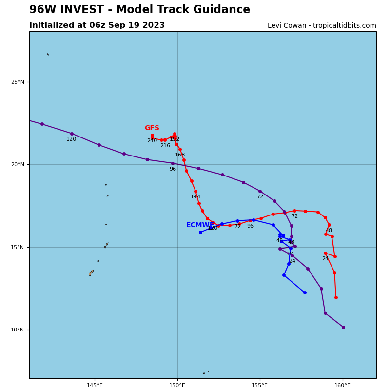
96W_tracks_latest
By PDC’s Senior Weather
Specialist Glenn James

The Pacific Disaster Center’s (PDC Global) Tuesday, June 24, 2025, Tropical Cyclone Activity Report…for the Pacific Ocean, the Indian Ocean, and adjacent Seas
Current Tropical Cyclones:
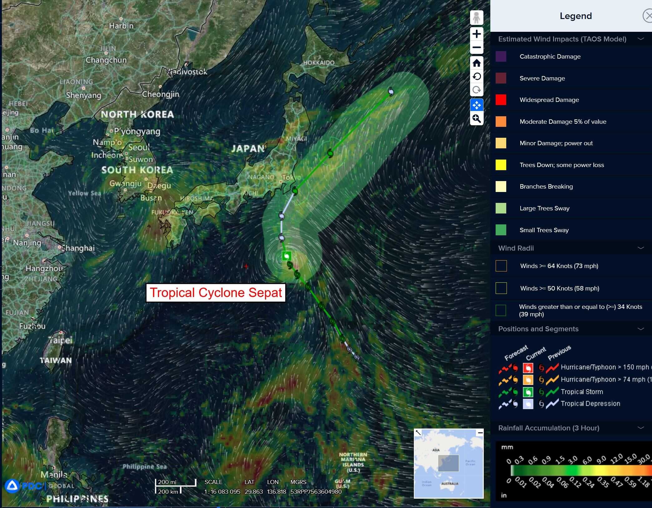
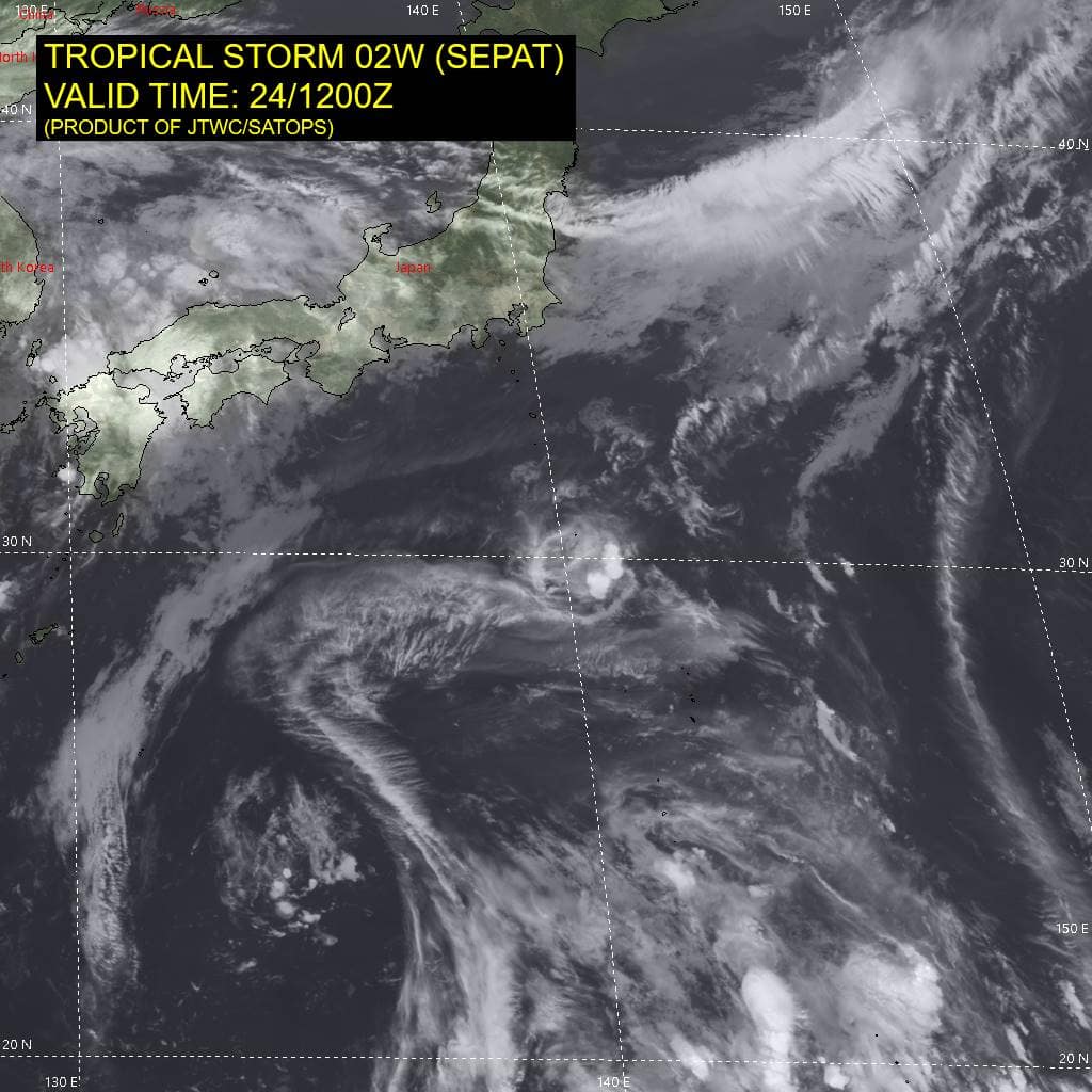
Tropical Cyclone 02W (Sepat) is located approximately 198 NM south of Yokosuka, Japan
Northeast Pacific Ocean: There are no Tropical Cyclones
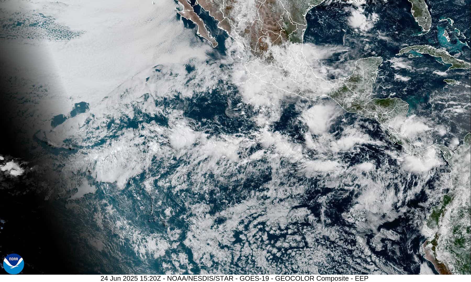
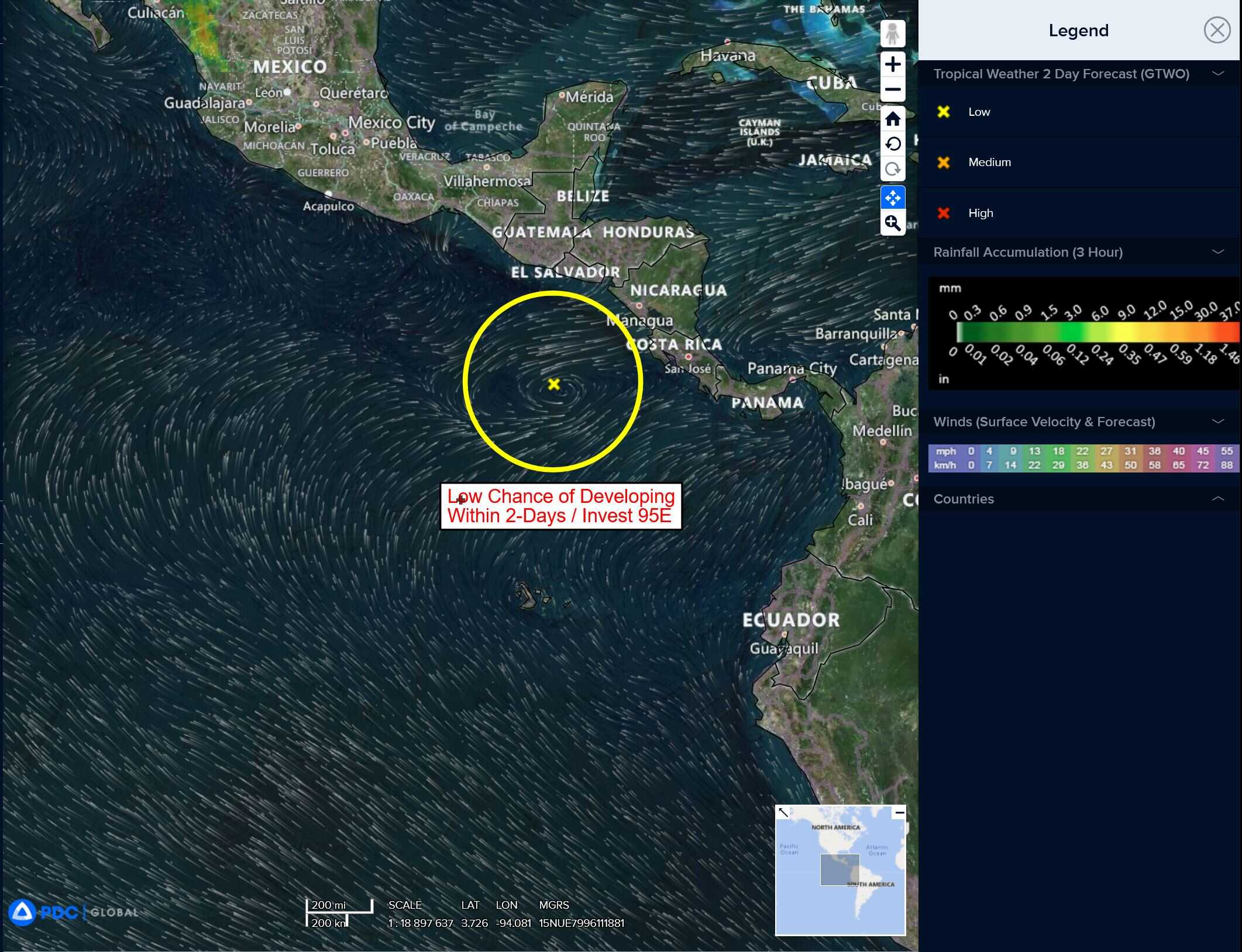
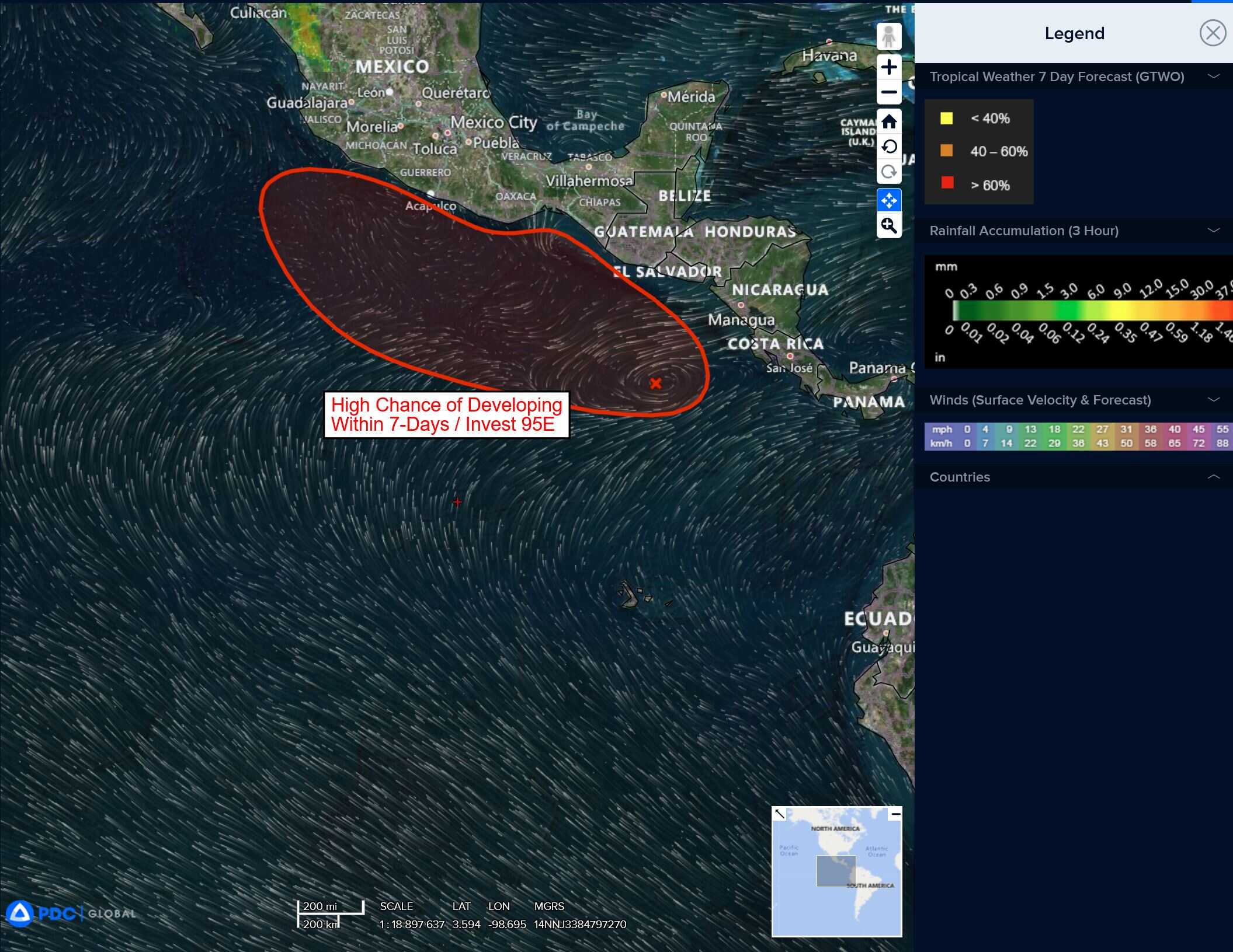
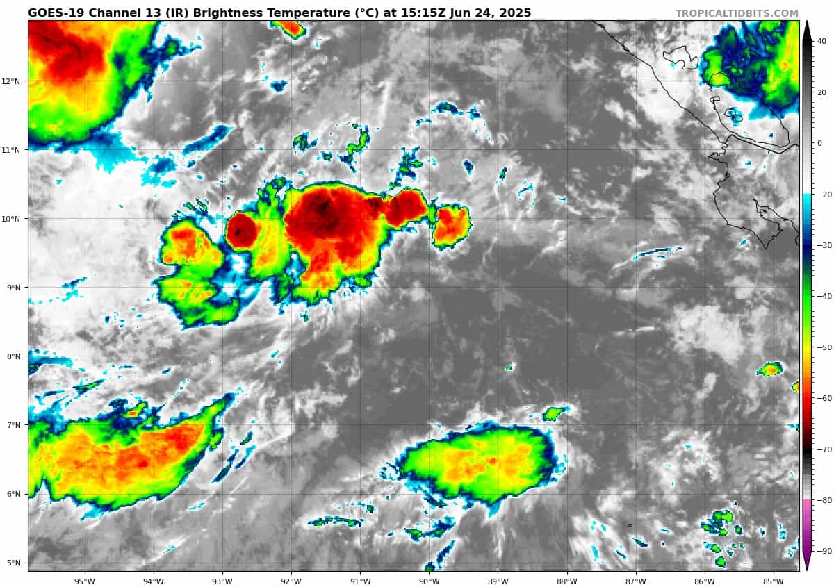
Offshore of Central America and Southern Mexico:
Invest 95E
>>> Shower and thunderstorm activity is beginning to show some signs of organization with an area of low pressure located a few hundred miles south of the coast of Guatemala. Environmental conditions appear conducive for gradual development of this system over the next few days, and a tropical depression or tropical storm is likely to form by this weekend while the system moves slowly west-northwestward, roughly parallel to the coast of southern Mexico.
* Formation chance through 48 hours…low…30 percent
* Formation chance through 7 days…high…80 percent
Central Pacific Ocean: There are no Tropical Cyclones
Tropical cyclone formation is not expected during the next 7-days.
Western Pacific, Indian Ocean, and adjacent Seas:
Western Pacific
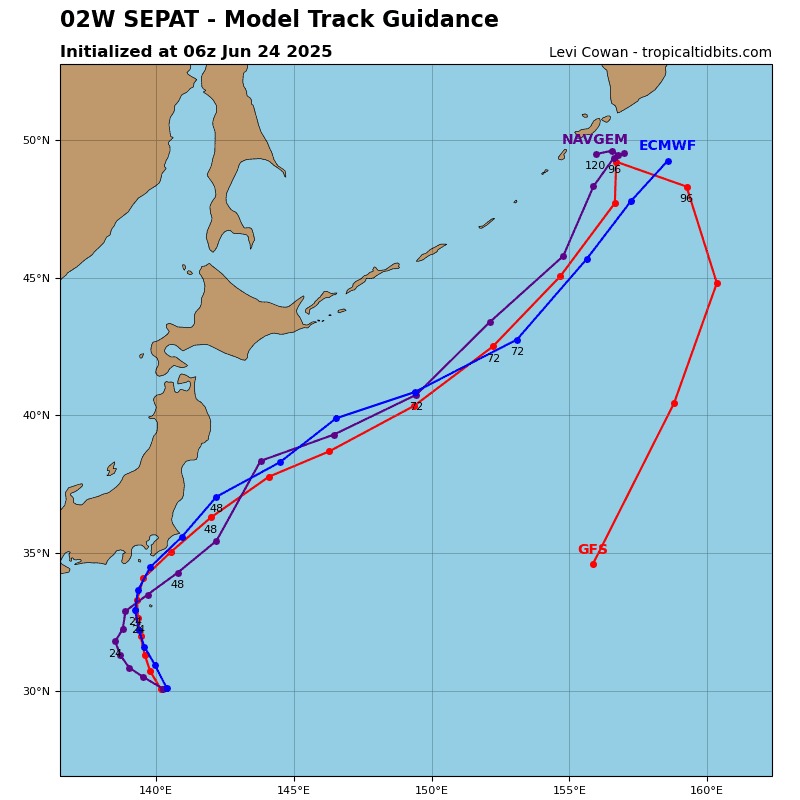
Tropical Cyclone 02W (Sepat)
According to the JTWC warning number 11, sustained winds are 30 knots with gusts to near 40 knots
Animated enhanced infrared (eir) satellite imagery depicts a decoupling low-level circulation center that continues on a
north-northwestward track while deep convection is sheared southward.
The system remains in an unfavorable environment with strong vertical wind shear from the upper-level trough to the north and the tropical upper tropospheric trough (tutt) cell to the southwest. Water vapor imagery highlights how outflow has ceased as the upper-level trough has moved eastward, putting the system in close proximity to the convergent region of the trough. Simultaneously, the tutt cell to the southwest has cut off the westward exhaust channel, preventing a favorable upper-level
environment overall.
Tropical storm 02W will track north-northwestward for the next 12 hours under the steering influence of the subtropical ridge to the northeast. Between 12-24 hours, the system will round the ridge axis and begin a northwestward track for the remainder of the forecast period.
Vertical wind shear will remain unfavorable for the first 24 hours of the forecast, resulting in slight weakening to 30 knots by 12 hours. After 24 hours, vertical wind shear will lessen, but an approaching upper-level trough and cool sea surface temperatures will cause the system to begin extratropical transition by 36 hours. During the extratropical transition, baroclinic forcing will allow for slight intensification from 36 until 48 hours. Extratropical transition will complete by 72 hours at an intensity of 30 knots.
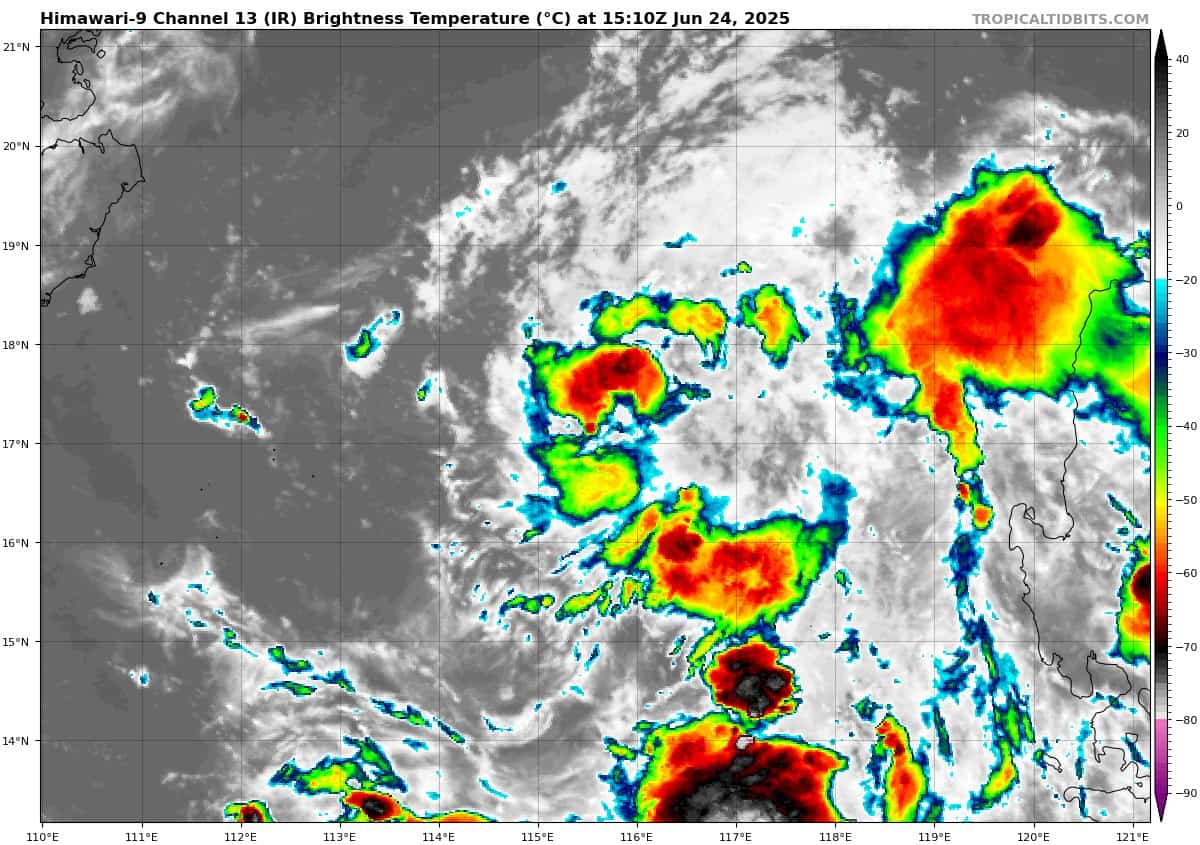
There’s an area of disturbed weather being referred to as Invest 96W, which is located approximately 303 NM east-southeast of Haikou
Animated multi-spectral satellite imagery depicts a consolidating low level circulation center (llcc) with deep convective activity persisting near the llcc. The lack of recent microwave imagery or scatterometer data preclude a high
confidence assessment of the precise position of the llcc, other than
to say it is tucked under the convective cloud shield.
Environmental analysis indicates that Invest 96W is in a favorable environment for further development due to warm sea surface temperatures,
good equatorward outflow aloft, and low (less than 15 knots) vertical wind shear.
Deterministic models are in agreement with the continued, but slow, development of 96W over the next 24-36 hours. Both the GEFS
and ECMWF ensemble models are in agreement with the overall northwesterly track towards the coast of southeastern China.
Maximum sustained surface winds are estimated at 18 to 23 knots.
The potential for the development of a significant tropical cyclone within the next 24 hours is upgraded to high.