
")
Current Snapshot
For all the latest updates visit: DisasterAWARE
1800x1080e
epac2
epac7

02w
02W_221200sair
himawari9_ir_02W_202506221540_lat23.2-lon145.9
By PDC’s Senior Weather
Specialist Glenn James

The Pacific Disaster Center’s (PDC Global) Sunday, June 22, 2025, Tropical Cyclone Activity Report…for the Pacific Ocean, the Indian Ocean, and adjacent Seas
Current Tropical Cyclones:
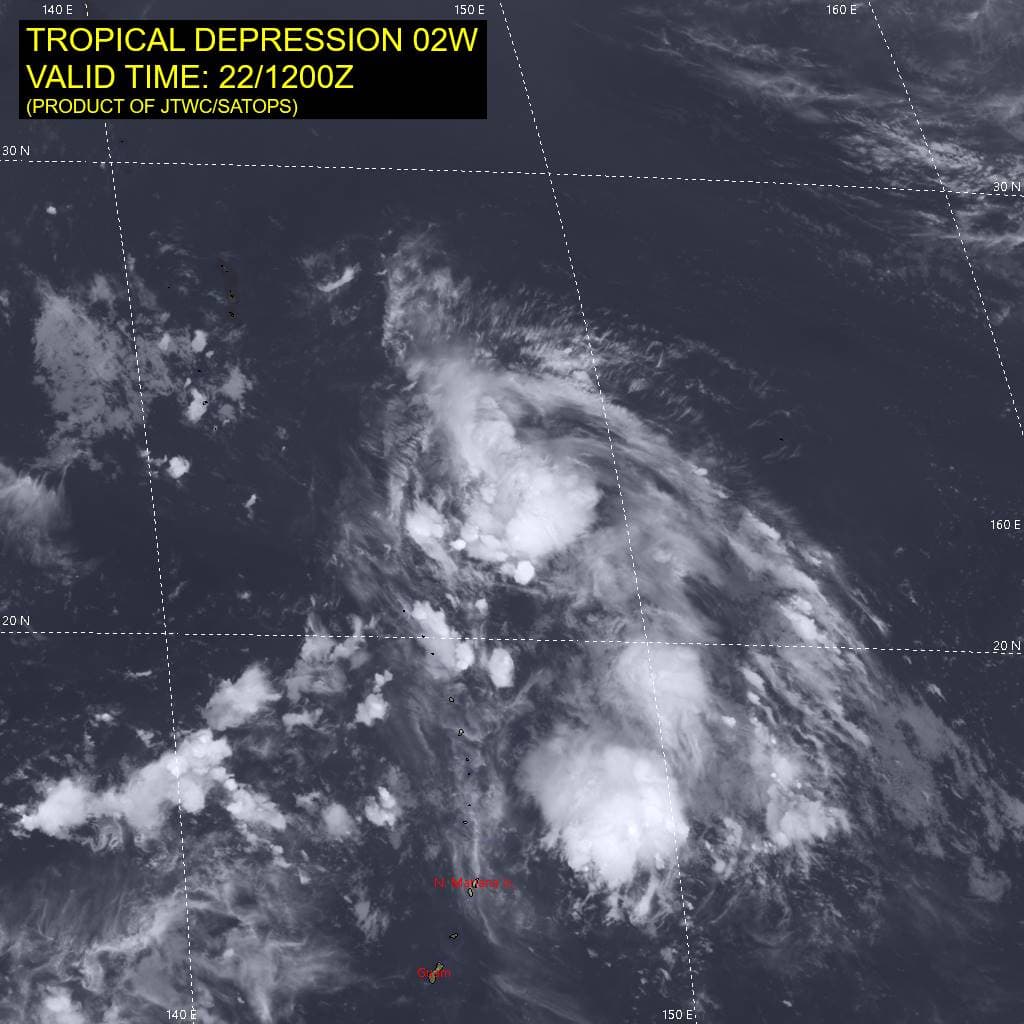
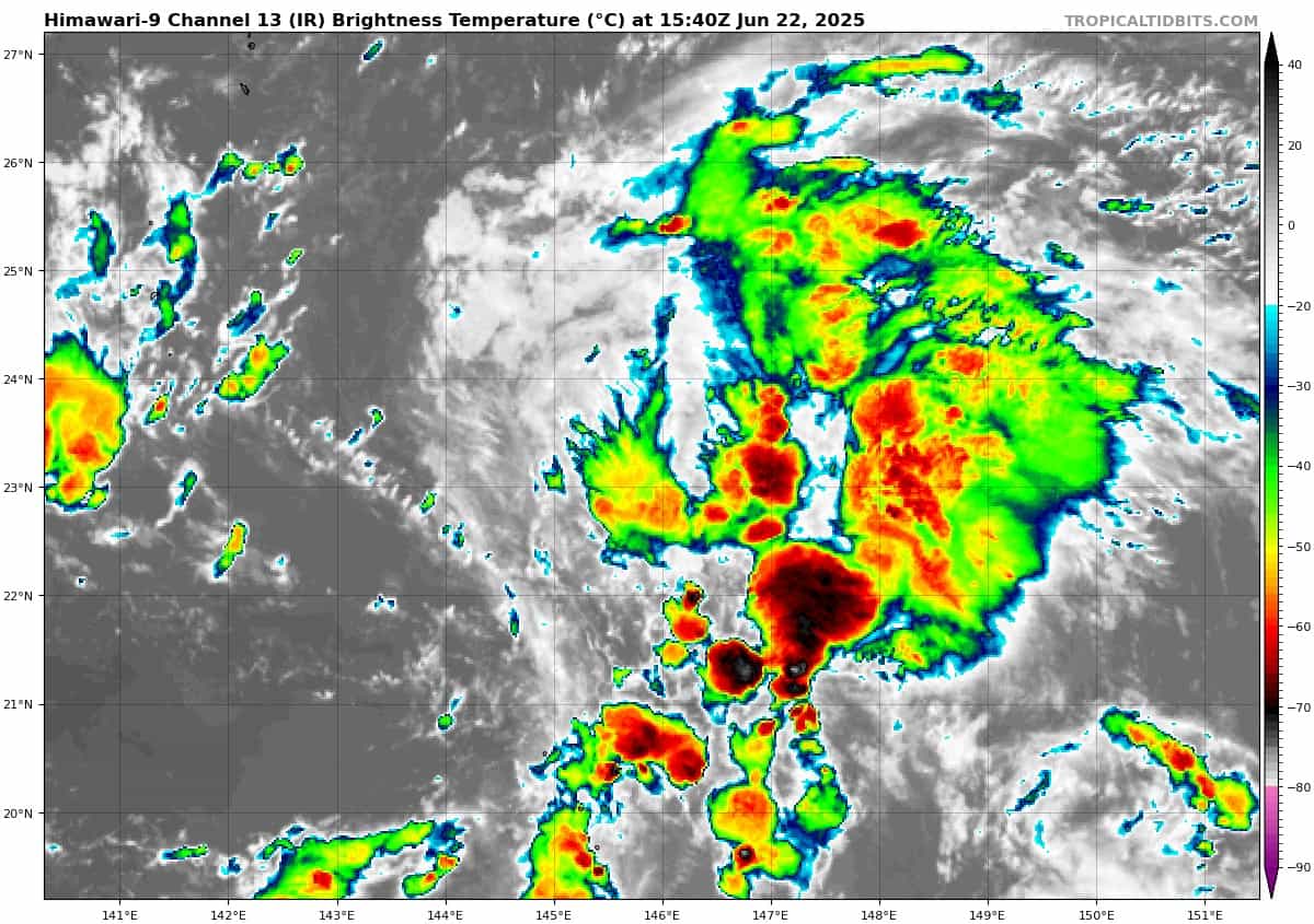
Tropical Cyclone 02W (Sepat) is located approximately 186 NM east of Iwo To
Northeast Pacific Ocean: There are no Tropical Cyclones
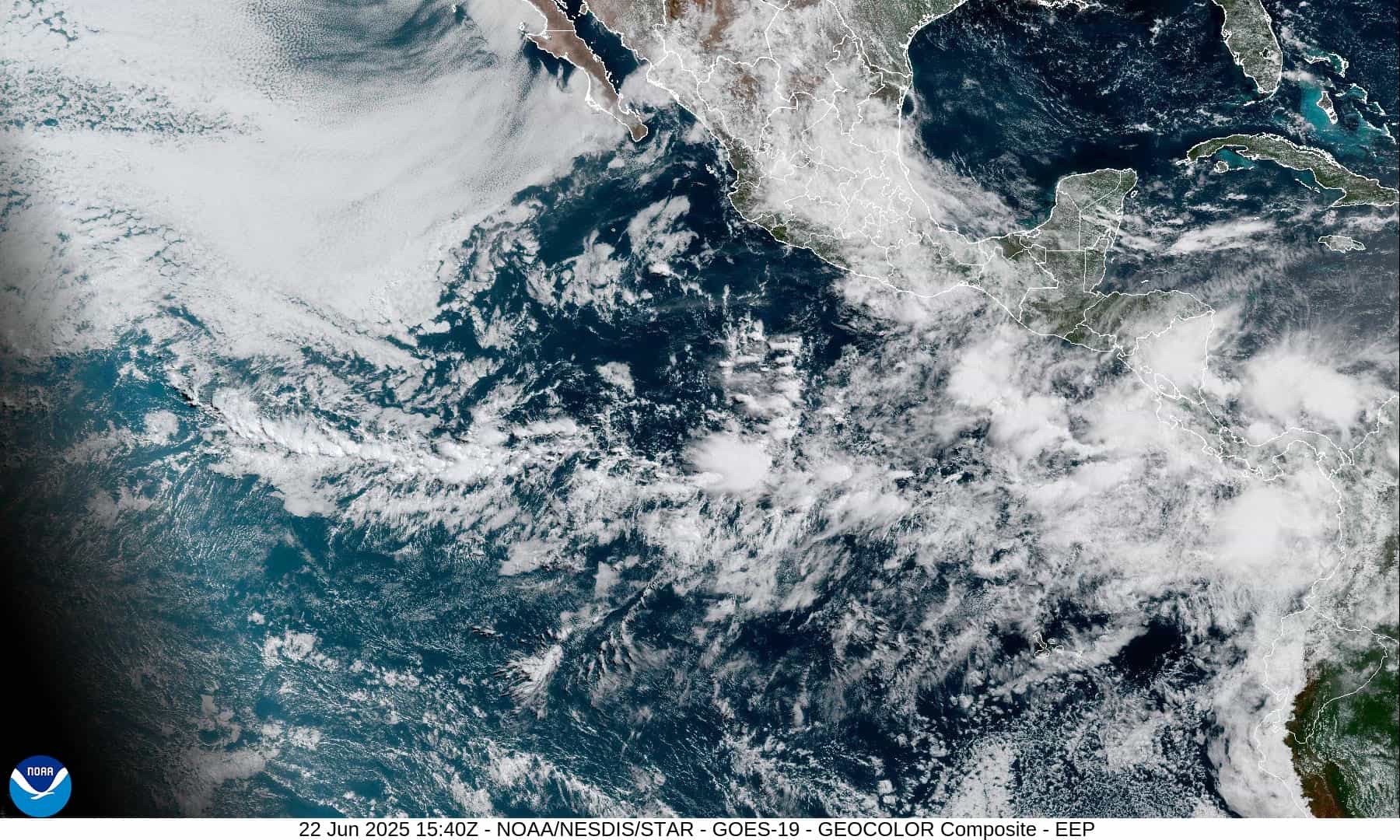
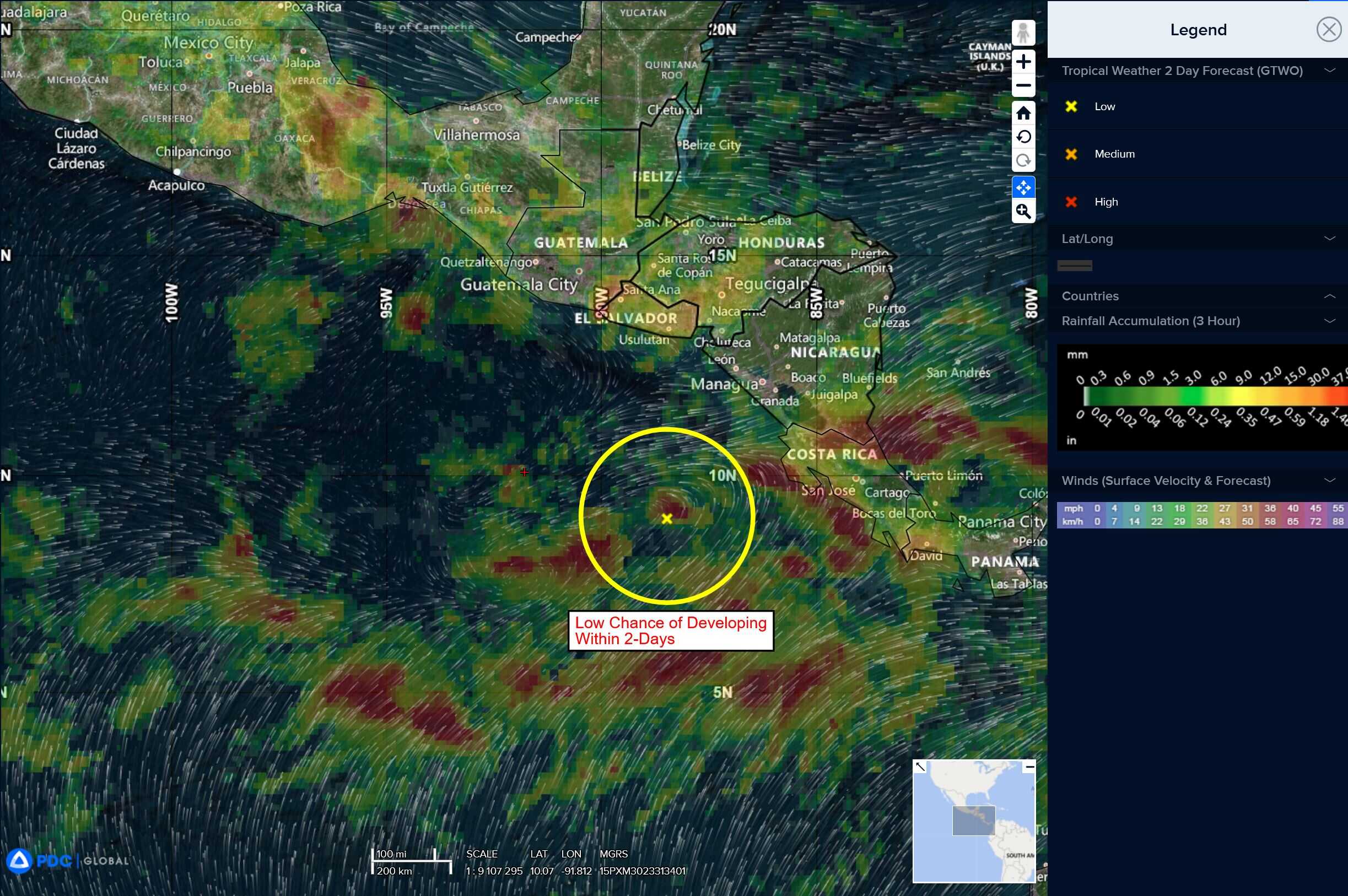
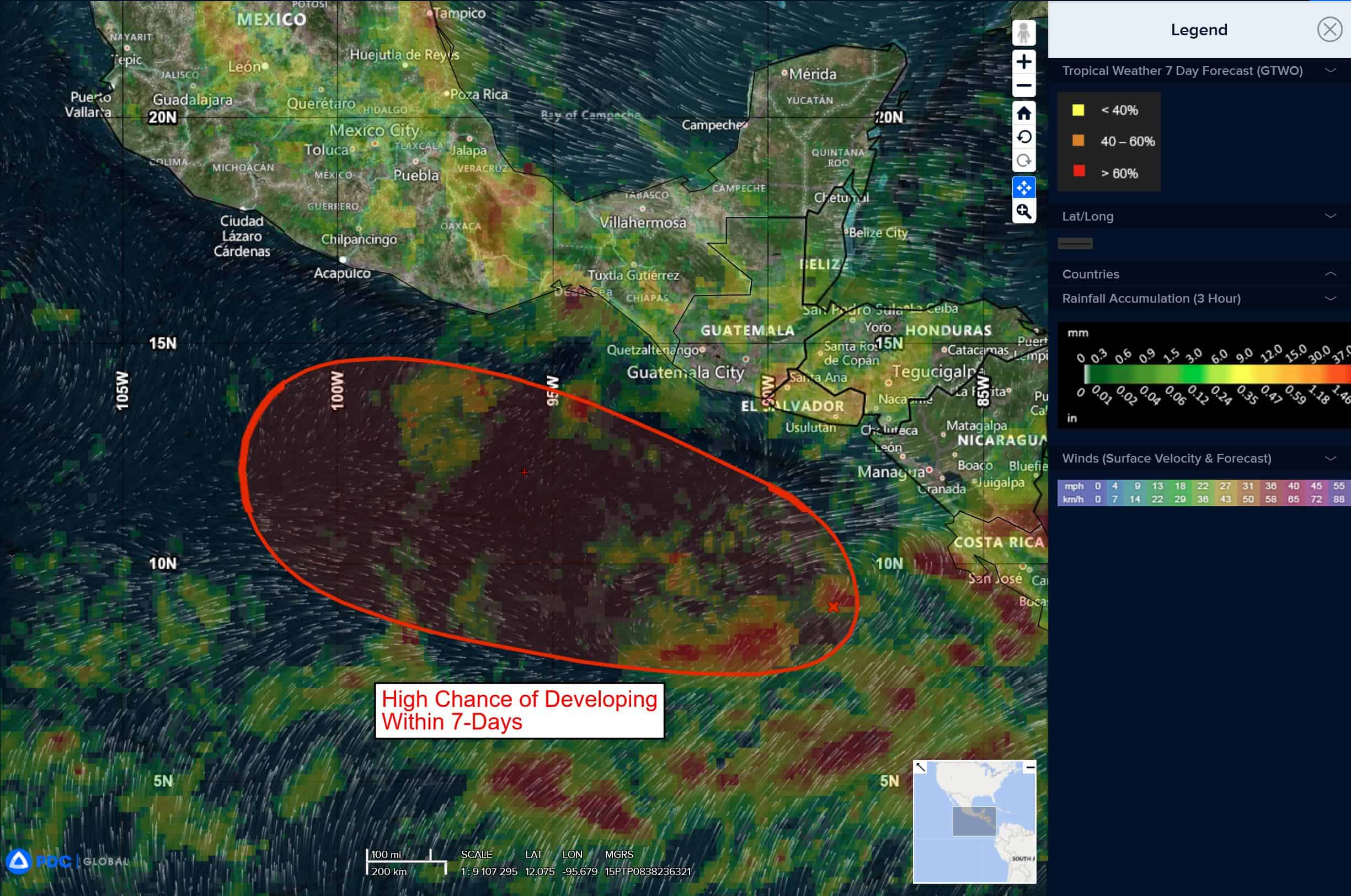
Offshore of Central America and Southern Mexico:
>>> A broad area of disorganized showers and thunderstorms remains located a couple of hundred miles offshore of Central America where an area of low pressure is forecast to develop over the next day or two. Thereafter, environmental conditions appear conducive for gradual development of this system, and a tropical depression is likely to form by the middle to latter part of the week while the system moves west-northwestward off the coasts of Central America and southern Mexico. Locally heavy rainfall is possible across portions of Costa Rica, Nicaragua, El Salvador, Honduras, and Guatemala through the early part of this week.
* Formation chance through 48 hours…low…10 percent
* Formation chance through 7 days…high…70 percent
Central Pacific Ocean: There are no Tropical Cyclones
Tropical cyclone formation is not expected during the next 7-days.
Western Pacific, Indian Ocean, and adjacent Seas:
Western Pacific
Tropical Cyclone 02W (Sepat)
According to the JTWC warning number 3, sustained winds are 30 knots with gusts to near 40 knots
Animated enhanced infrared (eir) satellite imagery depicts tropical depression 02W with an exposed low-level circulation center (llcc) and flaring convection along the eastern semicircle. Another image revealed 25-30 knots within the northeastern quadrant of the system. Additionally, the image showed how asyemmetric the wind field currently is, with the entirety of the western portion of the system considerably weaker (10-15 knots).
Environmental analysis indicates that 02W is in a marginally favorable environment characterized by moderate poleward outflow aloft, low to moderate (15-20 knot) southwesterly vertical wind shear, and warm sea surface temperatures. The presence of a tropical upper tropospheric trough (tutt) cell positioned to the west of the system is causing the elevated shear and outflow to be restricted. It is also likely the cause for the lack of central convection.
TD 02W is forecast to track northwestward, along the southwestern periphery of the subtropical ridge through 48 hours. Near 72 hours, the system will begin to round the ridge axis and turn northeastward as it skirts the eastern coast of central Honshu. 02W will then accelerate off to the northeast through the remainder of the forecast period.
Regarding intensity, 02W is forecast to marginally intensify through 24 hours as the vortex tracks away from the tutt cell and shear decreases. The poleward outflow channel will begin to wane simultaneously though, putting a cap on the intensification trend. Near 48 hours, sea surface temperatures will begin to drop as the system gains latitude. These lower sea temperatures will cause the system to weaken and drop below tropical storm strength as it approaches Honshu. Dissipation is forecast to occur near 96 hours due to combination of cool waters and rapidly increasing shear.