
")
Current Snapshot
For all the latest updates visit: DisasterAWARE
1800x1080e
wutip
01W_121200sair
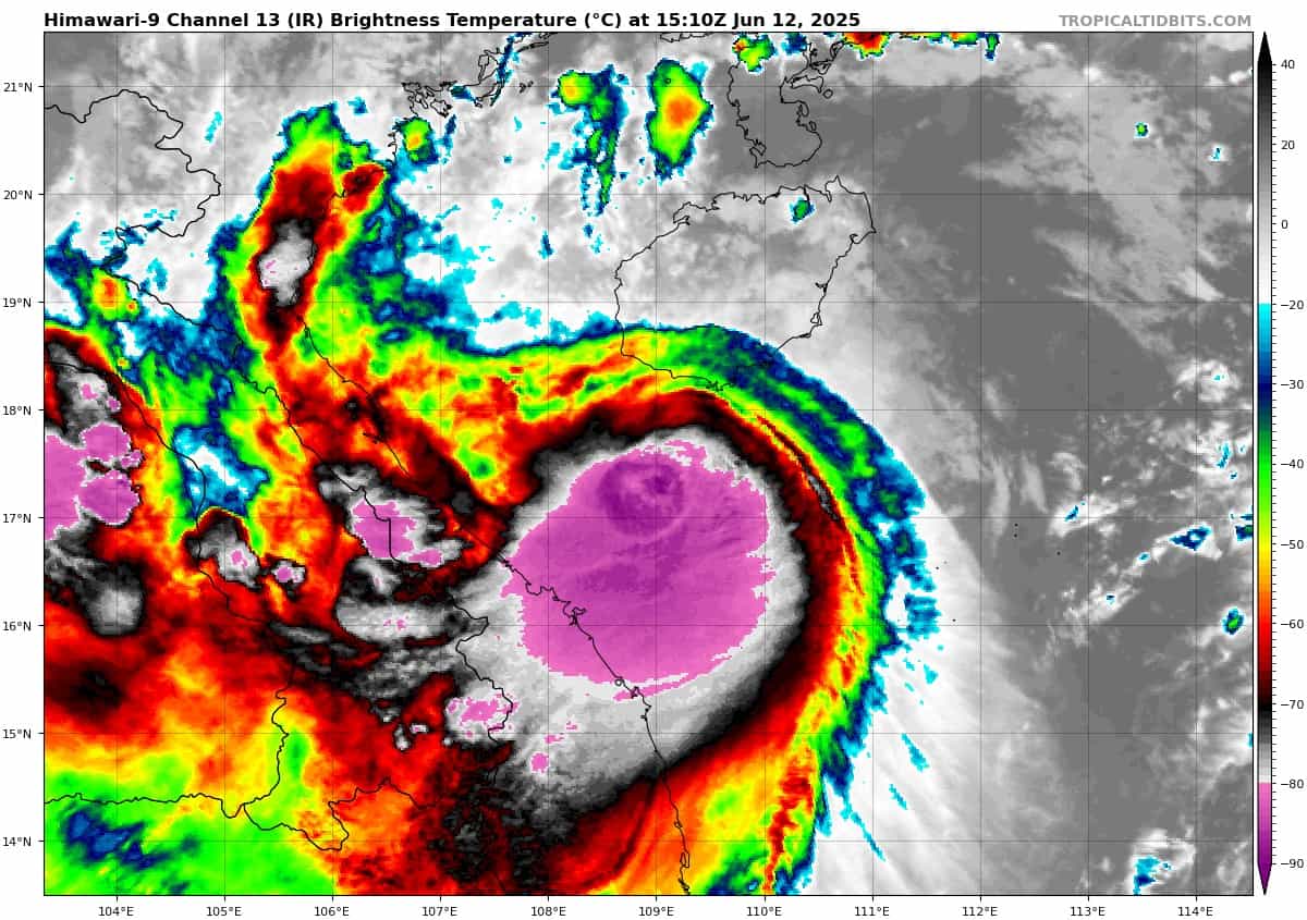
himawari9_ir_01W_202506121510_lat17.4-lon109.2

01W_tracks_latest
By PDC’s Senior Weather
Specialist Glenn James

The Pacific Disaster Center’s (PDC Global) Thursday, June 12, 2025, Tropical Cyclone Activity Report…for the Pacific Ocean, the Indian Ocean, and adjacent Seas
Current Tropical Cyclones:
Potential Tropical Cyclone 04E…is located about 390 miles south of Zihuatanejo, Mexico
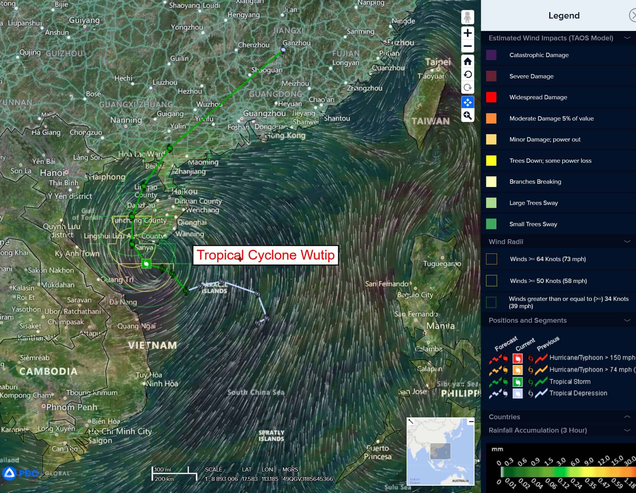
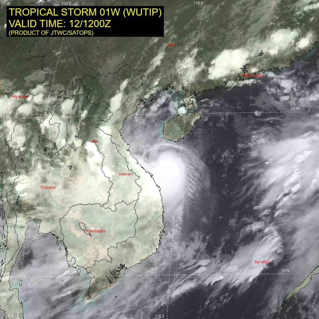
Tropical Cyclone 01W (Wutip)…is located about 219 NM southeast of Hanoi, Vietnam
Northeast Pacific Ocean:
Potential Tropical Cyclone 04E
DISTURBANCE GRADUALLY BECOMING BETTER ORGANIZED…TROPICAL STORM WATCH IN EFFECT FOR THE COAST OF SOUTHWESTERN MEXICO
According to the NHC Advisory number 2A
The system is moving toward the northwest near 7 mph (11 km/h), and this general motion is expected to continue for the next couple of days. A turn toward the west-northwest is forecast by Sunday. Maximum sustained winds are near 35 mph (55 km/h) with higher gusts. Strengthening is expected during the next couple of days. The system is forecast to become a tropical storm later today and continue strengthening on Saturday as it moves parallel to the coast of southwestern Mexico.
* Formation chance through 48 hours…high…90 percent
* Formation chance through 7 days…high…90 percent
HAZARDS AFFECTING LAND RAINFALL:
Rainfall totals of 2 to 4 inches, with localized amounts up to 6 inches, are possible across portions of the Mexican states of Guerrero, Michoacan, and Colima through this weekend. This rainfall may lead to areas of flooding and mudslides.
WIND: Tropical storm conditions are possible within the watch area on Saturday.
SURF: Swells generated by Potential Tropical Cyclone 04E will affect portions of the coast of southwestern Mexico during the next few days. These swells are likely to cause life-threatening surf and rip current conditions.
Offshore of Central America and Southern Mexico
>>> An area of low pressure is forecast to develop late this weekend or early next week near the coast of Central America. Environmental conditions appear conducive for some gradual development of this system as it moves west-northwestward near the coasts of Central America and southern Mexico.
* Formation chance through 48 hours…low…near 0 percent
* Formation chance through 7 days…low…30 percent
Central Pacific Ocean: There are no Tropical Cyclones
Tropical cyclone formation is not expected during the next 7-days.
Western Pacific, Indian Ocean, and adjacent Seas:
Western Pacific
Tropical Cyclone 01W (Wutip)
According to the JTWC Warning number 11, sustained winds are 60 knots with gusts to 75 knots
Animated enhanced infrared (eir) satellite imagery depicts tropical storm 01W (Wutip) with persistent convection now more aligned with the low-level circulation center (llcc). The cloud tops just south of the center are extremely cold.
Environmental analysis indicates that 01W is in a favorable environment characterized by strong equatorward outflow aloft, moderate (15-20 knots) northeasterly vertical wind shear, and warm sea surface temperatures. 01W is forecast to track northwestward through 12 hours before beginning to round the ridge axis and commencing a northwestward turn. The track has shifted slightly to the west when compared to the previous forecast, and now has the vortex center passing just to the west of Hainan from 12 to 24 hours. After 24 hours, 01W is forecast to track northwestward and head toward the western extent of the Leizhou Peninsula. Landfall along the southern coast of mainland China is forecast to occur between 36 and 48 hours.
Regarding intensity, 01W is forecast to slightly intensify to 55 knots at 12 hours in response to the overall favorable environment. After 12 hours, land interaction with western coast of Hainan will disrupt the system and cause gradual weakening through 48 hours. After making landfall, 01W will rapidly weaken due to significant terrain interaction. The vortex is then forecast to completely dissipate by 72 hours.