
")
Current Snapshot
For all the latest updates visit: DisasterAWARE
epac

1800×1080
01s
01S_170600sair
01S_tracks_latest
96w

96W_tracks_latest
By PDC’s Senior Weather
Specialist Glenn James

The Pacific Disaster Center’s (PDC Global) Thursday, July 17, 2025, Tropical Cyclone Activity Report…for the Pacific Ocean, the Indian Ocean, and adjacent Seas
Current Tropical Cyclones:
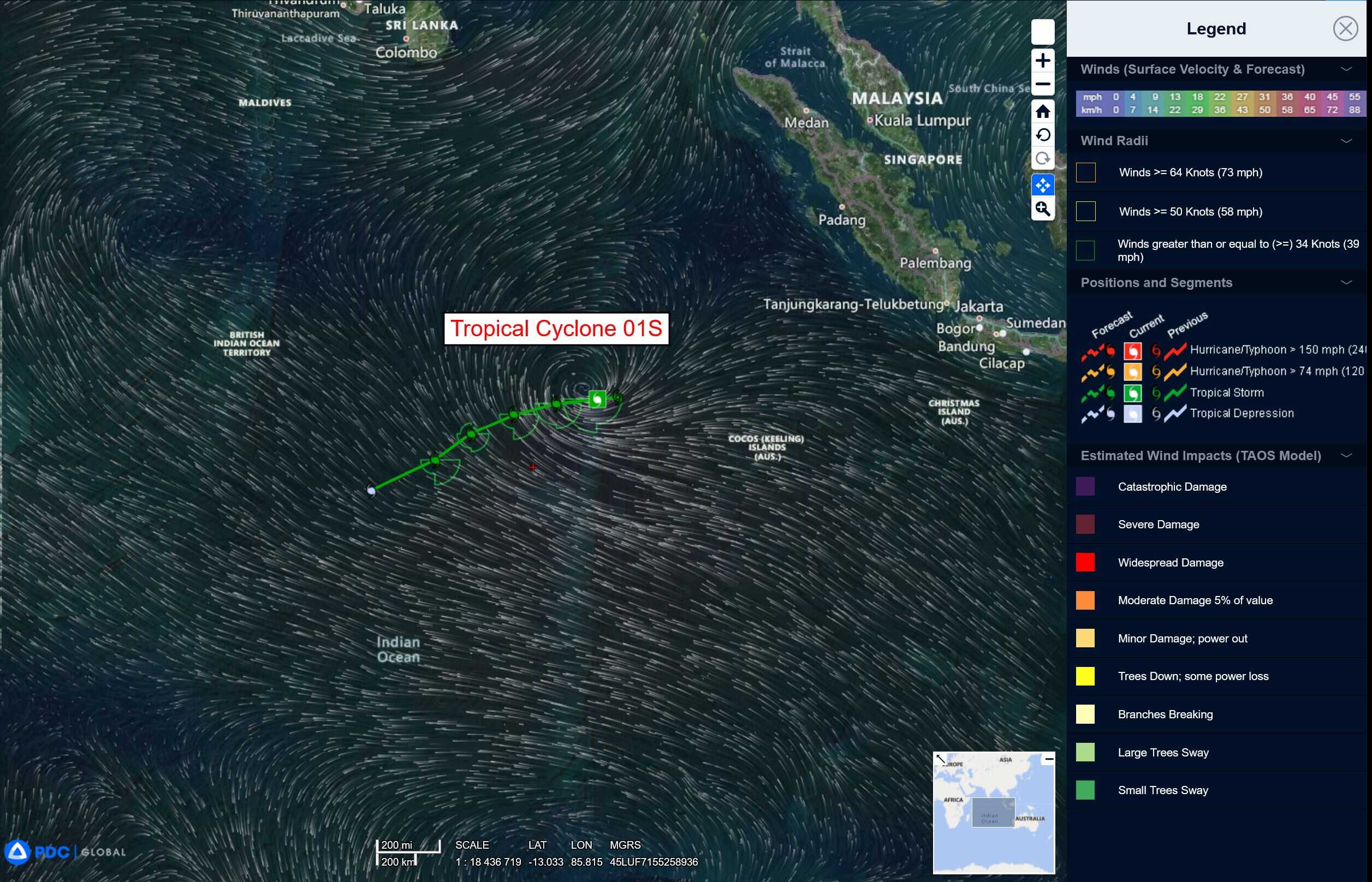
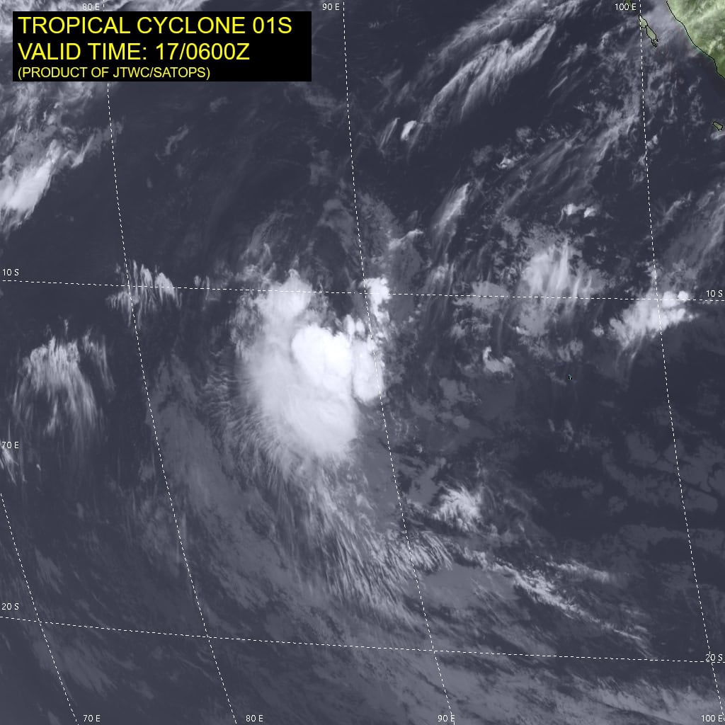
Tropical Cyclone 01S…is located 559 NM west of the Cocos Islands
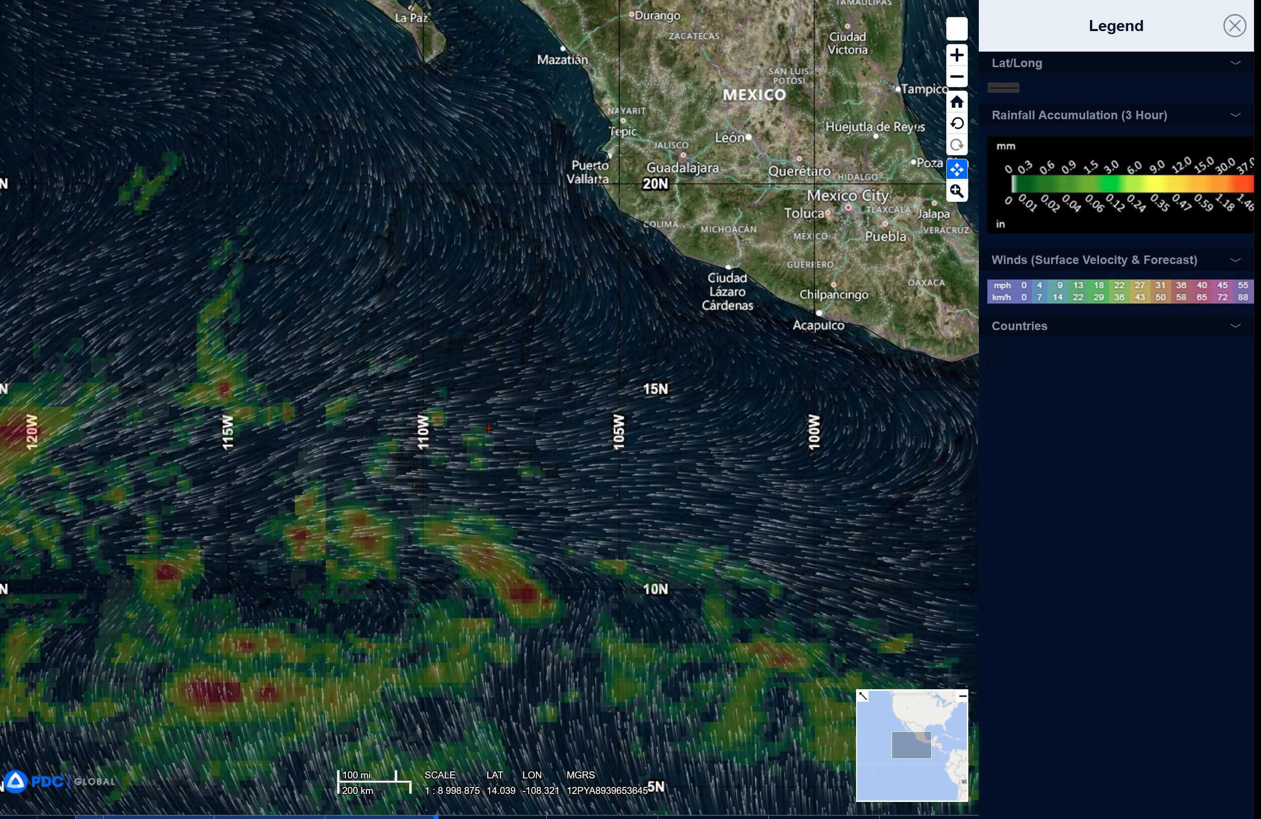
Northeast Pacific Ocean: There are no Tropical Cyclones
Tropical cyclone formation is not expected during the next 7-days.
Central Pacific Ocean: There are no Tropical Cyclones
Tropical cyclone formation is not expected during the next 7-days.
Western Pacific, Indian Ocean, and adjacent Seas:
Western Pacific
Tropical Cyclone 01S
According to the JTWC warning number 3 sustained winds are 35 knots with gusts to near 45 knots
Animated multi-spectral satellite imagery (msi) depicts a broad, exposed low-level circulation, with persistent deep convection sheared to the south and southwest. this weak structure is also evident in a microwave image, with a symmetric area of deep convection well south of the low-level circulation center. A ascat-c bullseye image reveals a defined center, with 30-35 knot winds over the southern quadrant, which supports the initial position and intensity with high confidence. ascat imagery also confirms that gale force winds are confined to the southern semicircle.
Environmental conditions are marginally favorable due to low to moderate mid-level
east-northeasterly vertical wind shear (vws) offset by moderate poleward outflow and warm sst values.
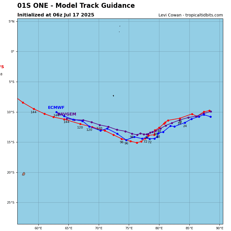
Tropical cyclone 01S will track west-southwestward through 36 hours along the northern periphery of the low- to mid-level subtropical ridge (str) positioned to the south. Vertical wind shear is forecast to abate briefly from 24 to 36 hours, which will support modest intensification to a peak intensity of 40 knots.
After 36 hours, the western portion of the str will weaken and reorient with the approach of a deep upper-level trough, which will allow tc 01s to turn southwestward through 48 hours. Slight weakening is expected as vws increases to moderate levels.
After 48 hours, the aforementioned upper-level trough will fill allowing the str to build back in to the south. The system will gradually weaken as it tracks over cooler sst values and entrains dry air, with dissipation anticipated by 72 hours.
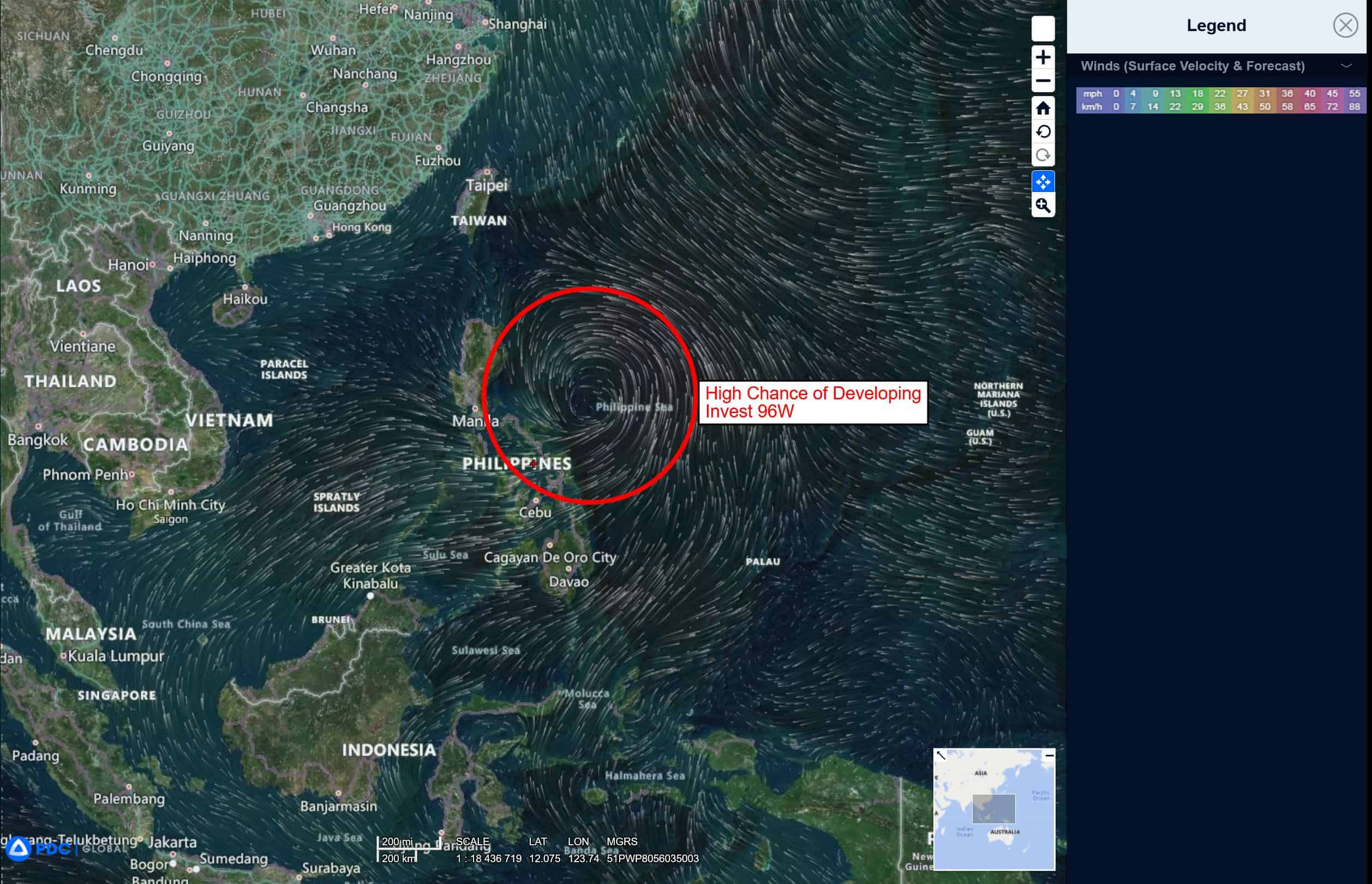
>>> There’s an area of disturbed weather being referred to as Invest 96W, which is located approximately 252 NM northeast of Manila, Philippines
The system is currently classified as a monsoon depression, generally characterized as a large cyclonic circulation, greater than 600 NM diameter, with extensive gale-force winds over the southeastern periphery and a weak core of light winds.
Animated multi-spectral satellite imagery depicts a broad, consolidating low level circulation center (llcc) with improved convective curved banding wrapping into a broad llcc. A partial metop-c ascat pass reveals a large core of weak winds (approximately 200 NM diameter)
surrounded by a band of 30-35 knot winds.
Environmental analysis depicts low to moderate vertical wind shear (vws) of 15-20 knots, good equatorward upper-level outflow, and warm sea surface temperatures (sst).
Deterministic and ensemble models forecast a more defined, consolidated structure with a northwestward track through 18 hours and increasing sustained winds of generally 35-45 knots. However, some models suggest sustained winds as high as 50 knots through the
next 24 to 48 hours.
Maximum sustained surface winds are estimated at 30 to 35 knots.
The potential for the development of a significant tropical cyclone within the next 24 hours remains high.