Current Snapshot
For all the latest updates visit: DisasterAWARE
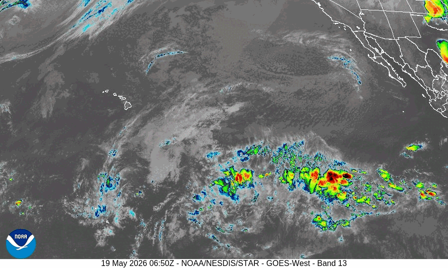
By PDC’s Senior Weather
Specialist Glenn James

The Pacific Disaster Center’s (PDC Global) Wednesday, May 7, 2025, Tropical Cyclone Activity Report…for the Pacific Ocean, the Indian Ocean, and adjacent Seas
Current Tropical Cyclones:
There are no Tropical Cyclones
Northeast Pacific Ocean: There are no Tropical Cyclones
The last regularly scheduled Tropical Cyclone Activity Report of the 2024 eastern North Pacific Hurricane Season has been issued. Routine issuance of this section of the PDC product will resume on May 15, 2025. During the off-season, Special Tropical Weather Outlooks will be issued as conditions warrant by the NHC.
Central Pacific Ocean: There are no Tropical Cyclones
The 2024 central North Pacific hurricane season has ended. As such, the final routine Tropical Cyclone Activity Report for the 2024 season has been issued. Routine issuance of this section of the PDC product will resume on June 1, 2025. During the off-season, Special Tropical Weather Outlooks will be issued as conditions warrant by the CPHC.
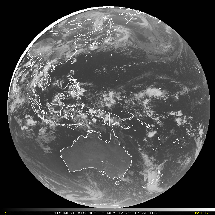
Western Pacific, Indian Ocean, and adjacent Seas: There are no Tropical Cyclones
There’s an area of disturbed weather being referred to as Invest 93P, which is located approximately 228 NM north of Weipa, Queensland, Australia
Animated enhanced infrared satellite imagery depicts a broad llcc obscured by flaring convection starting to organize. A microwave image depicts fragmented banding, primarily over water, wrapping around the southern semicircle. The position is based
on the center of the elongated circulation.
Environmental analysis indicates 93P is in a marginally favorable environment due to its position along the coast. However, warm sea surface temperatures, low (10-15 knot) vertical wind shear and good poleward flow could favor
further development if the system tracks over water.
Global models are in good agreement that 93P will continue to track generally westward, then remain near the Arafura Sea and slowly develop over the next 24-48 hours.
Maximum sustained surface winds are estimated at 18 to 23 knots.
The potential for the development of a significant tropical cyclone within the next 24 hours is low.