
")
Current Snapshot
For all the latest updates visit: DisasterAWARE
epac
1800x1080e
wpac
31W_061200sair
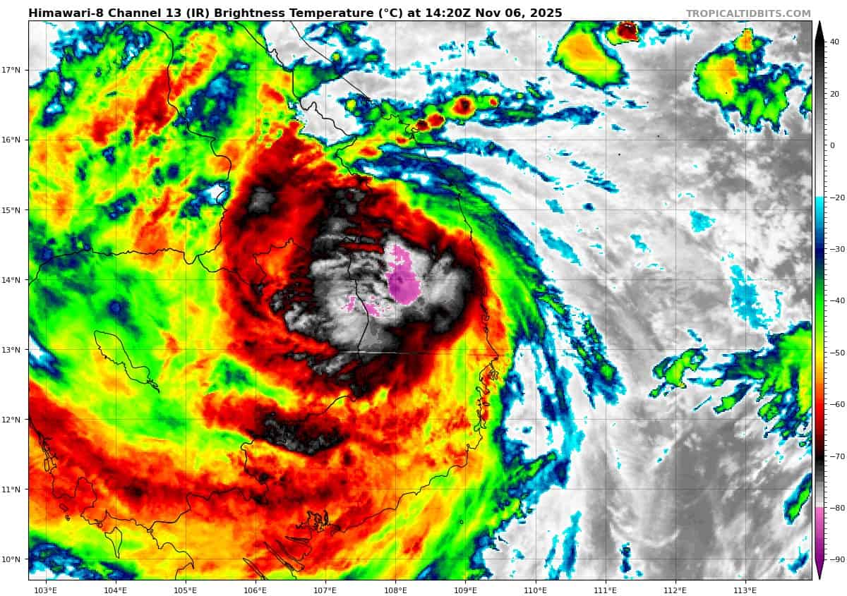
himawari8_ir_31W_202511061420_lat13.6-lon109.1
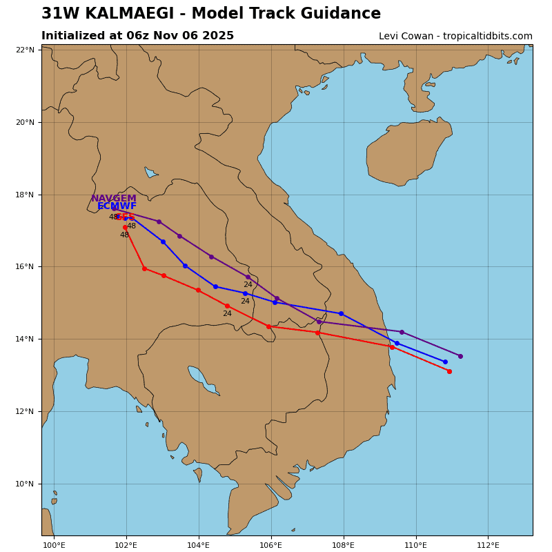
31W_tracks_latest
32W_061200sair
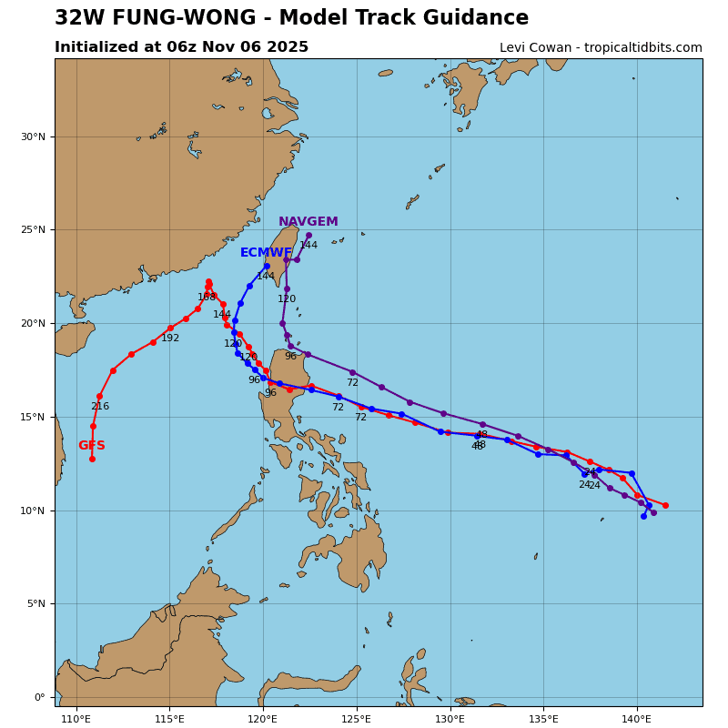
32W_tracks_latest
By PDC’s Senior Weather
Specialist Glenn James

The Pacific Disaster Center’s (PDC Global) Thursday, November 6, 2025, Tropical Cyclone Activity Report…for the Pacific Ocean, the Indian Ocean, and adjacent Seas
Current Tropical Cyclones:
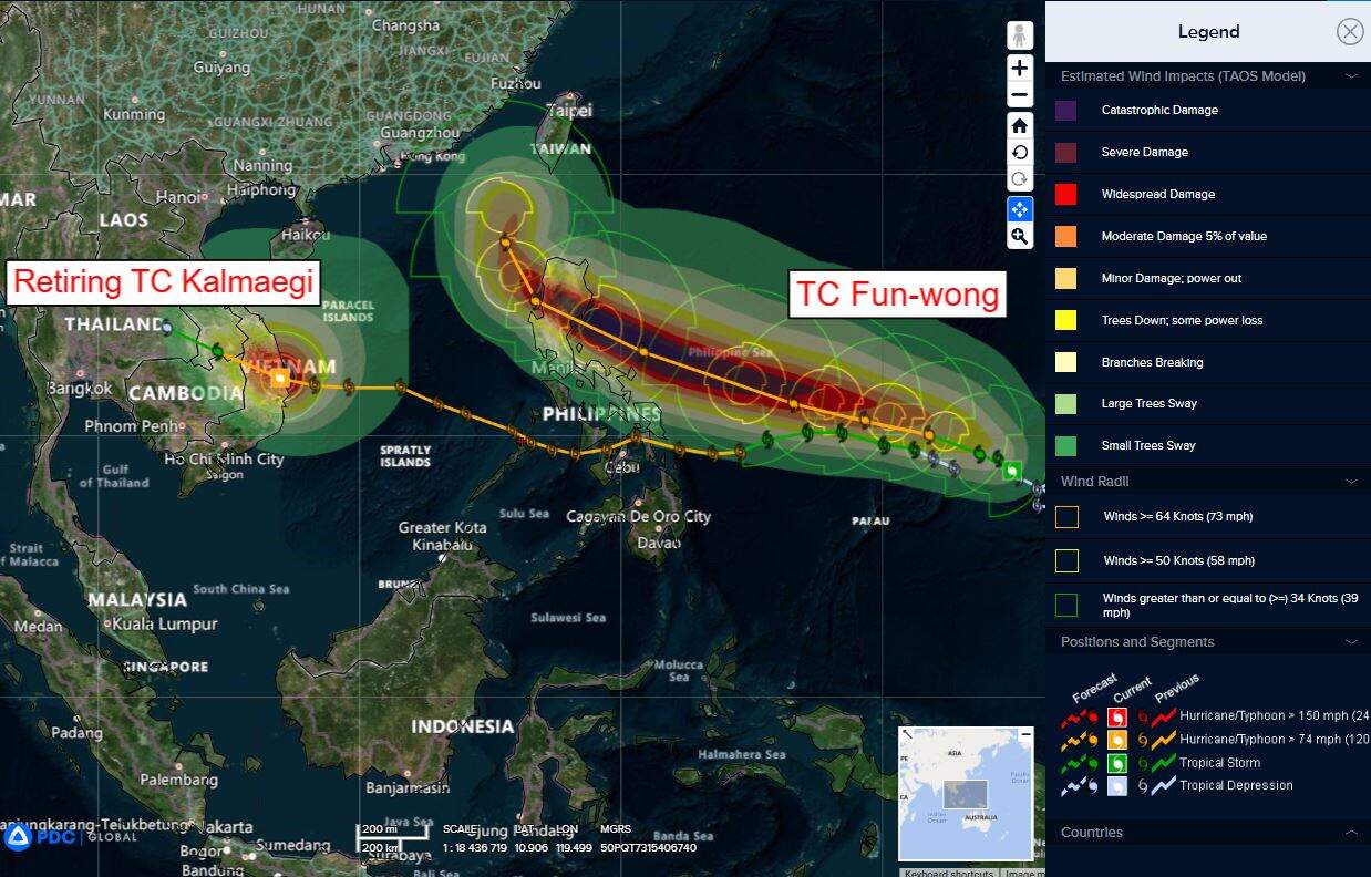
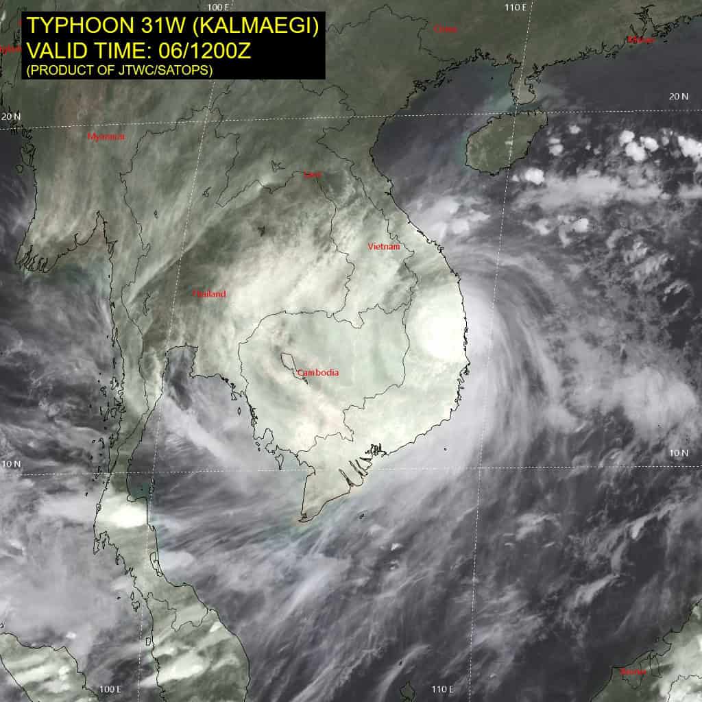
Tropical Cyclone 31W (Kalmaegi)…is located 151 NM south-southeast of Da Nang, Vietnam – Final Warning
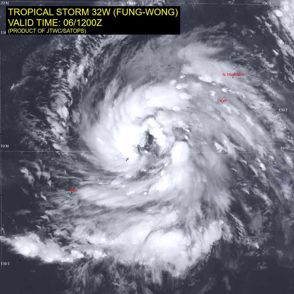
Tropical Cyclone 32W (Fung-wong)…is located 98 NM east-northeast of Yap
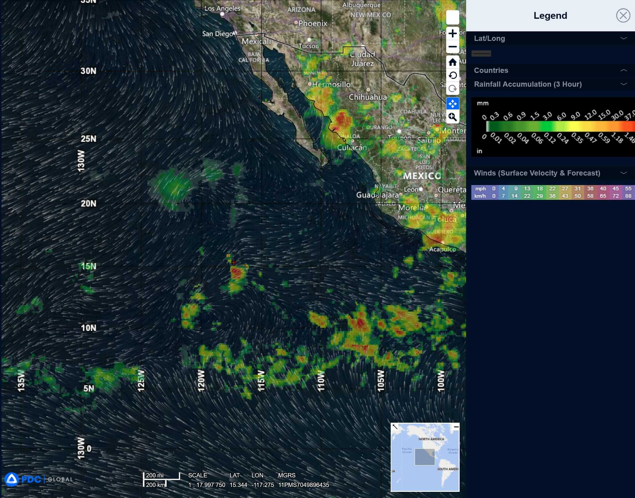
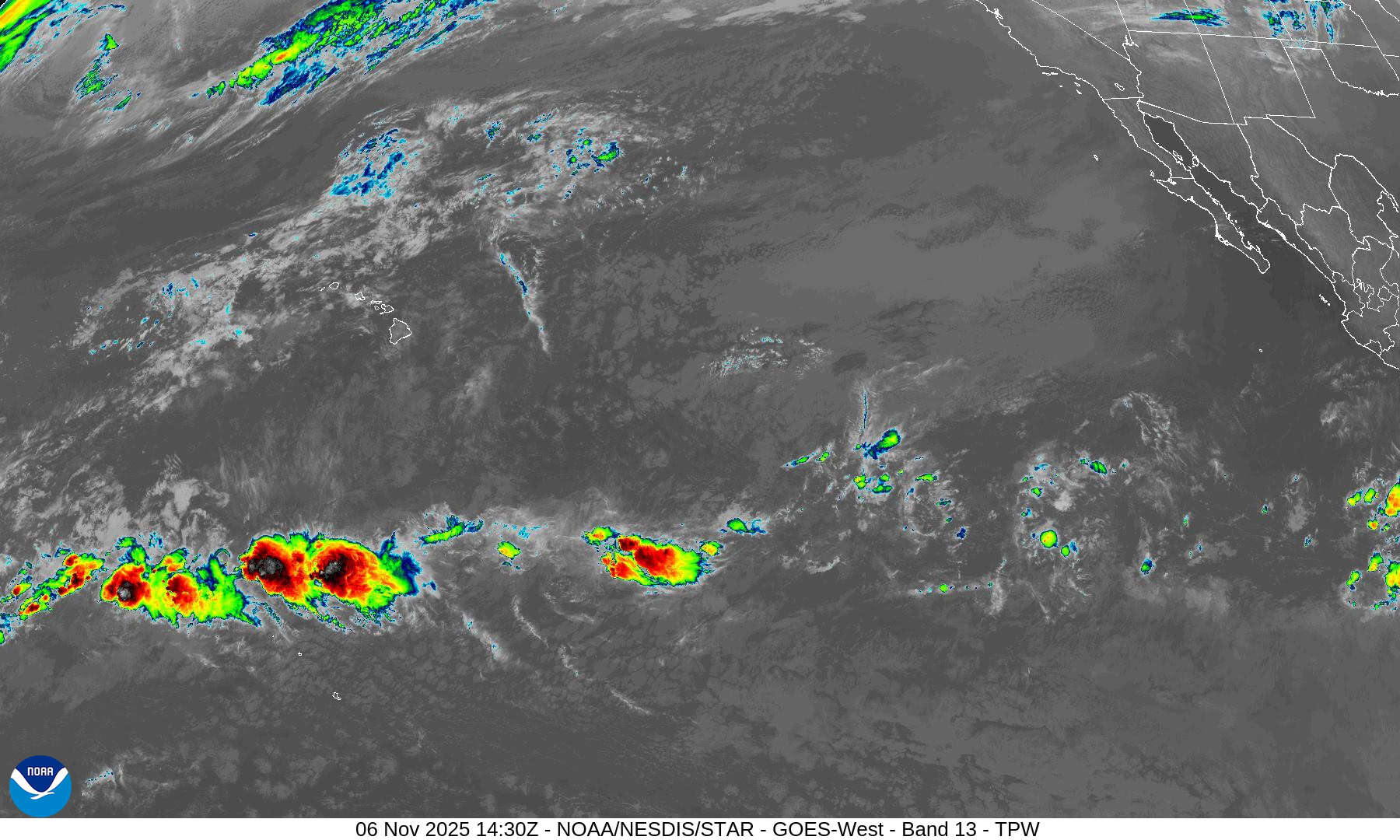
Northeast Pacific Ocean: There are no Tropical Cyclones
Tropical cyclone formation is not expected during the next 7 days.
Central Pacific Ocean: There are no Tropical Cyclones
Tropical cyclone formation is not expected during the next 7 days.
Western Pacific, Indian Ocean, and adjacent Seas:
Tropical Cyclone 31W (Kalmaegi) – Final Warning
According to the JTWC warning number 22…sustained winds are 100 knots with gusts to 125 knots
The system is forecast to track west-northwestward over the next 24 hours, under the influence of a subtropical ridge\ centered northwest of Luzon.
Tropical Cyclone 32W (Fung-wong)
According to the JTWC warning number 10…sustained winds are 40 knots with gusts to 50 knots
Animated multi-spectral satellite imagery (msi) depicts tropical
storm 32W (Fung-wong) with a very broad circulation and expansive convective banding along all quadrants of the system. Deep convection has continued to fail to build over the center, and is likely the cause of the rather gradual development in intensity over the past 24 hours. A partial 060431z amsr2 89 ghz microwave image revealed an ill-defined center with fragmented convective banding in both the northern and southern semicircles.
Environmental analysis indicates that 32W is in a favorable environment characterized by strong radial outflow aloft, low (5-10 kts) vertical wind shear, and warm (29-30 c) sea surface temperatures.
32W is forecast to track west-northwestward along the southwestern periphery of the subtropical ridge to the far northeast through 36 hours. Near 36 hours, track speeds are
expected to increase as a separate subtropical ridge forms to the immediate northeast of the system, tightening the steering gradient.
A west-northwestward track is forecast to continue through 72 hours as 32W approaches the eastern coast of Luzon. Landfall is forecast to occur near 84 hours, south of Casiguran, within the Aurora Province. 32W will then track across Luzon and emerge within the South China Sea 96. The system will then take a northward turn toward Taiwan as it rounds the western extent of the subtropical ridge.
In terms of intensity, 32W is forecast to rapidly intensify through 48 hours to around 100 kts. The large circulation is expected to quickly consolidate and form deep convection over the low-level circulation center. Northeasterly vertical wind shear is expected to increase after 48 hours to around 20 kts, causing the rapid intensification trend to slow. However, intensification through landfall is still likely. Currently, an intensity of 115 kts is forecast for the time of landfall. 32W will then rapidly weaken due to terrain interaction as it crosses Luzon.