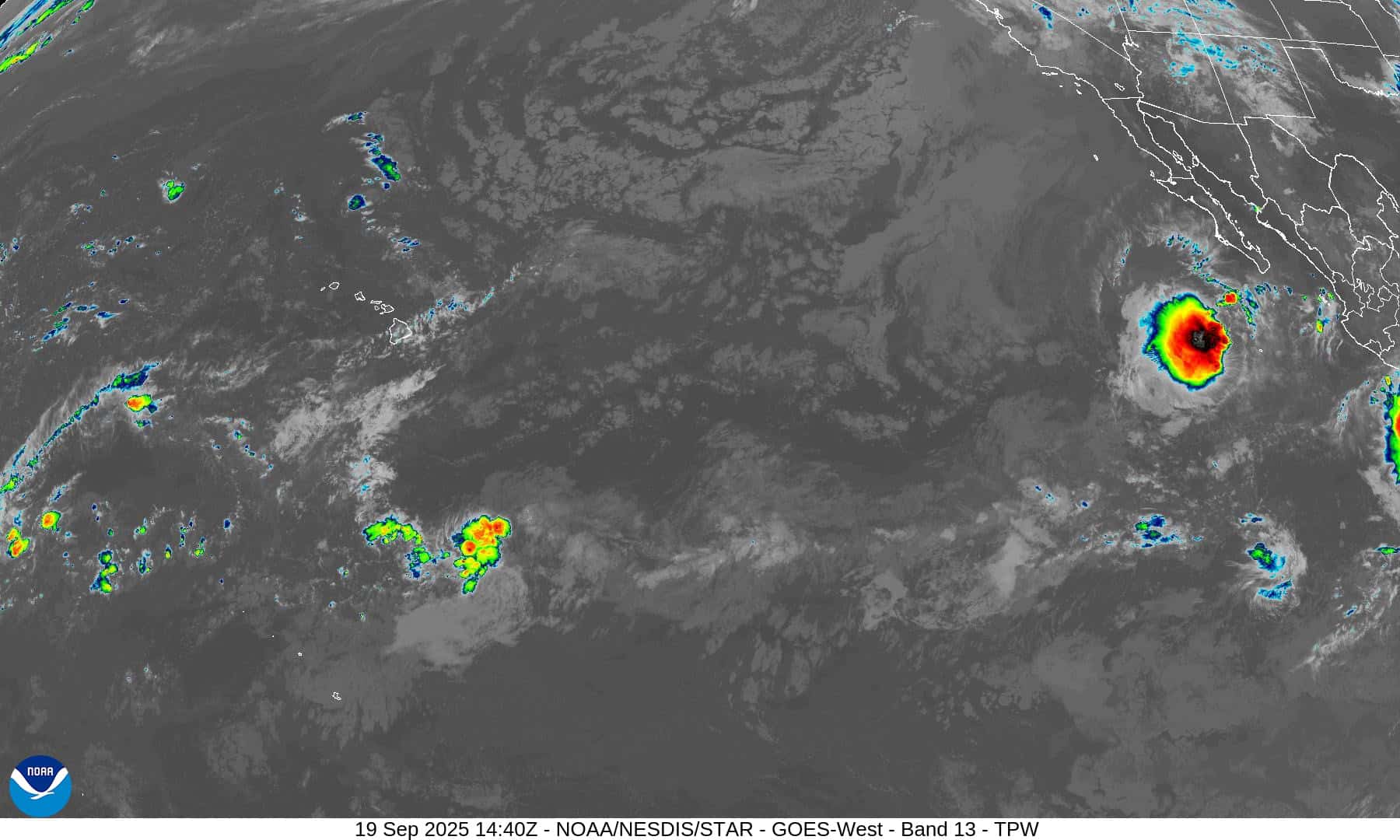
The Pacific Disaster Center’s (PDC Global) Friday, September 19, 2025, Tropical Cyclone Activity Report…for the Pacific Ocean, the Indian Ocean, and adjacent Seas
Current Tropical Cyclones:
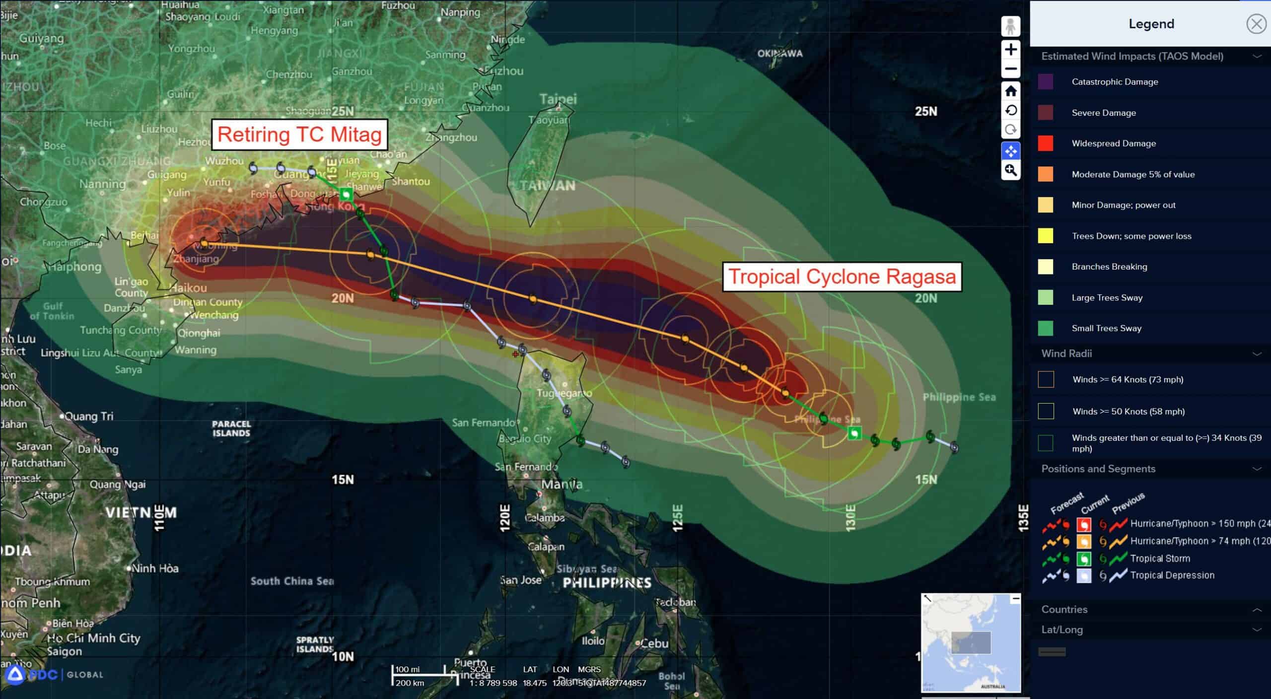
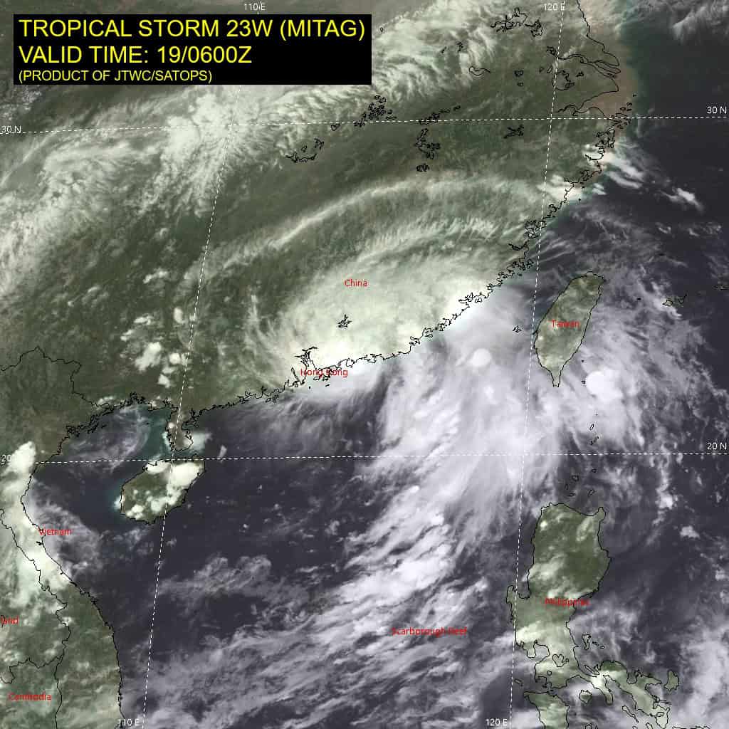
Tropical Cyclone 23W (Mitag) is located approximately 73 NM east-northeast of Hong Kong – Final Warning
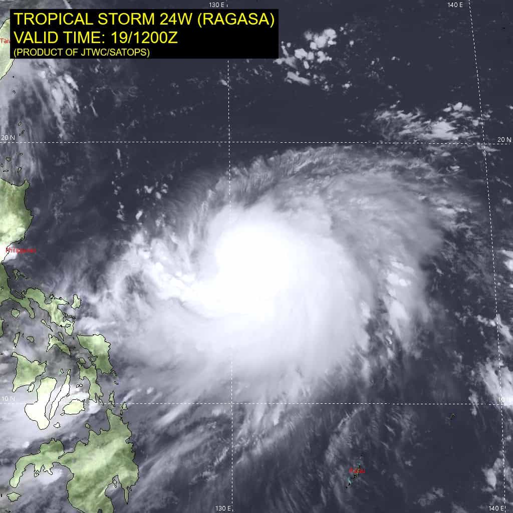
Tropical Cyclone 24W (Ragasa) is located approximately 508 NM east-northeast of Manila, Philippines
Tropical Cyclone 25W (Neoguri) is located approximately 654 NM northwest of Wake Island
Northeast Pacific Ocean:
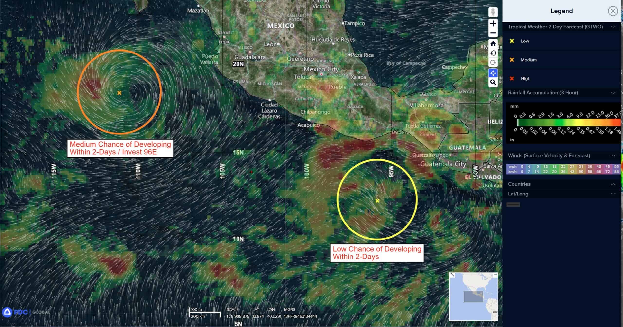
>>> South of the Baja California Peninsula:
Invest 96E
Shower and thunderstorm activity associated with a broad area of low pressure located a few hundred miles southwest of the southern tip of the Baja California Peninsula has continued to diminish this evening and remains displaced well to the west and southwest of the center of circulation. The system is forecast to move west-northwestward into a more hostile environment this weekend, where cooler waters and a drier airmass will inhibit further development.
*Formation chance through 48 hours…low…10 percent
*Formation chance through 7 days…low…10 percent
Off the coast of Southern Mexico:
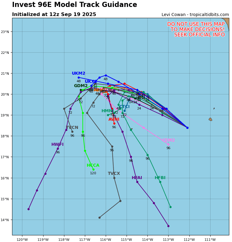
Invest 97E
>>> A large area of disorganized showers and thunderstorms located a couple of hundred miles south of the southern coast of Mexico is associated with a trough of low pressure. Environmental conditions appear conducive for some gradual development of this system, and a tropical depression could form by early to mid-next week while it moves generally west-northwestward at 5 to 10 mph, roughly parallel to the coast of southern and southwestern Mexico.
*Formation chance through 48 hours…medium…50 percent
*Formation chance through 7 days…high…80 percent
Central Pacific Ocean: There are no Tropical Cyclones
Tropical cyclone formation is not expected during the next 7 days.
Western Pacific, Indian Ocean, and adjacent Seas:
Western Pacific
Tropical Cyclone 23W (Mitag) – Final Warning
According to the JTWC warning number 13…sustained winds are 40 knots with gusts to near 50 knots.
Animated enhanced multi-spectral imagery (msi) depicts a partially obscured low-level circulation center (llcc) accompanied by persistent convection over the center. Based on radar analysis, tropical storm 23W (Mitag) has made landfall near Shanwei, China.
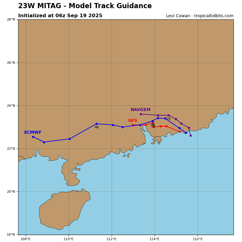
23W will continue its westward track inland along the southern periphery of the building subtropical ridge to its north. 23W is forecast to rapidly weaken over land, with dissipation expected by 36 hours. Both JTWC track and intensity guidances are in good agreement that 23W will remain over land and steadily deteriorate.
Tropical Cyclone 24W (Ragasa)
According to the JTWC warning number 7…sustained winds are 70 knots with gusts to near 85 knots.
Animated enhanced infrared (eir) satellite imagery depicts tropical storm 24W (Ragasa) with a large area of deep convection obscuring the low-level circulation center (llcc). Poleward outflow appears to be improving, apparent by cirrus filaments beginning to expand outward from the system in that direction. A 191148z gmi 37 ghz microwave image revealed that the low-levels are still a bit disorganized with no defined microwave eye formed yet. The 89 ghz version of the same image shows that the convection is still
displaced to the southeast of the llcc, and has not become entirely vertically stacked.
Environmental analysis indicates that 24W is in a highly favorable environment characterized by strong poleward and equatorward outflow aloft, low (5-10 knots) vertical wind shear, and warm (29-30 c) sea surface temperatures.
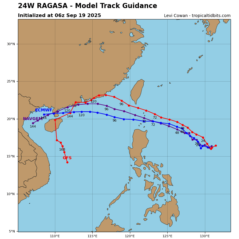
24W is forecast to track rather slowly northwestward over the next 48 hours as the subtropical ridge to the north continues to build. Near 72 hours, the ridge will have built in and will have more influence on steering the vortex. 24W will then increase track speeds as it passes through the Luzon Strait with a more west-northwestward trajectory. This motion will then persist through the remainder of the forecast period as the system approaches the southern coast of China.
Regarding intensity, 24W is forecast to rapidly intensify over the next 48 hours to around 105 knots. Environmental conditions will be nearly perfect for rapid development as the system taps into an improved poleward outflow channel over the next 24 hours. A peak intensity of around 120 knots is forecast to occur near 72 hours, north of Luzon. Easterly
vertical wind shear is expected to increase to 15-20 knots at 96 hours and onward, causing 24W to slightly weaken as it heads for the southern coast of China.
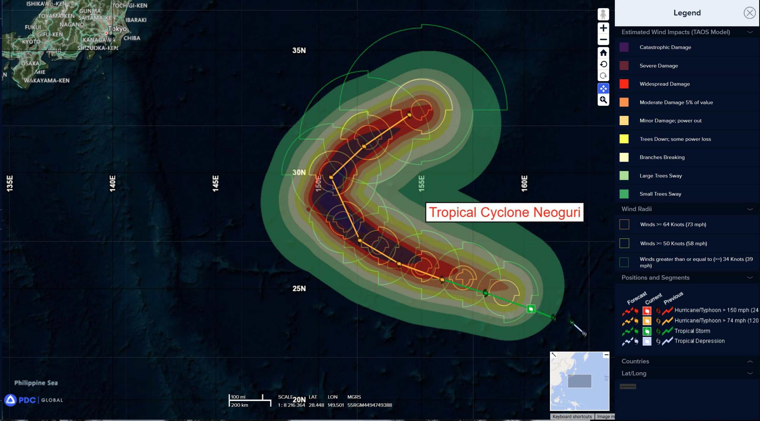
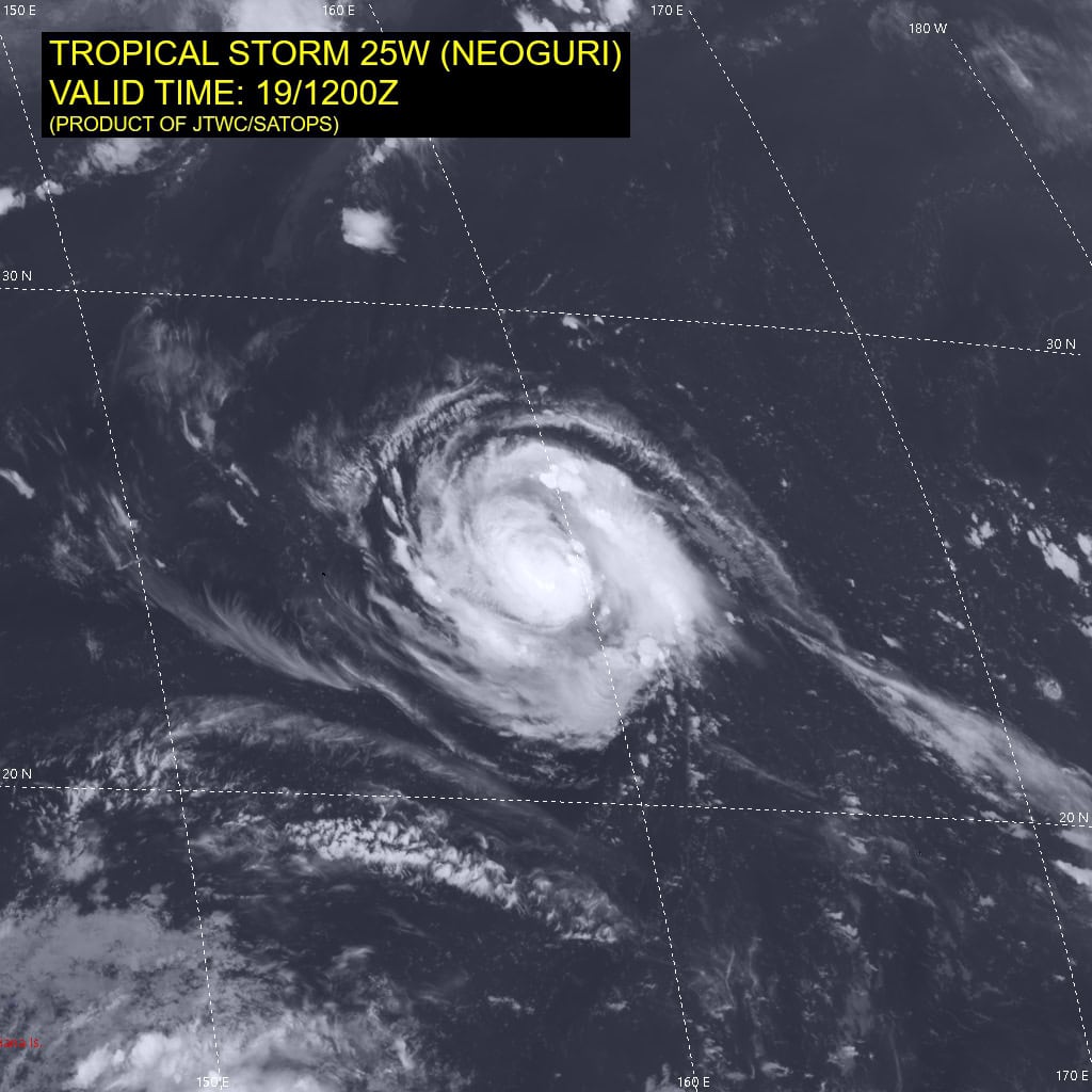
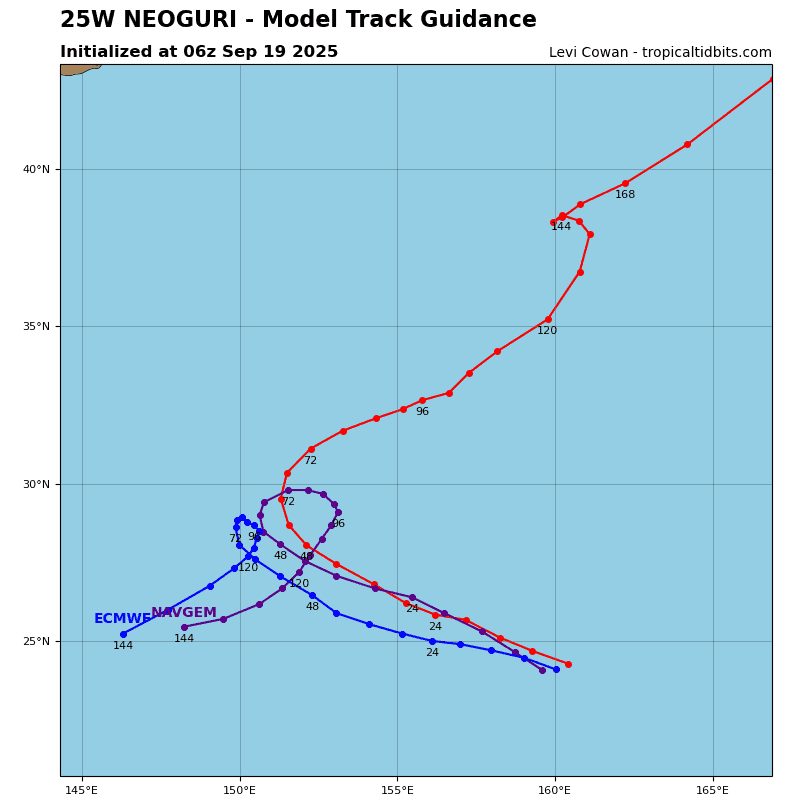
Tropical Cyclone 25W (Neoguri)
According to the JTWC warning number 7…sustained winds are 70 knots with gusts to near 85 knots.
Animated enhanced infrared (eir) satellite imagery depicts tropical storm 25W (Neoguri) with deep convection entirely obscuring the llcc and compact spiral banding tightly wrapping into the center. A 191022z metop-c ascat pass revealed 50-55 knot winds in close proximity to the assessed center. The radius of max winds has significantly shrunk over the past 12 hours and is now about 20 NM. 25W has also been analyzed to have rapidly intensified from 30 knots 24 hours ago, to 60 knots now.
Environmental analysis indicates that 25W is in a highly favorable environment characterized by strong radial outflow aloft, low (5-10 knot) vertical wind shear, and warm
(29-30 c) sea surface temperatures.
25W is forecast to track northwestward, along the southwestern periphery of the subtropical ridge through 48 hours. Near 48 hours, the system will begin to round the western extent of the ridge, changing the trajectory northward. A northeastward track is expected to ensue from 72 hours onward as the vortex runs along the northwestern periphery of the ridge and tracks poleward. There continues to be some uncertainty regarding the recurve. Models have started to agree more on a traditional recurve scenario though.
After an upper-level trough breaks down the ridge, there is a second ridge that propagates eastward behind the first, which could potentially keep 25W from tracking further poleward, and instead, out westward.
Regarding intensity, 25W is forecast to continue intensifying over the next 72 hours to a peak of 105 knots before beginning to recurve. Shear and sea surface temperatures are
expected to remain highly conducive through the first 72 hours of the forecast, allowing for the intensification. After 72 hours, cooling sea surface temperatures and increasing shear will cause 25W to weaken through the remainder of the forecast period.

")