
")
Current Snapshot
For all the latest updates visit: DisasterAWARE
1800x1080eee
2
montha
03B_290000sair
92A
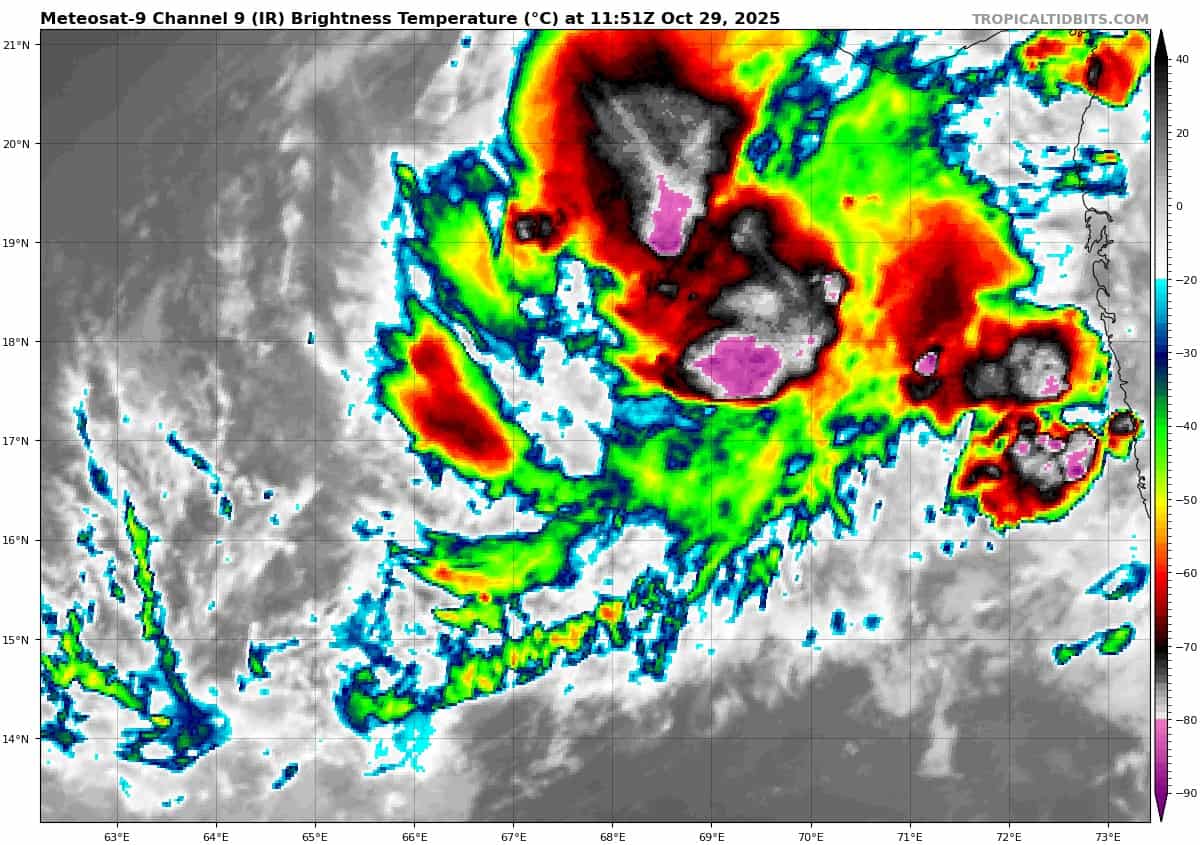
meteosat9_ir_92A_202510291151_lat17.3-lon68.0
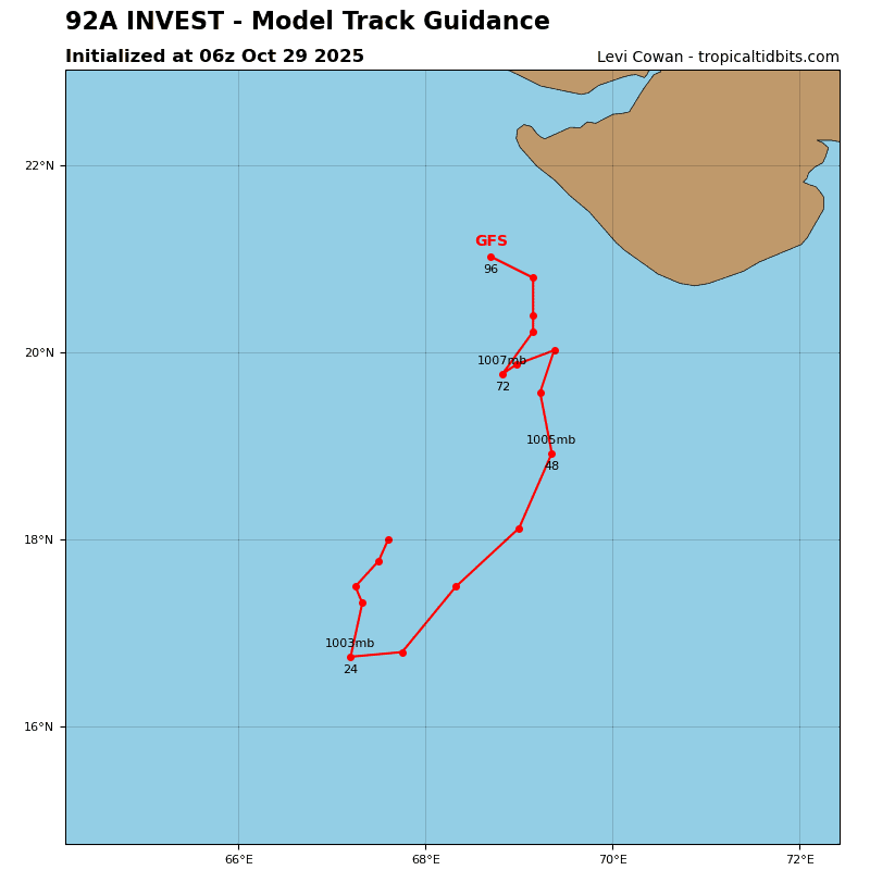
92A_tracks_latest
By PDC’s Senior Weather
Specialist Glenn James

The Pacific Disaster Center’s (PDC Global) Wednesday, October 29, 2025, Tropical Cyclone Activity Report…for the Pacific Ocean, the Indian Ocean, and adjacent Seas
Current Tropical Cyclones:
There are no Tropical Cyclones
Northeast Pacific Ocean: There are no Tropical Cyclones
Tropical cyclone formation is not expected during the next 7 days.
Central Pacific Ocean: There are no Tropical Cyclones
Tropical cyclone formation is not expected during the next 7 days.
Western Pacific, Indian Ocean, and adjacent Seas: There are no Tropical Cyclones
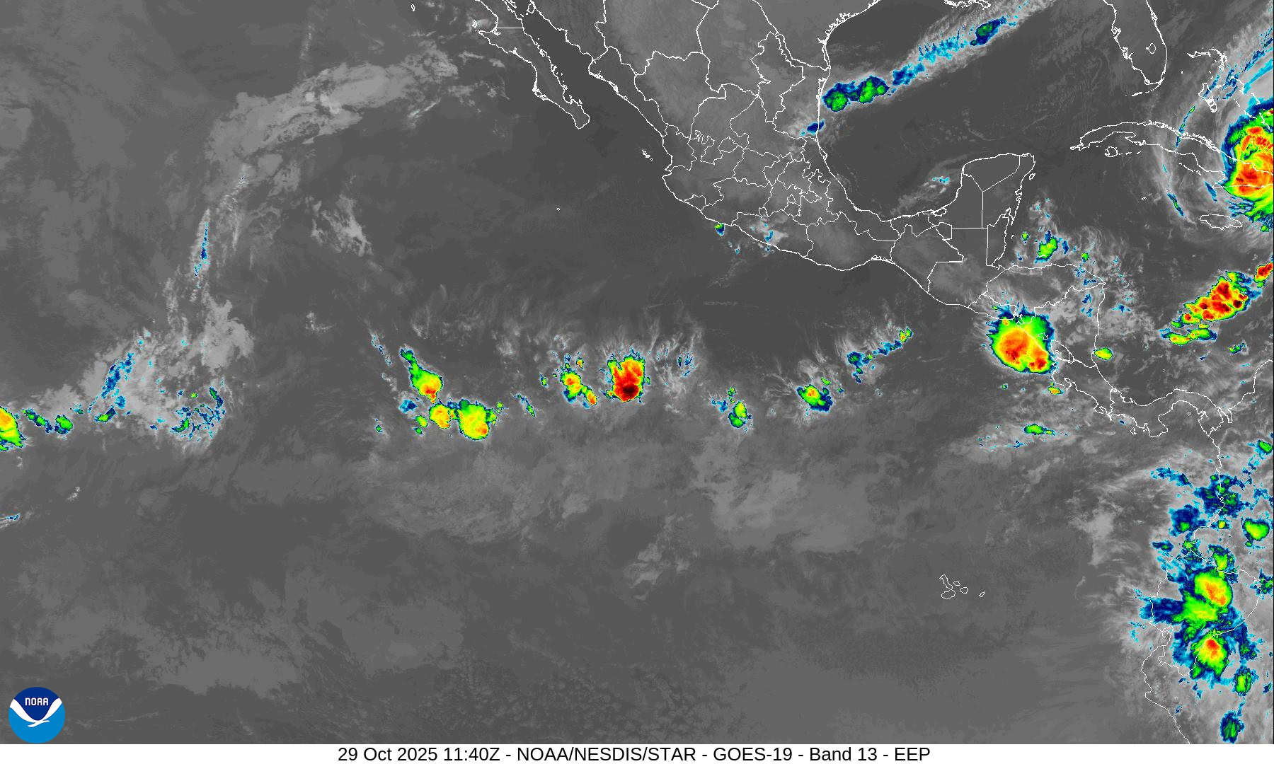
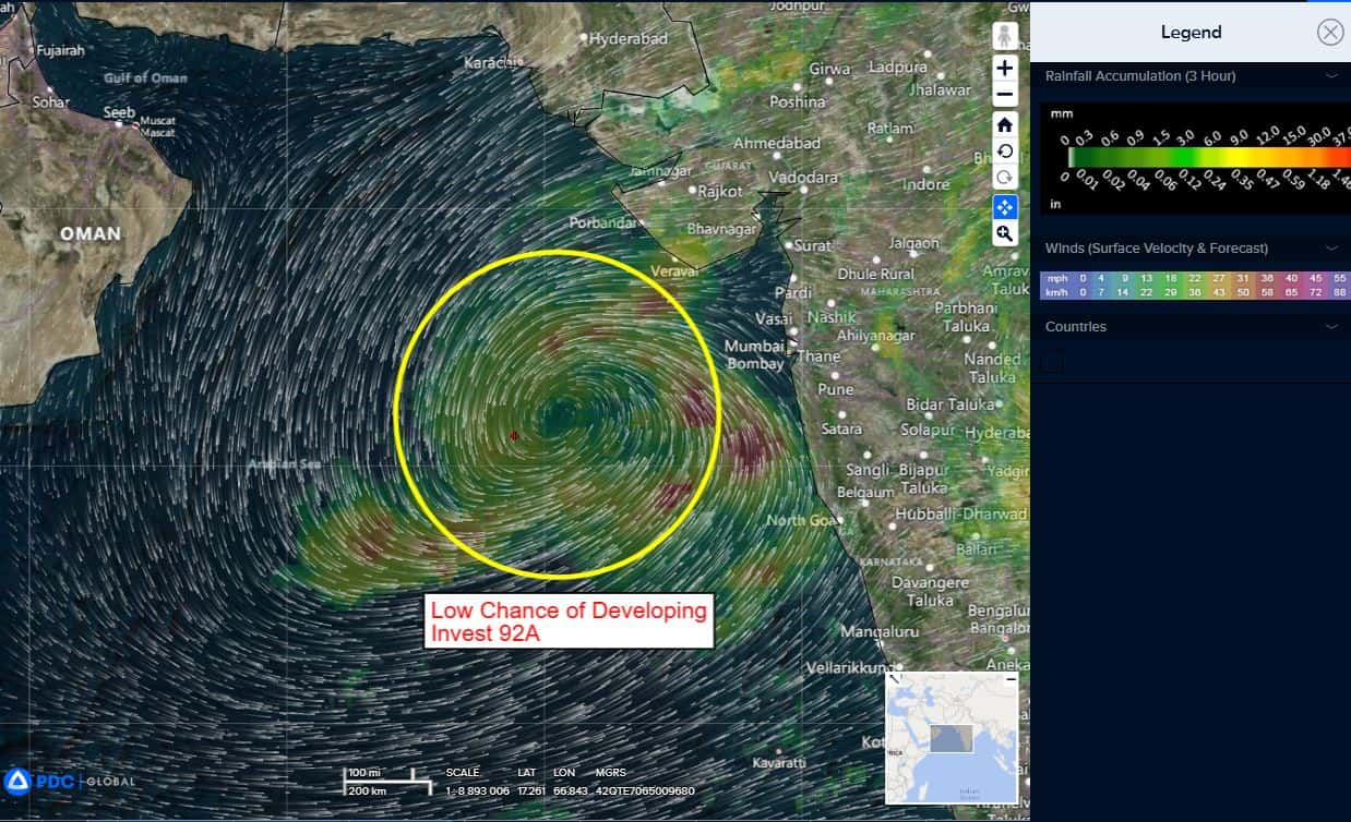
Arabian Sea
>>> There’s an area of disturbed weather being referred to as Invest 92A…which is located approximately 309 NM west-southwest of Mumbai, India
Enhanced infrared satellite imagery (eir) depicts a broad, poorly defined low-level circulation center with flaring convection.
Environmental analysis reveals moderately favorable conditions for development with moderate vertical wind shear (15-20 kts), good poleward outflow aloft, and warm sea surface temperatures
(27-28 c).
Ensemble models are in disagreement, with ecens showing a stronger signal for development on a north-northeastward track and increased winds while gefs captures less confidence in regards to track and weaker winds. deterministic models are in agreement revealing a broad and poorly defined circulation that transits north-northeastward.
Maximum sustained surface winds are estimated at 23 to 28 knots.
The potential for the development of a significant tropical cyclone within the next 24 hours remains low.