The Pacific Disaster Center’s (PDC Global) Wednesday, September 10, 2025, Tropical Cyclone Activity Report…for the Pacific Ocean, the Indian Ocean, and adjacent Seas
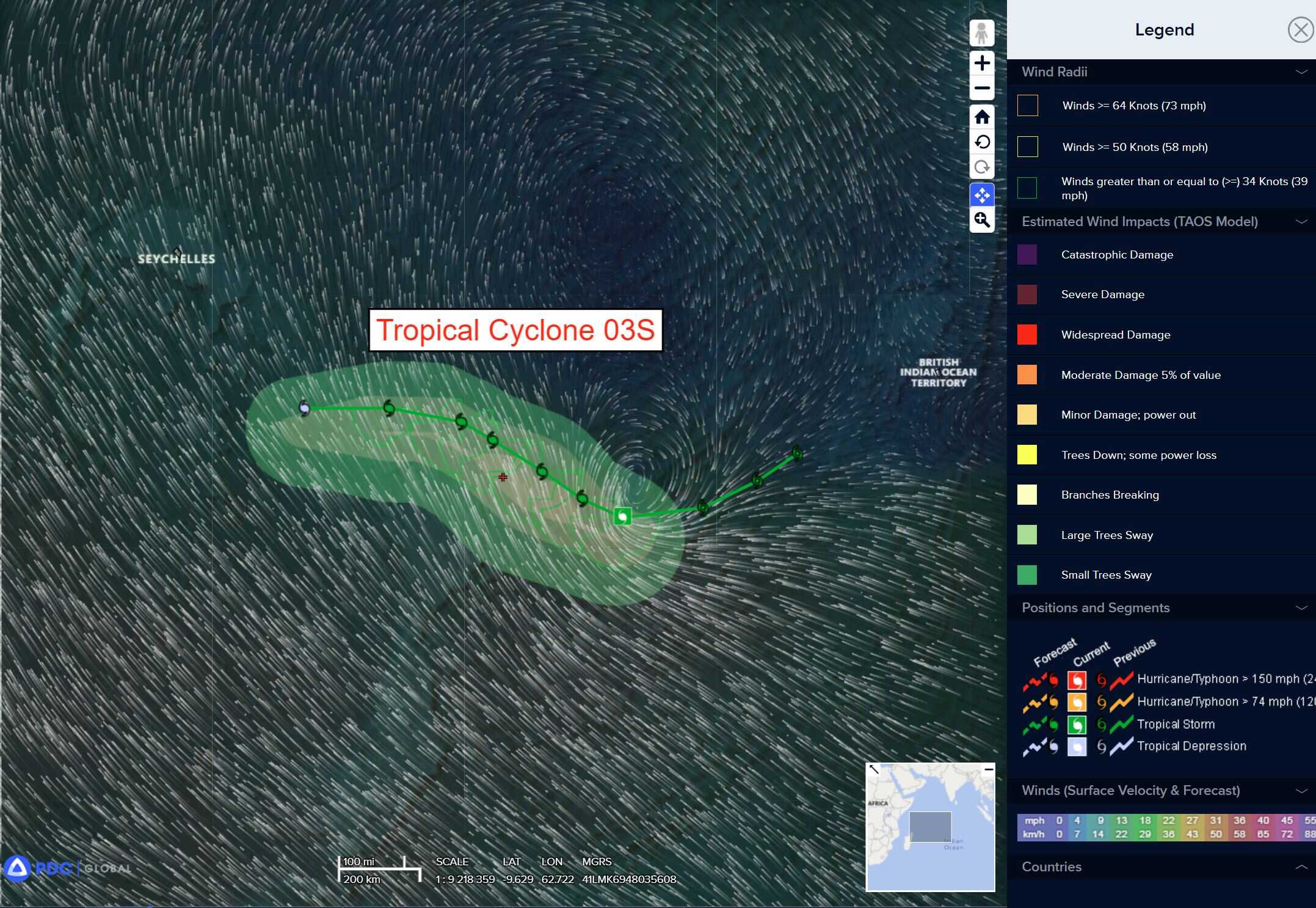
Tropical Cyclone 03S is located approximately 499 NM west-southwest of Diego Garcia
Northeast Pacific Ocean: There are no Tropical Cyclones
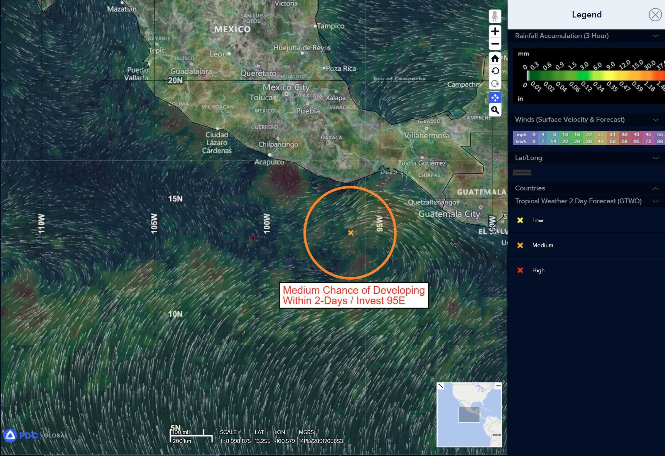
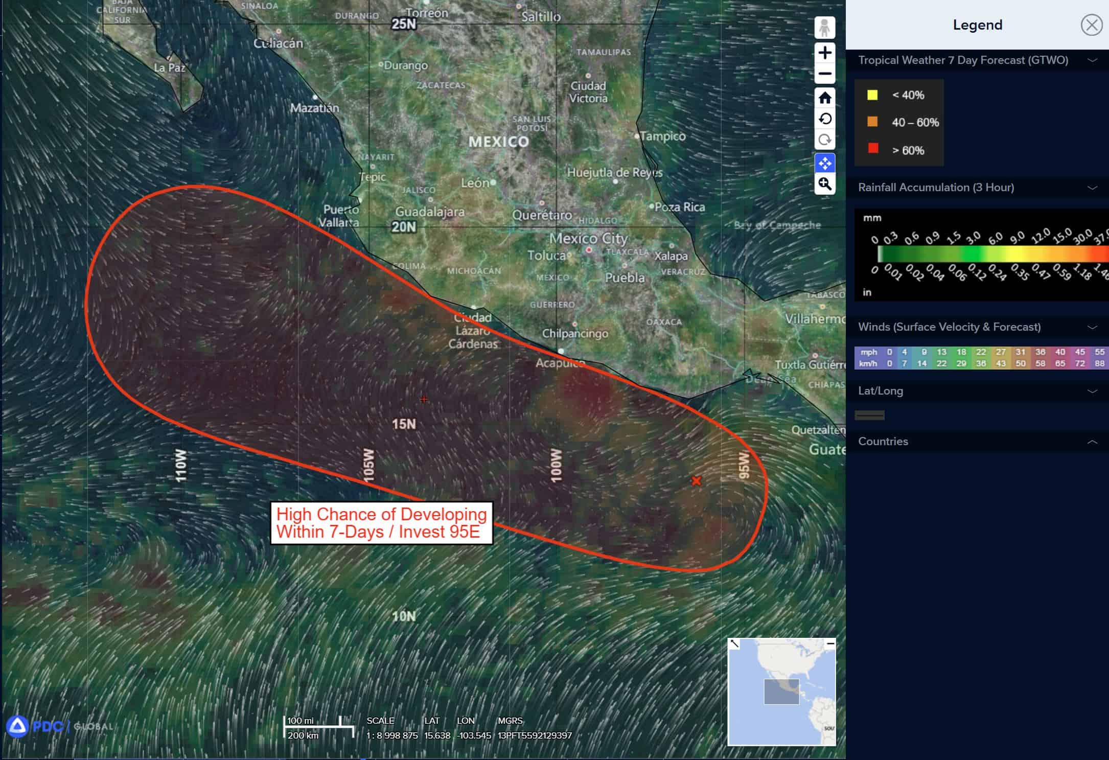
>>> South of Southern and Southwestern Mexico:
Invest 95E
Showers and thunderstorms associated with an area of low pressure just offshore of the coast of southern Mexico are showing signs of organization. Environmental conditions are favorable for further development, and a tropical depression is likely to form on Thursday as the system moves west-northwestward, roughly parallel to but offshore of the coast of southern and southwestern Mexico.
* Formation chance through 48 hours…high…90 percent
* Formation chance through 7 days…high…90 percent
Central Pacific Ocean: There are no Tropical Cyclones
Tropical cyclone formation is not expected during the next 7 days.
Western Pacific, Indian Ocean, and adjacent Seas:
South Indian Ocean
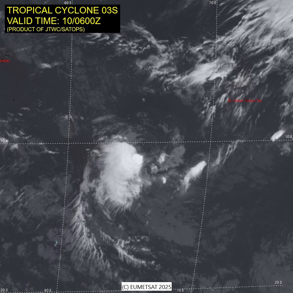
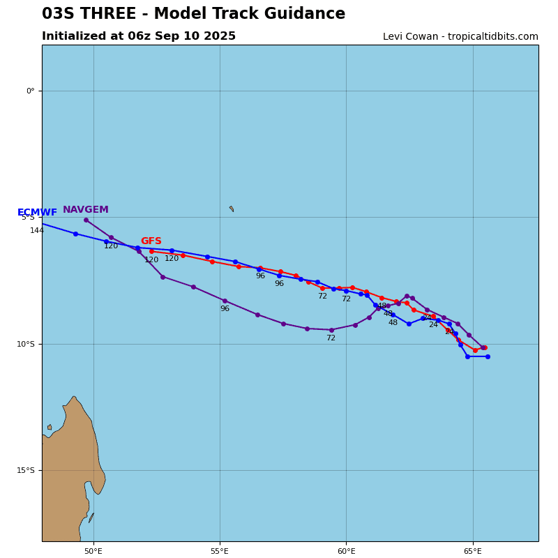
Tropical Cyclone 03S
According to the JTWC warning number 5, sustained winds are 35 knots with gusts to near 45 knots
Animated multi-spectral satellite imagery (msi) depicts a fully exposed low-level circulation center (llcc) with persistent convection sheared to the southwest. A 100500z metop-b ascat pass reveals an asymmetric wind field with 30-35 kt winds confined to the southern semicircle.
Environmental analysis indicates a marginally favorable environment, characterized by warm (26-27 c) sea surface temperatures (sst) and strong poleward outflow, offset by moderate to high (20-25 kts) vertical wind shear (vws) and dry air entrainment.
Tropical cyclone 03S is forecast to track northwestward over the next 48 hours as the str to the southwest builds. After 48 hours, 03S is forecast to maintain a generally westward track through the remainder of the forecast period.
03S is forecast to remain at 35 kts through 72 hours, with a brief period of
slight intensification occurring around 24 hours. Further intensification will be hindered by dry air entrainment and moderate to high easterly vws.
Near 72 hours, 03S will encounter cooler (25-26 c) ssts and increasing easterly vws (30 kts). As a result, dissipation is forecast to occur around 96 hours.
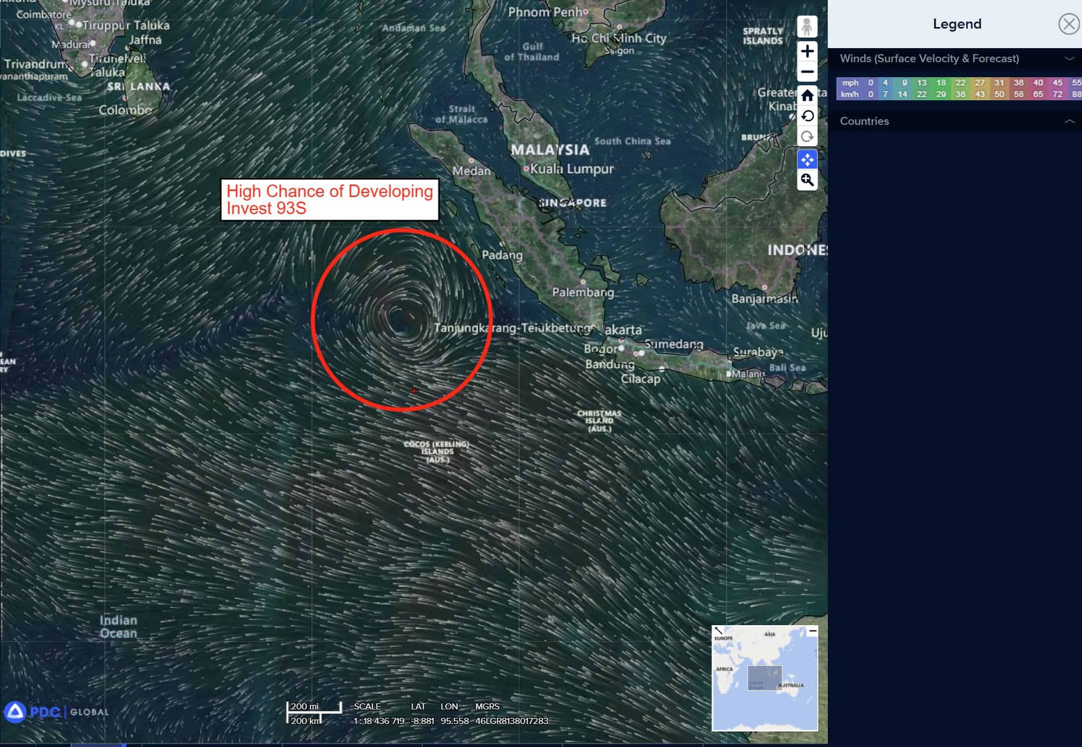
>>> There’s an area of disturbed weather being referred to as Invest 93S, which is located approximately 670 NM southwest of Singapore
Animated enhanced multi-spectral satellite imagery (msi) depicts a consolidating low level circulation center (llcc) with deep convection obscuring the center.
Environmental analysis indicates marginally favorable conditions for development with moderate to high (20-25 kts) vertical wind shear, offset by warm (29-30 c) sea surface temperatures, and moderate poleward outflow aloft.
Global deterministic models are in good agreement, with 93S tracking south-southwestward with marginal development over the next 24 hours. Gobal ensemble models are also in agreement that the circulation will track south-southwestward, with ecmwf showing support for a higher intensity over the next 24-48 hours.
Maximum sustained surface winds are estimated at 28 to 33 knots.
The potential for the development of a significant tropical cyclone within the next 24 hours remains high.

")