
")
Current Snapshot
For all the latest updates visit: DisasterAWARE
2
77777
goes18_ir_90C_202507261515_lat11.1-lon-142.1
90C_tracks_latest
1800x1080e
wpac
11W_260600sair
11W_tracks_latest
12W_260600sair

12W_tracks_latest
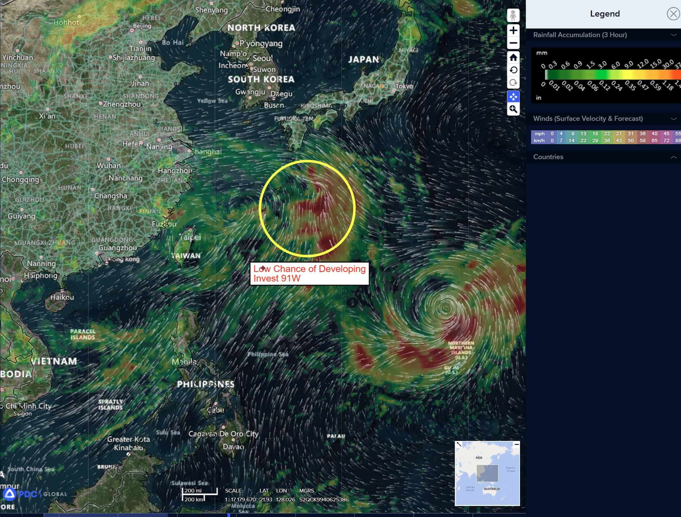
91w

91W_tracks_latest
By PDC’s Senior Weather
Specialist Glenn James

The Pacific Disaster Center’s (PDC Global) Saturday, July 26, 2025, Tropical Cyclone Activity Report…for the Pacific Ocean, the Indian Ocean, and adjacent Seas
Current Tropical Cyclones:
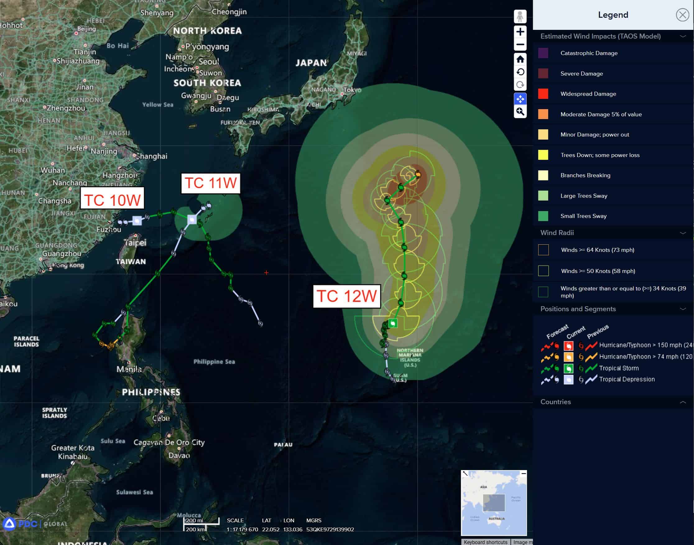
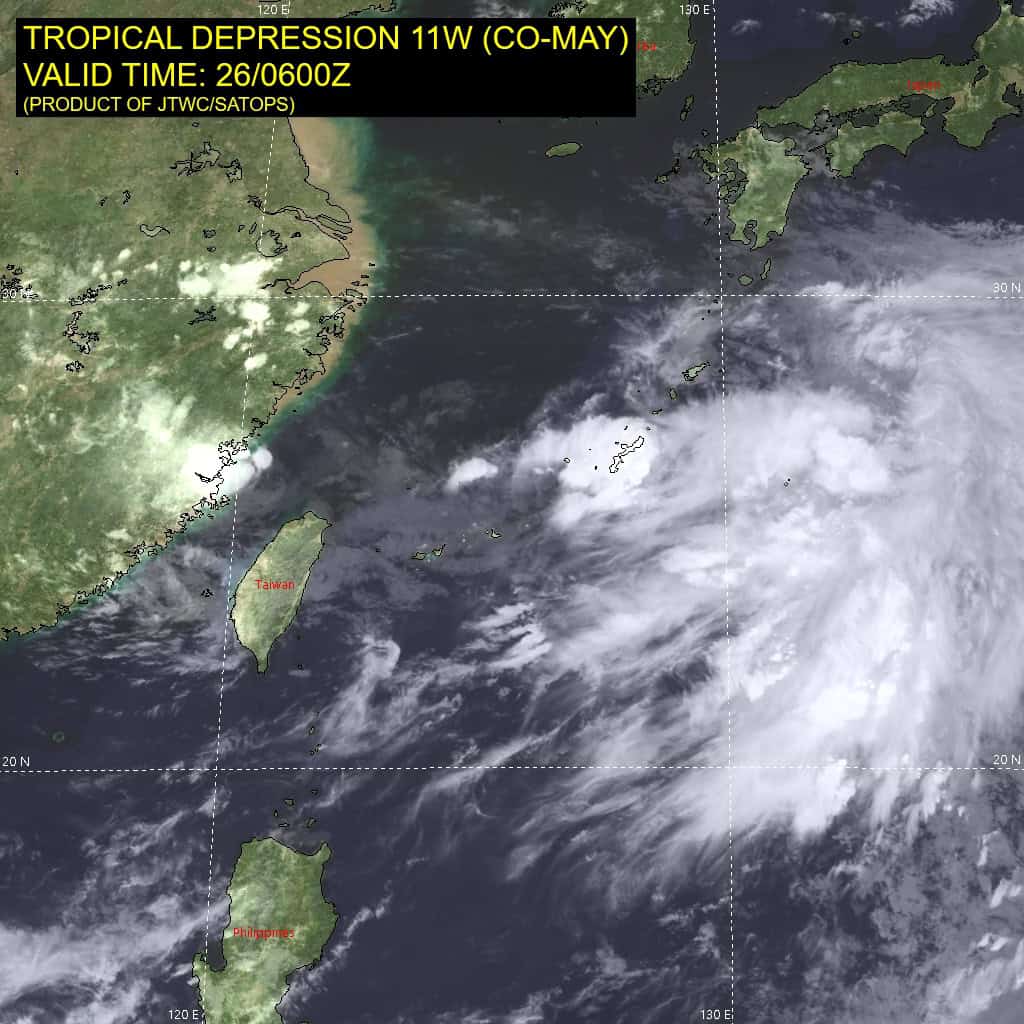
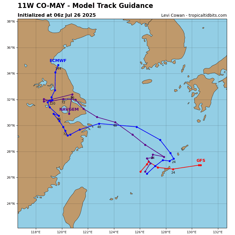
Tropical Cyclone 11W (Co-may)…is located 91 NM east of Kadena AB
Tropical Cyclone 12W (Krosa)…is located 950 NM south-southeast of Yokosuka, Japan
Northeast Pacific Ocean: There are no Tropical Cyclones
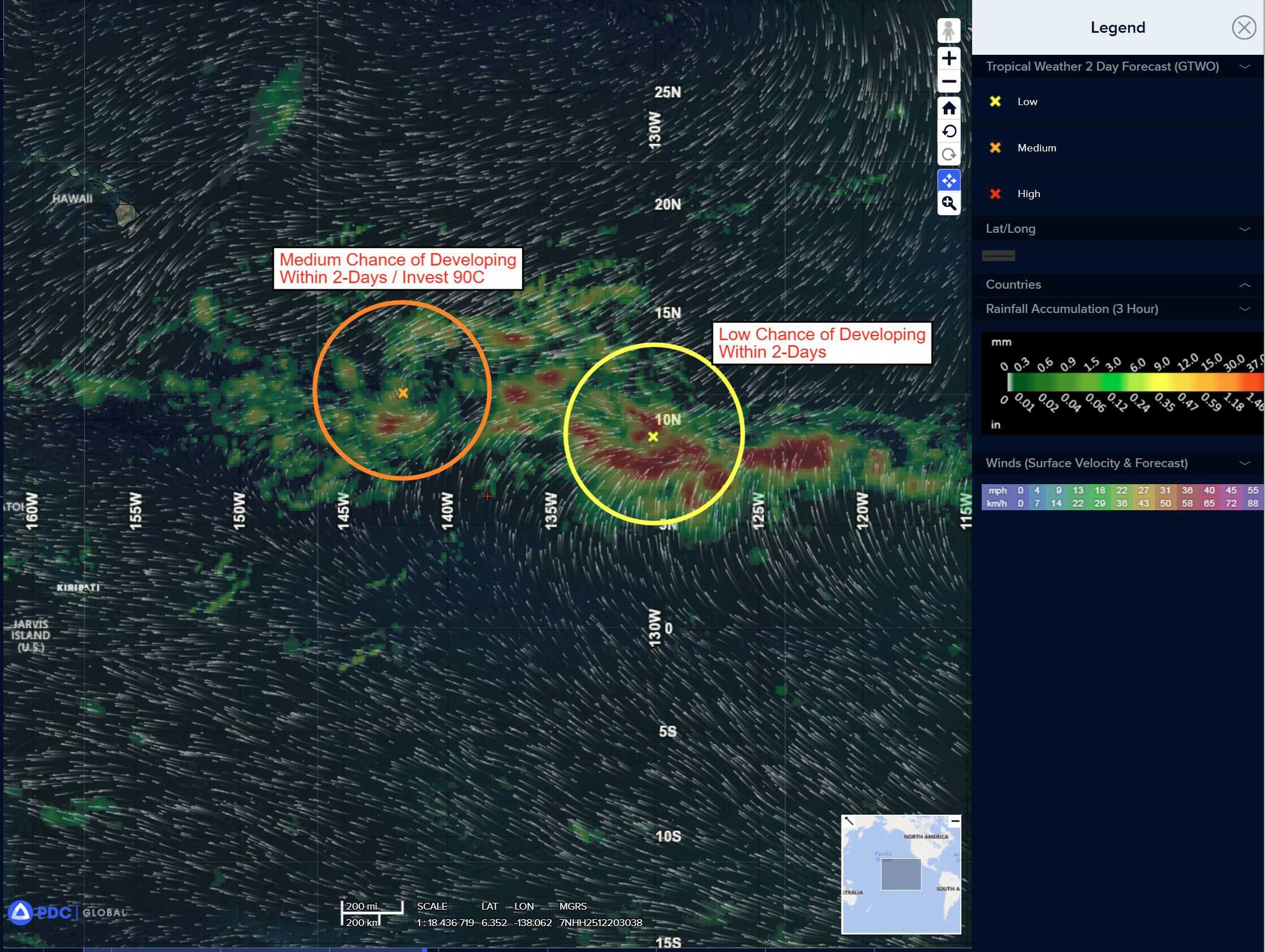
Eastern portion of Central Pacific:
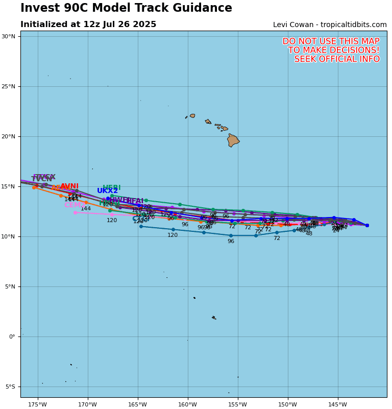
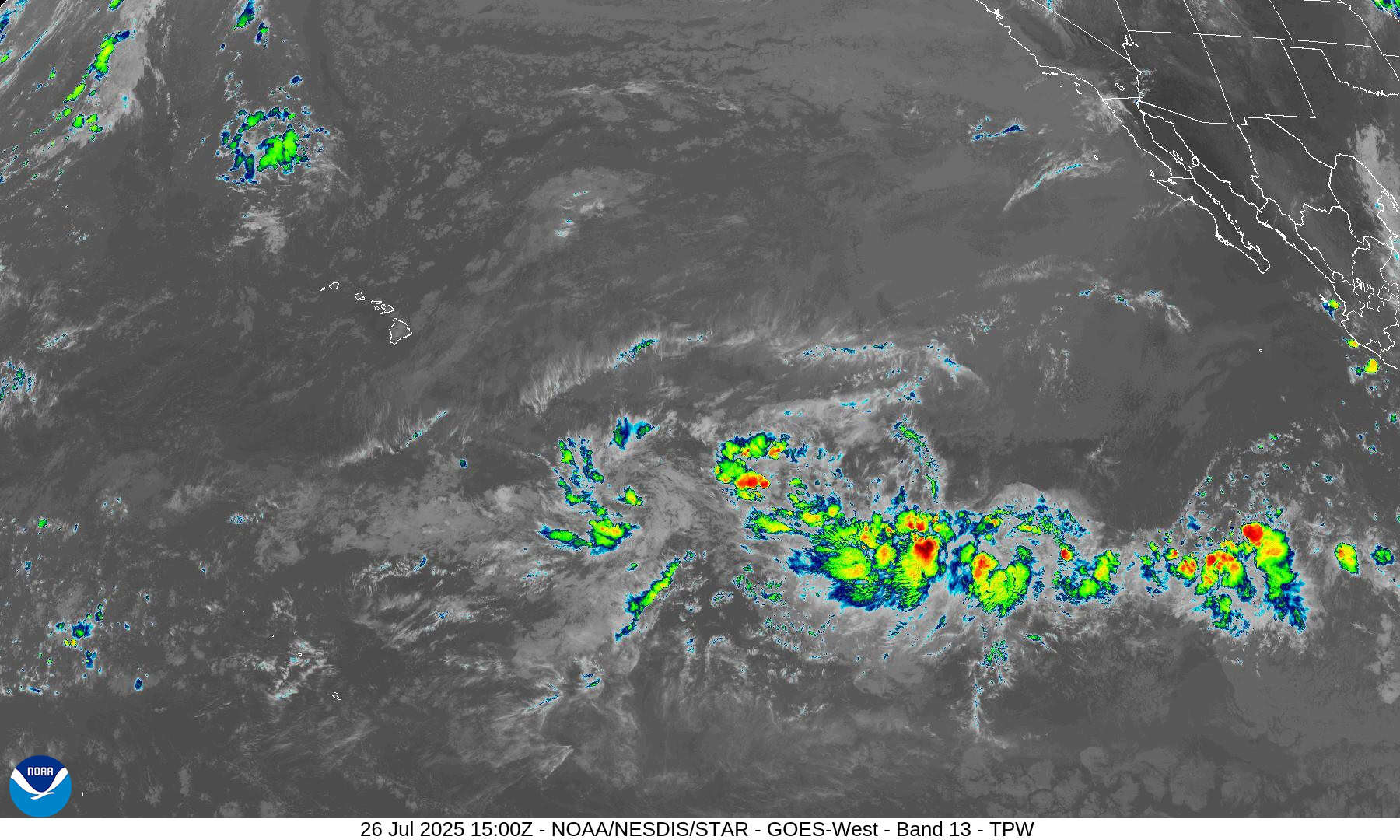
Invest 90C
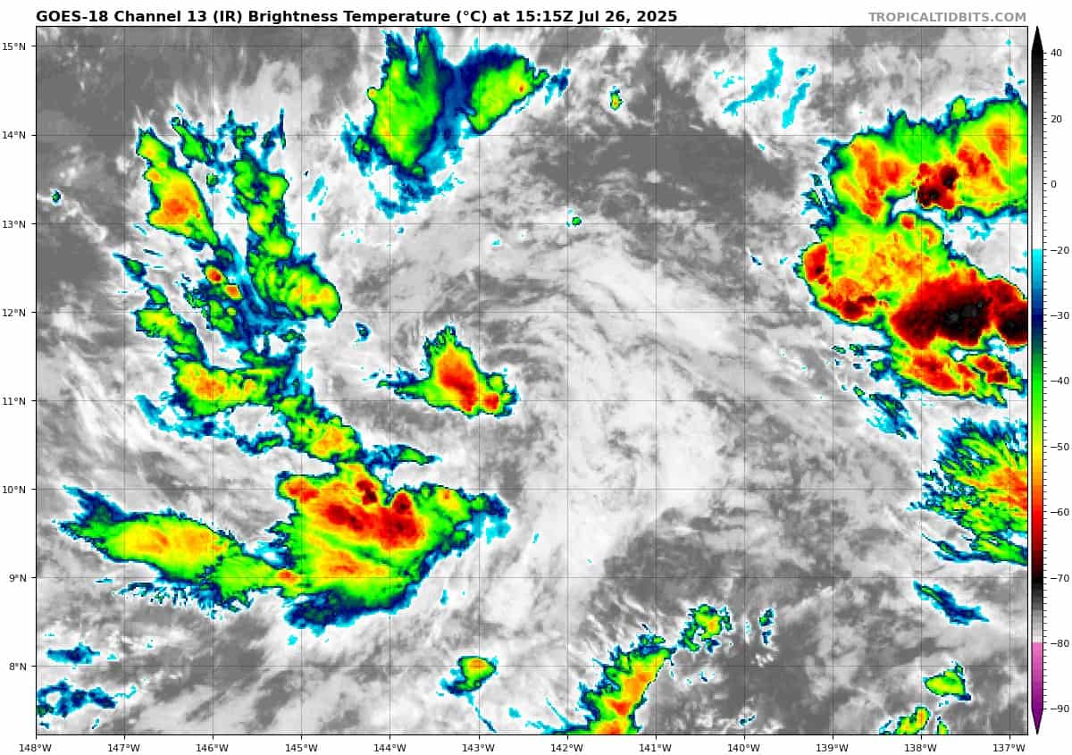
>>> Showers and thunderstorms associated with an area of low pressure about 900 miles southeast of the Hawaiian Islands have become better organized since earlier today. Additional development of this system is expected and a tropical depression is likely to form later tonight or Sunday as it moves generally westward around 10 mph, well to the south of the Hawaiian Islands.
* Formation chance through 48 hours…high…80 percent
* Formation chance through 7 days…high…80 percent
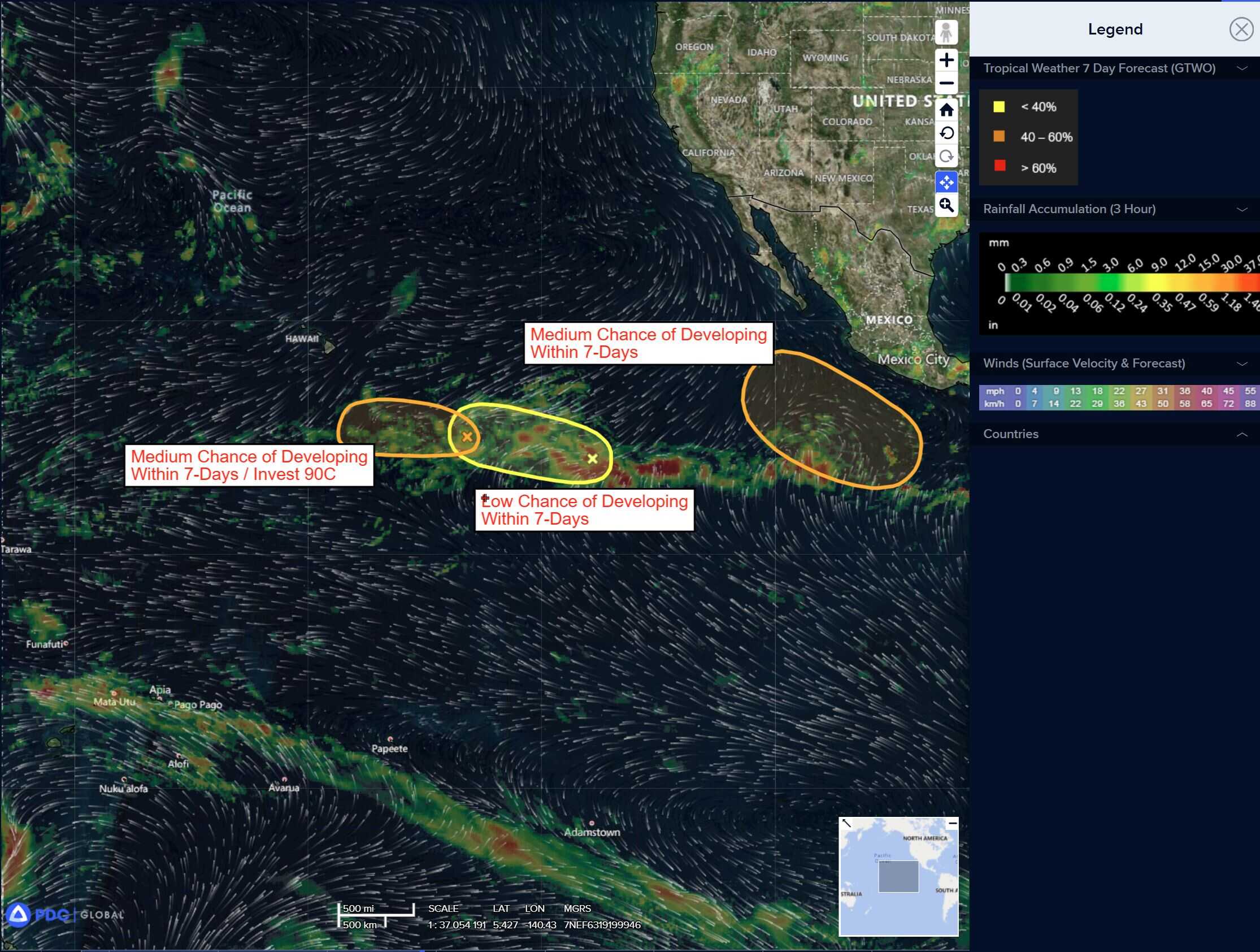
Western East Pacific:
>>> A trough of low pressure about 1700 miles east-southeast of the Hawaiian Islands is producing a large area of disorganized showers and thunderstorms. Some gradual development of this system is possible during the next few days at it moves generally westward around 10 mph.
* Formation chance through 48 hours…low…30 percent
* Formation chance through 7 days…low…30 percent
South of Southwestern Mexico:
>>> A trough of low pressure about 1700 miles east-southeast of the Hawaiian Islands is producing a large area of disorganized showers and thunderstorms. Some gradual development of this system is possible during the next few days at it moves generally westward around 10 mph.
* Formation chance through 48 hours…low…near 0 percent.
* Formation chance through 7 days…medium…40 percent
Central Pacific Ocean: There are no Tropical Cyclones
Eastern portion of Central Pacific:
Invest 90C
>>> Showers and thunderstorms remain limited and disorganized in association with an area of low pressure located about 1000 miles east-southeast of the Hawaiian Islands. Some gradual development of this system is possible, and a tropical depression could form before it moves into less conducive environmental conditions by the middle of next week. This system is forecast to move westward during the next several days well south of the Hawaiian Islands.
* Formation chance through 48 hours…high…80 percent
* Formation chance through 7 days…high…80 percent
Western East Pacific:
>>> A trough of low pressure about 1700 miles east-southeast of the Hawaiian Islands is producing a large area of disorganized showers and thunderstorms. Some gradual development of this system is possible during the next few days at it moves generally westward around 10 mph.
* Formation chance through 48 hours…low…10 percent
* Formation chance through 7 days…low…20 percent
Western Pacific, Indian Ocean, and adjacent Seas:
Western Pacific
Tropical Cyclone 11W (Co-may)
According to the JTWC warning number 18 sustained winds are 30 knots with gusts to near 40 knots
Animated enhanced infrared (eir) satellite imagery depicts deep convection flaring over an obscured low-level circulation center (llcc). Water vapor imagery reveals collapsing deep convection, indicating a degrading system.
Tropical depression 11W will continue weakly tracking northeastward on the northwestern periphery of the deep-layer ridge to the southwest along the enhanced monsoonal flow for the next 24 hours. The system will continue to degrade while becoming absorbed into the monsoonal flow. an upper-level cyclone approaching from the northwest will also further dissipation over the next 24 hours by creating an unfavorable upper-level environment.
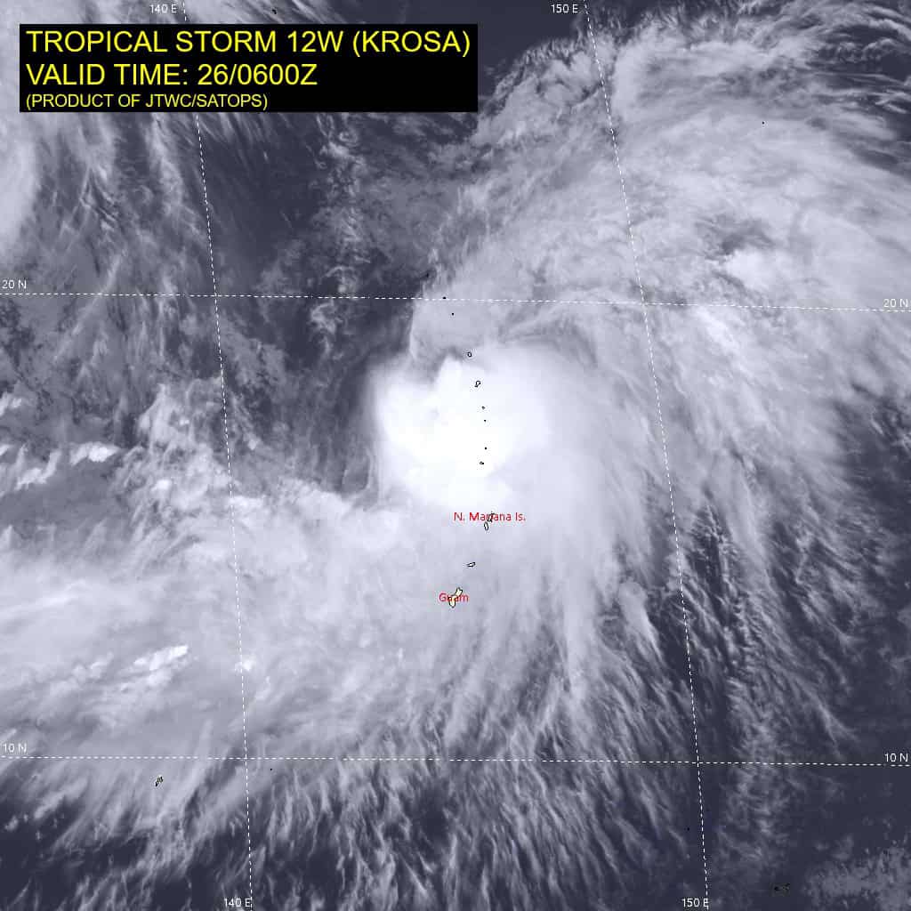
Tropical Cyclone 12W (Krosa)
According to the JTWC warning number 14 sustained winds are 60 knots with gusts to near 75 knots
Animated enhanced infrared (eir) satellite imagery depicts deep convection rebuilding over the low-level circulation center (llcc) with expansive deep convection drifting poleward and equatorward. Water vapor imagery reveals a trough introducing dry air and 15-20 knot vertical wind shear to the north of the system.
Tropical storm 12W is forecast to track northward for the next 36 hours on the western periphery of a near equatorial ridge to the east. Between 36-48 hours, the steering environment will become complex between the near equatorial ridge to the east and the building subtropical ridge to the northwest.
After 72 hours, the ridge to the southeast will reorient on at southwest-northeast axis, driving ts 12w northeastward for the remainder of the forecast period. The system will remain in a highly sheared environment for the first 24 hours of the forecast period, stagnating the rate of intensification.
The system will slowly intensify for the remainder of the forecast as the shear gradually decreases and the upper-level environment remains
strongly divergent. Ultimately, the system will peak at 70 knots at the end of the forecast period.