
")
Current Snapshot
For all the latest updates visit: DisasterAWARE
1800x1080a
atlantic
goes19_ir_08L_202509261445_lat22.3-lon-57.3
261445_earliest_reasonable_toa_3488888
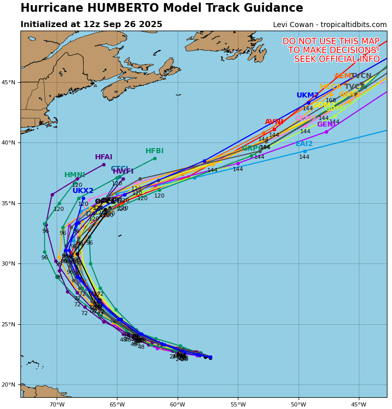
08L_tracks_latest
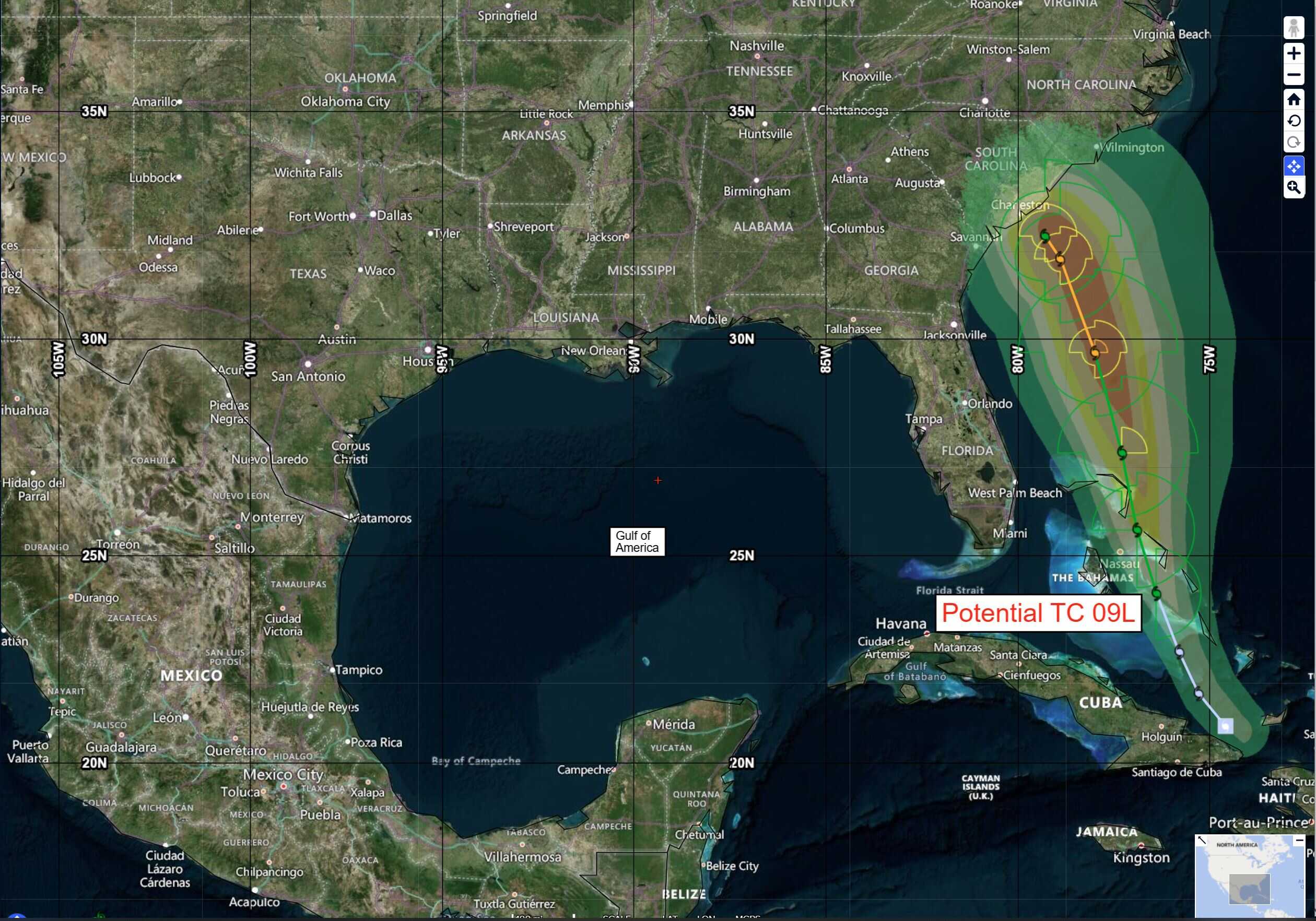
09L
GOES19-CAR-13-1000×1000
goes19_ir_09L_202509262122_lat20.7-lon-74.4
262040_earliest_reasonable_toa_34
262040INTQPF_sm

09L_tracks_latest
By PDC’s Senior Weather
Specialist Glenn James

The Pacific Disaster Center’s (PDC Global) Friday, September 26, 2025, Tropical Cyclone Activity Report…for the Atlantic Ocean, the Caribbean Sea, and the Gulf of America
Current Tropical Cyclones:
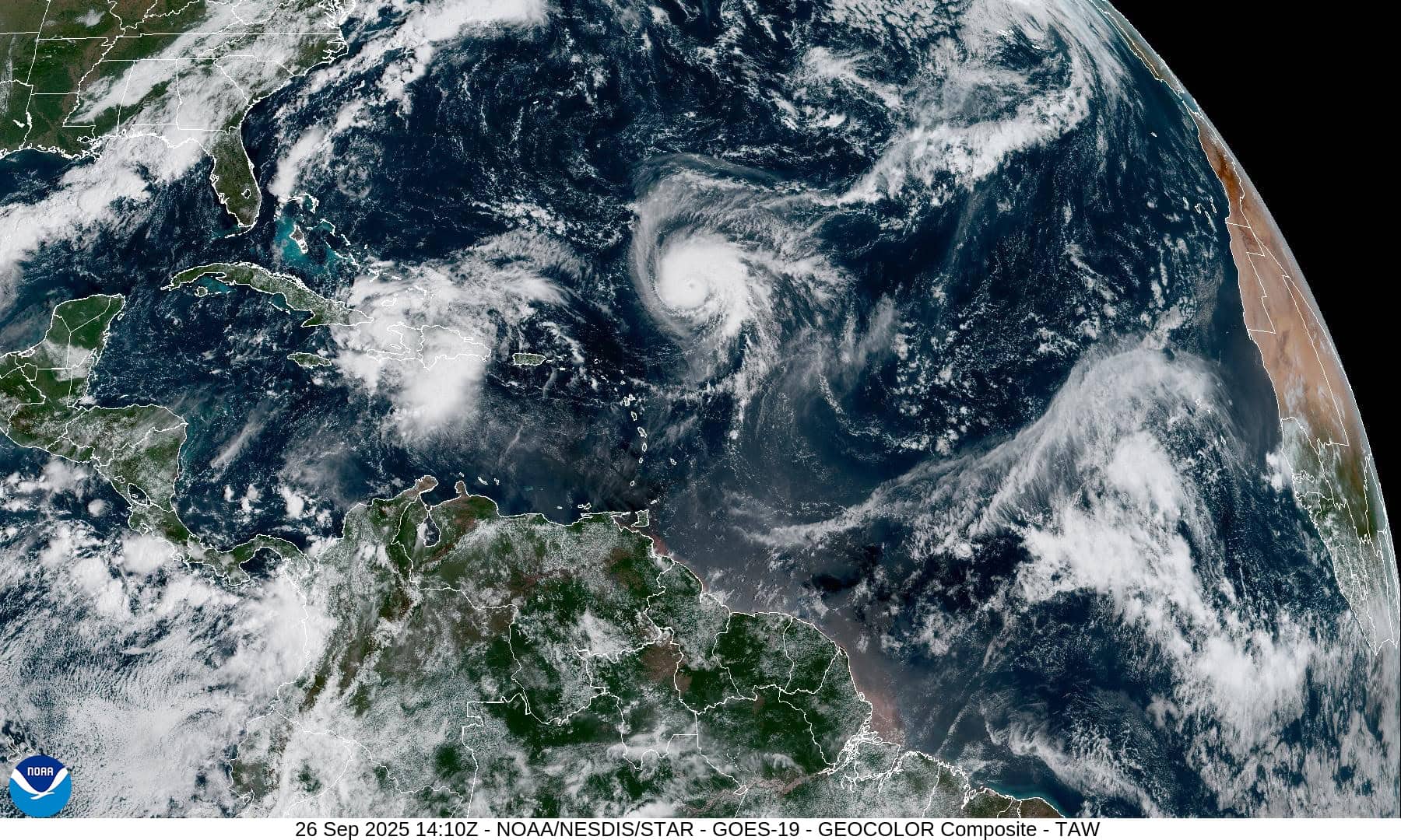
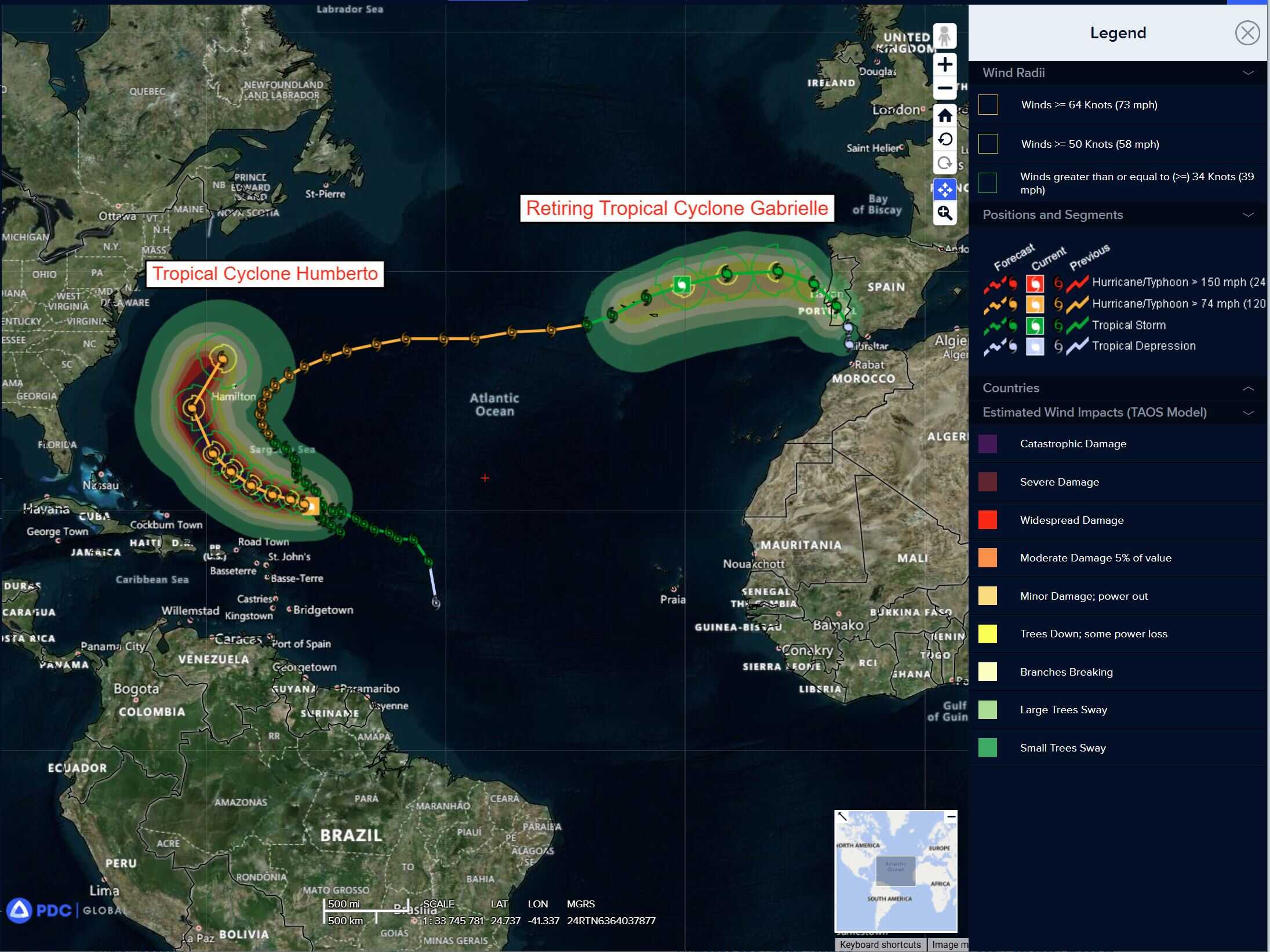
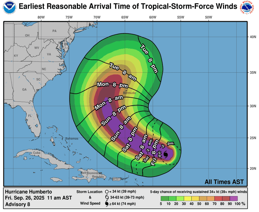
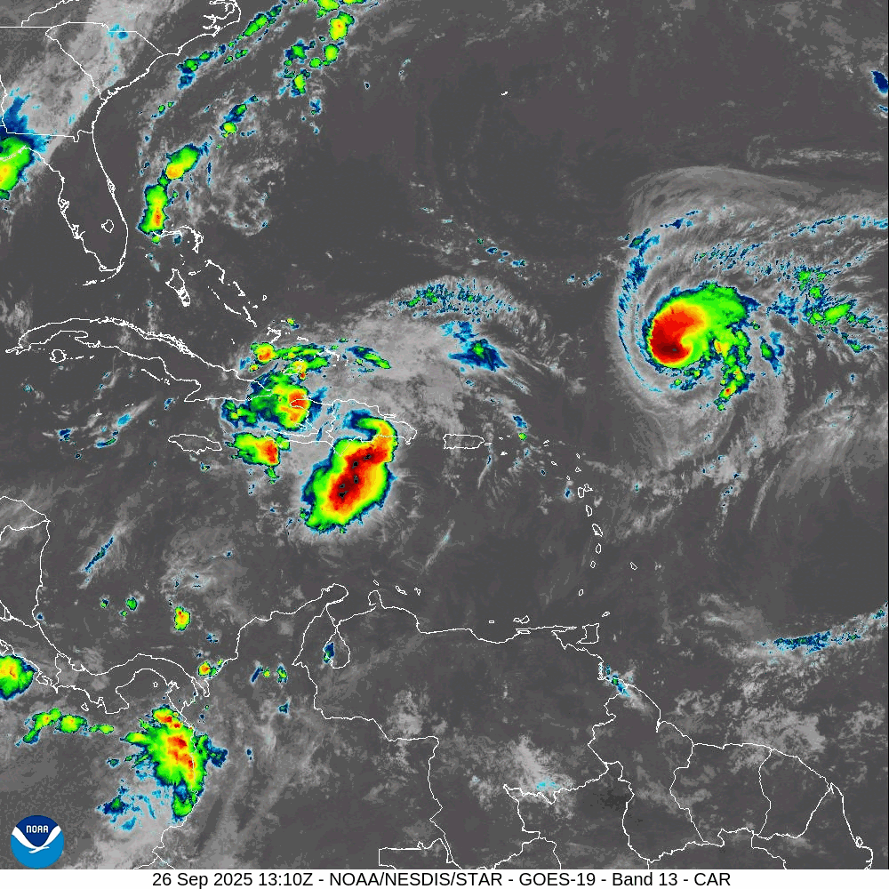
Tropical Cyclone 08L (Humberto)…is located about 390 northeast of the northern Leeward Islands
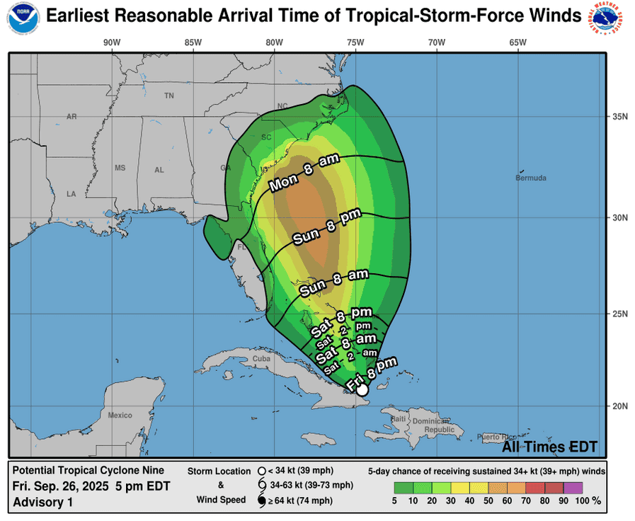
Potential Tropical Cyclone 09L…is located about 145 south of the central Bahamas
Atlantic Ocean:
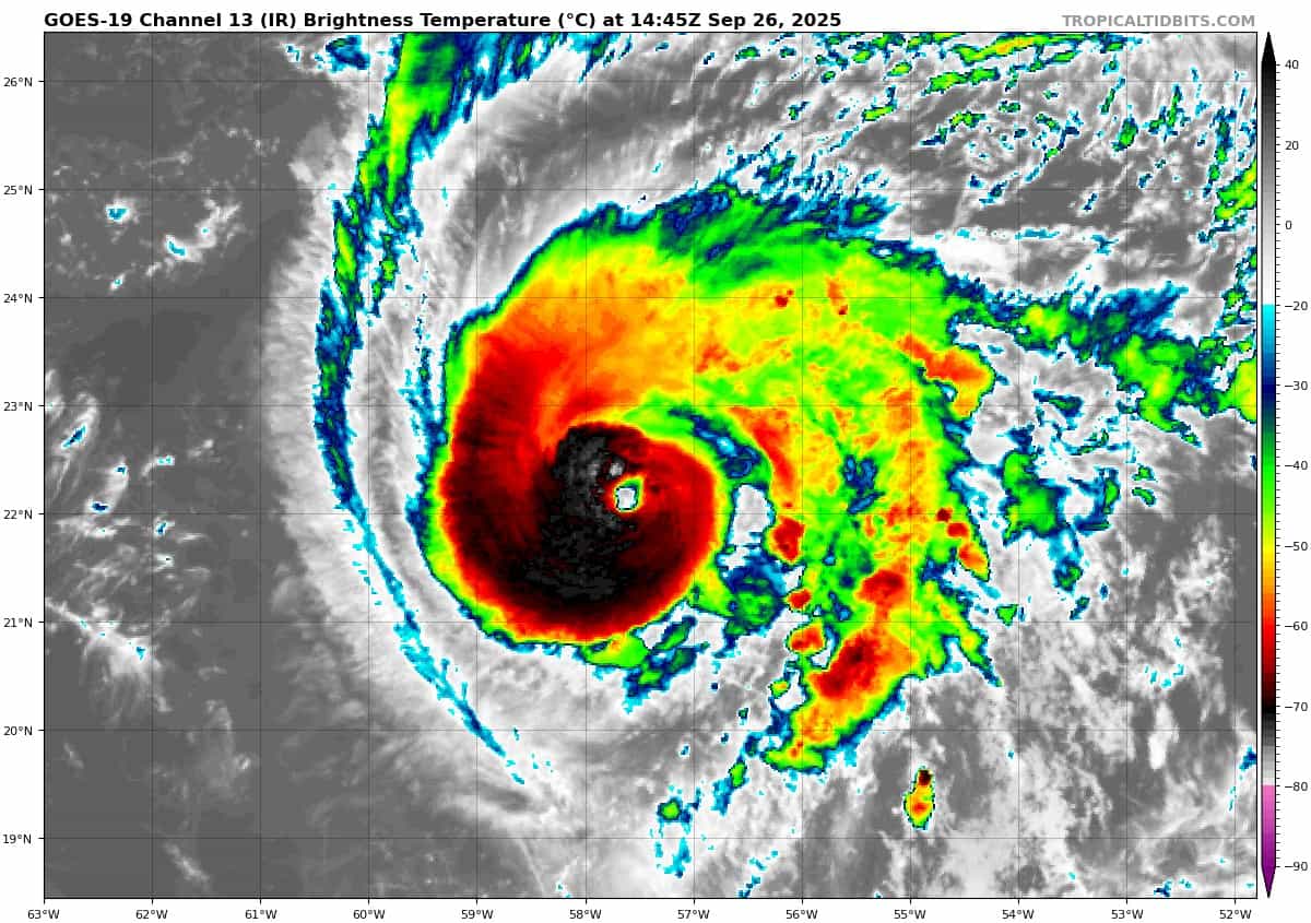
Tropical Cyclone 08L (Humberto)
HUMBERTO RAPIDLY STRENGTHENS TO A MAJOR HURRICANE…FURTHER INTENSIFICATION EXPECTED OVER THE CENTRAL ATLANTIC
According to the NHC advisory number 9
Humberto is moving toward the west-northwest near 5 mph (7 km/h). A west-northwestward to northwestward motion at a slightly faster forward speed is forecast through the weekend, followed by a turn toward the north-northwest on Monday. Maximum sustained winds have increased to near 115 mph (185 km/h) with higher gusts. Humberto is a category 3 hurricane on the Saffir-Simpson Hurricane Wind Scale. Additional strengthening is forecast over the next couple of days. Hurricane-force winds extend outward up to 25 miles (35 km) from the center and tropical-storm-force winds extend outward up to 105 miles (165 km). NOAA buoy 41044 located to the southwest of Humberto recently reported a sustained wind of 36 mph (57 km/h) and a gust of 49 mph (80 km/h). The estimated minimum central pressure is 962 mb (28.41 inches).
HAZARDS AFFECTING LAND SURF:
SURF: Swells generated by Humberto will begin affecting portions of the northern Leeward Islands, the Virgin Islands, Puerto Rico, and Bermuda this weekend. These swells are likely to cause life-threatening surf and rip current conditions.
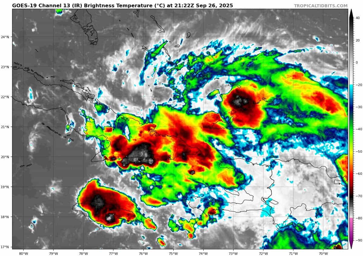
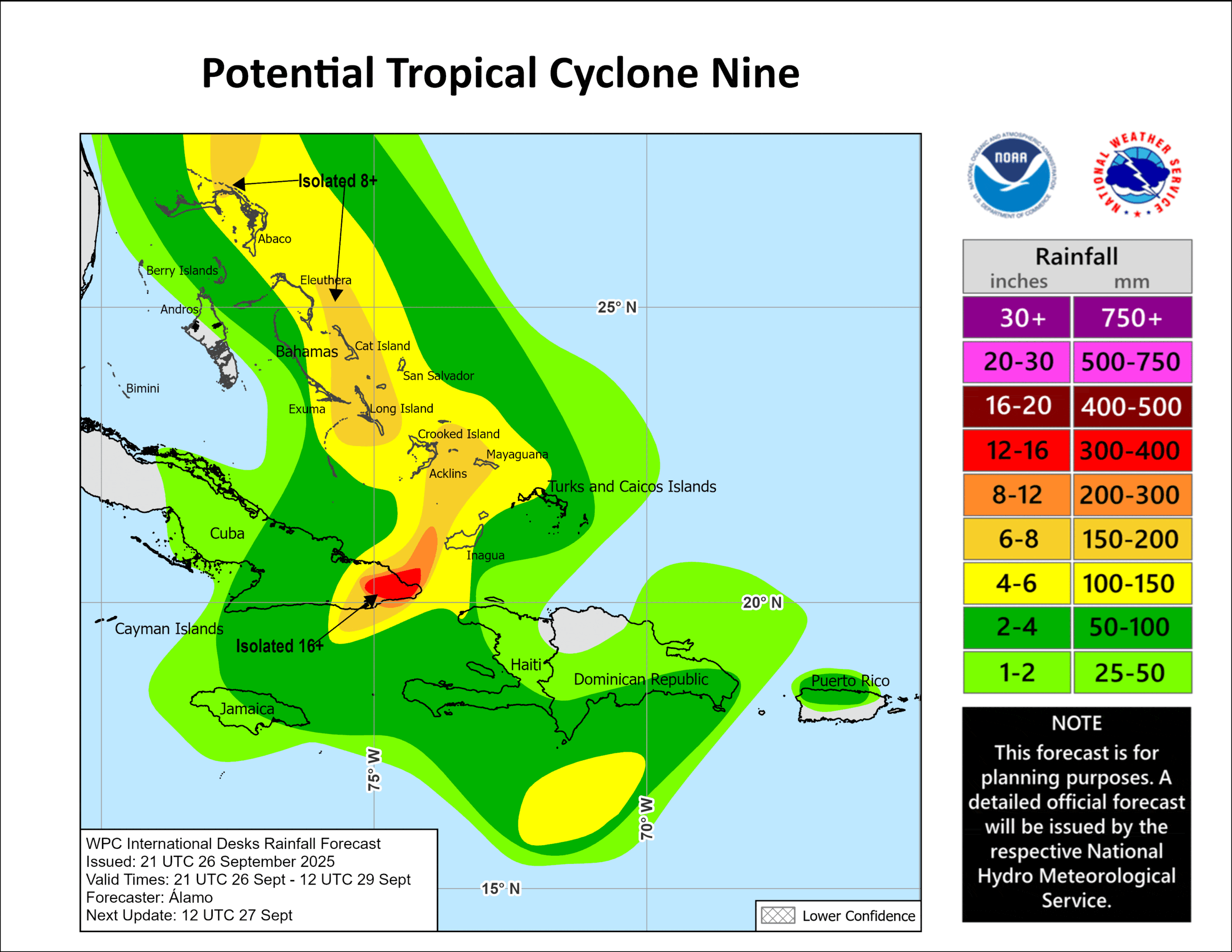
Potential Tropical Cyclone 09L
DISTURBANCE EXPECTED TO BECOME A TROPICAL STORM OVER THE WEEKEND…SIGNIFICANT RAINFALL EXPECTED OVER PORTIONS OF EASTERN CUBA AND THE BAHAMAS
According to the NHC advisory number 2
The system is moving toward the northwest near 9 mph (15 km/h). A north-northwestward motion is expected to begin by early Saturday and continue through Monday. On the forecast track, the center of the system is expected to move across the central and northwestern Bahamas this weekend and approach the southeast U.S. coast early next week. Maximum sustained winds are near 35 mph (55 km/h) with higher gusts. The system is expected to become a tropical depression by Saturday night. Gradual strengthening is forecast thereafter, with the system becoming a tropical storm by early Sunday, and a hurricane by late Monday.
* Formation chance through 48 hours…high…90 percent
* Formation chance through 7 days…high…90 percent
The estimated minimum central pressure based on dropsonde data from a NOAA Hurricane Hunter aircraft is 1007 mb (29.74 inches).
HAZARDS AFFECTING LAND
WIND: Tropical storm conditions are expected in the tropical storm warning area beginning Saturday night and are possible in the watch area on Sunday.
RAINFALL: The disturbance is expected to produce the following storm total rainfall amounts through Monday morning.
Eastern Cuba: 8 to 12 inches, with isolated maximum totals of 16 inches possible.
Bahamas: 4 to 8 inches of rain are expected.
Hispaniola, Jamaica, and portions of central and southern Cuba: 2 to 4 inches of additional rainfall are expected.
This rainfall will likely produce flash and urban flooding. Mudslides are also possible in areas of higher terrain across eastern Cuba, Hispaniola, and Jamaica.
An increasing threat of heavy rainfall from this system is forecast over the southern Mid-Atlantic through coastal Georgia which could cause flash, urban, and river flooding into next week.
STORM SURGE: A storm surge will raise water levels by as much as 1 to 3 feet above ground level along the immediate coast in areas of onshore winds in the northwestern Bahamas. Near the coast, the surge will be accompanied by large waves.
SURF: Swells generated by both this system and Hurricane Humberto will affect portions of the Bahamas this weekend, and spread to portions of the southeast U.S. coast early next week. These swells are likely to cause life-threatening surf and rip current conditions.
Caribbean Sea: There are no active tropical cyclones
Tropical cyclone formation is not expected during the next 7-days.
Gulf of America: There are no active tropical cyclones
Tropical cyclone formation is not expected during the next 7-days.