
")
Current Snapshot
For all the latest updates visit: DisasterAWARE
medium
2222
wutip

goes18_ir_03E_202506111535_lat16.2-lon-113.9
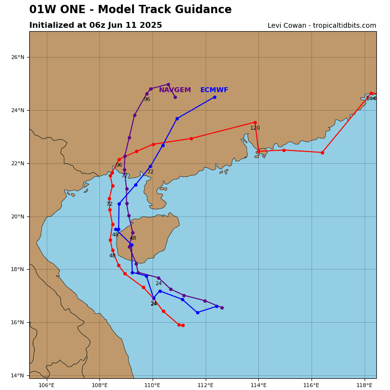
01W_tracks_latest
By PDC’s Senior Weather
Specialist Glenn James

The Pacific Disaster Center’s (PDC Global) Wednesday, June 11, 2025, Tropical Cyclone Activity Report…for the Pacific Ocean, the Indian Ocean, and adjacent Seas
Current Tropical Cyclones:
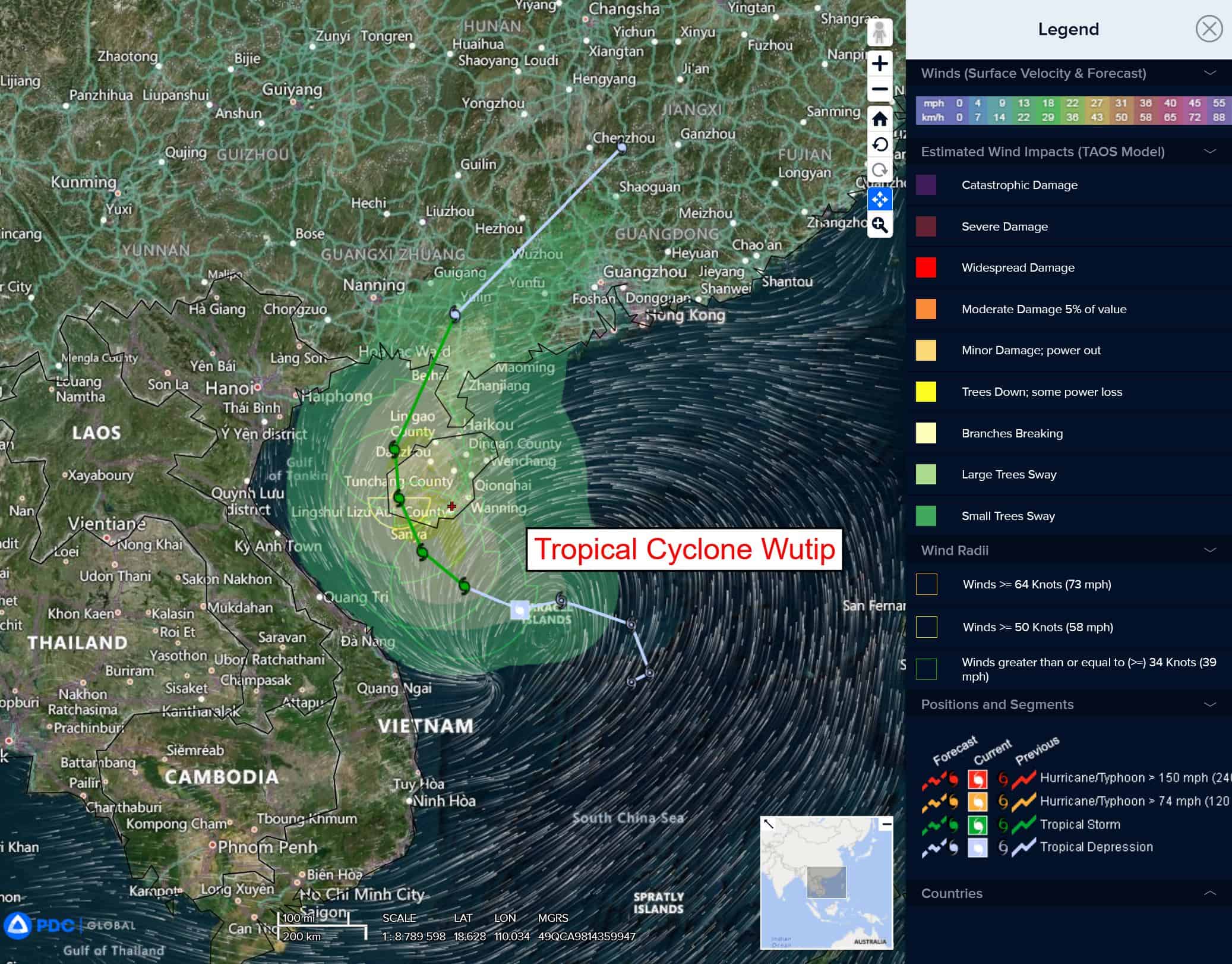
Tropical Cyclone 01W (Wutip)…is located about 130 NM east-northeast of Da Nang, Vietnam
Northeast Pacific Ocean: There are no Tropical Cyclones
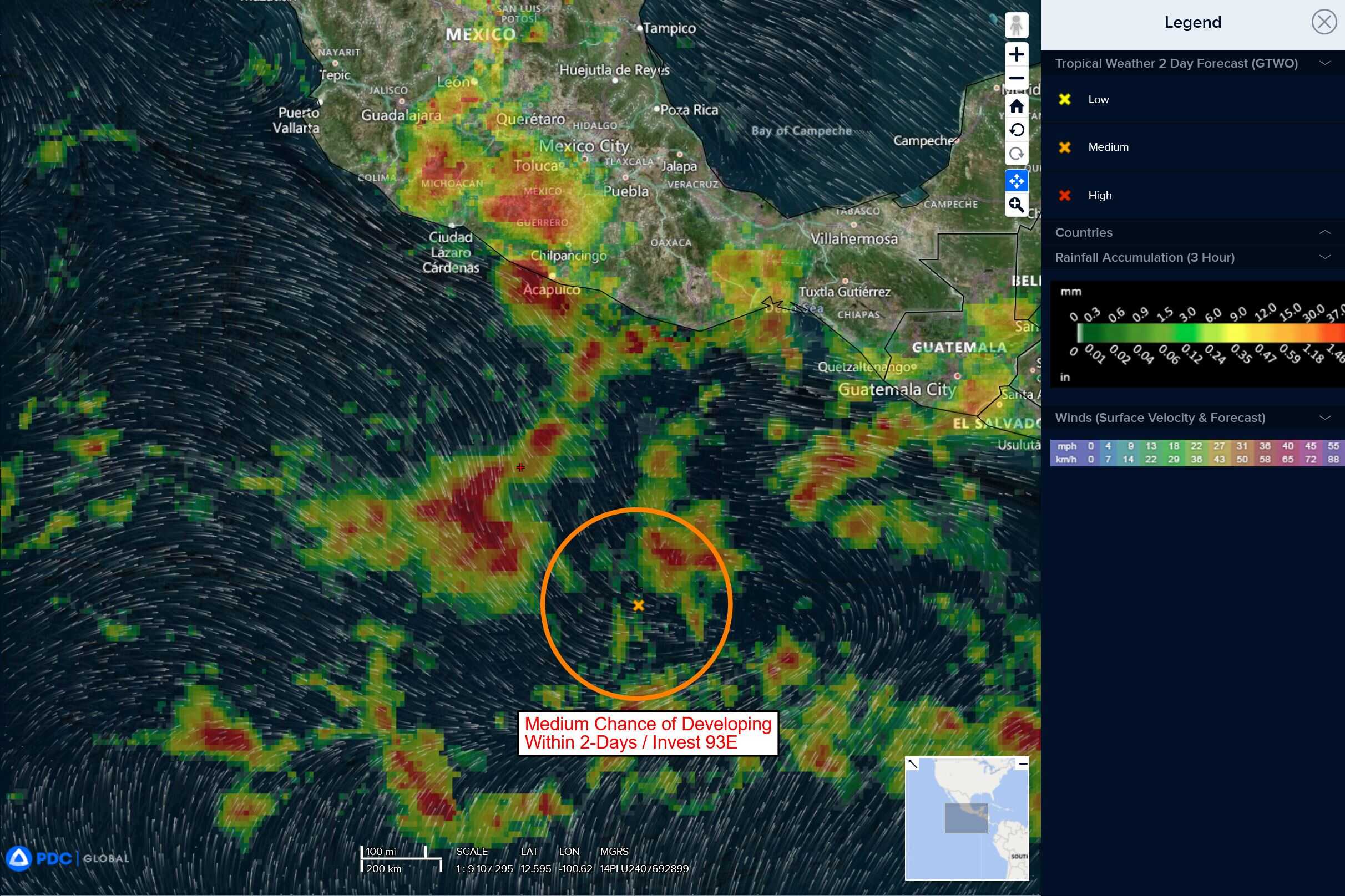
South of southern Mexico
Invest 93E
>>> A large area of disorganized showers and thunderstorms located several hundred miles southwest of the Gulf of Tehuantepec is associated with a broad area of low pressure. Environmental conditions appear conducive for development of this system, and a tropical depression is expected to form late this week or this weekend while it moves generally west-northwestward just offshore of the southwestern coast of Mexico.
* Formation chance through 48 hours…medium…60 percent
* Formation chance through 7 days…high…90 percent
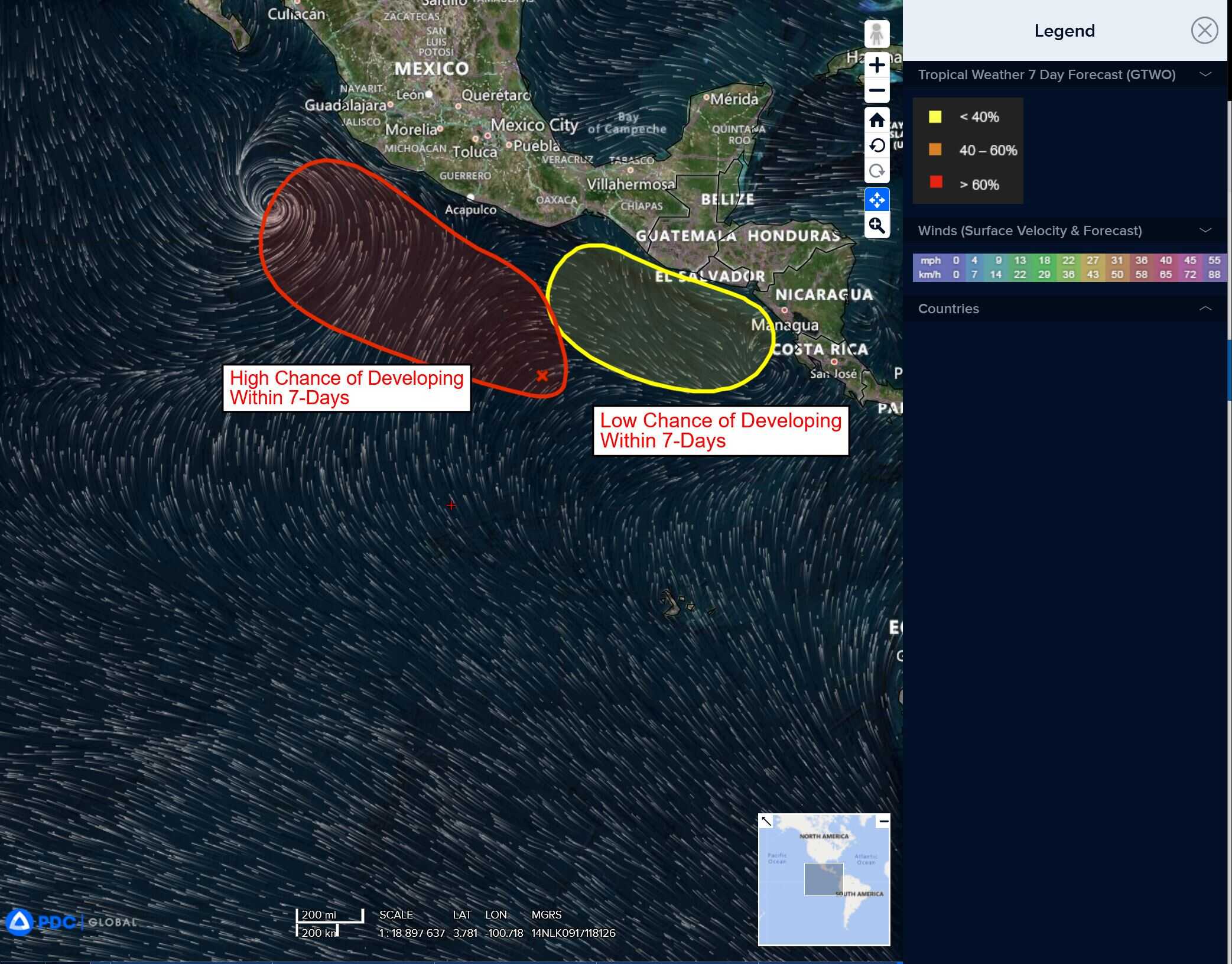
Offshore of Central America and Southern Mexico
>>> An area of low pressure is forecast to develop late this weekend or early next week near the coast of Central America. Environmental conditions appear conducive for some gradual development of this system as it moves west-northwestward near the coasts of Central America and southern Mexico.
* Formation chance through 48 hours…low…near 0 percent
* Formation chance through 7 days…low…20 percent
Central Pacific Ocean: There are no Tropical Cyclones
Tropical cyclone formation is not expected during the next 7-days.
Western Pacific, Indian Ocean, and adjacent Seas:
Western Pacific
Tropical Cyclone 01W (Wutip)
According to the JTWC Warning number 7, sustained winds are 40 knots with gusts to 50 knots