
")
Current Snapshot
For all the latest updates visit: DisasterAWARE

ensenada.jpg

dsc_0053.jpg
PDC executive team and AHA Centre Executive Director Adelina Kamal (third from left) at PDC headquarters.
silicon.jpg

proceso.jpg

vigia.jpg
By PDC’s Senior Weather
Specialist Glenn James

The Pacific Disaster Center’s (PDC Global) Friday, October 31, 2025, Tropical Cyclone Activity Report…for the Pacific Ocean, the Indian Ocean, and adjacent Seas
Current Tropical Cyclones:
There are no Tropical Cyclones
Northeast Pacific Ocean: There are no Tropical Cyclones
Tropical cyclone formation is not expected during the next 7 days.
Central Pacific Ocean: There are no Tropical Cyclones
Tropical cyclone formation is not expected during the next 7 days.
Western Pacific, Indian Ocean, and adjacent Seas: There are no Tropical Cyclones
Western Pacific
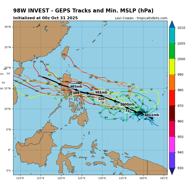
Invest 98W
>>> There’s an area of disturbed weather being referred to as Invest 98W…which is located approximately 44 NM east of Yap
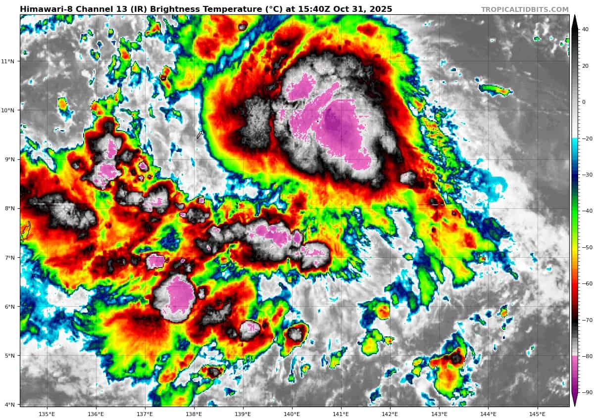
Animated multi-spectral satellite imagery (msi) depicts a broad low-level circulation center (llcc) with persistent deep convection to the north and the near the center of the llcc. A 312304z 37ghz gmi microwave image also depicts deep convective curved banding near the center of the low-level rotation.
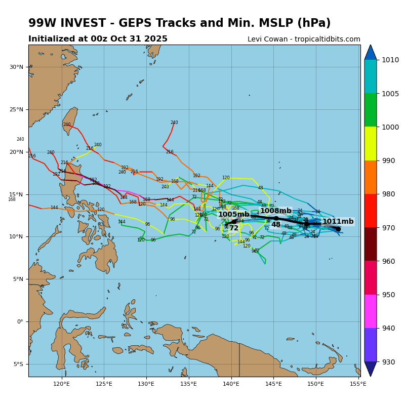
Invest 99W
>>> There’s an area of disturbed weather being referred to as Invest 99W…which is located approximately 184 NM east-southeast of Guam
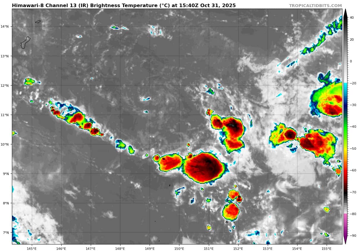
Animated enhanced multi-spectral imagery (msi) depicts flaring convection in the northeastern periphery along the disorganized low level circulation center (llcc).
Environmental analysis for the area indicates favorable conditions for development with low vertical wind shear (10-15 kts), warm sea surface temperatures (29-30 c) and good equatorward outflow aloft.
Global deterministic and ensemble models are in good agreement that 99W will continue west with gfs and gefs showing a more significant intensification over the next 48 hours.
Maximum sustained surface winds are estimated at 13 to 18 knots.
The potential for the development of a significant tropical cyclone within the next 24 hours remains low.