The Pacific Disaster Center’s (PDC Global) Saturday, September 13, 2025, Tropical Cyclone Activity Report…for the Pacific Ocean, the Indian Ocean, and adjacent Seas
Current Tropical Cyclones:
There are no Tropical Cyclones
Northeast Pacific Ocean: There are no Tropical Cyclones
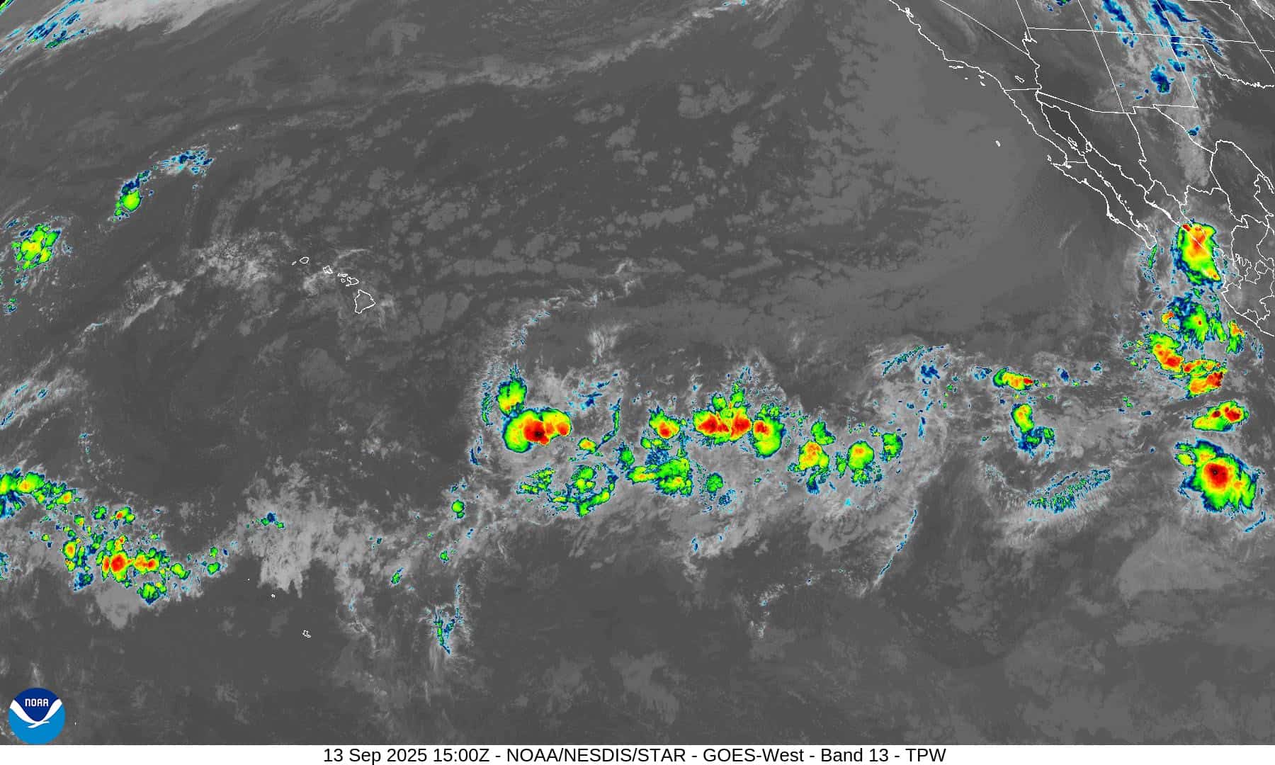
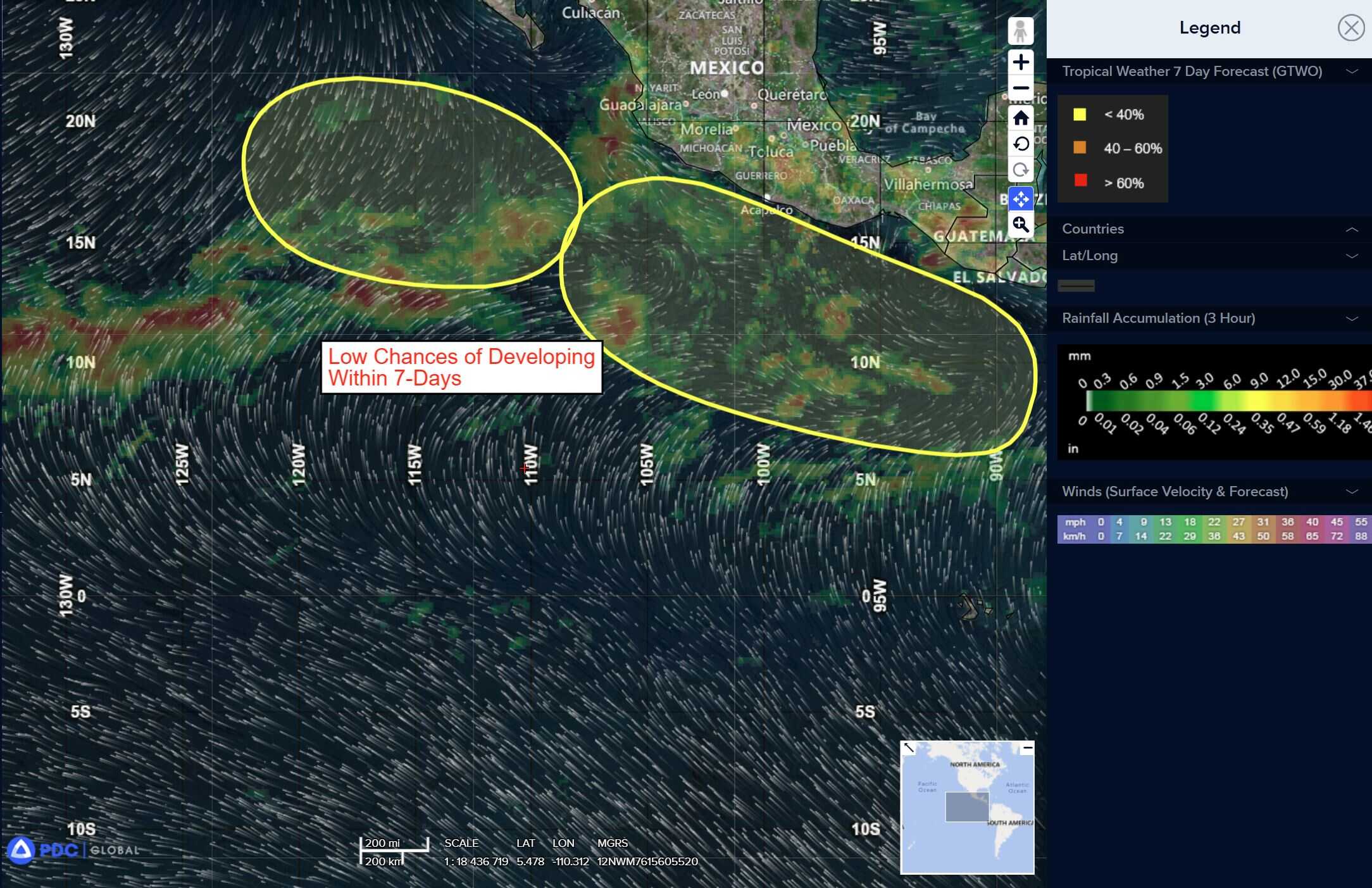
Off the coast of Southwestern Mexico:
>>> An area of low pressure could develop well offshore of the coast of southern or southwestern Mexico early next week. Environmental conditions are expected to be conducive for gradual development thereafter, as the low tracks westward to west-northwestward around 10 to 15 mph.
*Formation chance through 48 hours…low…near 0 percent
*Formation chance through 7 days…low…30 percent
South of Baja California Peninsula:
>>> An area of low pressure located south of the Baja California Peninsula, which includes the remnants of Mario, is producing a broad area of disorganized showers and thunderstorms. Environmental conditions are expected to be conducive for gradual development, and a tropical depression could form during the early to middle part of next week as it tracks slowly westward.
*Formation chance through 48 hours…low…30 percent
*Formation chance through 7 days…medium…50 percent
Central Pacific Ocean: There are no Tropical Cyclones
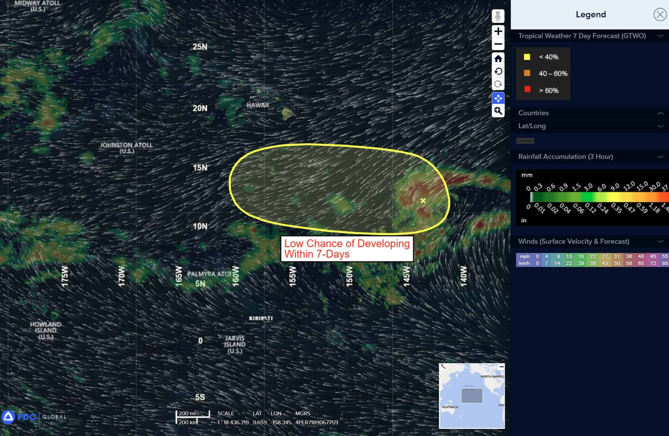
South and southeast of the Hawaiian Islands:
>>> An area of low pressure well southeast of the Hawaiian Islands is producing a large area of disorganized showers and thunderstorms. Environmental conditions appear conducive for some gradual development of this system as it moves westward around 10 mph.
*Formation chance through 48 hours…low…near 0 percent
*Formation chance through 7 days…low…20 percent
Western Pacific, Indian Ocean, and adjacent Seas: There are no Tropical Cyclones
Western Pacific
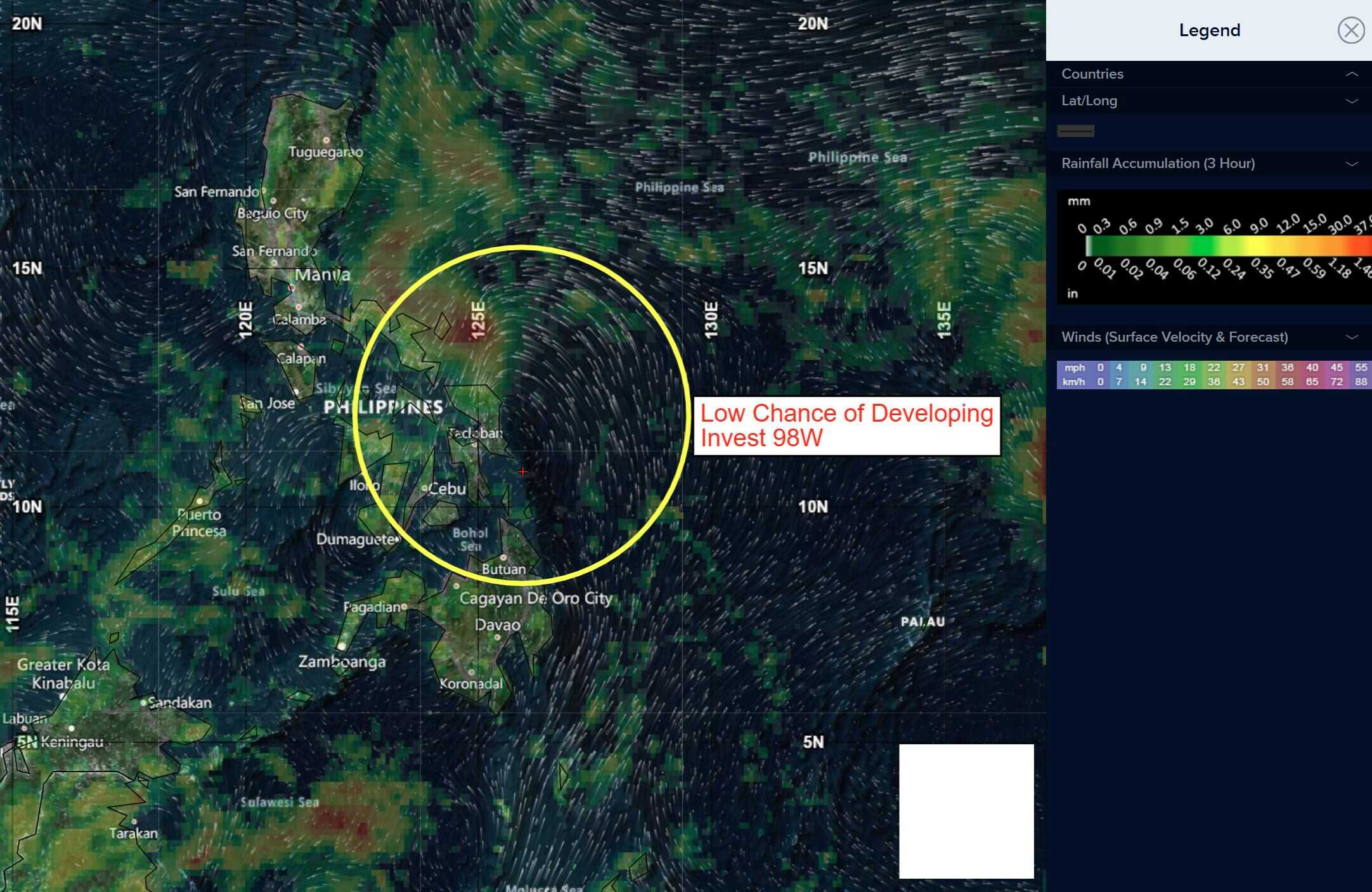
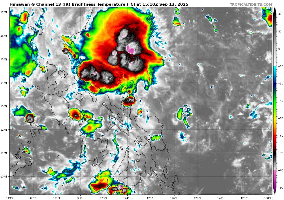
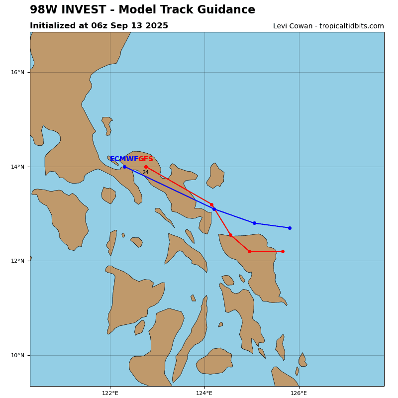
>>> There’s an area of disturbed weather being referred to as Invest 98W, which is located approximately 96 NM southeast of Manila
Animated multi-spectral satellite imagery (msi) depicts a weak low level circulation transiting westward across the Philippines towards the South China Sea.
Environmental analysis indicates marginal conditions for development with low vertical wind shear (10-15 kts) offset by land interaction with the Philippines and weak equatorward outflow aloft.
Global deterministic models are in agreement that 98W will move westward over the Philippines with little development. Ensemble models are also in fair agreement with ECENS showing more members forming in the South China Sea compared to GEFS.
Maximum sustained surface winds are estimated at 13 to 18 knots.
The potential for the development of a significant tropical cyclone within the next 24 hours remains low.

")