
")
Current Snapshot
For all the latest updates visit: DisasterAWARE
1800×1080
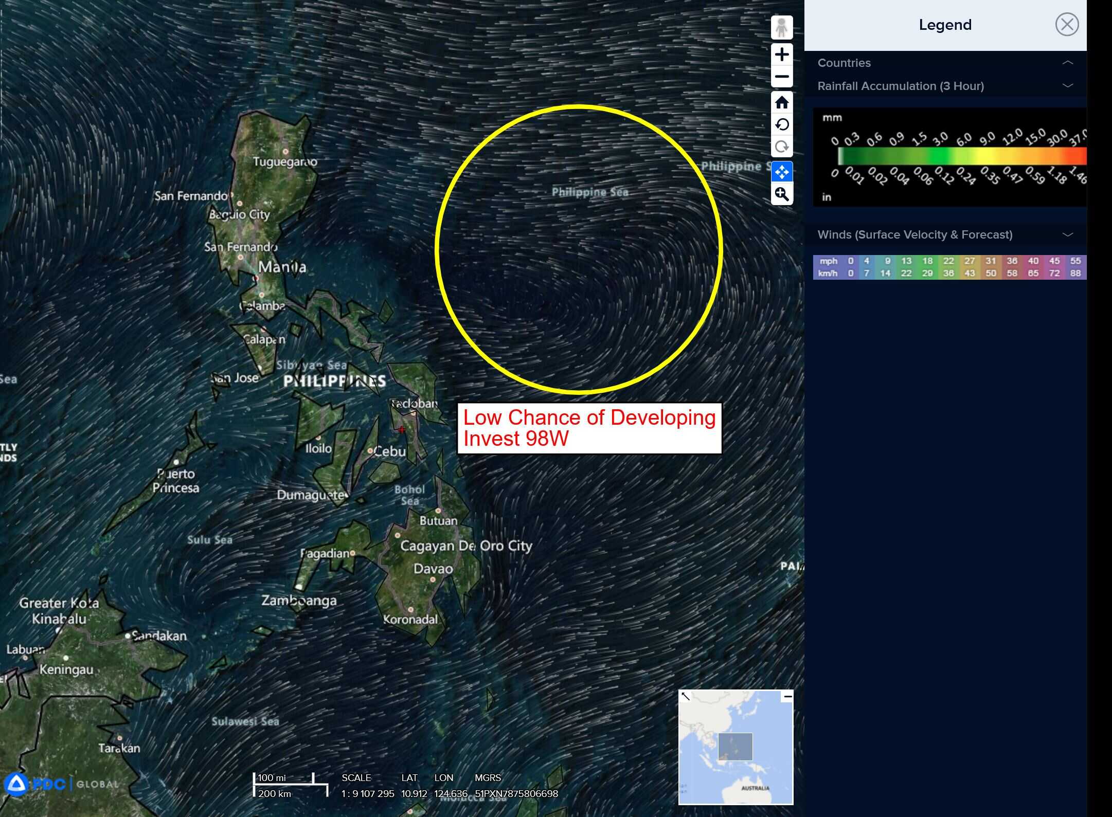
98w
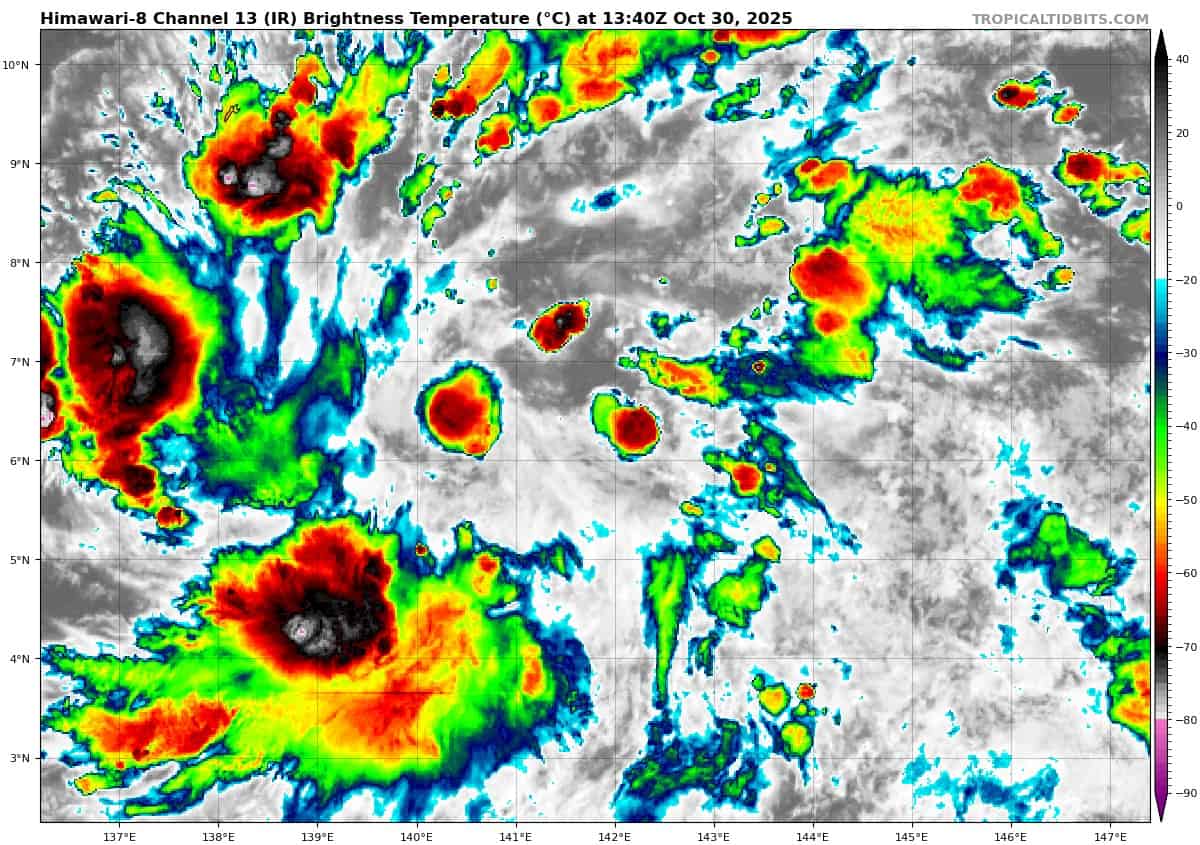
himawari8_ir_98W_202510301340_lat6.5-lon142.0

98W_tracks_latest
By PDC’s Senior Weather
Specialist Glenn James

The Pacific Disaster Center’s (PDC Global) Thursday, October 30, 2025, Tropical Cyclone Activity Report…for the Pacific Ocean, the Indian Ocean, and adjacent Seas
Current Tropical Cyclones:
There are no Tropical Cyclones
Northeast Pacific Ocean: There are no Tropical Cyclones
Tropical cyclone formation is not expected during the next 7 days.
Central Pacific Ocean: There are no Tropical Cyclones
Tropical cyclone formation is not expected during the next 7 days.
Western Pacific, Indian Ocean, and adjacent Seas: There are no Tropical Cyclones
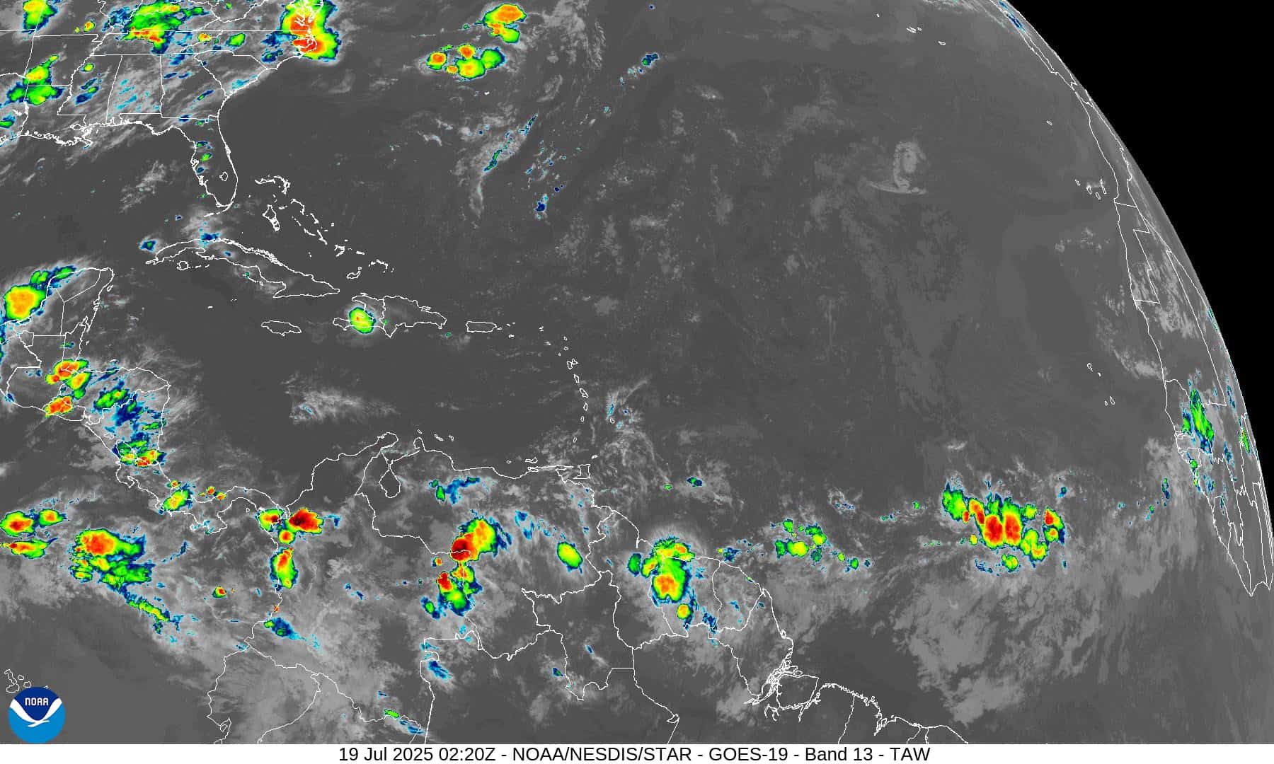
Western Pacific
>>> There’s an area of disturbed weather being referred to as Invest 98W…which is located approximately 259 NM east-southeast of Yap
Animated enhanced multi-spectral imagery (msi) depicts a slowly consolidating low level circulation center (llcc).
Environmental analysis for the area indicates favorable conditions for development with low vertical wind shear (5-10 kts), warm sea surface temperatures (30-31 c), and good poleward outflow.
Global deterministic models show 98W intensifying over the next 36-48 hours with gfs being the more aggressive model. While global ensembles are in good agreement on gradual development as it transits along a westward track.
Maximum sustained surface winds are estimated at 12 to 18 knots.
The potential for the development of a significant tropical cyclone within the next 24 hours remains