
")
Current Snapshot
For all the latest updates visit: DisasterAWARE
1000×1000
98LLLLL
goes19_ir_98L_202510191435_lat12.6-lon-59.7

98L_tracks_latest
By PDC’s Senior Weather
Specialist Glenn James

The Pacific Disaster Center’s (PDC Global) Sunday, October 19, 2025, Tropical Cyclone Activity Report…for the Atlantic Ocean, the Caribbean Sea, and the Gulf of America
Current Tropical Cyclones:
There are no Tropical Cyclones
Atlantic Ocean: There are no active tropical cyclones
Tropical cyclone formation is not expected during the next 7-days.
Caribbean Sea: There are no active tropical cyclones
Caribbean Sea:
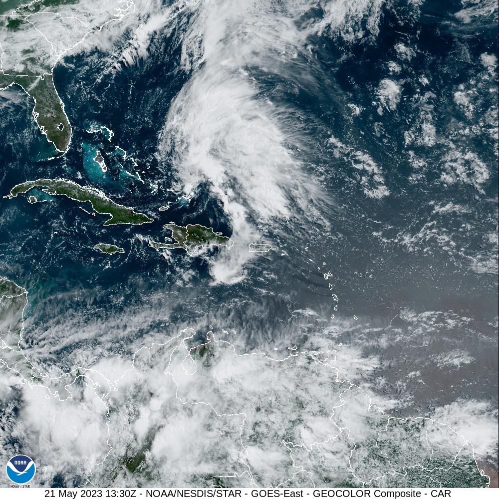
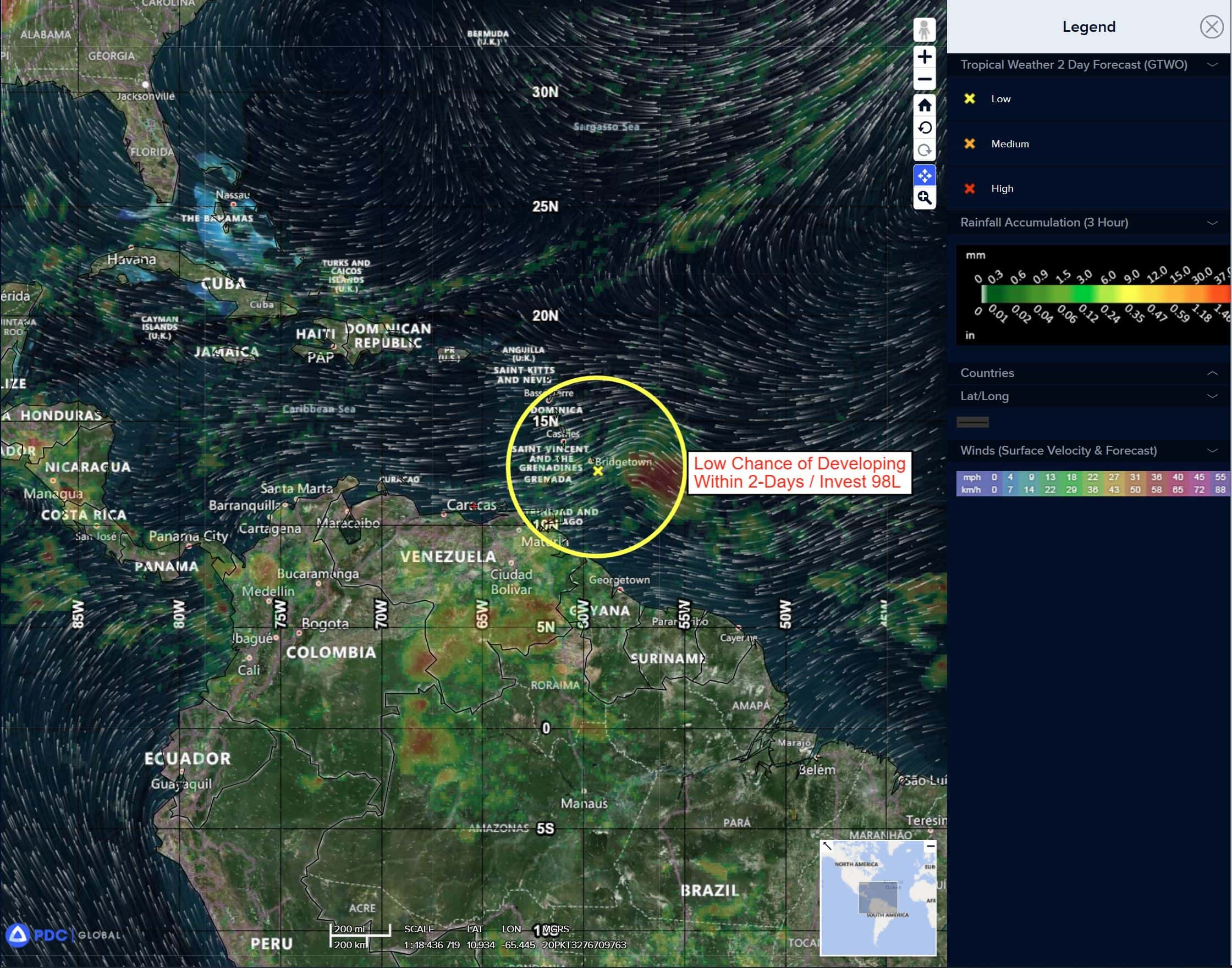
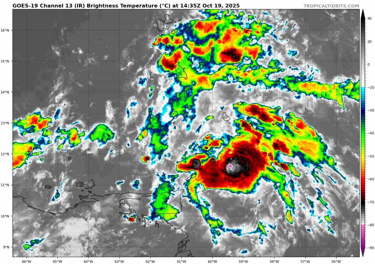
Invest 98L
>>> A tropical wave located over the eastern Caribbean Sea, a few hundred miles west of the Windward Islands, is producing a large area of poorly organized showers and thunderstorms. Recent satellite-derived wind data indicate that the disturbance continues to lack a closed circulation, although it is producing winds of 30 to 40 mph to the north and east of the wave axis. The system is moving quickly westward at 20 to 25 mph, which should limit significant development during the next day or so. Thereafter, environmental conditions are expected to become more conducive for development as the wave slows down over the central Caribbean Sea, and a tropical depression is likely to form during the middle to latter part of this week. Regardless of development, heavy rainfall and gusty winds are expected to continue affecting portions of the Windward and Leeward Islands this morning.
* Formation chance through 48 hours…low…30 percent
* Formation chance through 7 days…high…70 percent
Gulf of America: There are no active tropical cyclones
Tropical cyclone formation is not expected during the next 7-days.