
")
Current Snapshot
For all the latest updates visit: DisasterAWARE
epac
1800x1080e
97s
himawari8_ir_97S_202511171510_lat-10.7-lon129.7
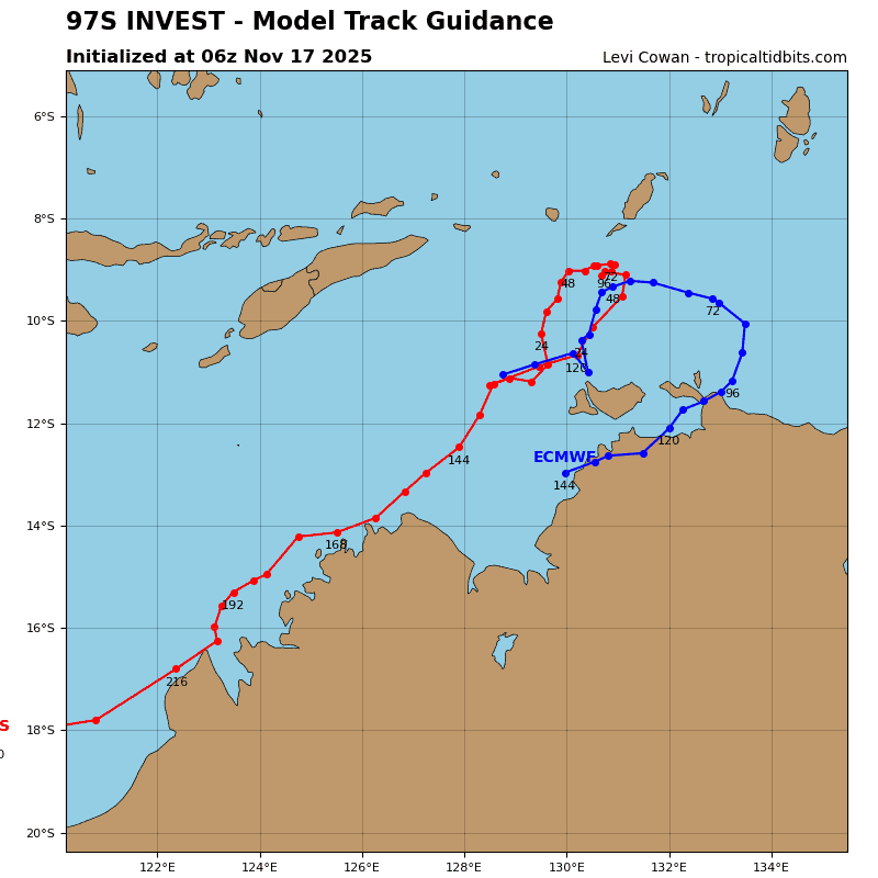
97S_tracks_latest
By PDC’s Senior Weather
Specialist Glenn James

The Pacific Disaster Center’s (PDC Global) Monday, November 17, 2025, Tropical Cyclone Activity Report…for the Pacific Ocean, the Indian Ocean, and adjacent Seas
Current Tropical Cyclones:
There are no Tropical Cyclones
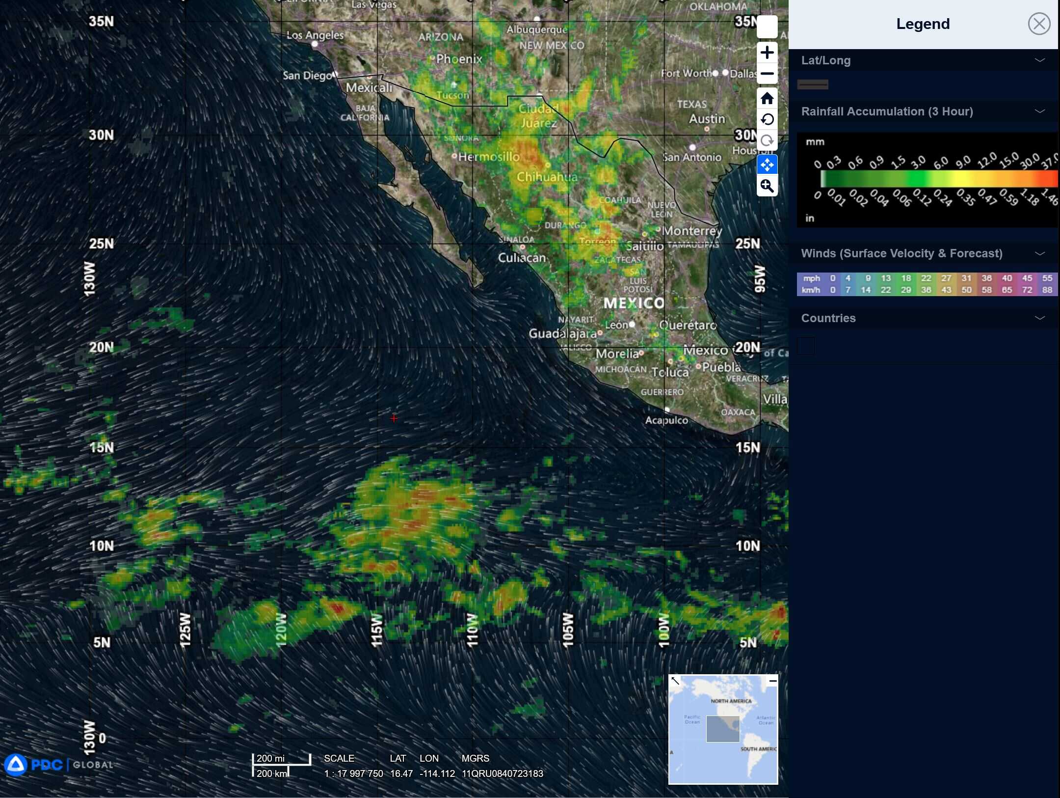
Northeast Pacific Ocean: There are no Tropical Cyclones
Tropical cyclone formation is not expected during the next 7 days.
Central Pacific Ocean: There are no Tropical Cyclones
Tropical cyclone formation is not expected during the next 7 days.
Western Pacific, Indian Ocean, and adjacent Seas:
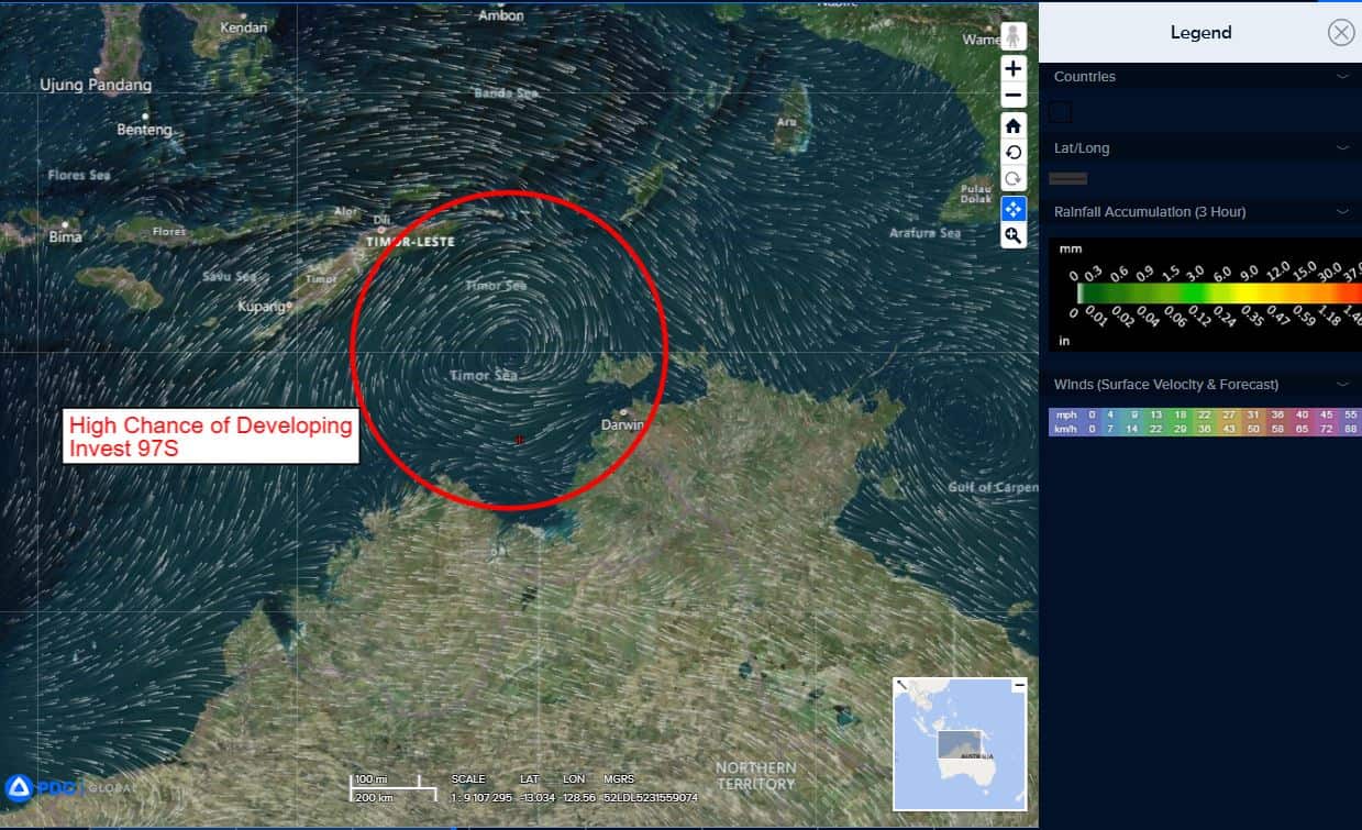
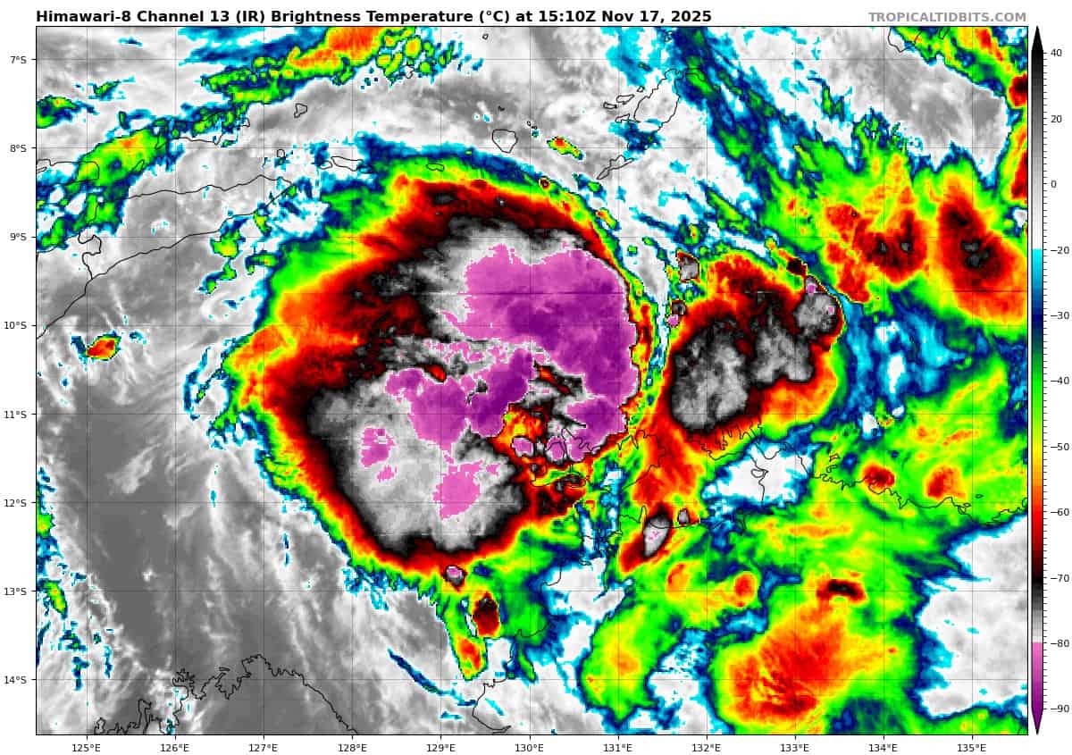
South Indian Ocean
>>> There’s an area of disturbed weather being referred to as Invest 97S, which is located approximately 131 NM north-northwest of Darwin, Australia
Animated enhanced infrared satellite imagery (eir) and a 170907z ssmis 91 ghz microwave image depict a compact low level circulation center (llcc) with pockets of deep convection building over the center.
Environmental analysis reveals favorable conditions for development with low vertical wind shear (10-15 knots), strong poleward outflow aloft, and very warm sea surface temperatures (30-31 c).
Global models are in fair agreement that invest 97S will continue to develop with a slow east-northeastward track over the next 24 hours,
Maximum sustained surface winds are estimated at 28 to 33 knots.
The potential for the development of a significant tropical cyclone within the next 24 hours is high.