
")
Current Snapshot
For all the latest updates visit: DisasterAWARE
1800x1080a
at2
goes19_ir_96L_202508091435_lat20.0-lon-46.6

96L_tracks_latest
By PDC’s Senior Weather
Specialist Glenn James

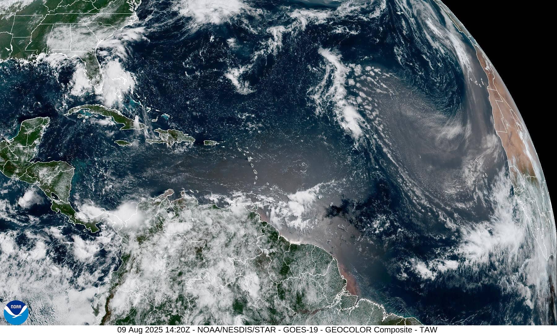
The Pacific Disaster Center’s (PDC Global) Saturday, August 9, 2025, Tropical Cyclone Activity Report…for the Atlantic Ocean, the Caribbean Sea, and the Gulf of America
Current Tropical Cyclones:
There are no Tropical Cyclones
Atlantic Ocean:
Central Atlantic
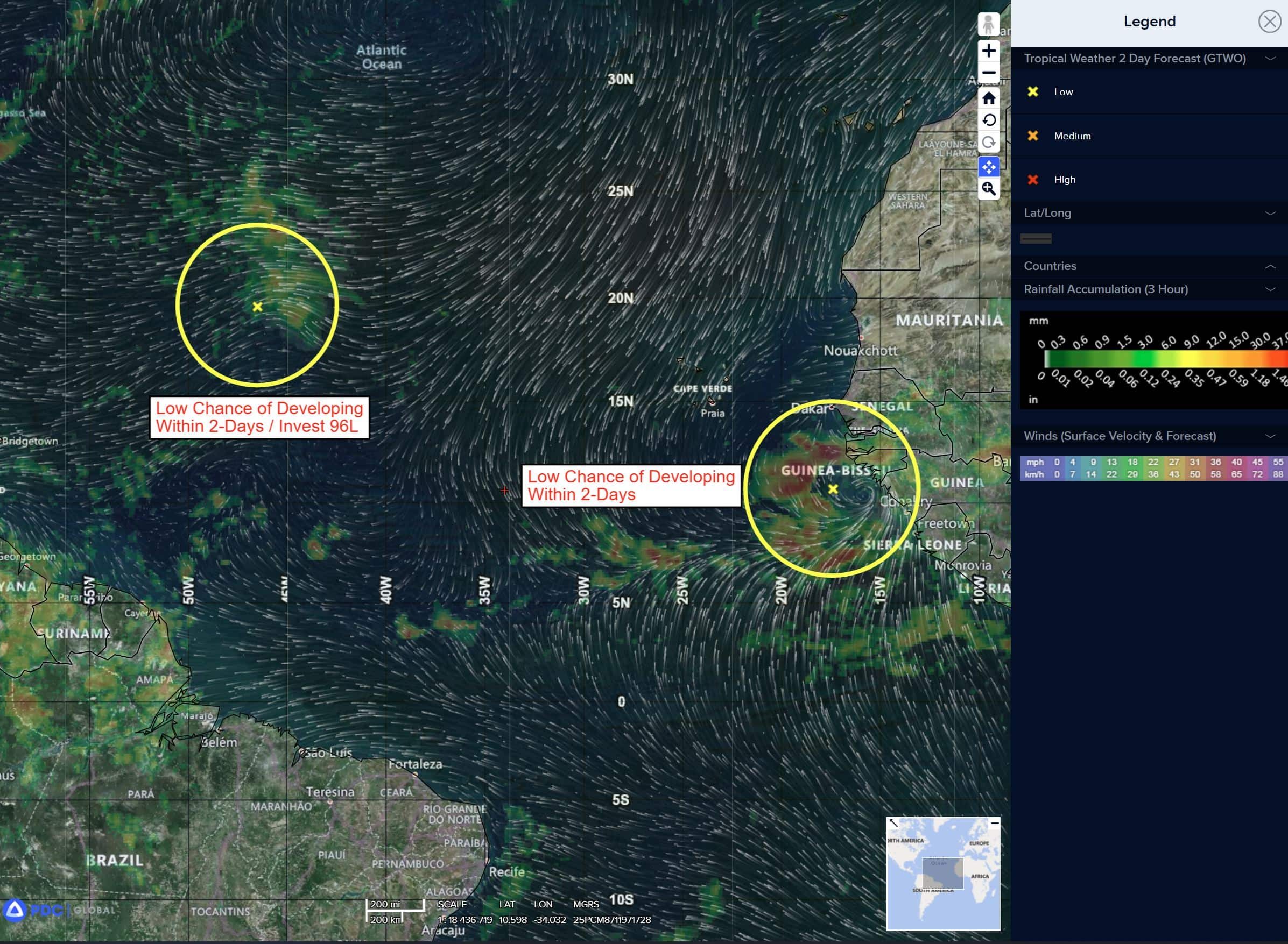
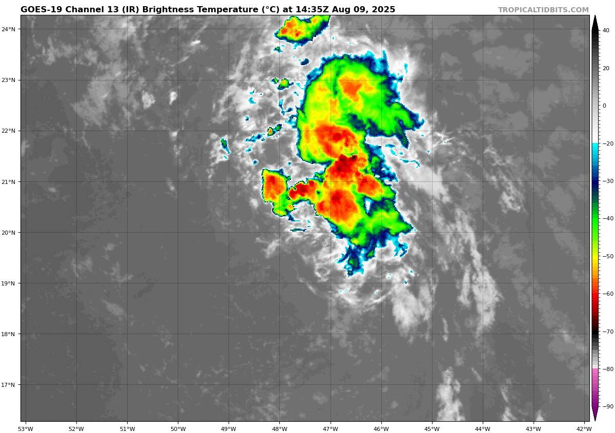
Invest 96L
>>> Disorganized showers and thunderstorms continue in association with a tropical wave over the central tropical Atlantic. Development of this system appears unlikely during the next couple of days due to surrounding dry air, but some gradual development is possible during the middle part of next week while the system moves northward across the central Atlantic.
* Formation chance through 48 hours…low…near 0 percent
* Formation chance through 7 days…low…20 percent
Eastern Tropical Atlantic
Invest 97L
>>> A broad area of low pressure, associated with a tropical wave, is producing a large area of disorganized showers and thunderstorms just to the east and southeast of the Cabo Verde Islands. Environmental conditions appear conducive for gradual development of this system, and a tropical depression is likely to form by the middle to latter portion of this week while moving west-northwestward at 15 to 20 mph across the eastern and central tropical Atlantic. Locally heavy rainfall and gusty winds are possible today and Monday across portions of the Cabo Verde Islands.
* Formation chance through 48 hours…low…10 percent
* Formation chance through 7 days…high…70 percent