
")
Current Snapshot
For all the latest updates visit: DisasterAWARE
1800x1080e
himawari9_ir_95W_202506211520_lat21.9-lon146.2
By PDC’s Senior Weather
Specialist Glenn James

The Pacific Disaster Center’s (PDC Global) Saturday, June 21, 2025, Tropical Cyclone Activity Report…for the Pacific Ocean, the Indian Ocean, and adjacent Seas
Current Tropical Cyclones:
There are no Tropical Cyclones
Northeast Pacific Ocean: There are no Tropical Cyclones
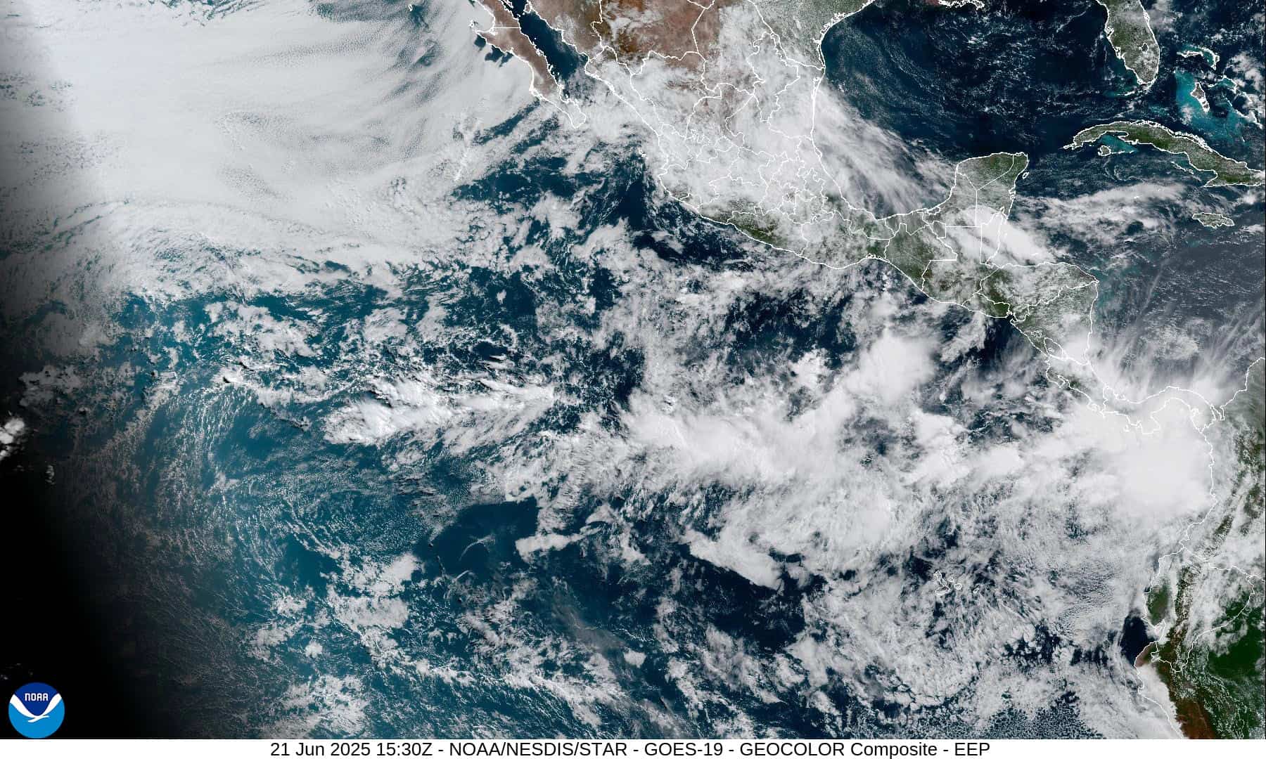
Offshore of Central America and Southern Mexico:
>>> An area of low pressure is forecast to develop in a couple of days off the coast of Central America.
Environmental conditions appear conducive for gradual development after that time and a tropical depression is likely to form by the middle of next week. This system is forecast to move west-northwestward just off the coasts of Central America and southern Mexico.
* Formation chance through 48 hours…low…near 0 percent
* Formation chance through 7 days…high…70 percent
Central Pacific Ocean: There are no Tropical Cyclones
Tropical cyclone formation is not expected during the next 7-days.
Western Pacific, Indian Ocean, and adjacent Seas: There are no Tropical Cyclones
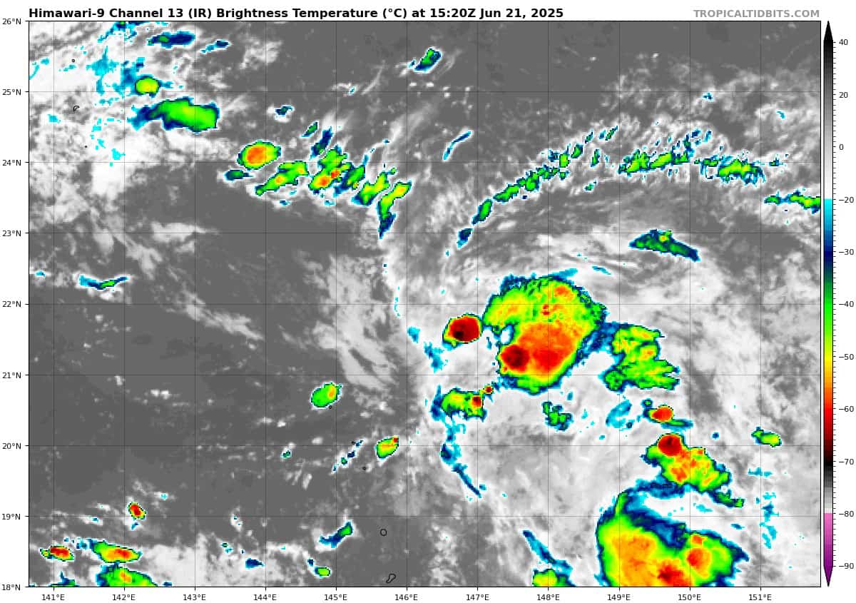
Western Pacific
>>> There’s an area of disturbed weather being referred to as Invest 95W, which is located approximately 301 NM south-southeast of Iwo To.
Animated multi-spectral satellite imagery and a microwave image depict flaring convection over a consolidating low level circulation center. Furthermore, another image emphasizes a broad circulation within the area.
Analysis indicates 95W is currently in a marginally favorable environment for development with low (10-15 knot) vertical wind shear, weak divergence aloft and warm sea surface temperatures. A tropical upper tropospheric trough cell over the western portion of the system is currently degrading the upper-level environment.
Global models are in fair agreement that 95W will track northwestward and develop over the next couple days as the system moves into a more favorable upper-level environment.
Maximum sustained surface winds are estimated at 18 to 23 knots.
The potential for the development of a significant tropical cyclone within the next 24 hours is upgraded to high.