
")
Current Snapshot
For all the latest updates visit: DisasterAWARE
9944
9
999
By PDC’s Senior Weather
Specialist Glenn James

The Pacific Disaster Center’s (PDC Global) Monday, May 12, 2025, Tropical Cyclone Activity Report…for the Pacific Ocean, the Indian Ocean, and adjacent Seas
Current Tropical Cyclones:
There are no Tropical Cyclones
Northeast Pacific Ocean: There are no Tropical Cyclones
The last regularly scheduled Tropical Cyclone Activity Report of the 2024 eastern North Pacific Hurricane Season has been issued. Routine issuance of this section of the PDC product will resume on May 15, 2025. During the off-season, Special Tropical Weather Outlooks will be issued as conditions warrant by the NHC.
Central Pacific Ocean: There are no Tropical Cyclones
The 2024 central North Pacific hurricane season has ended. As such, the final routine Tropical Cyclone Activity Report for the 2024 season has been issued. Routine issuance of this section of the PDC product will resume on June 1, 2025. During the off-season, Special Tropical Weather Outlooks will be issued as conditions warrant by the CPHC.
Western Pacific, Indian Ocean, and adjacent Seas:
Southwest Pacific Ocean
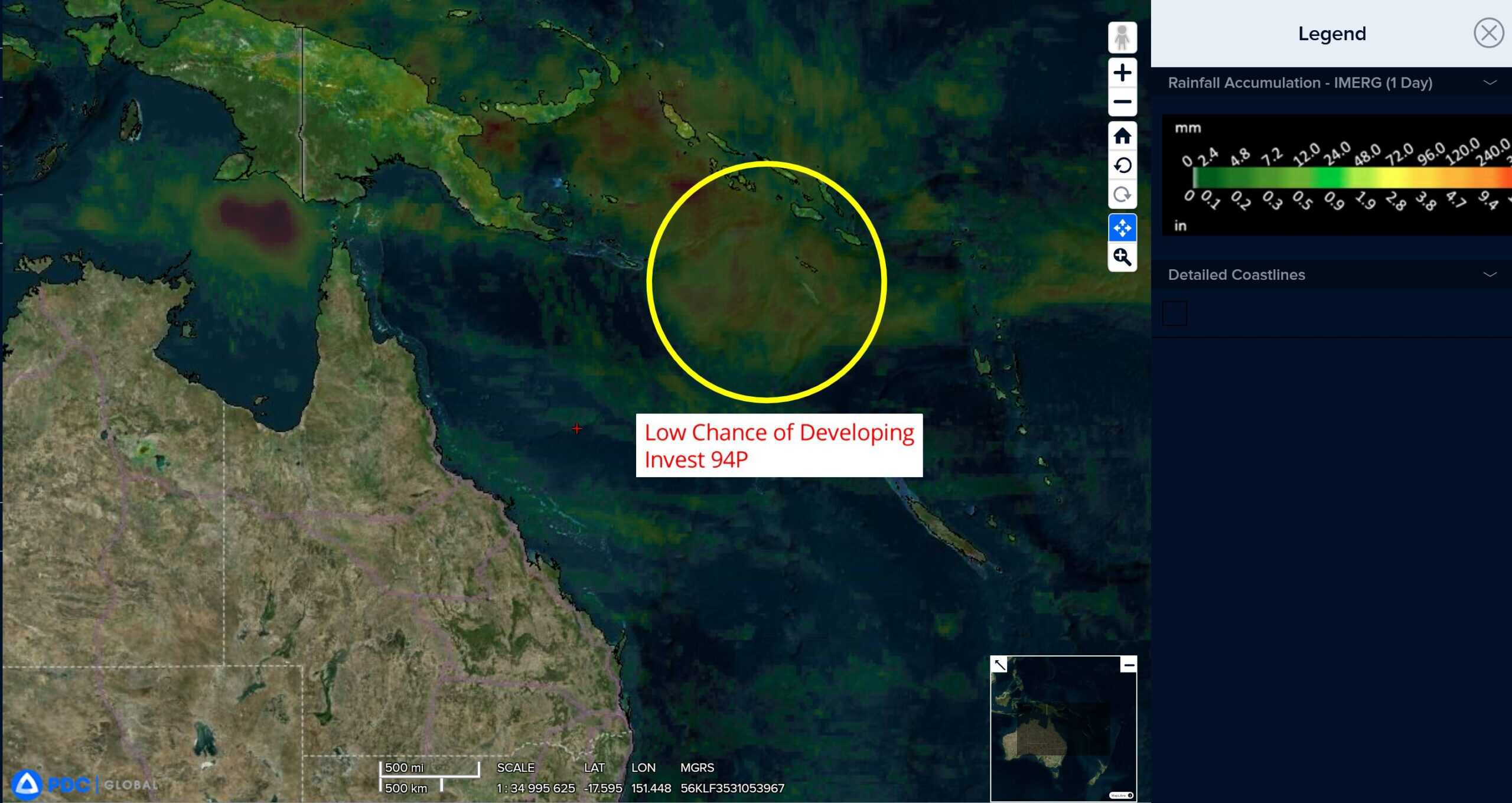
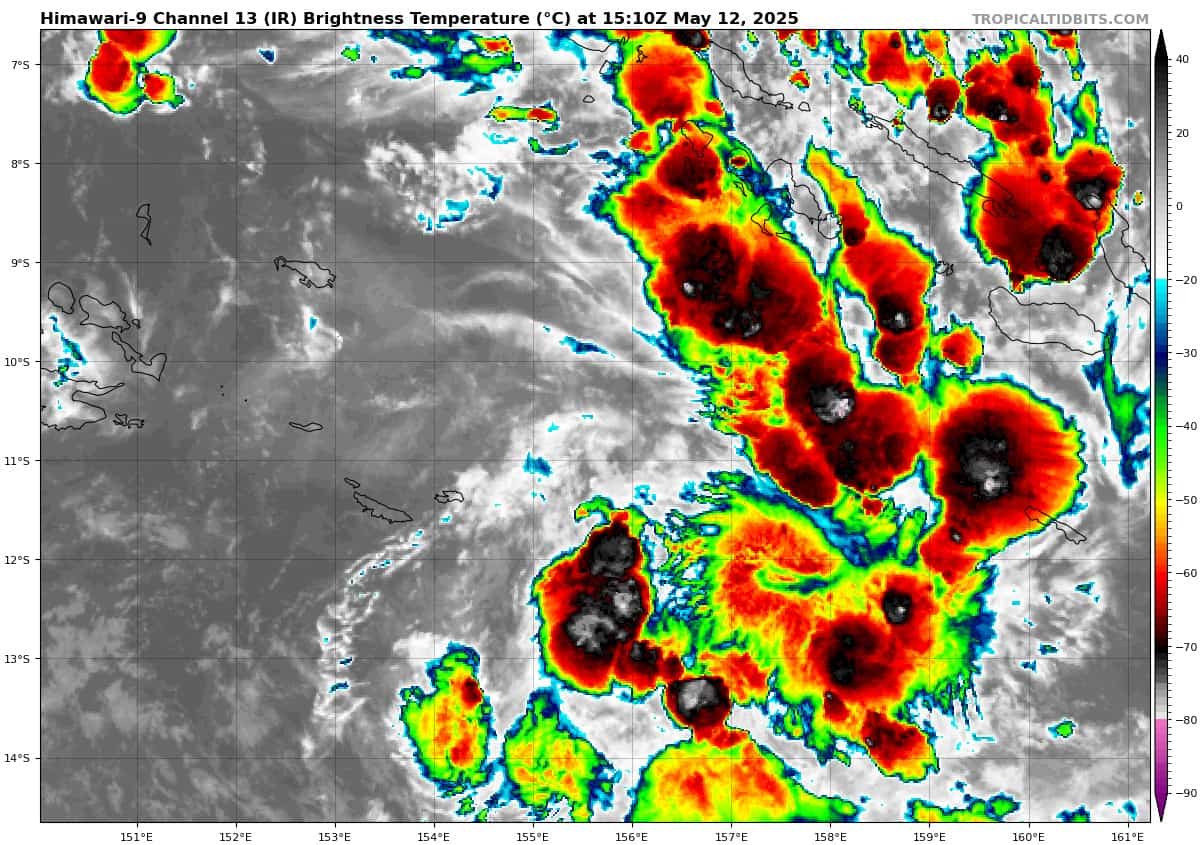
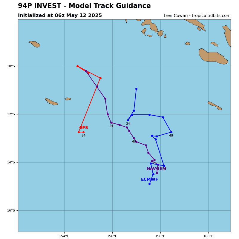
>>> There’s an area of disturbed weather being referred to as Invest 94P, which is located approximately 236 NM west-southwest of Honiara
Animated multi-spectral satellite imagery (msi) and a microwave pass depict an elongated low level circulation with fragmented outer convective banding. A ascat-c pass depicts a broad circulation, with a weak core of 5 knots and a swath of 15-20 knot winds displaced over 120 NM to the south.
Environmental analysis reveals a marginally favorable environment for development with low to moderate vertical wind shear of 15-20 knots, good dual-channel upper-level outflow and warm sea surface temperatures, offset by mid-level dry air entrainment.
Deterministic and ensemble models are not in agreement on development with ecmwf, gfs and gefs forecasting no model development due to significant dry air entrainment while navgem and ecens forecast weak/borderline development within 24-48 hours.
Maximum sustained surface winds are estimated at 18 to 23 knots.
The potential for the development of a significant tropical cyclone within the next 24 hours remains low.