
")
Current Snapshot
For all the latest updates visit: DisasterAWARE

3
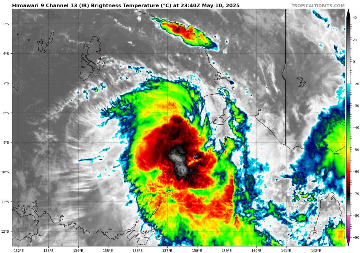
himawari9_ir_93P_202505102340_lat-8.3-lon137.2
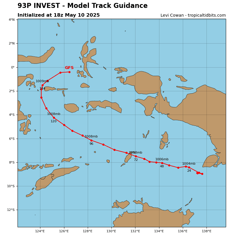
93P_tracks_latest
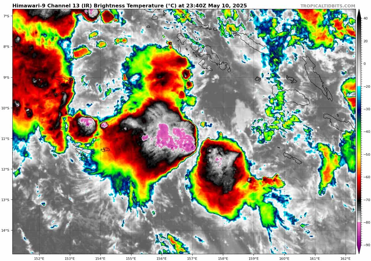
himawari9_ir_94P_202505102340_lat-10.9-lon156.9

94P_tracks_latest
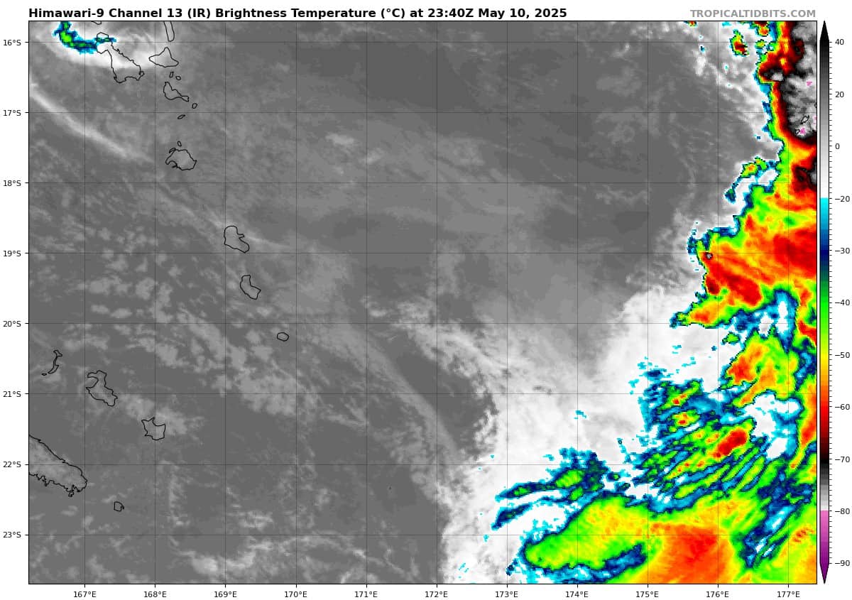
himawari9_ir_95P_202505102340_lat-19.7-lon171.8
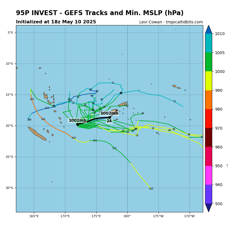
95P_gefs_latest
By PDC’s Senior Weather
Specialist Glenn James

The Pacific Disaster Center’s (PDC Global) Saturday, May 10, 2025, Tropical Cyclone Activity Report…for the Pacific Ocean, the Indian Ocean, and adjacent Seas
Current Tropical Cyclones:
There are no Tropical Cyclones
Northeast Pacific Ocean: There are no Tropical Cyclones
The last regularly scheduled Tropical Cyclone Activity Report of the 2024 eastern North Pacific Hurricane Season has been issued. Routine issuance of this section of the PDC product will resume on May 15, 2025. During the off-season, Special Tropical Weather Outlooks will be issued as conditions warrant by the NHC.
Central Pacific Ocean: There are no Tropical Cyclones
The 2024 central North Pacific hurricane season has ended. As such, the final routine Tropical Cyclone Activity Report for the 2024 season has been issued. Routine issuance of this section of the PDC product will resume on June 1, 2025. During the off-season, Special Tropical Weather Outlooks will be issued as conditions warrant by the CPHC.
Western Pacific, Indian Ocean, and adjacent Seas: There are no Tropical Cyclones
Southwest Pacific Ocean
>>> There’s an area of disturbed weather being referred to as Invest 93P, which is located approximately 238 NM north of Gore AP, Australia
Animated multi-spectral satellite imagery and a microwave image depicts an obscured low-level circulation center (llcc) with flaring convection over the center and along the southern periphery of the system.
Environmental analysis indicates that 93P is in a favorable environment for development characterized by strong poleward outflow aloft, low (10-15 knot) vertical wind shear, and warm sea surface temperatures.
Numerical model guidance is in poor agreement with ECMWF depicting a slow southward track and further intensification while GFS depicts a westward track and little development. The window for development is short, due to increasing dry air entrainment from the west after 24 hours.
Maximum sustained surface winds are estimated at 28 to 33 knots.
The potential for the development of a significant tropical cyclone within the next 24 hours is upgraded to high.
>>> There’s a second area of disturbed weather being referred to as Invest 94P, which is located approximately 204 NM west-southwest of Honiara
Animated enhanced infrared satellite imagery depicts a poorly organized low level circulation center obscured by flaring convection that is sheared from the southwest. A partial pass reveals an elongated circulation with its strongest winds isolated to the southwest.
Environmental analysis for the area indicates marginally favorable conditions for development with low to moderate (15-20 knot) vertical
wind shear offset by warm sea surface temperatures and moderate poleward outflow aloft.
Global deterministic models are in fair agreement that the area of convection 94P will continue southeast as it gradually intensifies over the next 48 hours. Ensemble guidance agrees on a southeastward track with ECENS being more aggressive on development than the GEFS.
Maximum sustained surface winds are estimated at 23 to 28 knots.
The potential for the development of a significant tropical cyclone within the next 24 hours is upgraded to low.
>>> There’s a third area of disturbed weather being referred to as Invest 95P, which is located approximately 342 NM west-southwest of Nadi, Fiji
Animated enhanced infrared satellite imagery depicts an asymmetric circulation under very strong westerly vertical wind shear (over 50 knots) due to the presence of an upper-level jet max to the south of the system. Convection is being vigorously sheared to the south and east of the circulation center. An ascat-c pass revealed 35-40 knot winds confined to the southern periphery, displaced about 100 NM south of the center.
Environmental analysis indicates that 95P is in an unfavorable environment for tropical transition due to the high vertical wind shear and significant dry air entrainment along the entire western portion of the system, offset by warm sea surface temperatures
Numerical model guidance agrees on a fast eastward track over the next 48 hours with an increasingly elongated wind field and the strongest winds remaining within the southern periphery.
Maximum sustained surface winds are estimated at 33 to 38 knots.
The potential for the development of a significant tropical cyclone within the next 24 hours is upgraded to low.