
")
Current Snapshot
For all the latest updates visit: DisasterAWARE
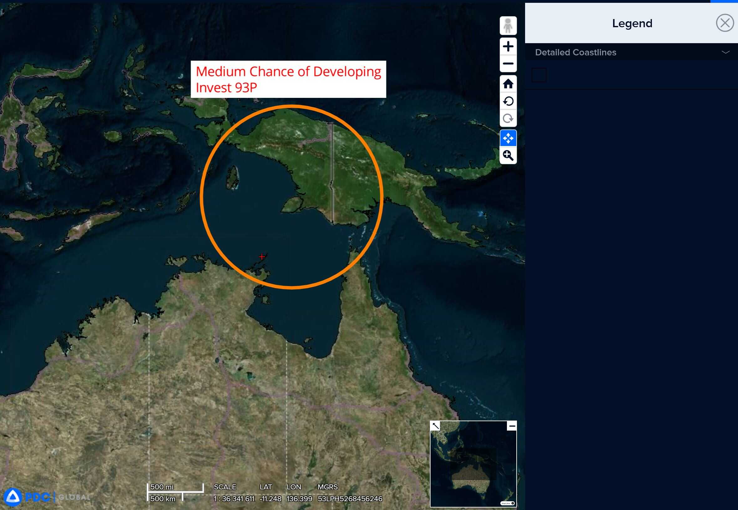
93p
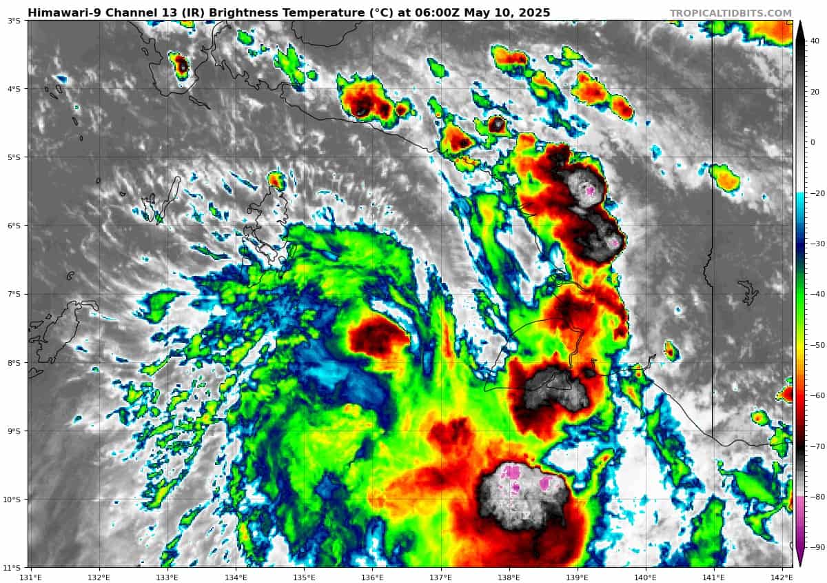
himawari9_ir_93P_202505100600_lat-7.2-lon136.5
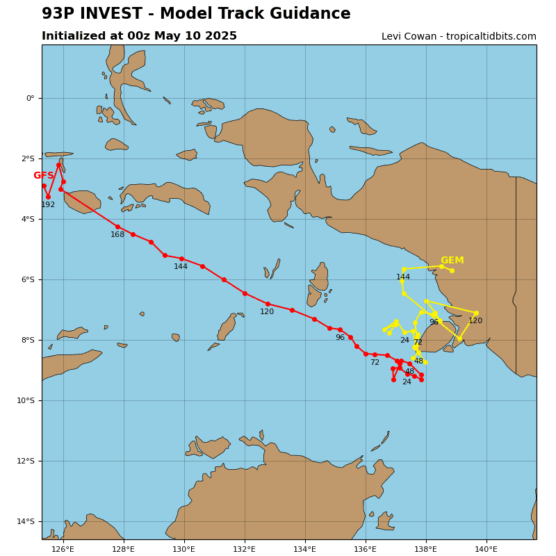
93P_tracks_latest
By PDC’s Senior Weather
Specialist Glenn James

The Pacific Disaster Center’s (PDC Global) Friday, May 9, 2025, Tropical Cyclone Activity Report…for the Pacific Ocean, the Indian Ocean, and adjacent Seas
Current Tropical Cyclones:
There are no Tropical Cyclones
Northeast Pacific Ocean: There are no Tropical Cyclones
The last regularly scheduled Tropical Cyclone Activity Report of the 2024 eastern North Pacific Hurricane Season has been issued. Routine issuance of this section of the PDC product will resume on May 15, 2025. During the off-season, Special Tropical Weather Outlooks will be issued as conditions warrant by the NHC.
Central Pacific Ocean: There are no Tropical Cyclones
The 2024 central North Pacific hurricane season has ended. As such, the final routine Tropical Cyclone Activity Report for the 2024 season has been issued. Routine issuance of this section of the PDC product will resume on June 1, 2025. During the off-season, Special Tropical Weather Outlooks will be issued as conditions warrant by the CPHC.
Western Pacific, Indian Ocean, and adjacent Seas: There are no Tropical Cyclones
Southwest Pacific Ocean
>>> There’s an area of disturbed weather being referred to as Invest 93P, which is located approximately 311 NM north of Gore AP, Australia
Animated multi-spectral satellite imagery depicts a slowly consolidating, partially-exposed low level circulation center (llcc) with flaring convection along the southern periphery of the center.
Environmental analysis reveals a moderate environment for development with low to moderate (15-20 knots) vertical wind shear and moderate poleward outflow aloft. Furthermore, warm sea surface temperatures and a humid climate are currently helping 93P with potential development.
Deterministic and ensemble models are in good agreement that Invest 93P will remain quasi-stationary near the Arafura Sea and continue to intensify over the next 24 hours.
Maximum sustained surface winds are estimated at 23 to 28 knots.
The potential for the development of a significant tropical cyclone within the next 24 hours remains medium.