
")
Current Snapshot
For all the latest updates visit: DisasterAWARE

2
7

1000×1000
goes19_ir_93L_202507151452_lat28.7-lon-80.5

93L_tracks_latest
By PDC’s Senior Weather
Specialist Glenn James

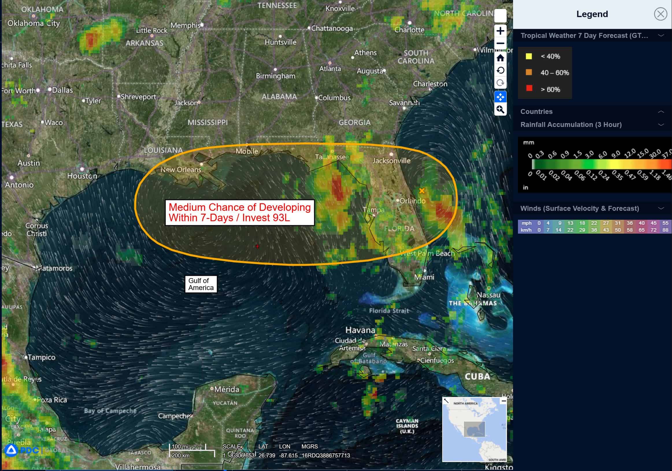
The Pacific Disaster Center’s (PDC Global) Tuesday, July 15, 2025, Tropical Cyclone Activity Report…for the Atlantic Ocean, the Caribbean Sea, and the Gulf of America
Current Tropical Cyclones:
There are no Tropical Cyclones
Northeastern and north-central Gulf:
Invest 93L
>>> Surface observations indicate that a broad area of low pressure
continues to move westward across the Florida Panhandle and is
producing disorganized shower and thunderstorm activity mainly south
of its center. This system is forecast to continue moving westward,
and could emerge or redevelop over the far northeastern to
north-central portion of the Gulf, reaching the coast of Louisiana
by Thursday.
If this system moves far enough offshore, environmental conditions over the Gulf appear generally favorable for additional development, and a tropical depression could still form over the next couple of days before the system moves fully inland by the end of the week.
Regardless of development, heavy rainfall could produce localized
flash flooding over portions of Florida through through today. Heavy rainfall could also cause flash flooding for portions of the north-central Gulf Coast beginning late today and continuing through Friday.
* Formation chance through 48 hours…medium…40 percent
* Formation chance through 7 days…medium…40 percent