
")
Current Snapshot
For all the latest updates visit: DisasterAWARE
pdc7
1800x1080p
93a
meteosat9_ir_93A_202505241521_lat18.2-lon75.7
93A_tracks_latest
By PDC’s Senior Weather
Specialist Glenn James

The Pacific Disaster Center’s (PDC Global) Saturday, May 24, 2025, Tropical Cyclone Activity Report…for the Pacific Ocean, the Indian Ocean, and adjacent Seas
Current Tropical Cyclones:
There are no Tropical Cyclones
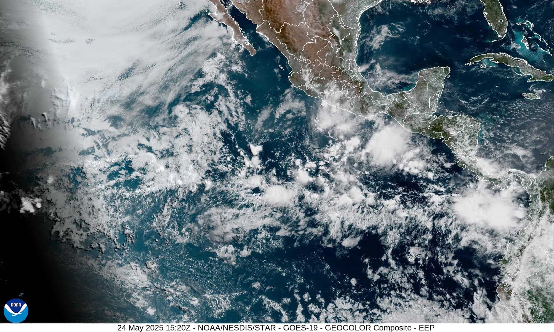
Northeast Pacific Ocean: There are no Tropical Cyclones
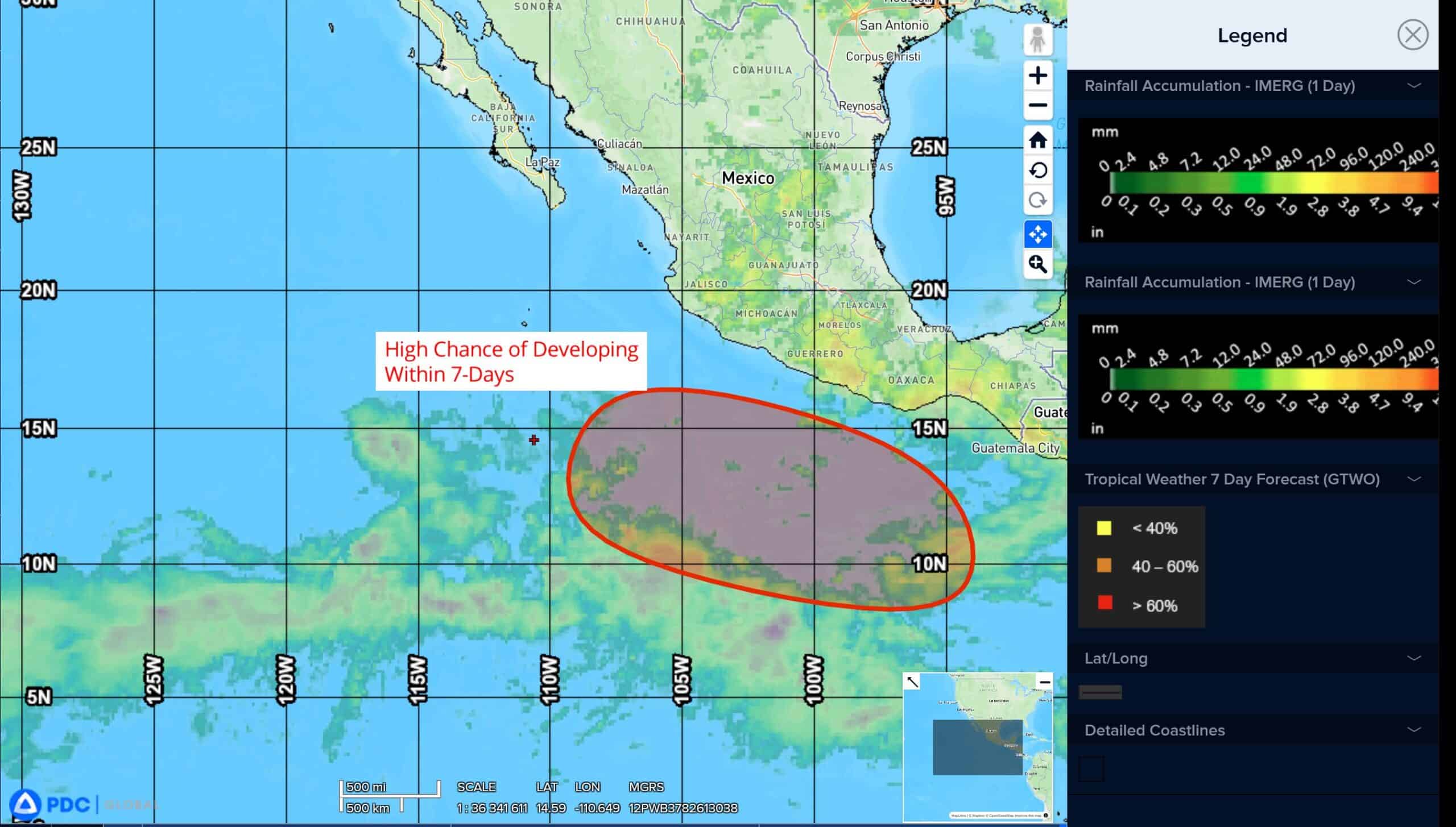
South of the Southern Coast of Mexico:
>>> An area of low pressure is likely to form early next week several hundred miles south of the southern coast of Mexico. Conditions appear favorable for development of this system, and a tropical depression could form around the middle of next week while moving westward to west-northwestward at 10 to 15 mph.
* Formation chance through 48 hours…low…near 0 percent
* Formation chance through 7 days…high…80 percent
Central Pacific Ocean: There are no Tropical Cyclones
The 2024 central North Pacific hurricane season has ended. As such, the final routine Tropical Cyclone Activity Report for the 2024 season has been issued. Routine issuance of this section of the PDC product will resume on June 1, 2025. During the off-season, Special Tropical Weather Outlooks will be issued as conditions warrant by the CPHC.
Western Pacific, Indian Ocean, and adjacent Seas: There are no Tropical Cyclones
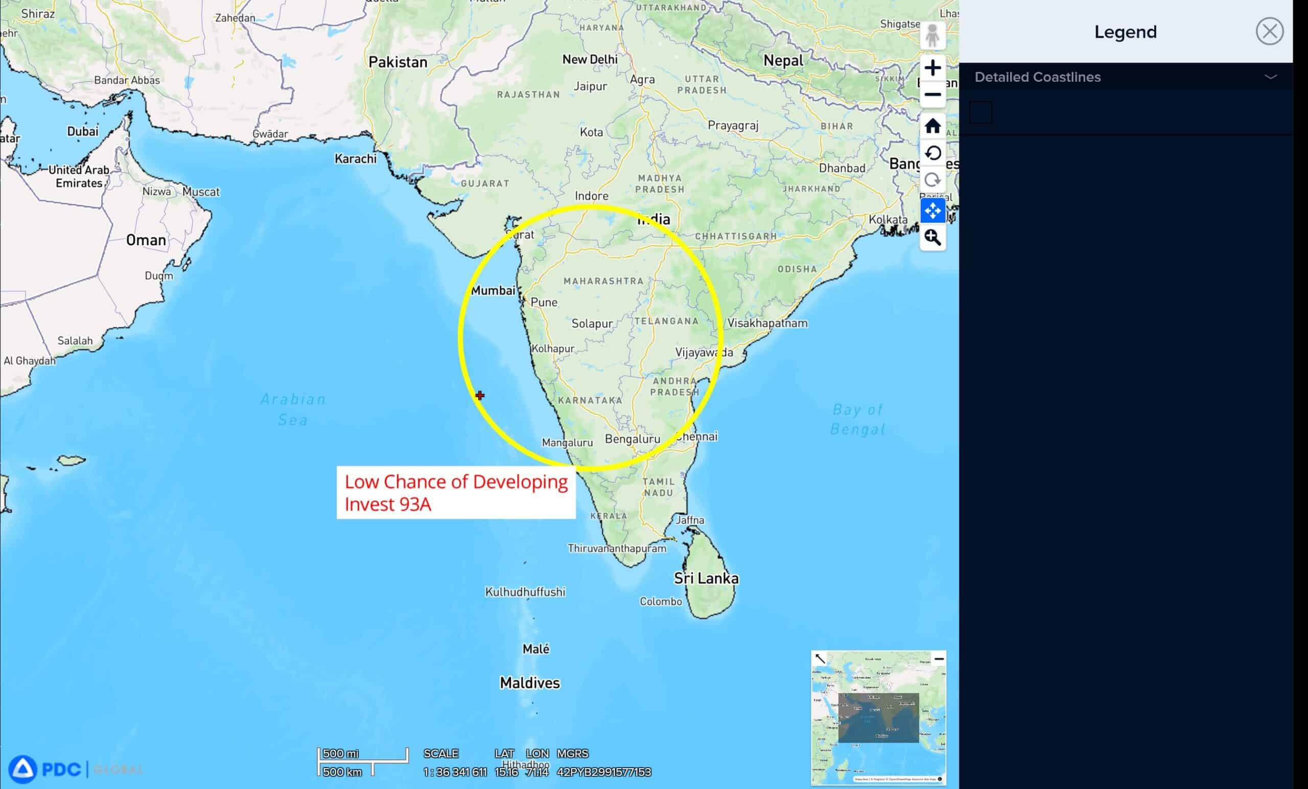
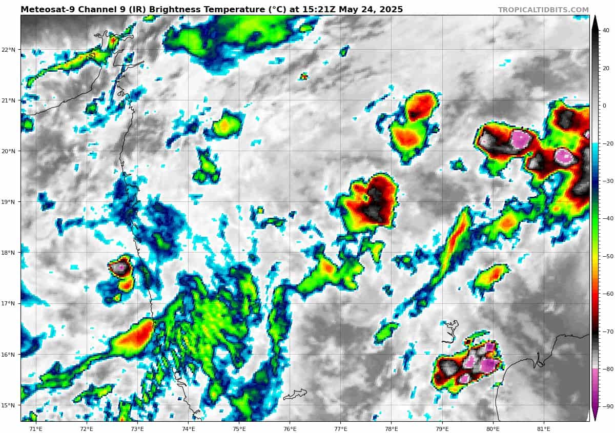
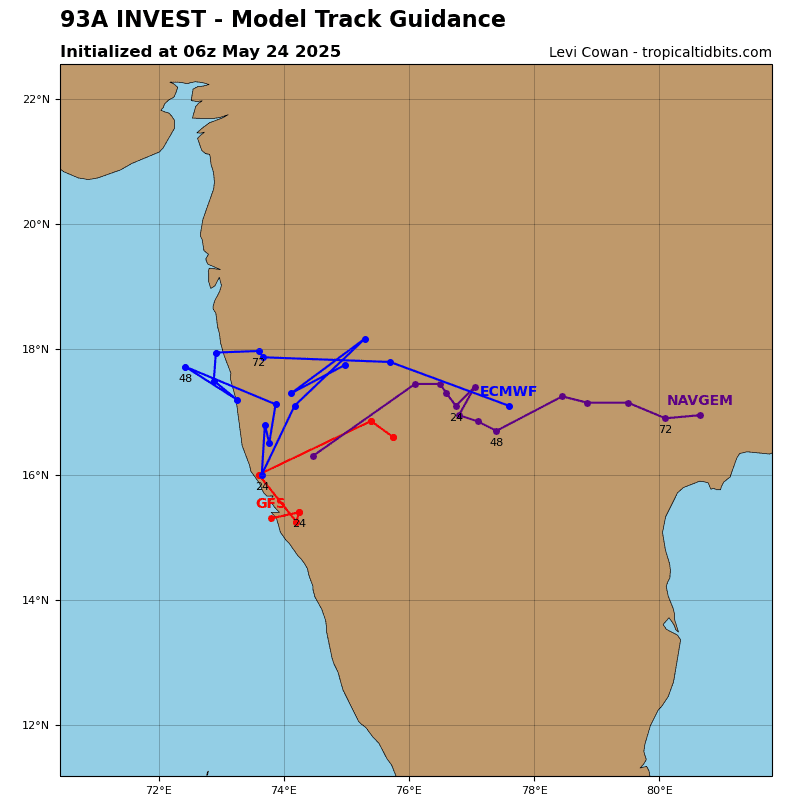
>>> There’s an area of disturbed weather being referred to as Invest 93A, that is located approximately 164 NM north-northwest of Mumbai, India
Animated multi-spectral satellite imagery reveals an exposed low-level circulation center (llcc) over land with an area of displaced flaring convection along the western coast of India.
Environmental analysis indicates unfavorable conditions for development with strong equatorward outflow greatly offset by moderate to high (20-25 knot) vertical wind shear and significant terrain interaction.
Global deterministic models maintain a narrative of non development as the vortex stagnates over India.
Maximum sustained surface winds are estimated at 15 to 20 knots.
The potential for the development of a significant tropical cyclone within the next 24 hours is downgraded to low.