
")
Current Snapshot
For all the latest updates visit: DisasterAWARE
PDC
1800x1080e
93a
meteosat9_ir_93A_202505211536_lat16.3-lon71.3
93A_tracks_latest
By PDC’s Senior Weather
Specialist Glenn James

The Pacific Disaster Center’s (PDC Global) Wednesday, May 21, 2025, Tropical Cyclone Activity Report…for the Pacific Ocean, the Indian Ocean, and adjacent Seas
Current Tropical Cyclones:
There are no Tropical Cyclones
Northeast Pacific Ocean: There are no Tropical Cyclones
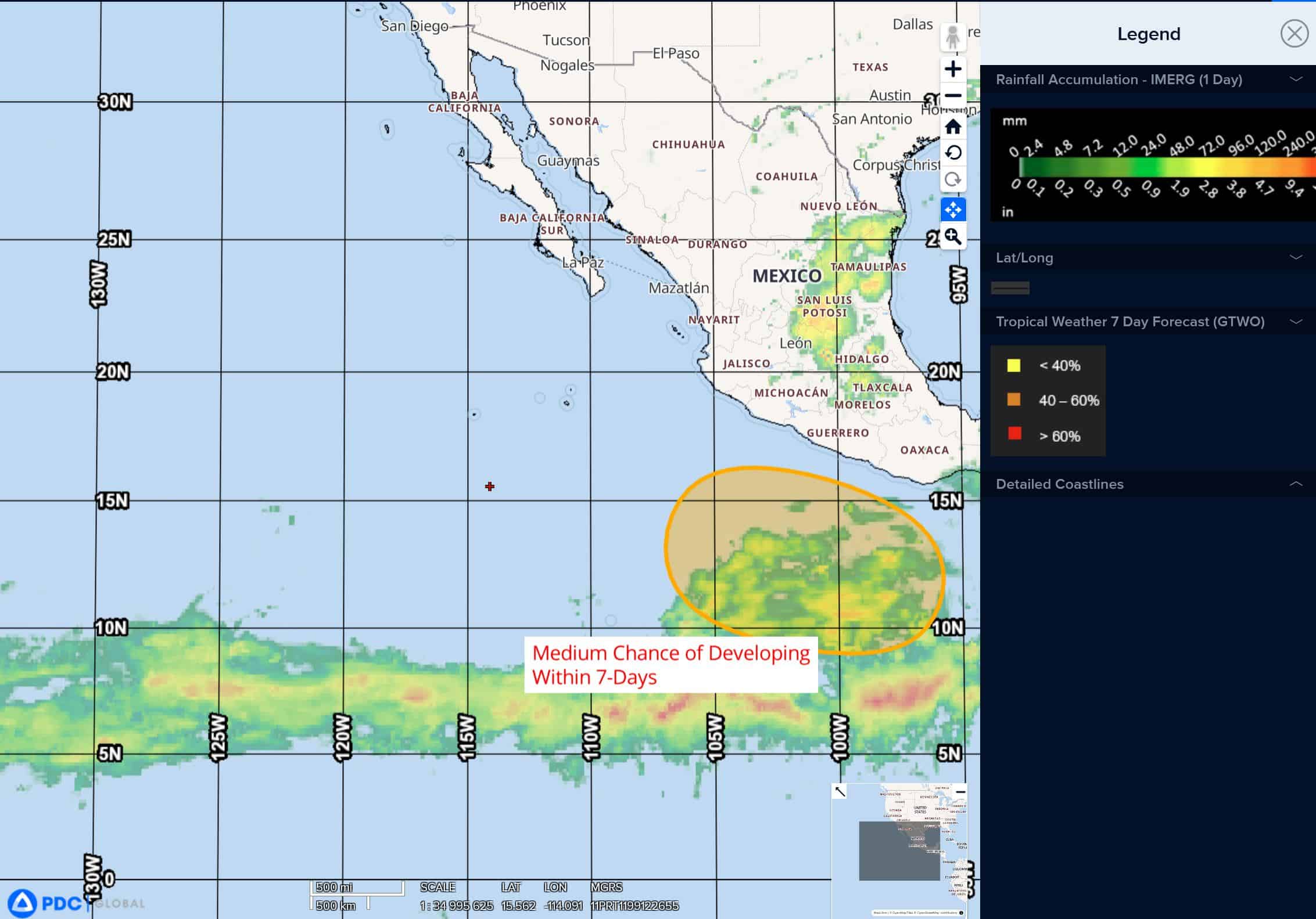
South of the Southern Coast of Mexico:
>>> An area of low pressure could form late this weekend or early next week several hundred miles south of the southern coast of Mexico. Conditions appear favorable for development of this system, and a tropical depression could form around the middle of next week while moving westward to west-northwestward at 10 to 15 mph.
* Formation chance through 48 hours…low…near 0 percent
* Formation chance through 7 days…medium…50 percent
Central Pacific Ocean: There are no Tropical Cyclones
The 2024 central North Pacific hurricane season has ended. As such, the final routine Tropical Cyclone Activity Report for the 2024 season has been issued. Routine issuance of this section of the PDC product will resume on June 1, 2025. During the off-season, Special Tropical Weather Outlooks will be issued as conditions warrant by the CPHC.
Western Pacific, Indian Ocean, and adjacent Seas: There are no Tropical Cyclones
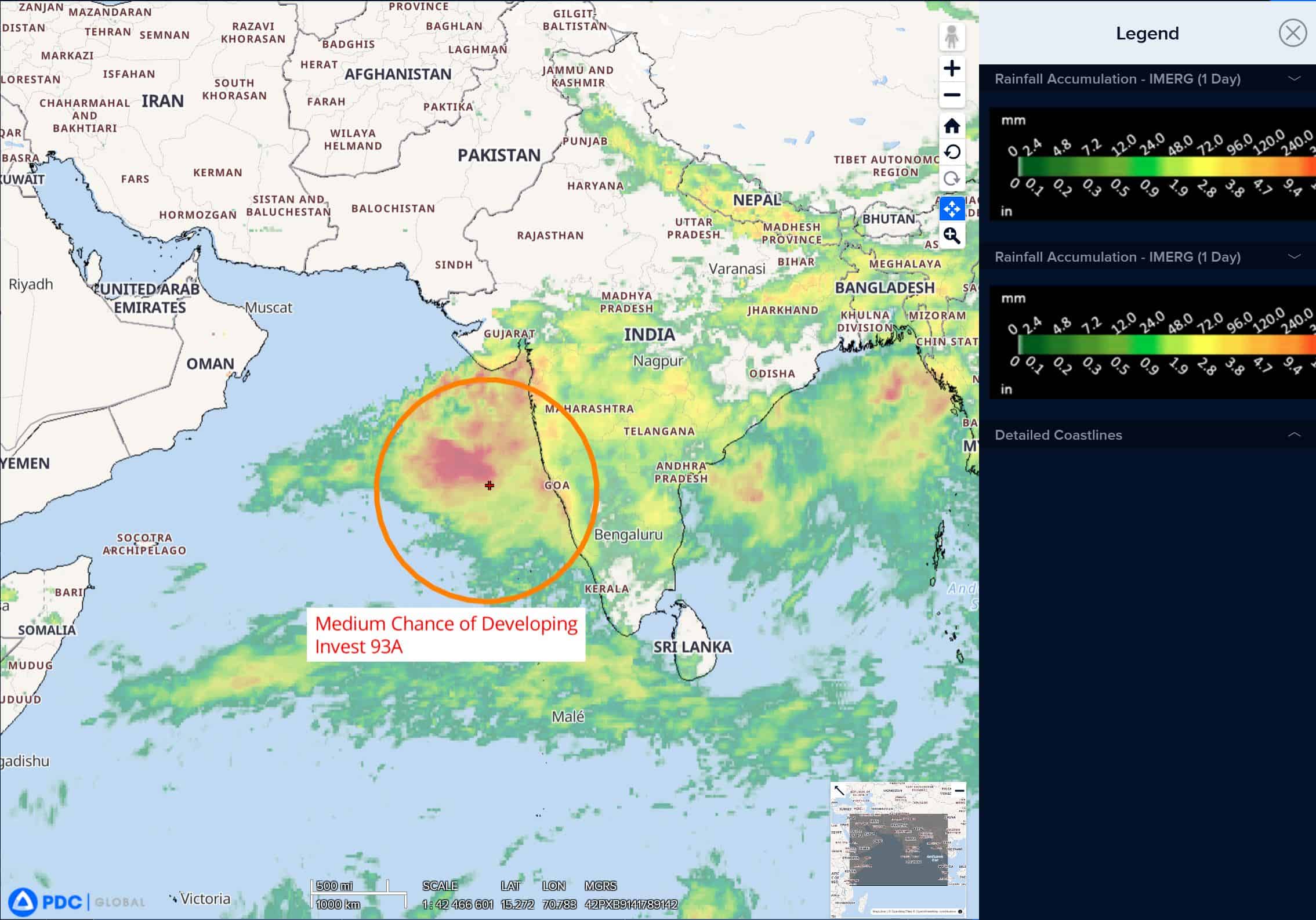
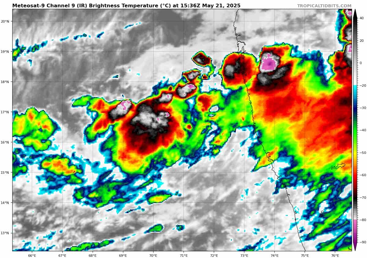
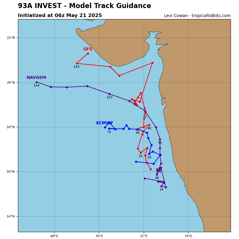
>>> There’s an area of disturbed weather being referred to as Invest 93A, that is located approximately 165 NM south-southeast of Mumbai, India
Animated enhanced infrared satellite imagery reveals low-level clouds continuing to consolidate with fragmented convection flaring up over the center of the system.
Environmental analysis reveals favorable conditions for development with low to moderate (15-20 knot) easterly vertical wind shear, moderate poleward outflow aloft, and very warm sea surface temperatures.
Global deterministic and ensemble models are in fair agreement that 93A will continue to steadily intensify, however ecmwf is less aggressive than other deterministic models, reaching TC criteria later than other models do.
Maximum sustained surface winds are estimated at 20 to 25 knots.
The potential for the development of a significant tropical cyclone within the next 24 hours remains medium.