
")
Current Snapshot
For all the latest updates visit: DisasterAWARE
pdceast7
1800x1080e
Pdchawaii
1200x1200hawaii
92w
himawari9_ir_92W_202506061520_lat13.8-lon126.2
92W_tracks_latest
By PDC’s Senior Weather
Specialist Glenn James

The Pacific Disaster Center’s (PDC Global) Friday, June 6, 2025, Tropical Cyclone Activity Report…for the Pacific Ocean, the Indian Ocean, and adjacent Seas
Current Tropical Cyclones:
There are no Tropical Cyclones
Northeast Pacific Ocean: There are no Tropical Cyclones
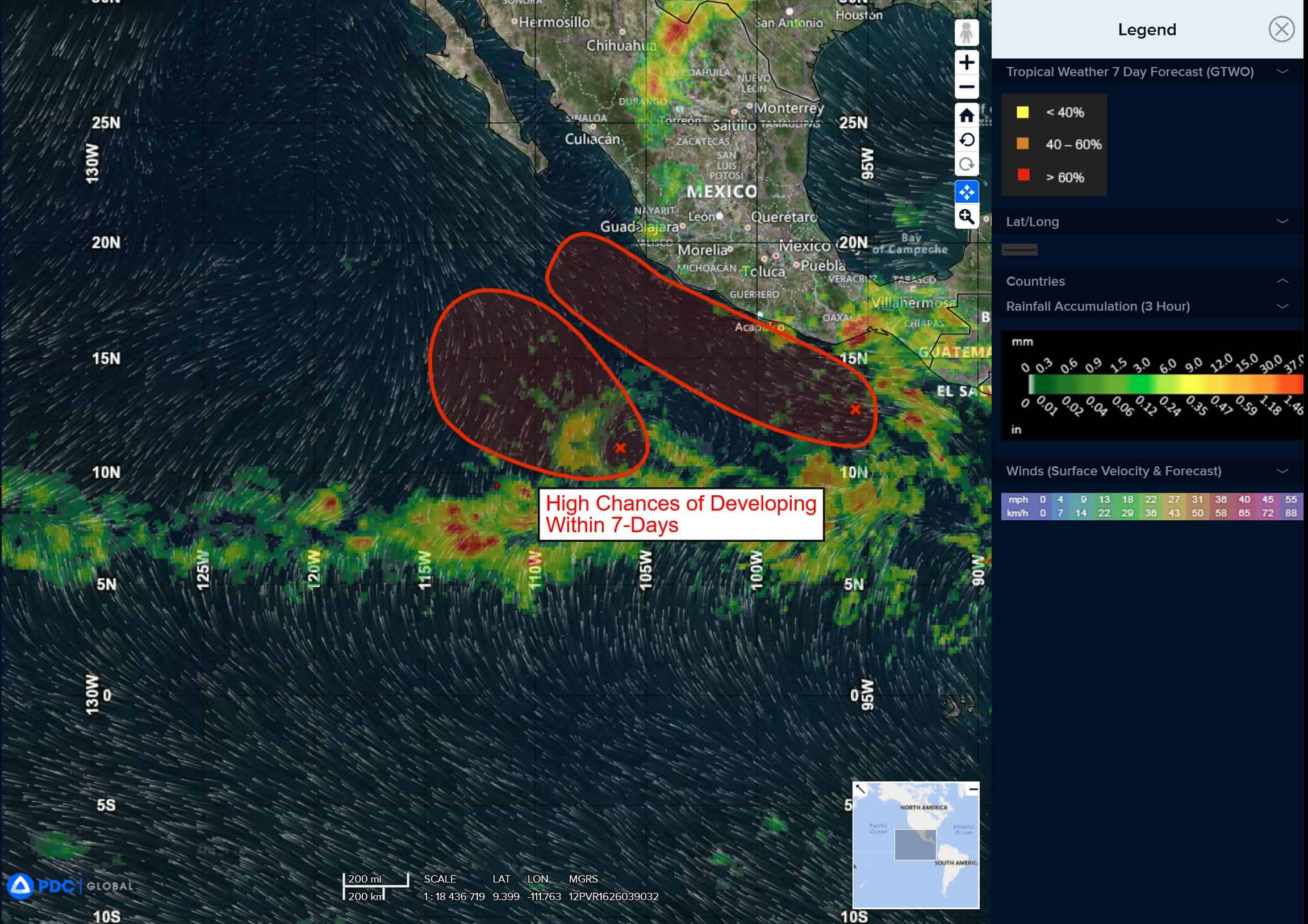
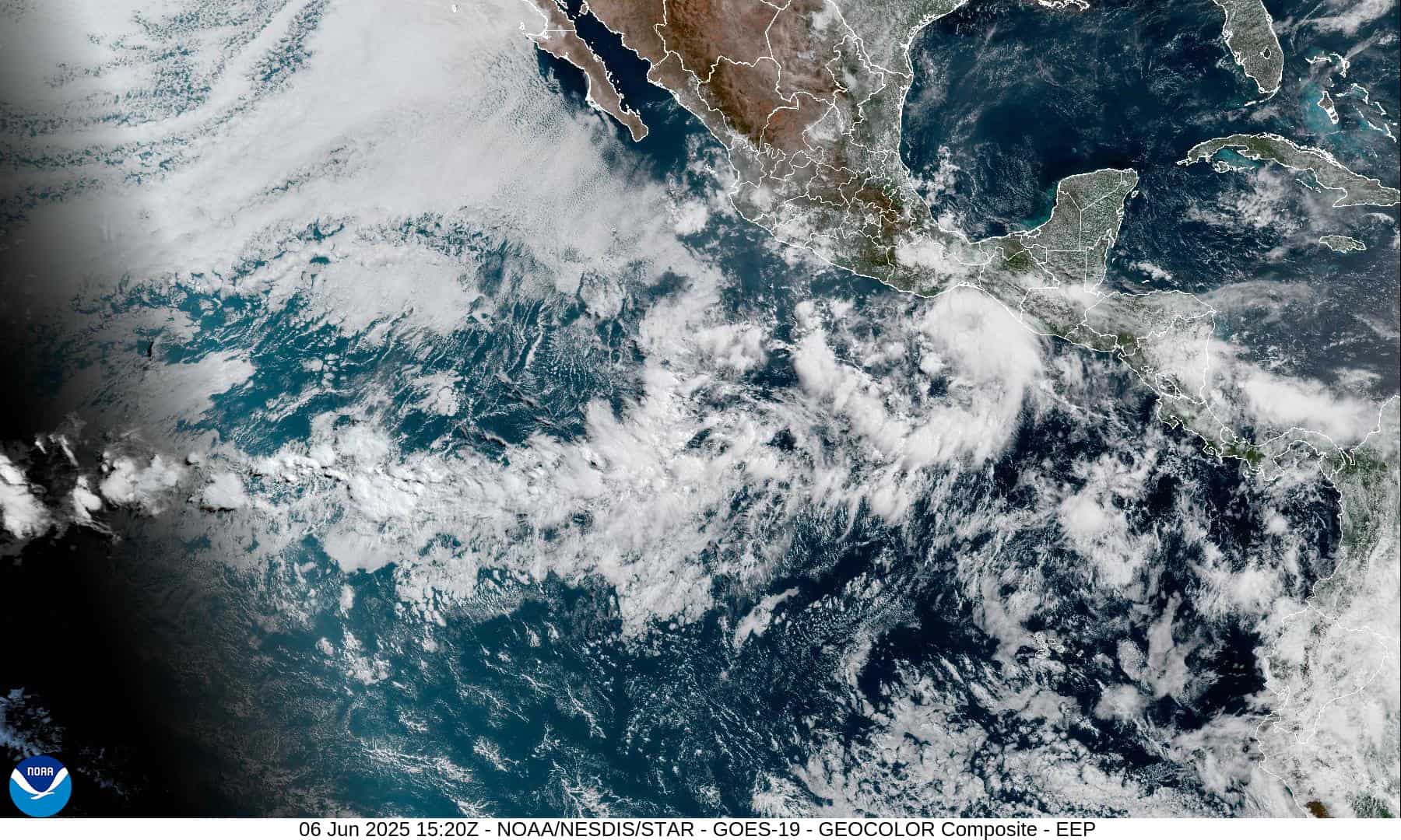
South of Southern Mexico
Invest 92E
>>> Showers and thunderstorms associated with a trough of low pressure located several hundred miles southwest of the Gulf of Tehuantepec continue to show signs of organization. Environmental conditions are conducive for further development, and a tropical depression or tropical storm is expected to form this weekend as the system moves west-northwestward at 10 to 15 mph. Locally heavy rains are possible along portions of the southwestern coast of Mexico during the next couple of days, and interests there should monitor the progress of this system.
* Formation chance through 48 hours…high…80 percent
* Formation chance through 7 days…high…90 percent
Offshore of Southwestern Mexico
Invest 91E
>>> Showers and thunderstorms associated with a broad area of low pressure located several hundred miles southwest of the southwestern coast of Mexico have changed little in organization for much of the day. However, gradual development of this system is expected, and a tropical depression is likely to form over the weekend or early next week while the system moves northwestward at about 10 mph.
* Formation chance through 48 hours…high…70 percent
* Formation chance through 7 days…high…80 percent
South of the Gulf of Tehuantepec
>>> An area of low pressure is forecast to develop late next week south of southern Mexico. Environmental conditions appear conducive for some gradual development of this system as it moves west-northwestward.
* Formation chance through 48 hours…low…near 0 percent
* Formation chance through 7 days…low…20 percent
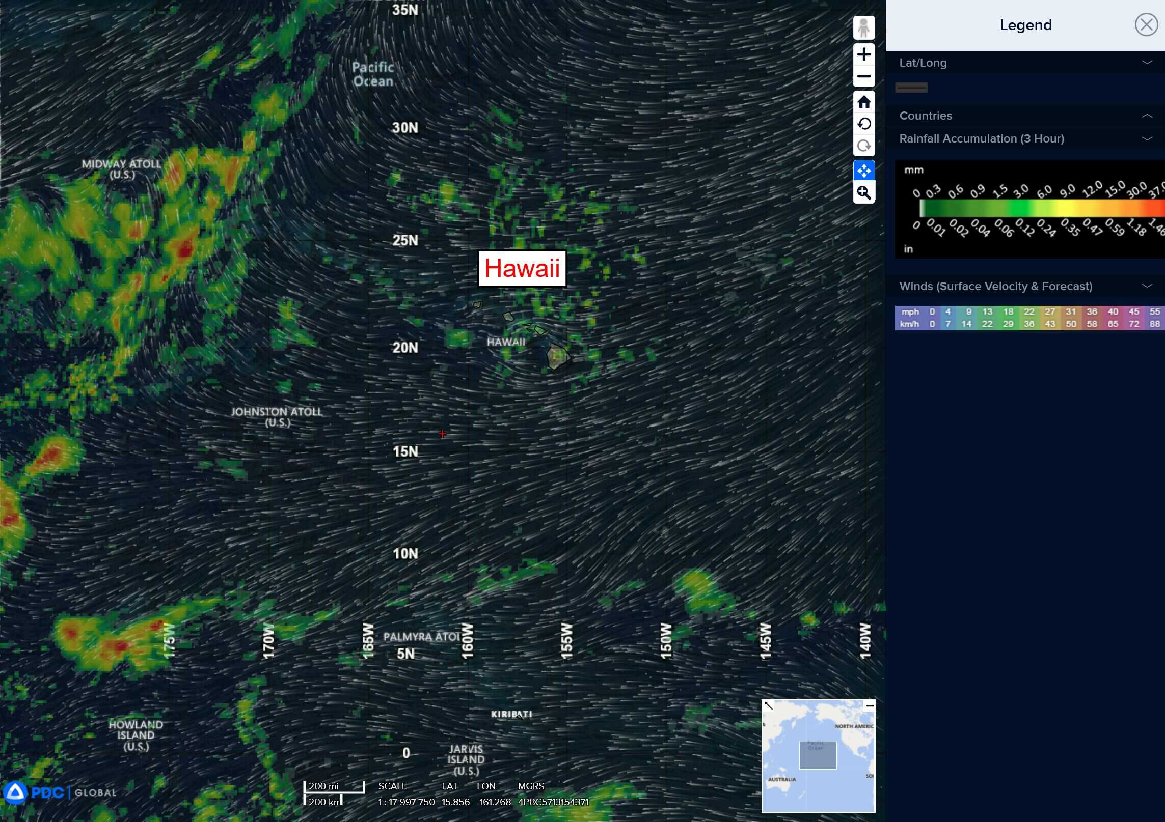
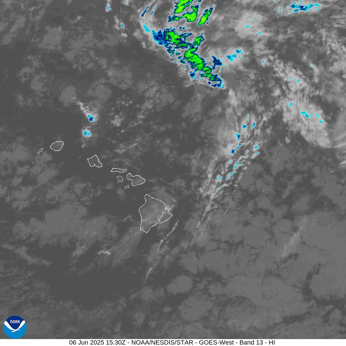
Central Pacific Ocean: There are no Tropical Cyclones
Tropical cyclone formation is not expected during the next 7-days.
Western Pacific, Indian Ocean, and adjacent Seas: There are no Tropical Cyclones
Western Pacific
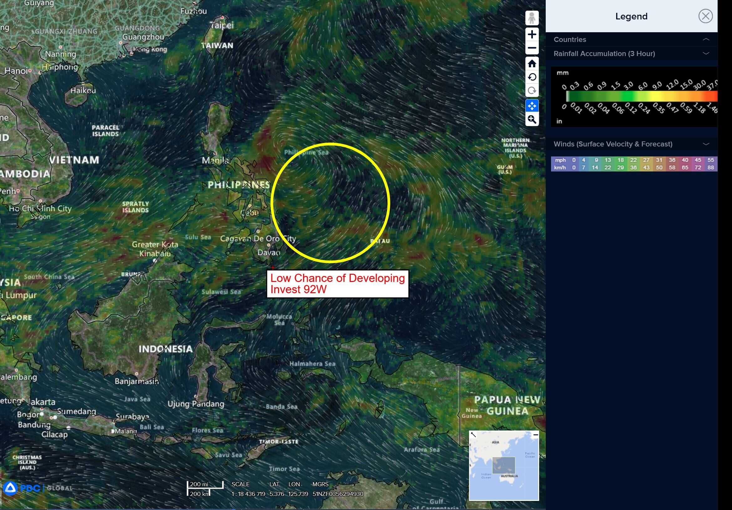
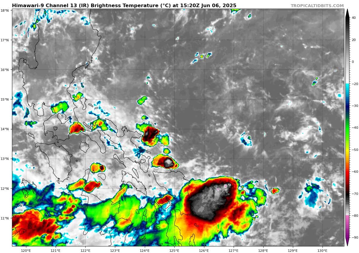
There’s an area of disturbed weather being referred to as Invest 92W, which is located approximately 162 NM east of Legazpi.
Animated multi-spectral satellite imagery depicts sparse flaring convection within the southwestern semicircle of an extremely broad low-level circulation (llc). Another image reveals a swath of 10-15 knot southerly winds within the southern periphery of an elongated circulation. The system is showing signs of being a possible monsoon depression, with a very large radius of maximum winds and pockets of enhanced vorticity along the southern and eastern periphery.
Environmental analysis reveals a moderately favorable environment, with moderate upper-level equatorward flow aloft and low vertical wind shear (vws) of 10-15 knots. Wrm sea surface temperatures are generally conducive for development if the llc can continue to consolidate.
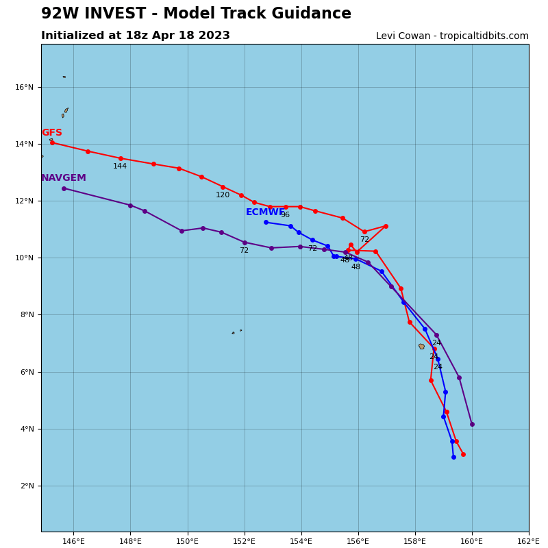
Deterministic models are currently split, with the GFS being slightly more aggressive, indicating 92W will remain relatively stationary over the next couple days. As for the ensemble models, the ECENS shows two distinct areas of possible development, 92W and an area originating north of Yap, which will eventually merge and show moderate development. The GEFS maintains a single area of development associated with 92W that remains quasi-stationary throughout.
Maximum sustained surface winds are estimated at 13 to 18 knots.
The potential for the development of a significant tropical cyclone within the next 24 hours remains low.