
")
Current Snapshot
For all the latest updates visit: DisasterAWARE
1800x1080a
2a
7a
goes19_ir_92L_202509161445_lat13.4-lon-41.5

92L_tracks_latest
By PDC’s Senior Weather
Specialist Glenn James

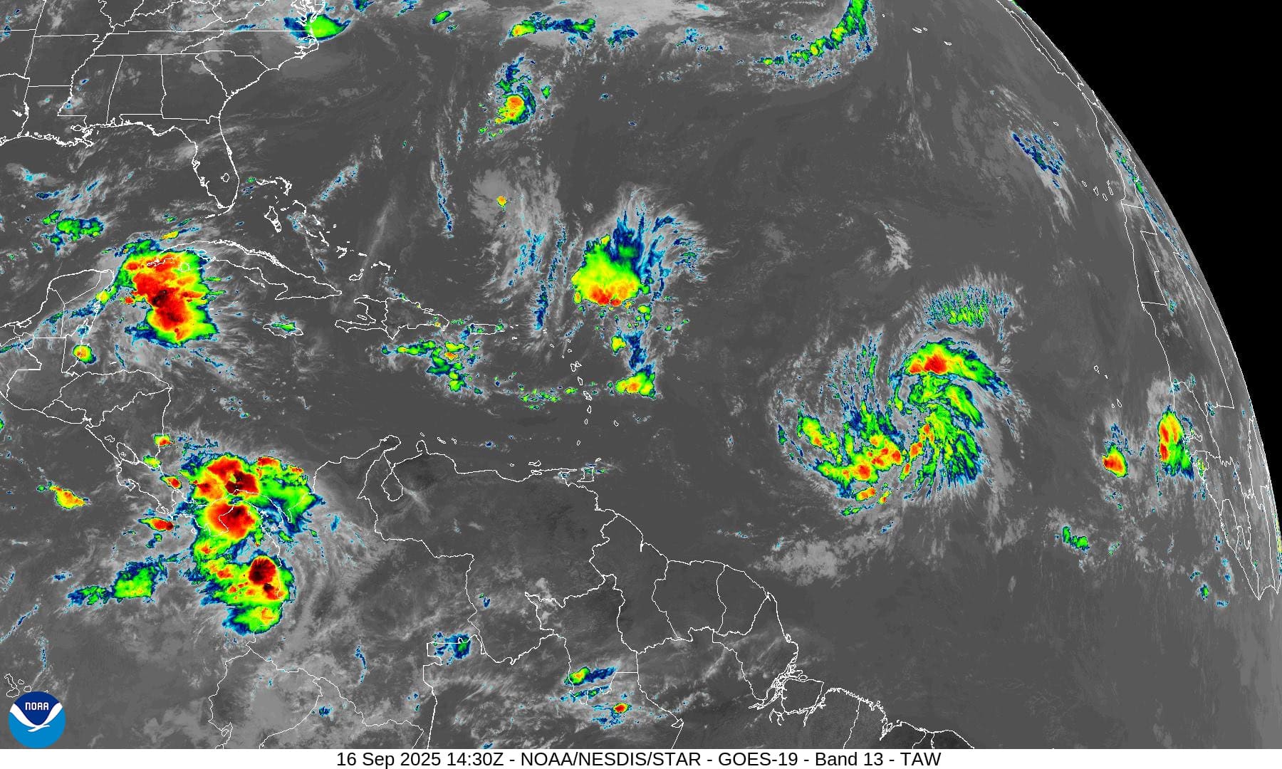
The Pacific Disaster Center’s (PDC Global) Tuesday, September 16, 2025, Tropical Cyclone Activity Report…for the Atlantic Ocean, the Caribbean Sea, and the Gulf of America
Current Tropical Cyclones:
There are no Tropical Cyclones
Atlantic Ocean: There are no active tropical cyclones
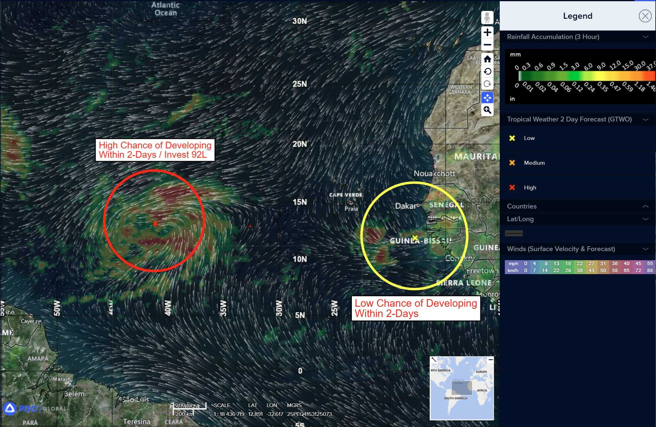
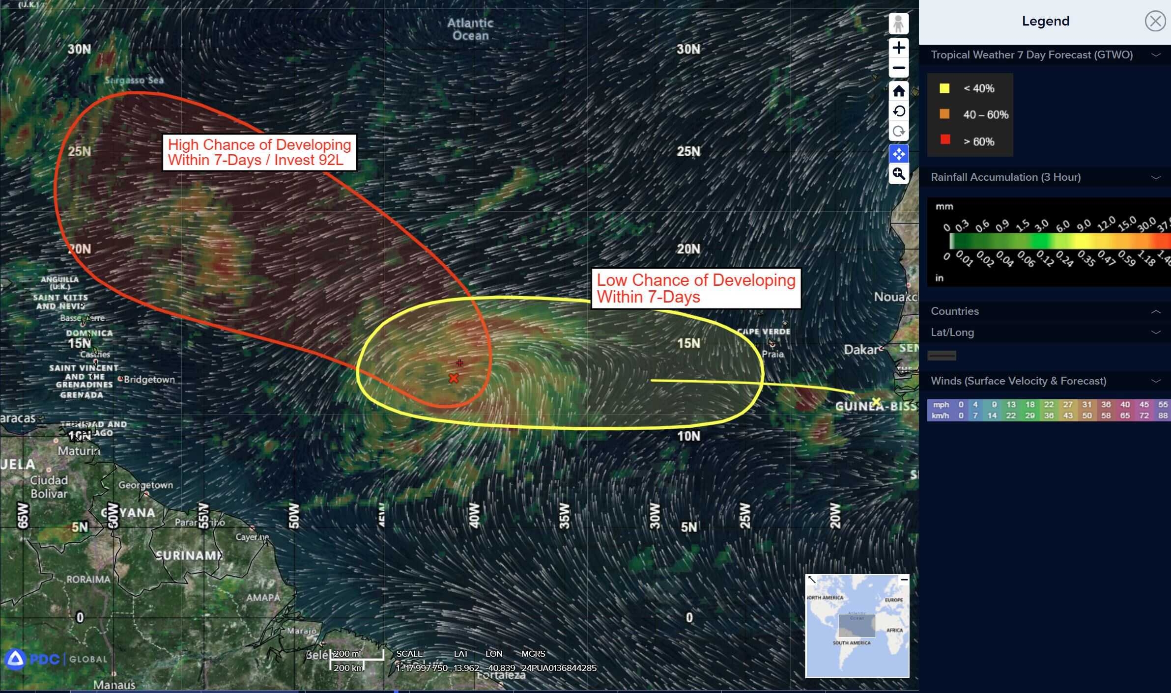
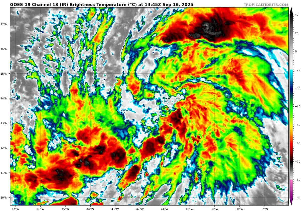
Central Tropical Atlantic:
Invest 92L
>>> Showers and thunderstorms associated with a broad low pressure area located about midway between the Windward Islands and the coast of west Africa have become better organized since yesterday. Environmental conditions are conducive for additional development, and a tropical depression or storm is likely to form in the next day or two as the system moves west-northwestward or northwestward at 10 to 15 mph over the central tropical Atlantic.
* Formation chance through 48 hours…high…90 percent
* Formation chance through 7 days…high…90 percent
Eastern Tropical Atlantic:
>>> A tropical wave emerging off the west coast of Africa is producing an area of disorganized showers and thunderstorms. Some slow development of this system is possible towards the mid to latter part of this week as it moves westward at 15 to 20 mph, moving from the eastern to central portion of the tropical Atlantic.
* Formation chance through 48 hours…low…near 0 percent
* Formation chance through 7 days…low…20 percent
Caribbean Sea: There are no active tropical cyclones
Tropical cyclone formation is not expected during the next 7-days.
Gulf of America: There are no active tropical cyclones
Tropical cyclone formation is not expected during the next 7-days.