Current Snapshot
For all the latest updates visit: DisasterAWARE
By PDC’s Senior Weather
Specialist Glenn James

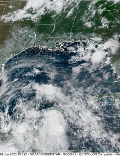
The Pacific Disaster Center’s (PDC Global) Saturday, June 28, 2025, Tropical Cyclone Activity Report…for the Atlantic Ocean, the Caribbean Sea, and the Gulf of America
Current Tropical Cyclones:
Tropical Cyclone 02L…is located about 135 southeast of Tuxpan, Mexico
Tropical Cyclone 02L
According to the NHC advisory number 2A
The depression is moving toward the west-northwest near 8 mph and this general motion is anticipated to continue for the next day or two. On the forecast track, the depression is expected to make landfall along the eastern coast of Mexico tonight and move inland early Monday. Maximum sustained winds are near 30 mph with higher gusts. Some gradual strengthening is expected through tonight, and the depression is forecast to become a tropical storm before it reaches the coast of Mexico. Weakening is expected after landfall, and the system is forecast to dissipate over eastern Mexico on Monday.
HAZARDS AFFECTING LAND
RAINFALL: Tropical Depression Two is expected to produce rainfall totals of 3 to 6 inches, with maximum totals of 10 inches possible across the Mexican states of Veracruz, San Luis Potosi, and Tamaulipas. This rainfall may produce life-threatening flooding and mudslides, especially in areas of steep terrain.
WIND: Tropical storm conditions are expected in the tropical storm warning area beginning this afternoon.
