
")
Current Snapshot
For all the latest updates visit: DisasterAWARE

1800×1080
91e2
91e7
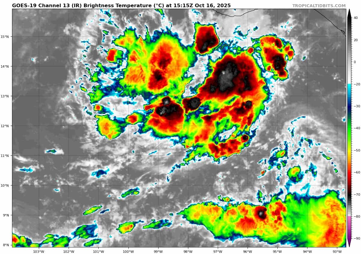
goes19_ir_91E_202510161515_lat11.9-lon-97.9

91E_tracks_latest
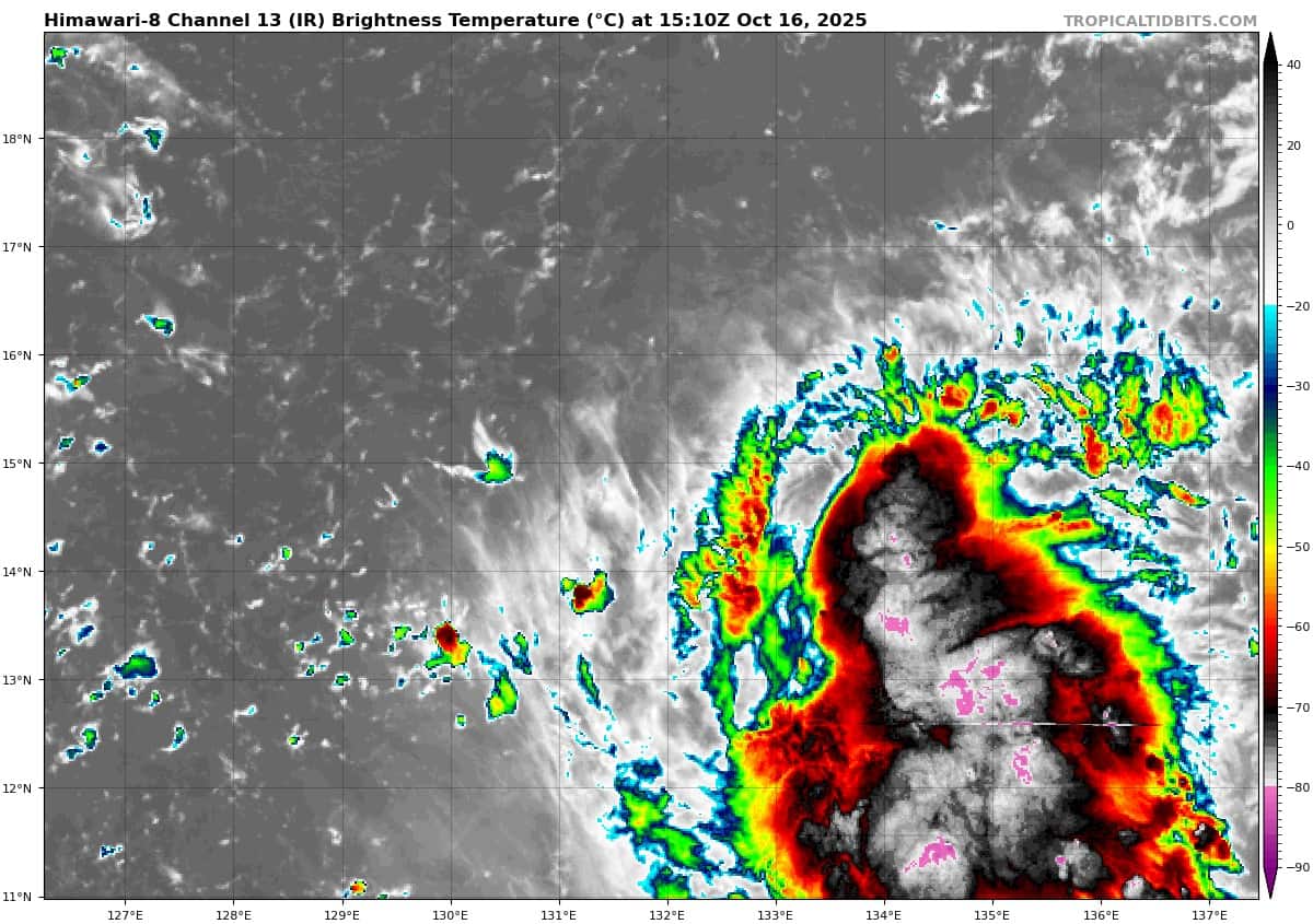
himawari8_ir_96W_202510161510_lat14.6-lon132.9
96W_tracks_latest
By PDC’s Senior Weather
Specialist Glenn James

The Pacific Disaster Center’s (PDC Global) Thursday, October 16, 2025, Tropical Cyclone Activity Report…for the Pacific Ocean, the Indian Ocean, and adjacent Seas
Current Tropical Cyclones:
There are no Tropical Cyclones at the time of this writing
Northeast Pacific Ocean:
South of Southern Mexico:
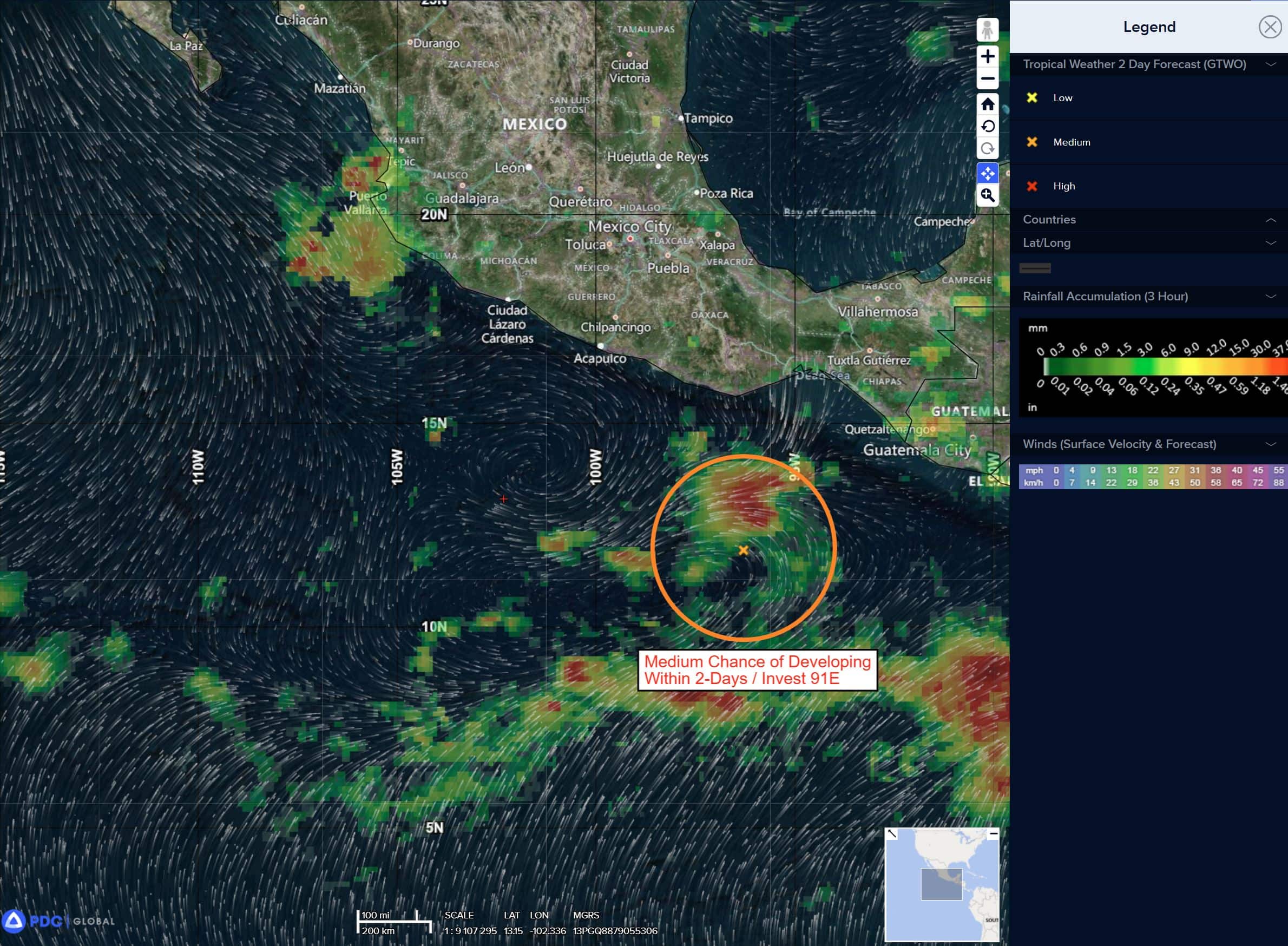
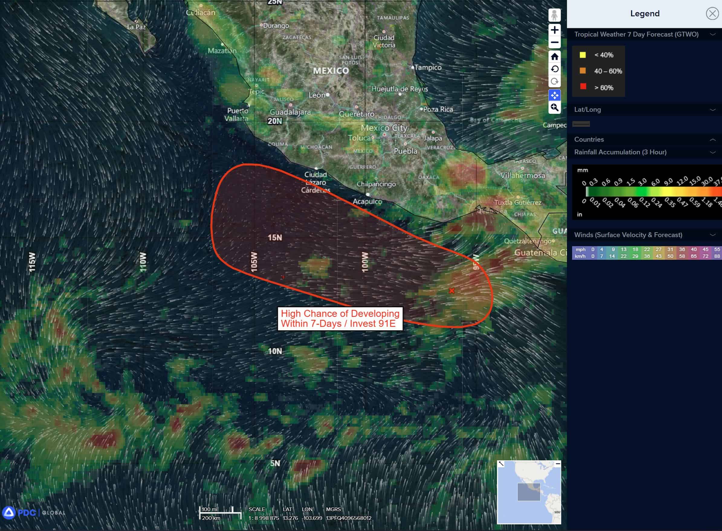
Invest 91E
>>> A broad area of low pressure is producing some disorganized showers and thunderstorms offshore of southern Mexico.
Environmental conditions appear conducive for gradual development of this disturbance, and a tropical depression could form during the next couple of days or so.
The system is forecast to move slowly west-northwestward or northwestward near the coast of southern and southwestern Mexico through the weekend.
* Formation chance through 48 hours…low…50 percent
* Formation chance through 7 days…medium…50 percent
Central Pacific Ocean: There are no Tropical Cyclones
Tropical cyclone formation is not expected during the next 7 days.
Western Pacific, Indian Ocean, and adjacent Seas:
Western Pacific
There’s an area of disturbed weather being referred to as Invest 96W, which is located approximate 423 NM east of Legazpi, Philippines
Animated multi-spectral satellite imagery (msi) depicts a consolidating low-level circulation center (llcc) embedded within persistent convection.
Environmental analysis reveals marginally favorable conditions for development with good radial outflow, warm sea surface temperatures (30-31 c), and low northwesterly vertical wind shear (10-15 kts).
Global deterministic and ensemble models are in good agreement that invest 96W will steadily consolidate over the next 24 hours while tracking northwestward.
Maximum sustained surface winds are estimated at 18 to 23 knots.
The potential for the development of a significant tropical cyclone within the next 24 hours upgraded to high.