
")
Current Snapshot
For all the latest updates visit: DisasterAWARE
1800x1080e
91e2
91e7

goes19_ir_91E_202510151445_lat12.5-lon-94.6
91E_tracks_latest
96w
96W_tracks_latest
By PDC’s Senior Weather
Specialist Glenn James

The Pacific Disaster Center’s (PDC Global) Wednesday, October 15, 2025, Tropical Cyclone Activity Report…for the Pacific Ocean, the Indian Ocean, and adjacent Seas
Current Tropical Cyclones:
There are no Tropical Cyclones at the time of this writing
Northeast Pacific Ocean:
South of Southern Mexico:
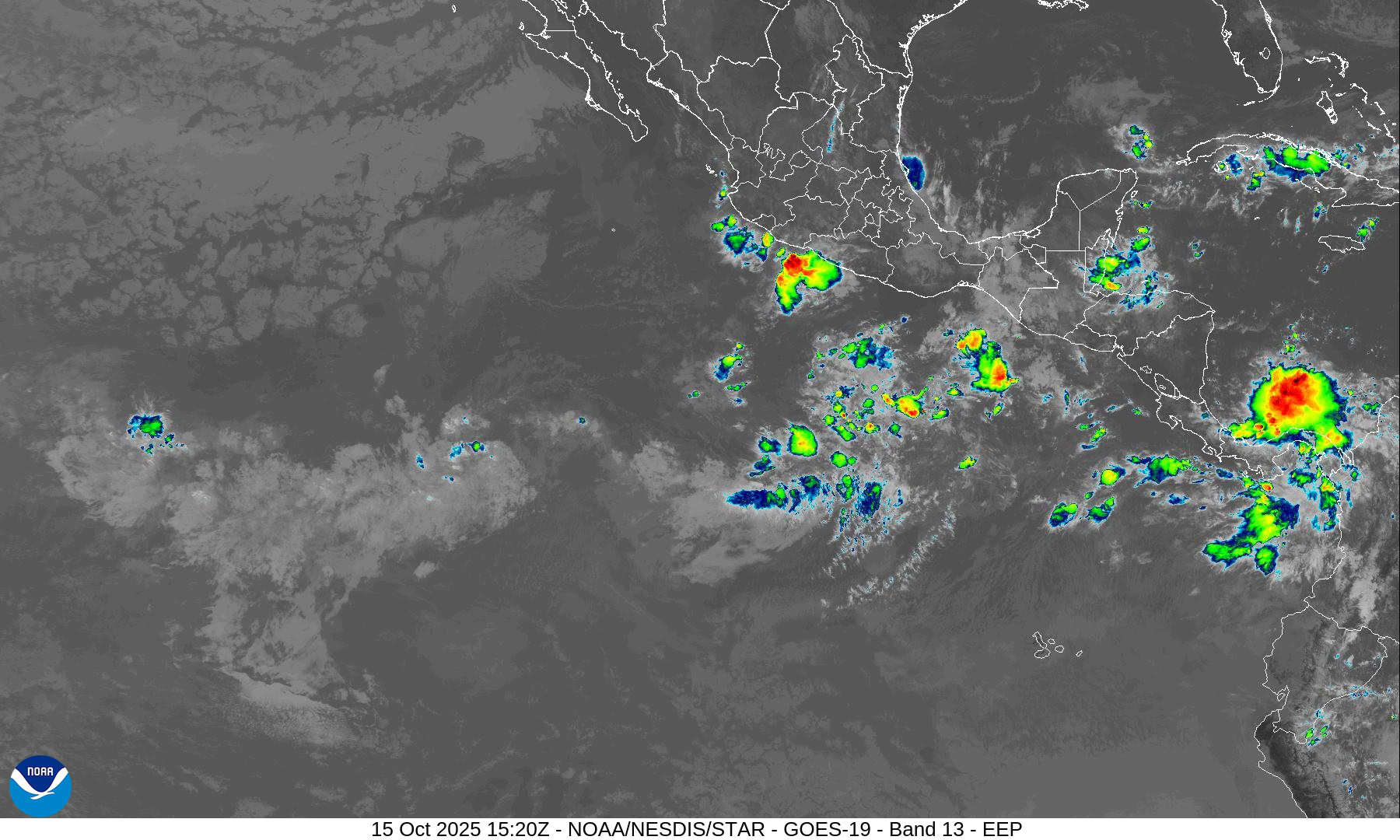
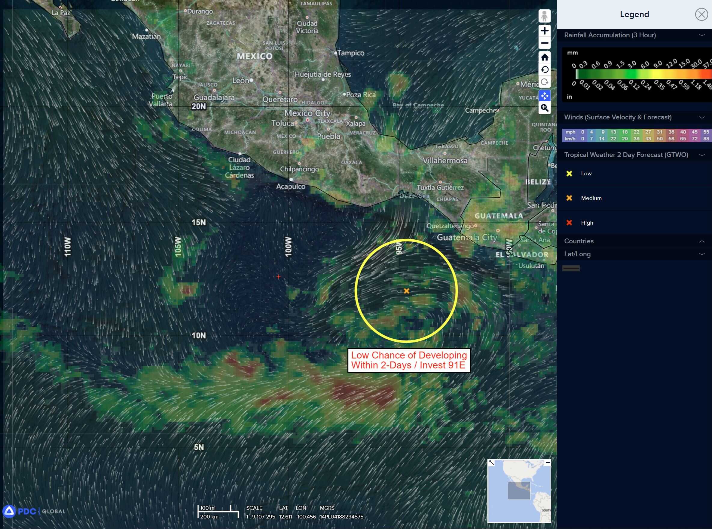
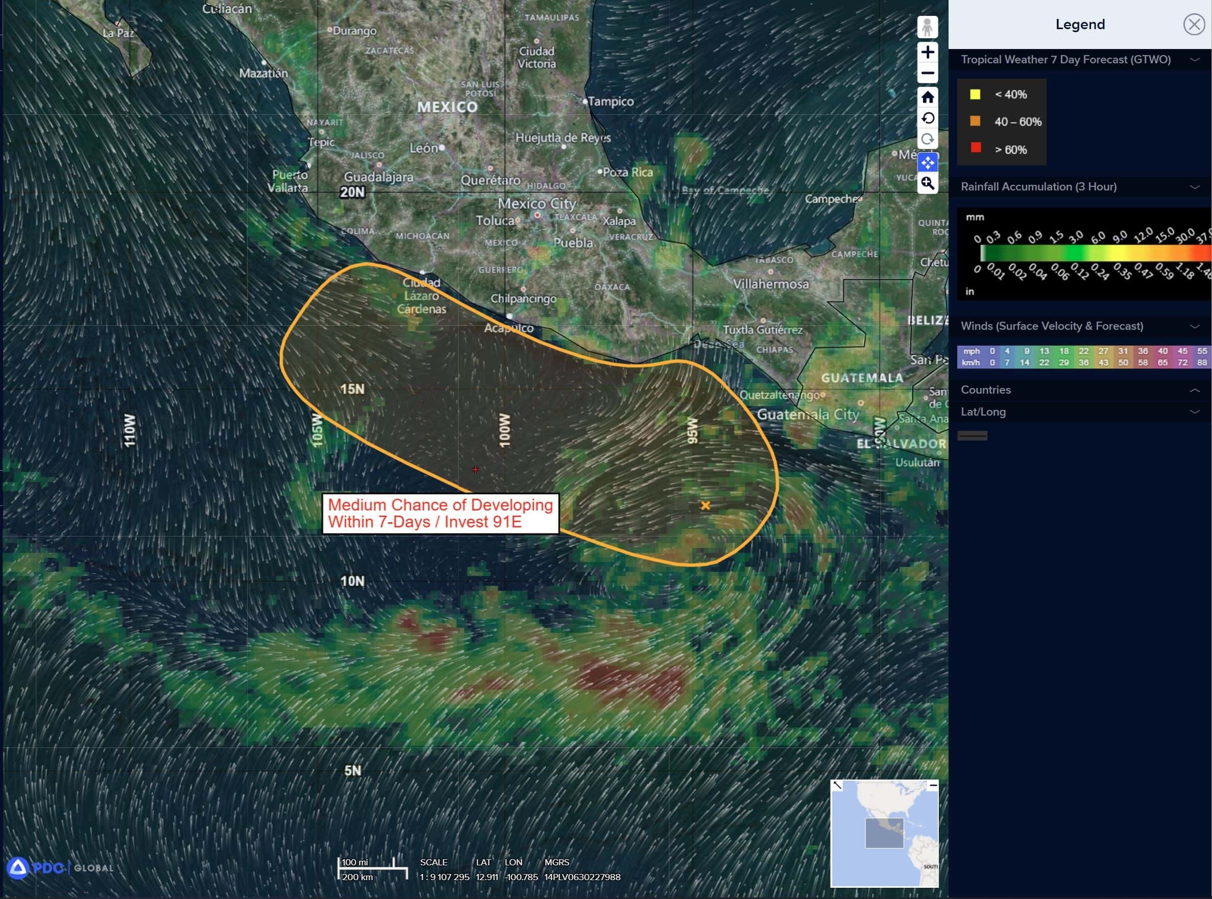
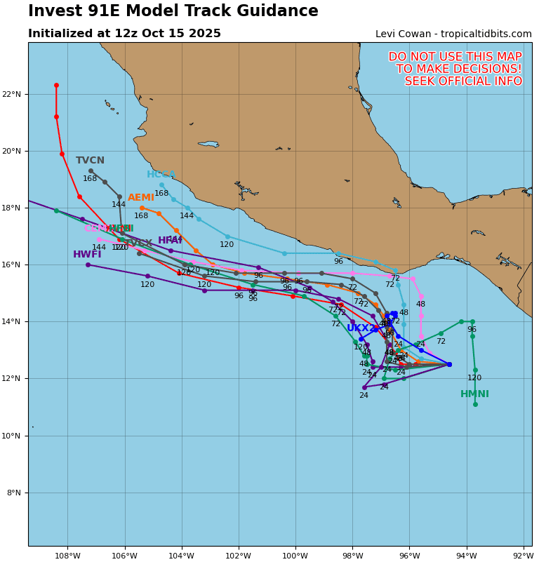
Invest 91E
>>> A broad area of low pressure is producing some disorganized showers and thunderstorms offshore of southern Mexico and portions of Central America.
Environmental conditions appear conducive for gradual development of this disturbance, and a tropical depression could form late this week or over the weekend.
The system is expected to move little during the next couple of days, but a slow northwestward motion near the coast of southern and southwestern Mexico is expected by the weekend.
* Formation chance through 48 hours…low…40 percent
* Formation chance through 7 days…medium…60 percent
Central Pacific Ocean: There are no Tropical Cyclones
Tropical cyclone formation is not expected during the next 7 days.
Western Pacific, Indian Ocean, and adjacent Seas:
Western Pacific
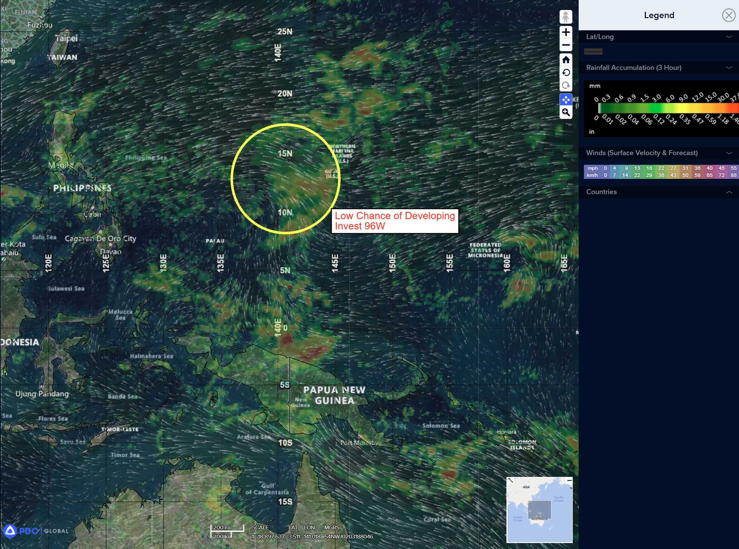
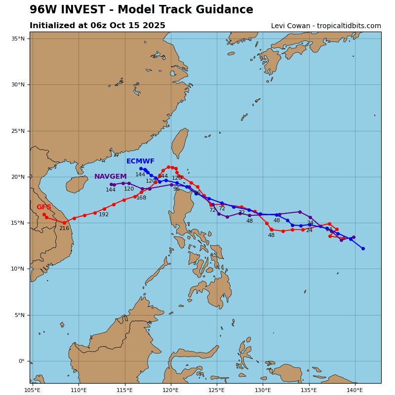
There’s an area of disturbed weather being referred to as Invest 96W, which is located approximate 160 NM west of Guam
Animated multi-spectral satellite imagery (msi) depicts a wave like feature with no defined low level circulation center (llcc) with flaring, disorganized convection scattered around the assessed position.
Environmental analysis reveals marginal to favorable conditions for development with good poleward outflow, low vertical wind shear (15
knots or less), and warm sea surface temperatures (29-30 c).
Global models are in fair agreement that invest 96W will have steady development over the next 24-48 hours while tracking northwestward. All
global models indicate development in the long-ranger, though navgem and
gfs are the most aggressive. Ensemble models (gefs/ecens/gdm) are all in
agreement that the system will track west-northwestward while slowly developing over the next couple of days.
Maximum sustained surface winds are estimated at 18 to 23 knots.
The potential for the development of a significant tropical cyclone within the next 24 hours remains low.