
")
Current Snapshot
For all the latest updates visit: DisasterAWARE

epac2
epac7
1800x1080e
cpac
1200×1200
92W
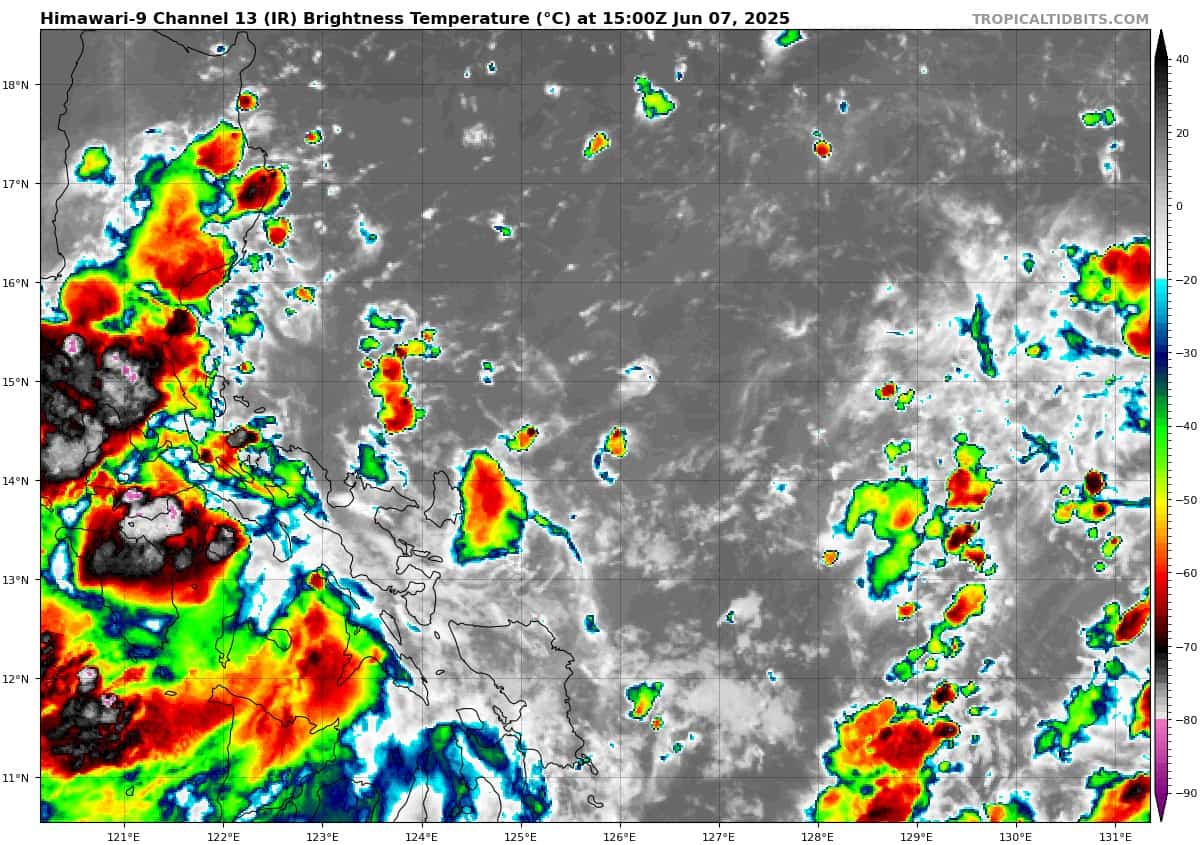
himawari9_ir_92W_202506071500_lat14.3-lon125.9
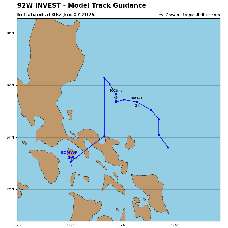
92W_tracks_latest
By PDC’s Senior Weather
Specialist Glenn James

The Pacific Disaster Center’s (PDC Global) Sunday, June 8, 2025, Tropical Cyclone Activity Report…for the Pacific Ocean, the Indian Ocean, and adjacent Seas
Current Tropical Cyclones:
Northeast Pacific Ocean:
BARBARA EXPECTED TO BECOME A HURRICANE ON MONDAY
COSME POISED TO STRENGTHEN ON MONDAY
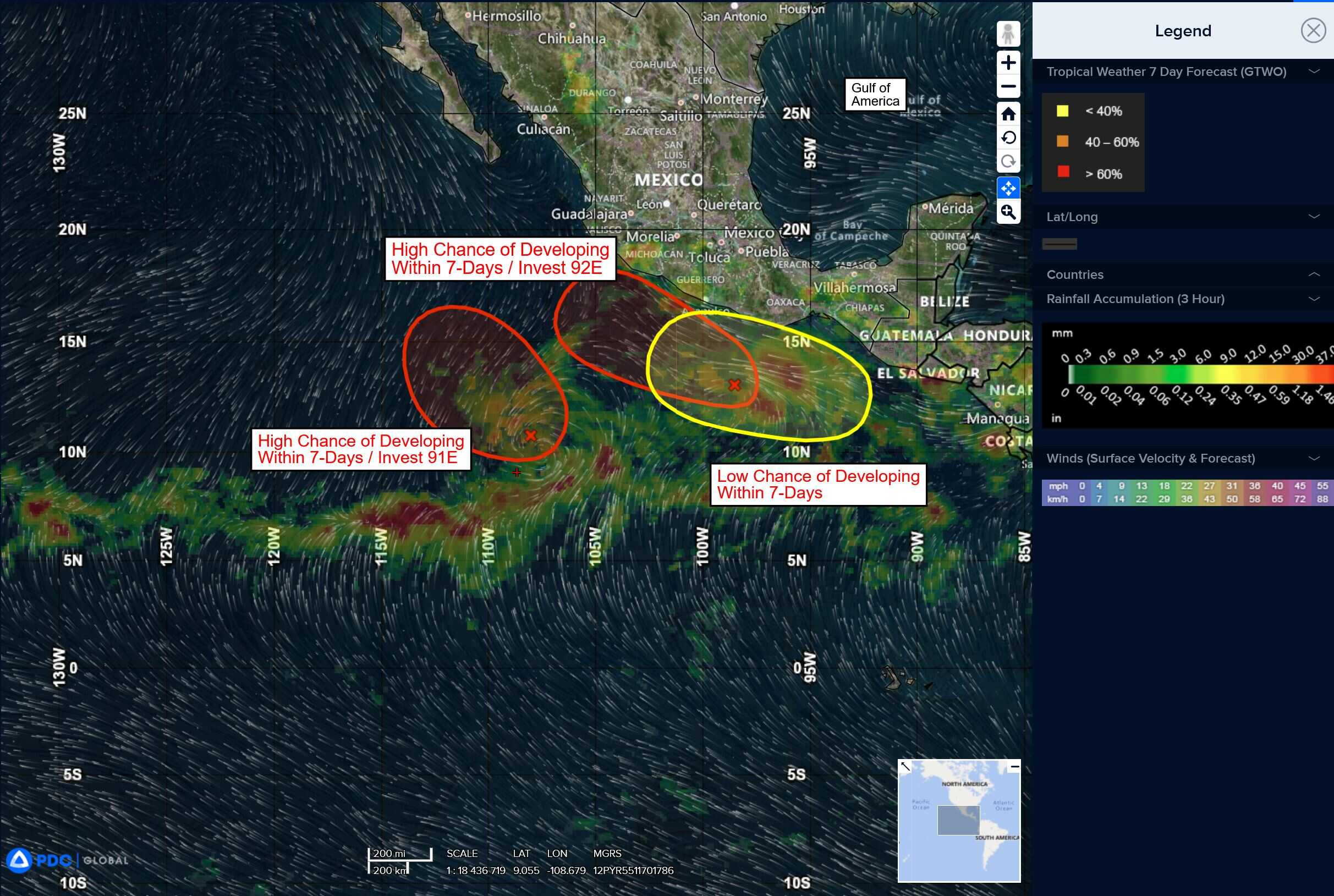
South of the Gulf of Tehuantepec
>>> An area of low pressure is forecast to develop late next week south of southern Mexico. Environmental conditions appear conducive for some gradual development of this system, and a tropical depression could form late next week or next weekend.
* Formation chance through 48 hours…low…near 0 percent
* Formation chance through 7 days…medium…50 percent
Central Pacific Ocean: There are no Tropical Cyclones
Tropical cyclone formation is not expected during the next 7-days.
Western Pacific, Indian Ocean, and adjacent Seas: There are no Tropical Cyclones
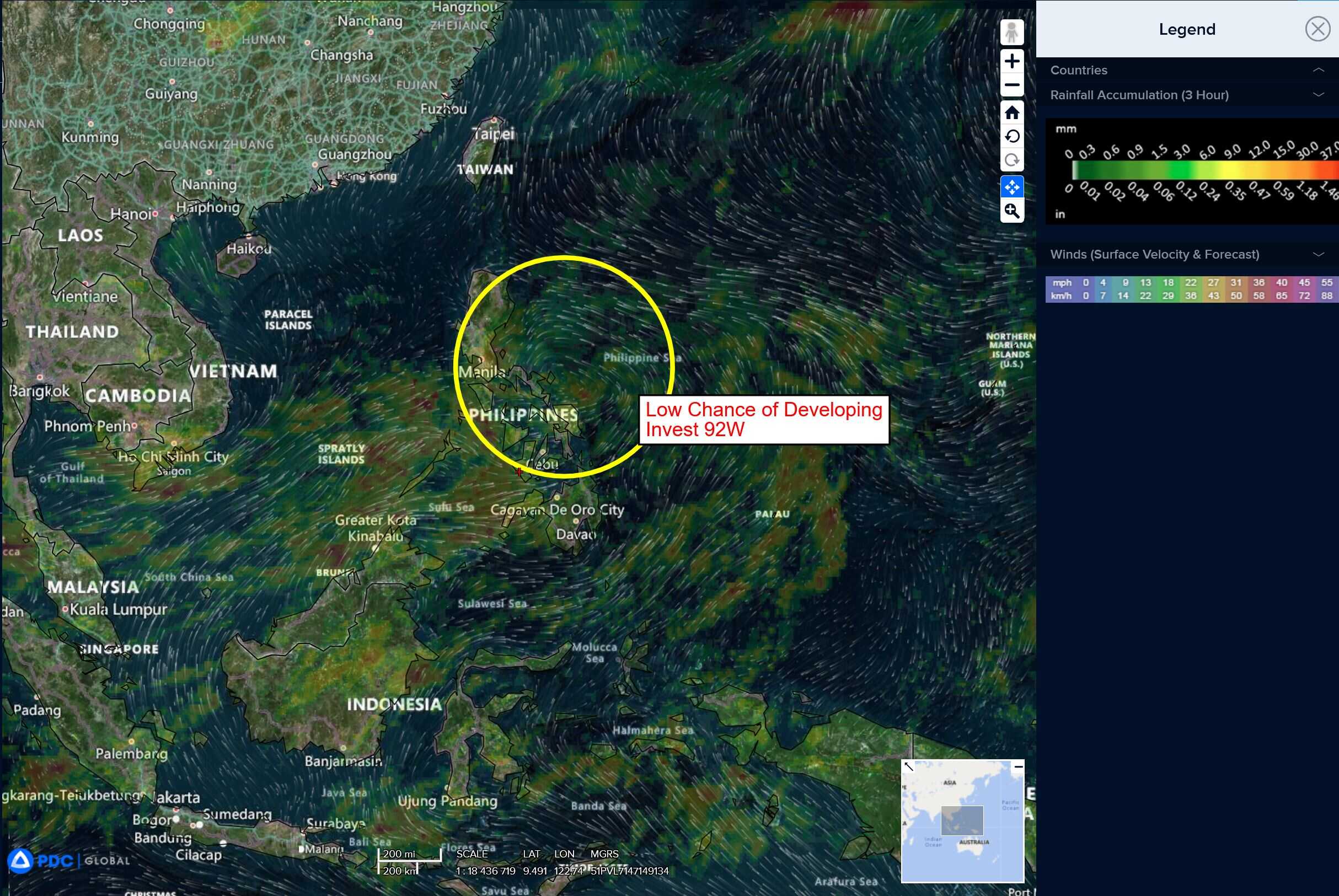
Western Pacific
>>> There’s an area of disturbed weather being referred to as Invest 92W, which is located approximately 394 NM south-southeast of Hong Kong
Animated multi-spectral satellite imagery (msi) depicts a broad, partially exposed low-level circulation with flaring convection along the western periphery of the system. Another image reveals 10 knot winds wrapping in from the north and east.
Environmental analysis reveals a moderately favorable environment, with moderate equatorward outflow aloft, warm sea surface temperatures and low to moderate vertical wind shear (vws) of
15-20 knots from the northeast.
Global deterministic and ensemble models are currently in good agreement on a westward track further into the South China Sea over the next 48 hours with steady intensification as the system continues to consolidate.
Maximum sustained surface winds are estimated at 10 to 15 knots.
The potential for the development of a significant tropical cyclone within the next 24 hours remains low.