Current Snapshot
For all the latest updates visit: DisasterAWARE
By PDC’s Senior Weather
Specialist Glenn James

The Pacific Disaster Center’s (PDC Global) Saturday, August 23, 2025, Tropical Cyclone Activity Report…for the Atlantic Ocean, the Caribbean Sea, and the Gulf of America
Current Tropical Cyclones:
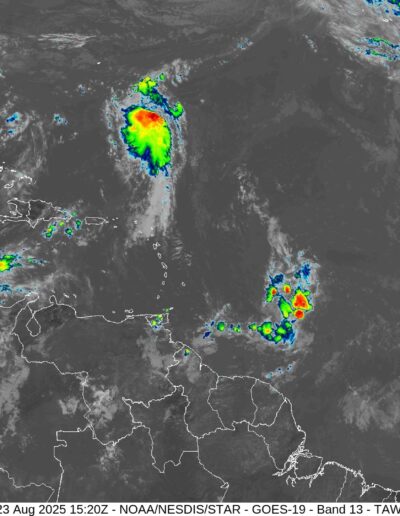
Tropical Cyclone Fernand…is located about 325 miles southeast of Bermuda
Atlantic Ocean
Tropical Cyclone Fernand
FERNAND MOVING NORTH-NORTHEASTWARD
Fernand is moving toward the north-northeast near 16 mph (26 km/h) and this motion is expected to continue for the next couple of days, followed by a turn to the northeast. On the forecast track, Fernand should move well east of Bermuda and across the open waters of the subtropical North Atlantic. Maximum sustained winds are near 40 mph (65 km/h) with higher gusts. Some strengthening is forecast during the next 48 hours. A weakening trend is expected by Tuesday. Tropical-storm-force winds extend outward up to 105 miles (165 km) from the center.
East of the Windward Islands
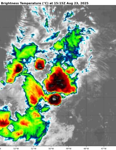
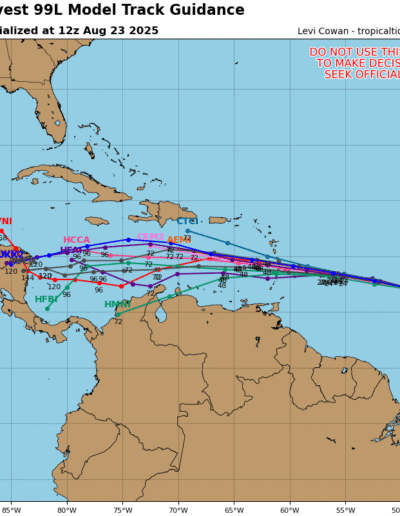
Invest 99L
>>> Disorganized showers and thunderstorms continue in association with a tropical wave located about 850 miles east of the Windward Islands. Some development of this system could occur during the next few days while the system moves quickly westward at about 20 mph. Locally heavy rainfall and gusty winds are possible across portions of the Windward Islands as the system moves through on Sunday and Monday. By the middle of next week, conditions over the central Caribbean are expected to be unfavorable for further development.
* Formation chance through 48 hours…medium…40 percent
* Formation chance through 7 days…medium…40 percent
Caribbean Sea: There are no active tropical cyclones
Tropical cyclone formation is not expected during the next 7-days.
Gulf of America: There are no active tropical cyclones
Tropical cyclone formation is not expected during the next 7-days.


